Bishopville Bay, SC
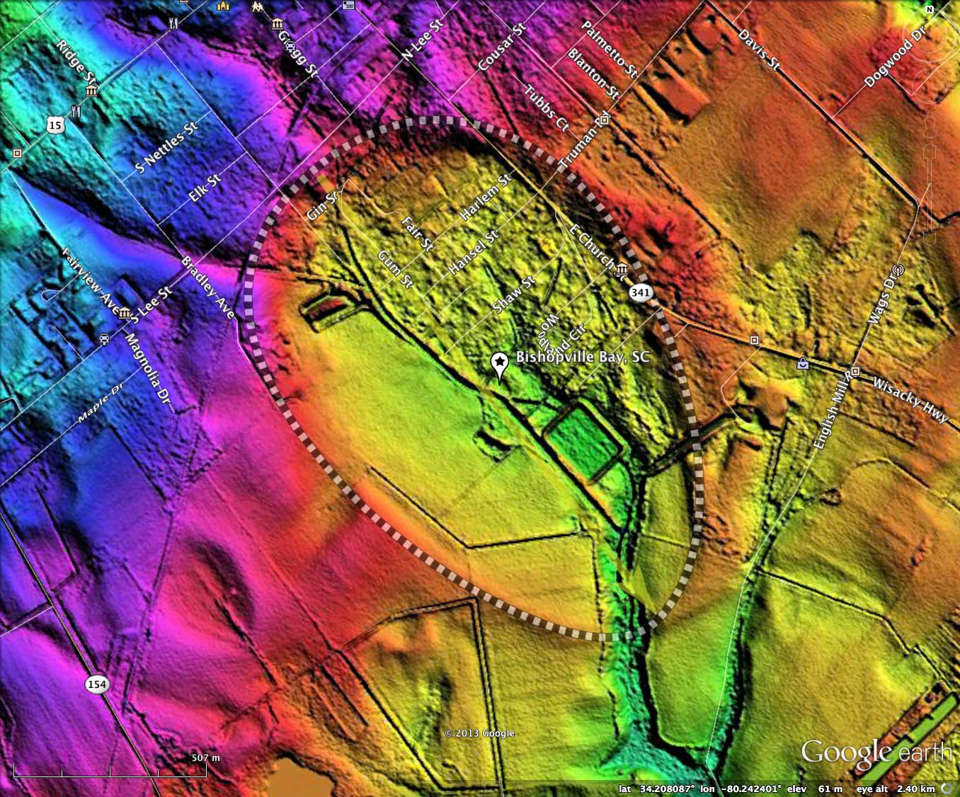
Bishopville Bay was named by me after the city in South Carolina which surrounds the northern half, and literally penetrates into it on the northeastern side. The baySouth archetype bay makes a perfect fit on this landform, and it has the proper bowl-shaped floor.
Significantly, the bay has a fully-developed natural drainage channel running into it from the north, traversing the bay, and exiting on the south end. For this bay to have been formed by wind action on standing water, the process must have ended long ago. Instead I interpret the bay to have been formed over an antecedent landscape which included the drainage network.
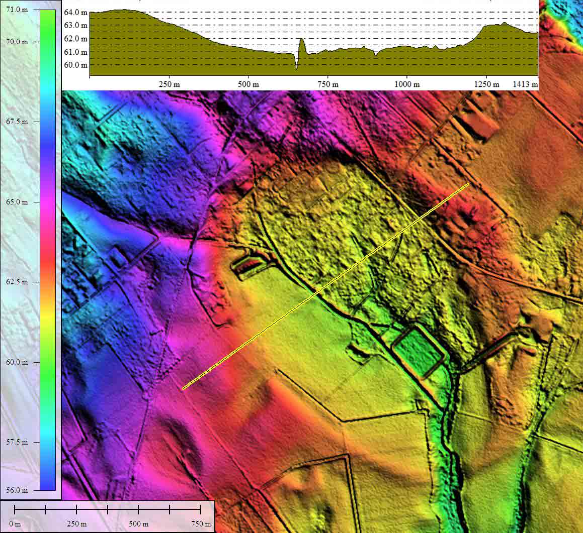
In addition to the usual cross-bay elevation profile map, I have included one across the 50-meter wide southern outlet channel, where the relief is measured at almost 3 meters.
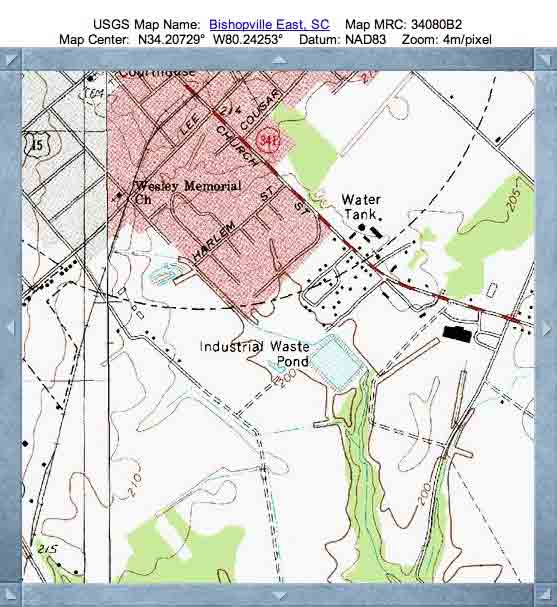
Likely due to the natural drainage, this "bay" was not identified in the USGS genomes database - see the album's topo map. Today, 40% of the bay is farmland, 20% is wooded, and the remainder has been occupied by roads and homes. It seems likely that none is aware of the bay's presence.
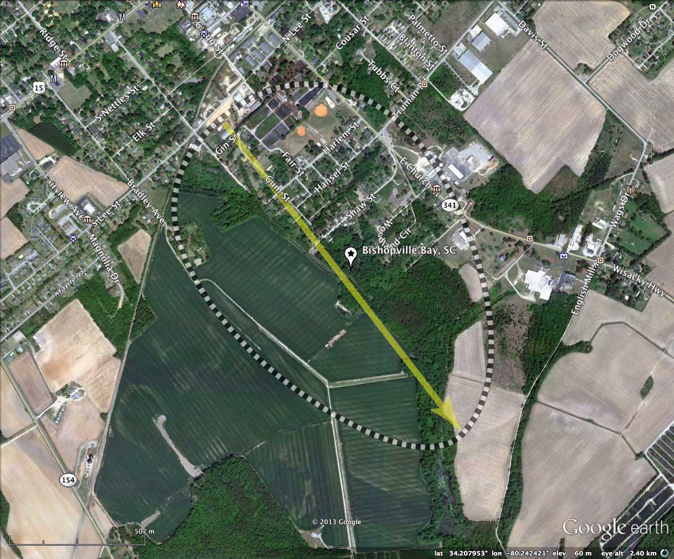
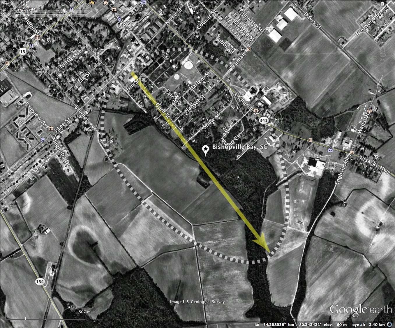
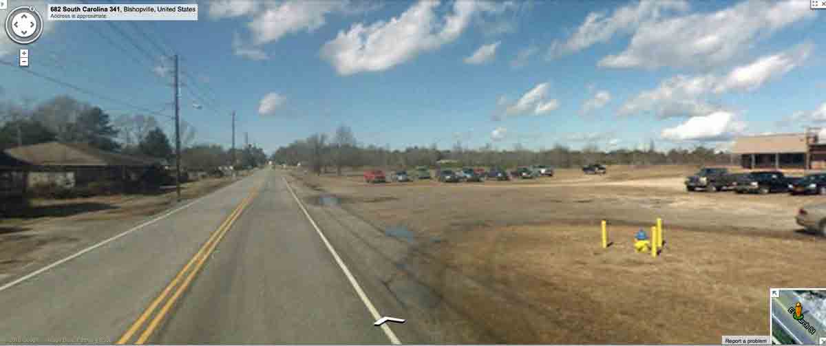
Google Streetview imagery is available along most of the paved roads in and along the bay. The album and the KMZ file contain a Streetview looking north along SC 341 towards the center of Bishopville. The roadbed is within the bay here, running along the inside the eastern rim. The terrain can be seen rising from the road level up to the right, where it rises to the rim's maximum hight. Compare the elevations of the homes on the left of the road to that of the building on the right. You can browse the Streetview interactively with this LINK.
The Carolina Bay Survey has identified and measured over 1400 bays in Octant 136320, which puts the octant in the company of only a few with such a large concentration of bays. Their location and metrics can be referenced through a Fusion Table spatial visualization.
Significantly, the bay has a fully-developed natural drainage channel running into it from the north, traversing the bay, and exiting on the south end. For this bay to have been formed by wind action on standing water, the process must have ended long ago. Instead I interpret the bay to have been formed over an antecedent landscape which included the drainage network.
In addition to the usual cross-bay elevation profile map, I have included one across the 50-meter wide southern outlet channel, where the relief is measured at almost 3 meters.
Likely due to the natural drainage, this "bay" was not identified in the USGS genomes database - see the album's topo map. Today, 40% of the bay is farmland, 20% is wooded, and the remainder has been occupied by roads and homes. It seems likely that none is aware of the bay's presence.
Google Streetview imagery is available along most of the paved roads in and along the bay. The album and the KMZ file contain a Streetview looking north along SC 341 towards the center of Bishopville. The roadbed is within the bay here, running along the inside the eastern rim. The terrain can be seen rising from the road level up to the right, where it rises to the rim's maximum hight. Compare the elevations of the homes on the left of the road to that of the building on the right. You can browse the Streetview interactively with this LINK.
The Carolina Bay Survey has identified and measured over 1400 bays in Octant 136320, which puts the octant in the company of only a few with such a large concentration of bays. Their location and metrics can be referenced through a Fusion Table spatial visualization.
- Index #: 136320_8396
- Location: 34.20754662055322,-80.24242629292664
- Major: 1.52 km . . . Minor: 1.01 km
- Eccentricity: 0.746
- Area: 121.41 hectares
- Bearing: 142.45º
- Elevation: 60.4 m
- Archetype: baySouth
- Effective Diameter: 1,243.317 m
Copyright 2018 by Michael Davias