Heart of the Carolina Bays, NC
Here is my Valentine Day offering!
History lesson: This is a reprise from my very first Google + post, 10/8/2012, with significant new content. Going forward, I shall be replacing about 50 of my first posts, using the new Album format used here, along with better imagery and Streetviews when available. At present, all the CBotD posts are being re-published on a private web site, since Google has announced it is shuttering Google +.
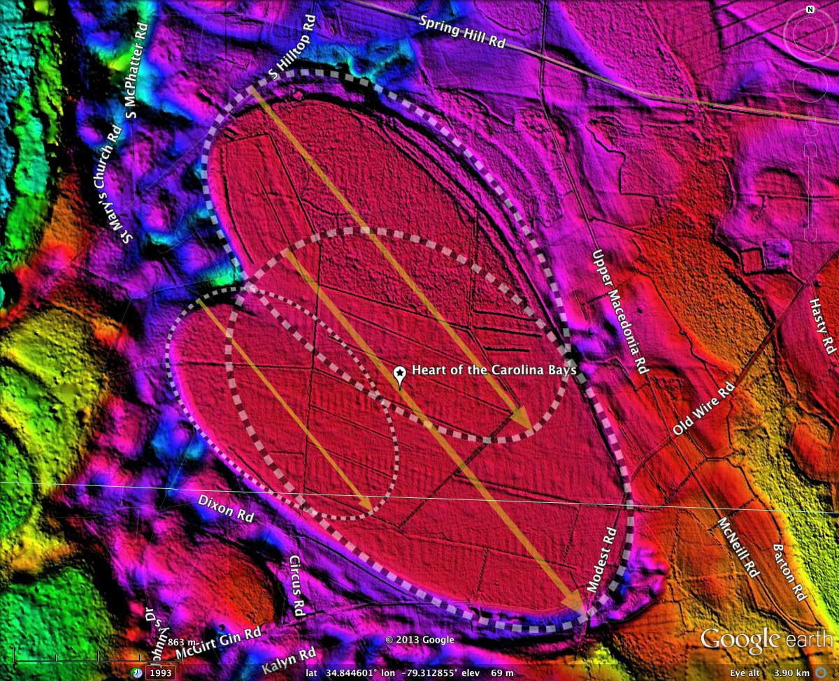
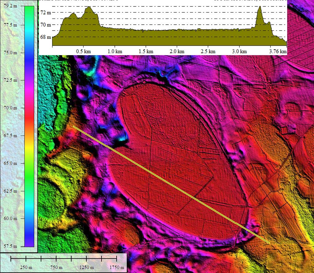
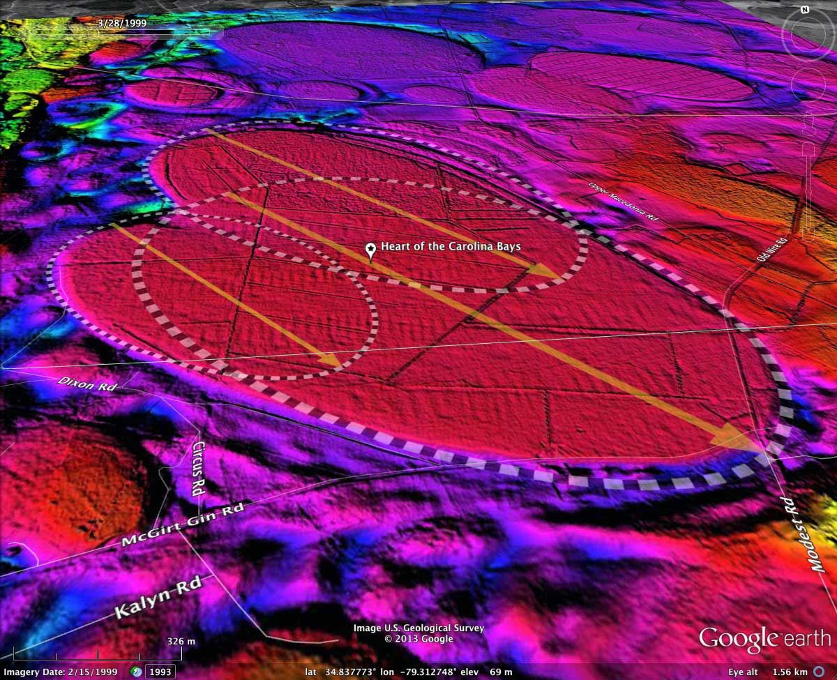
"Heart Bay" is one of the most enigmatic of the Carolina bays. It is located primarily in southwestern Hoke County, NC. The LiDAR's hsv false color shading values have been selected to highlight the floor of the bay in red. The current shape is considered to be the mashup of three classic bayCarolina archetype oval planforms. All three have the identical orientation (140.61º), but differ in length and eccentricity. The survey has catalogued 600 bays within the 139317 1/4º octant, all similarly shaped and orientated. See the entire survey data for the local area using this KMZ LINK.
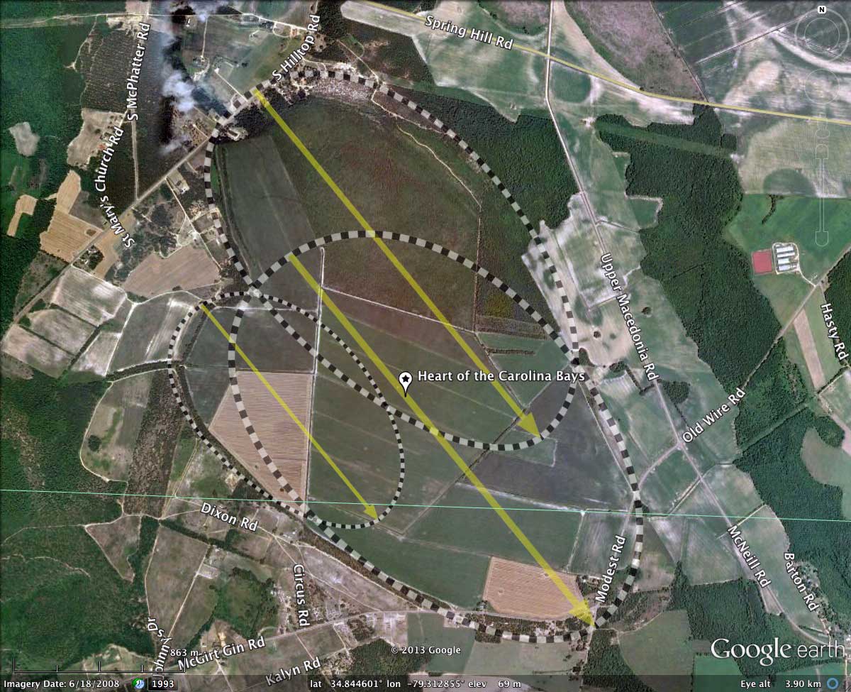
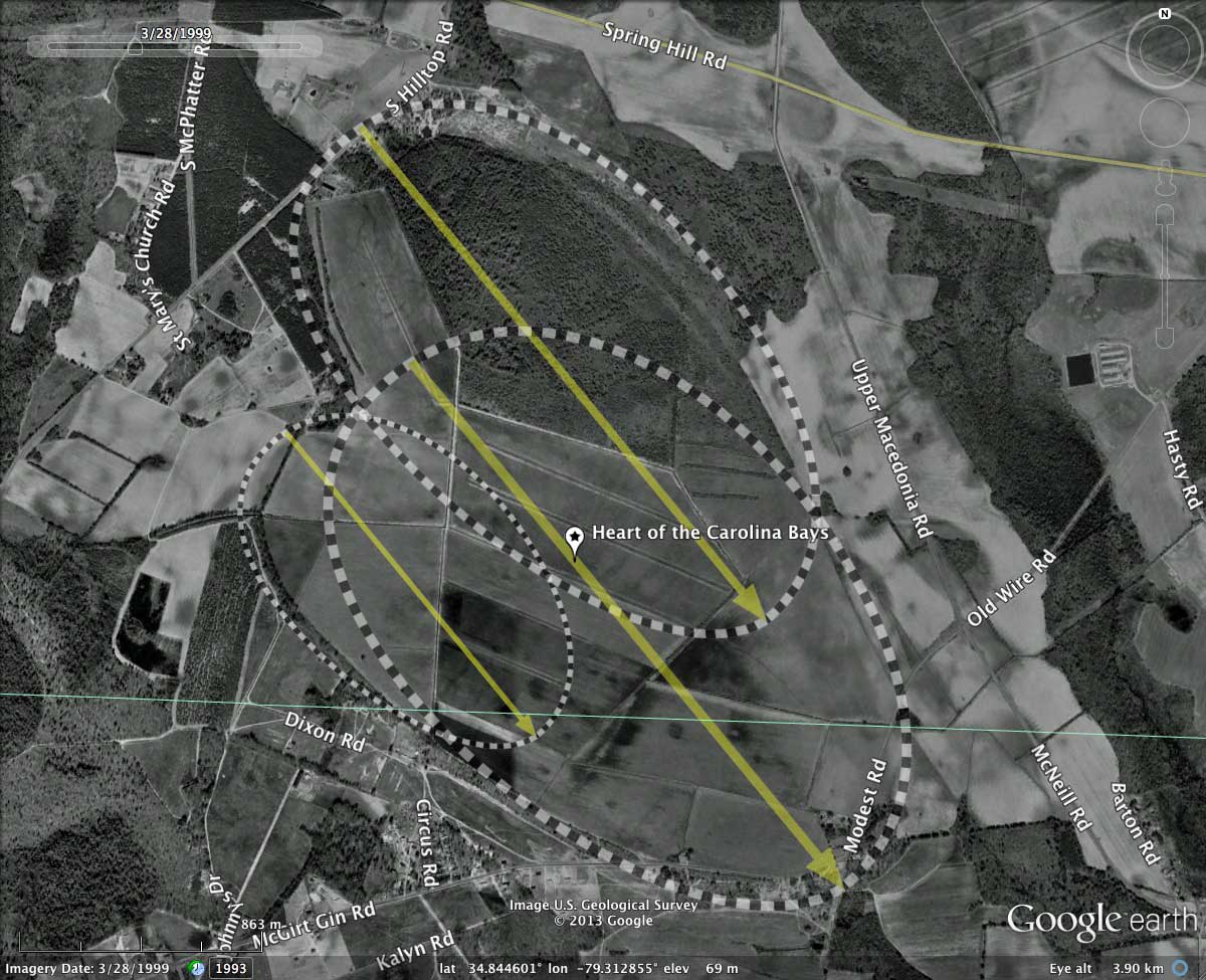
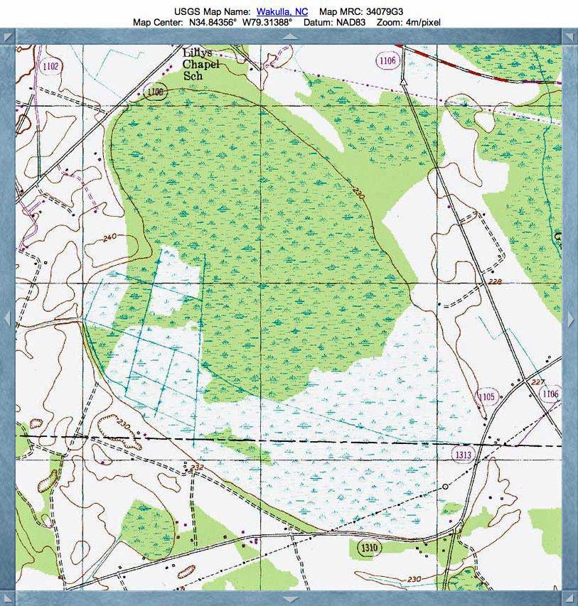
Heart Bay has been ditched and drained, and is fully applied to agricultural uses.
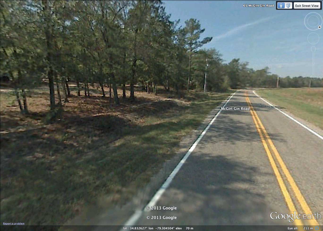
Google Streetview photography is available along roads in the area, and the attached album contains a static image from near the southeastern point of the heart. Taken from the bay floor, the land on the left side rises up towards the rim. These indications of elevation change are very subtle, and reference to the LiDAR maps is essential to validate the visualization. Streetview of rim from floor LINK. ; and can also be reached using using Google Earth through the placemark in the above linked KMZ file.
History lesson: This is a reprise from my very first Google + post, 10/8/2012, with significant new content. Going forward, I shall be replacing about 50 of my first posts, using the new Album format used here, along with better imagery and Streetviews when available. At present, all the CBotD posts are being re-published on a private web site, since Google has announced it is shuttering Google +.
"Heart Bay" is one of the most enigmatic of the Carolina bays. It is located primarily in southwestern Hoke County, NC. The LiDAR's hsv false color shading values have been selected to highlight the floor of the bay in red. The current shape is considered to be the mashup of three classic bayCarolina archetype oval planforms. All three have the identical orientation (140.61º), but differ in length and eccentricity. The survey has catalogued 600 bays within the 139317 1/4º octant, all similarly shaped and orientated. See the entire survey data for the local area using this KMZ LINK.
Heart Bay has been ditched and drained, and is fully applied to agricultural uses.
Google Streetview photography is available along roads in the area, and the attached album contains a static image from near the southeastern point of the heart. Taken from the bay floor, the land on the left side rises up towards the rim. These indications of elevation change are very subtle, and reference to the LiDAR maps is essential to validate the visualization. Streetview of rim from floor LINK. ; and can also be reached using using Google Earth through the placemark in the above linked KMZ file.
- Index #: 139317_3525
- Location: 34.842329,-79.314008
- Major: 3.09 km . . . Minor: 1.75 km
- Eccentricity: 0.881
- Area: 243.85 hectares
- Bearing: 140.61º
- Elevation: 69.11 m
- Archetype: bayCarolina
- Effective Diameter: 1,762.041 m
Copyright 2018 by Michael Davias