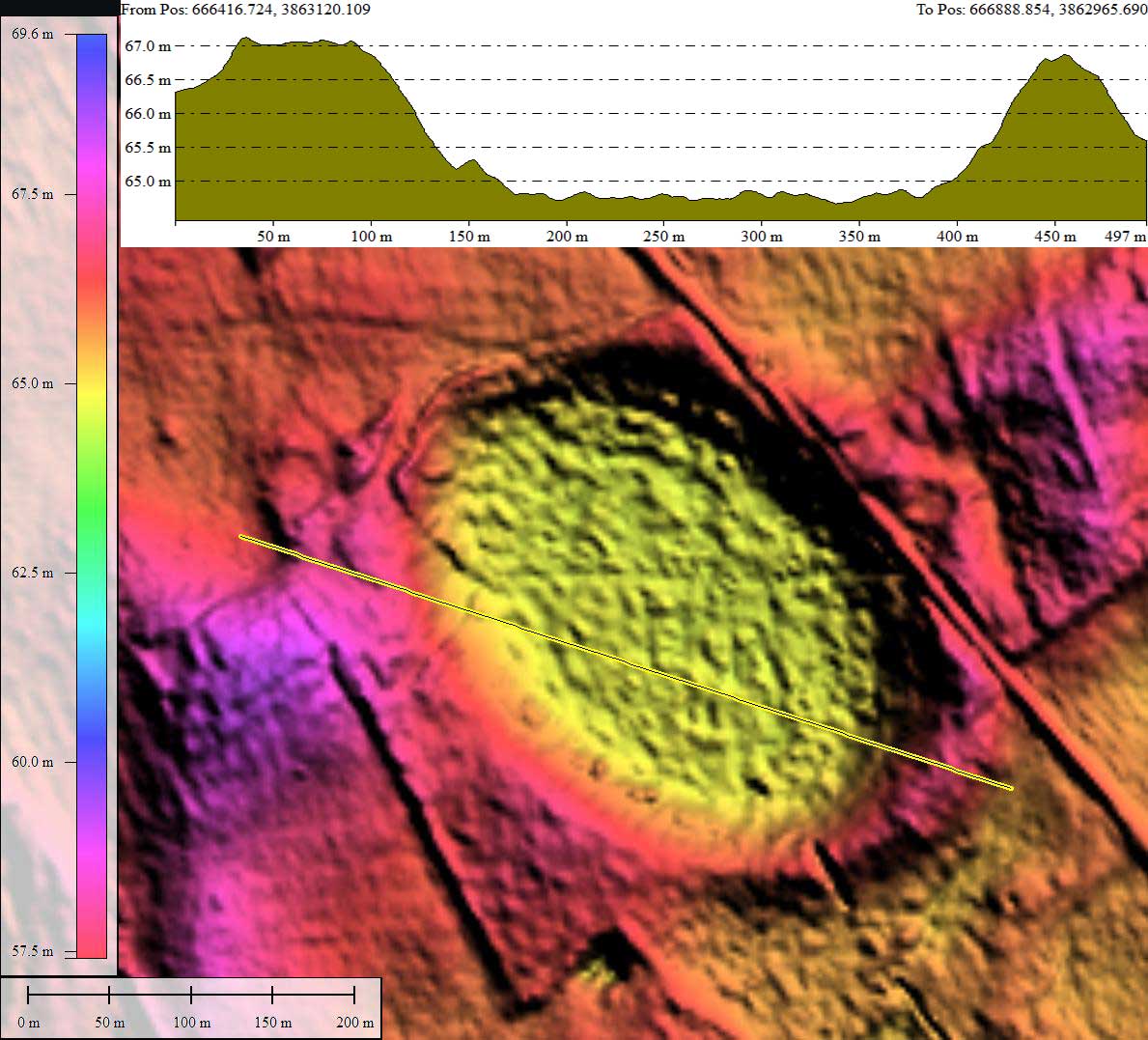
Blueberry Bay, NC
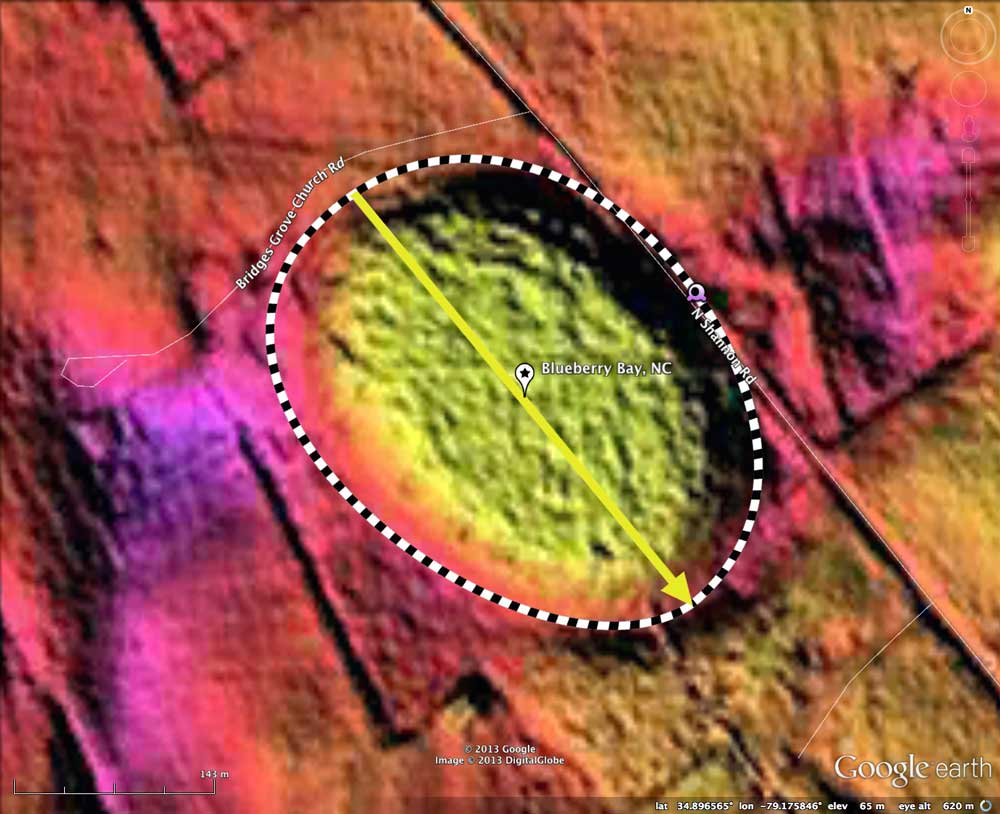
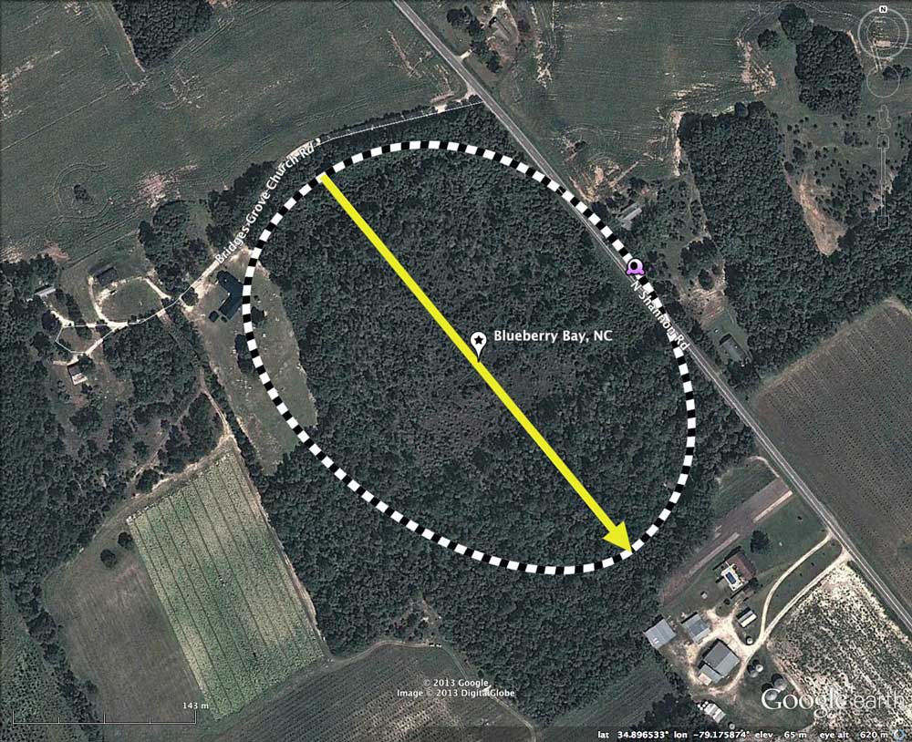
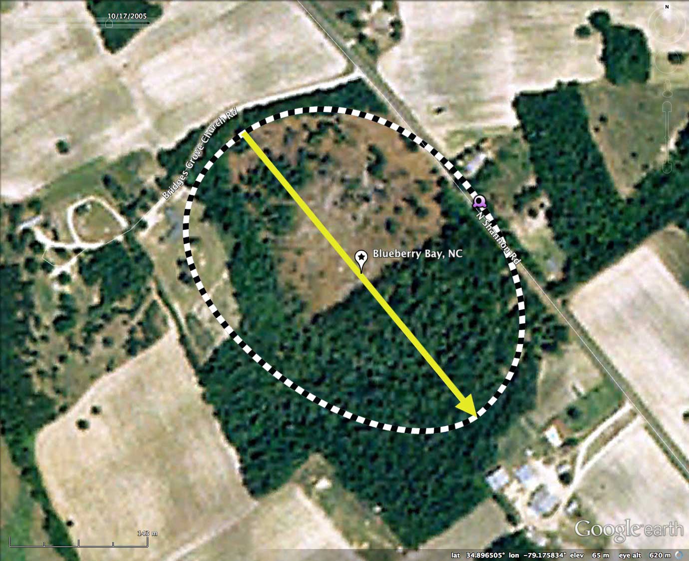
Blueberry Bay is located in Hoke County, SC, 10 kilometers south of Raeford. The bay is easily fit to the bayCarolina archetype overlay shape, and has an alignment similar to other local bays. 2005 Google Satellite imagery shows ~40% of bay timber recently cut.
Here is an excerpt from Timothy Nifong's review of Blueberry Bay in his _The "Clay Subsoil" Carolina Bays of North Carolina_.
"This site represents the only known occurrence of pondspice (Litsea aestivalis ) within a clay "subsoil" bay and one of a very few records of its occurrence in the Middle Coastal Plain. The predominance of fetter-bush (Leucothoe racemosa) in the shrub layer here is unknown in other clay subsoil bays, and thus notable."
In his paper, Nifong gave Arabia Bay 15 points out of a possible 20, and rated the bay one of the "B" Priority bays for restoration efforts. ( the report only listed four bays in the "A" list)
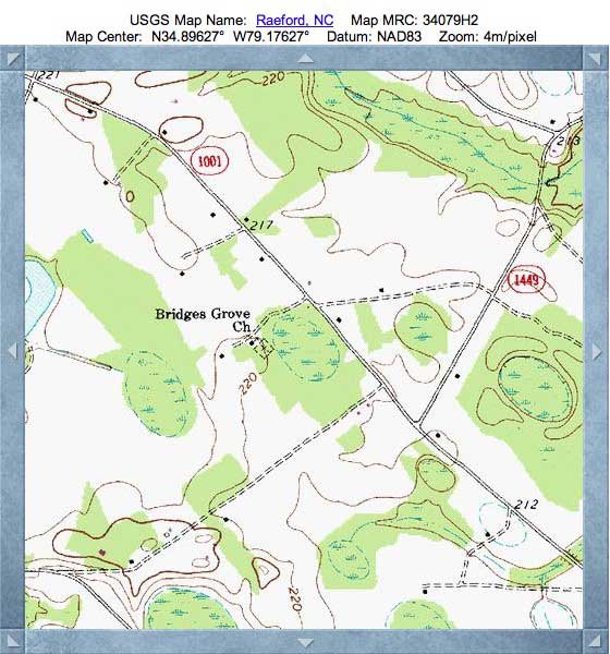
The Hoke County Natural Area Inventory (2004) also documented Blueberry Bay. This paper, commissioned by the North Carolina Natural Heritage Program, was written by Bruce Sorrie. His topographic map, identifying the location of Arabia Bay, is included in the album here. Here are some of his comments:
SIGNIFICANT FEATURES: Blueberry Bay features one of the few remaining examples of a Cypress Savanna community in the state. It supports populations of three rare plant species, one of which is the sole record of pondspice (Litsea aestivalis, a shrub or small tree), in Hoke County Pondspice is a Federal Species of Concern. The bay also serves as a breeding site for amphibians and a feeding area for songbirds and wood ducks. Several other Carolina bays occur in the vicinity, forming a complex that is critical to long-term viability of flora and fauna.
MANAGEMENT AND PROTECTION: The bay needs active management to reduce tree density, especially loblolly pines and sweetgums. Opening the canopy will increase herbaceous growth and promote reproduction of the rare species. An occasional prescribed burn will also promote herbaceous plants and suppress pines and sweetgums. Currently the bay is not under conservation protection.
Excerpts from the two papers mention above are available in a PDF, which can be retrieved HERE.
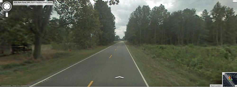
Google Streetview image looking south along SR 1001 is included in the attached Photo Album. It shows the road passing along the inside of the eastern bay rim. The bay floor is off to right, while rim rises up on the left. In the distance, the roadbed rises back out of the bay, and land can be seen to be level on both sides of the road. Browse interactively in Google maps using: this LINK.
The Carolina Bay Survey has identified and measured over 1600 bays in _Octant 139316_.
Here is an excerpt from Timothy Nifong's review of Blueberry Bay in his _The "Clay Subsoil" Carolina Bays of North Carolina_.
"This site represents the only known occurrence of pondspice (Litsea aestivalis ) within a clay "subsoil" bay and one of a very few records of its occurrence in the Middle Coastal Plain. The predominance of fetter-bush (Leucothoe racemosa) in the shrub layer here is unknown in other clay subsoil bays, and thus notable."
In his paper, Nifong gave Arabia Bay 15 points out of a possible 20, and rated the bay one of the "B" Priority bays for restoration efforts. ( the report only listed four bays in the "A" list)
The Hoke County Natural Area Inventory (2004) also documented Blueberry Bay. This paper, commissioned by the North Carolina Natural Heritage Program, was written by Bruce Sorrie. His topographic map, identifying the location of Arabia Bay, is included in the album here. Here are some of his comments:
SIGNIFICANT FEATURES: Blueberry Bay features one of the few remaining examples of a Cypress Savanna community in the state. It supports populations of three rare plant species, one of which is the sole record of pondspice (Litsea aestivalis, a shrub or small tree), in Hoke County Pondspice is a Federal Species of Concern. The bay also serves as a breeding site for amphibians and a feeding area for songbirds and wood ducks. Several other Carolina bays occur in the vicinity, forming a complex that is critical to long-term viability of flora and fauna.
MANAGEMENT AND PROTECTION: The bay needs active management to reduce tree density, especially loblolly pines and sweetgums. Opening the canopy will increase herbaceous growth and promote reproduction of the rare species. An occasional prescribed burn will also promote herbaceous plants and suppress pines and sweetgums. Currently the bay is not under conservation protection.
Excerpts from the two papers mention above are available in a PDF, which can be retrieved HERE.
Google Streetview image looking south along SR 1001 is included in the attached Photo Album. It shows the road passing along the inside of the eastern bay rim. The bay floor is off to right, while rim rises up on the left. In the distance, the roadbed rises back out of the bay, and land can be seen to be level on both sides of the road. Browse interactively in Google maps using: this LINK.
The Carolina Bay Survey has identified and measured over 1600 bays in _Octant 139316_.
- Index #: 139316_5870
- Location: 34.89642246305617,-79.17584828383596
- Major: 0.38 km . . . Minor: 0.29 km
- Eccentricity: 0.653
- Area: 8.87 hectares
- Bearing: 140.61º
- Elevation: 64.88 m
- Archetype: bay
- Effective Diameter: 336.06 m
Copyright 2018 by Michael Davias