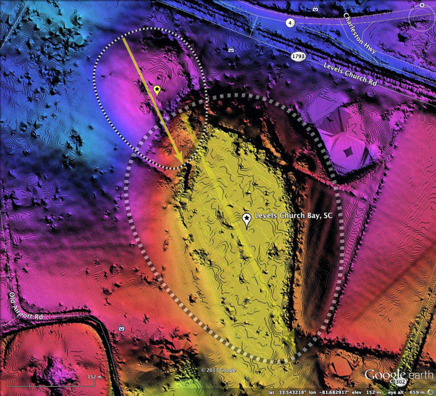
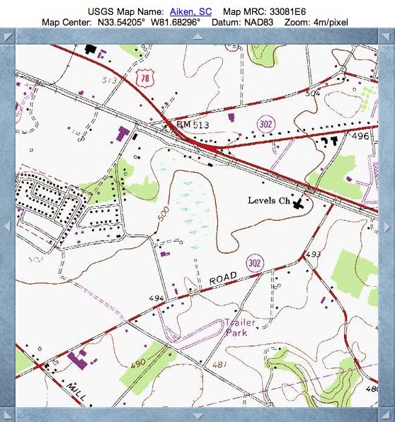
Levels Church Bay, SC
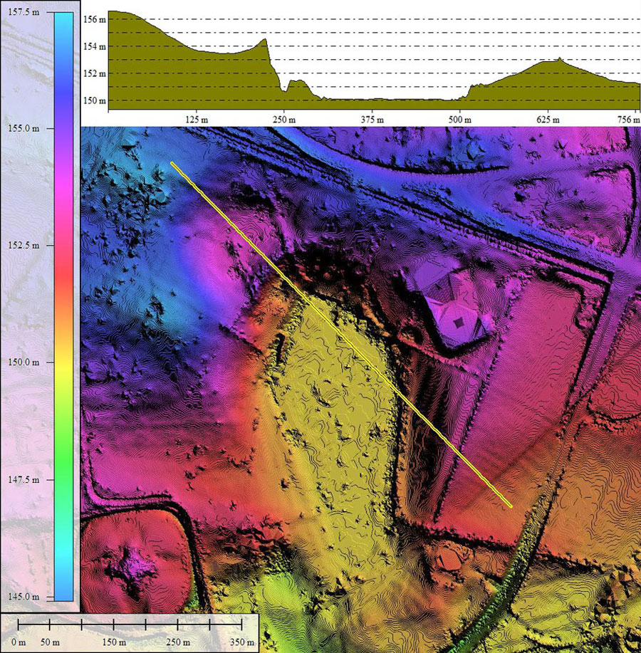
Our bay today is located on the east side of Aiken, South Carolina. It has been named by me after the highway which passes to the north. I interpret the bay architecture to be comprised of two baySouth shapes, where a primary bay has been extended to the northwest by a the overlap of a smaller one.
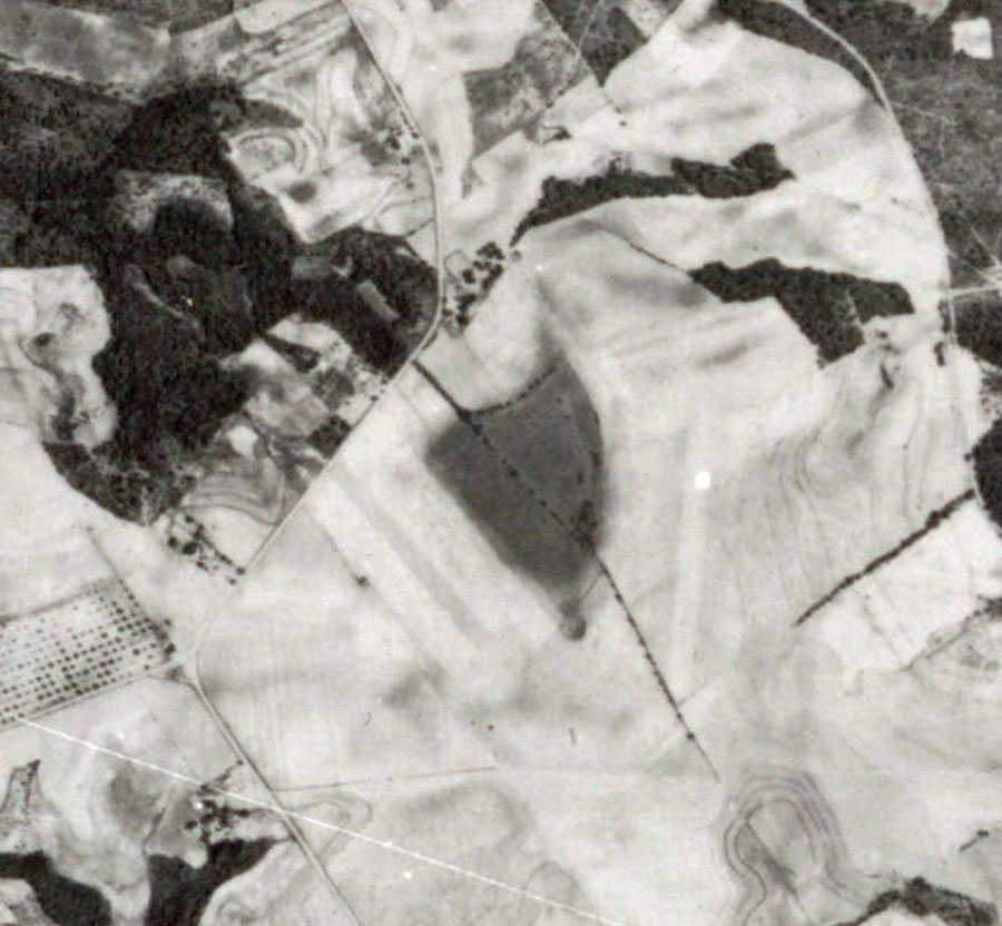
Despite it being in the urban area, it remains in a fairly natural state. A small parking area has been built within the northeast area of the bay, and a major drainage channel has been sliced down its long axis, exiting out the southern tip of the rim. The LiDAR suggests the southern-most tip of the rim was leveled to provide fill for a building site to the south.
Areas of the eastern and western bay floor have been converted to open farmland, but the central run of the bay looks to be either open water or marshy.
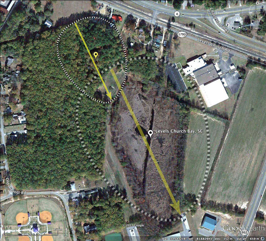
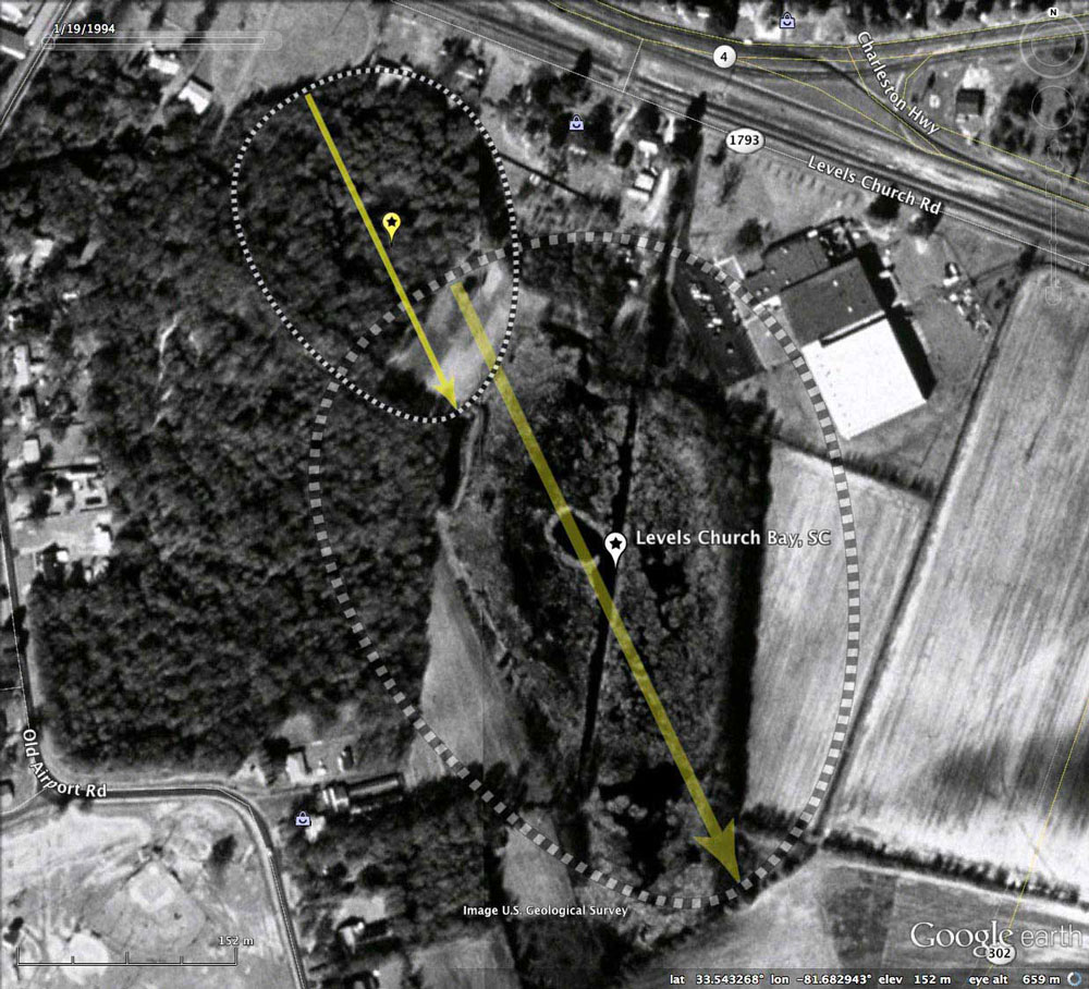
The historical imagery available through Google Earth suggests there has been little human encroachment since 1994. In the fall of 2011, the west central bay floor was disc cultivated, and perhaps by today (2013), there is farmland there also.
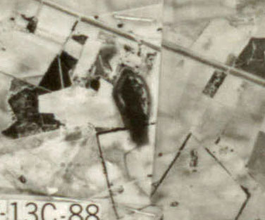
Included in the album are two historical aerial photos (1938 & 1943), sourced from the SC University Libraries Digital Collection. Both images support a finding that the bay has remained in somewhat of a natural state.
The Carolina Bay Survey has identified and measured ~30 bays in Hexatant 134326. Given the extensive dissection of the area by deep river drainage channels, it is surprising there are any; where they do appear is on a few areas of elevated level terrain.
Despite it being in the urban area, it remains in a fairly natural state. A small parking area has been built within the northeast area of the bay, and a major drainage channel has been sliced down its long axis, exiting out the southern tip of the rim. The LiDAR suggests the southern-most tip of the rim was leveled to provide fill for a building site to the south.
Areas of the eastern and western bay floor have been converted to open farmland, but the central run of the bay looks to be either open water or marshy.
The historical imagery available through Google Earth suggests there has been little human encroachment since 1994. In the fall of 2011, the west central bay floor was disc cultivated, and perhaps by today (2013), there is farmland there also.
Included in the album are two historical aerial photos (1938 & 1943), sourced from the SC University Libraries Digital Collection. Both images support a finding that the bay has remained in somewhat of a natural state.
The Carolina Bay Survey has identified and measured ~30 bays in Hexatant 134326. Given the extensive dissection of the area by deep river drainage channels, it is surprising there are any; where they do appear is on a few areas of elevated level terrain.
- Index #: 134326_1773
- Location: 33.54307156796206,-81.68294719369827
- Major: 0.47 km . . . Minor: 0.36 km
- Eccentricity: 0.649
- Area: 13.67 hectares
- Bearing: 154.6º
- Elevation: 151.49 m
- Archetype: baySouth
- Effective Diameter: 417.195 m
- Index #: 134326_1873
- Location: 33.54510970243919,-81.6846265336549
- Major: 0.25 km . . . Minor: 0.18 km
- Eccentricity: 0.657
- Area: 3.75 hectares
- Bearing: 154.6º
- Elevation: 153.21 m
- Archetype: baySouth
- Effective Diameter: 218.509 m
Copyright 2018 by Michael Davias