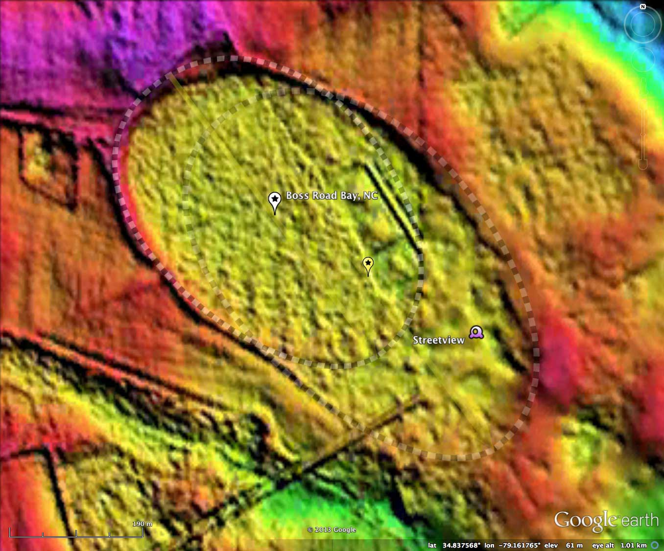
Boss Road Bay, NC
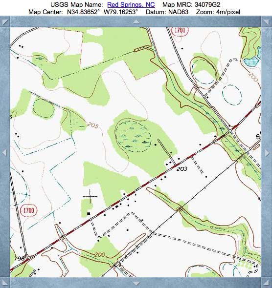
Just like our "Heart Bay" is a mashup of two Carolina bay planforms, the current offering is a 3/4 km long bay composed of two smaller planform shapes. Our interpretation is that one bay was created first, and the second one was deposited over it. Since the more northerly bay has an existing faint rim trace across the bay floor, this is likely the 2nd in the development. The two planforms are slightly offset, and close inspection shows the tie points on each lateral wall.
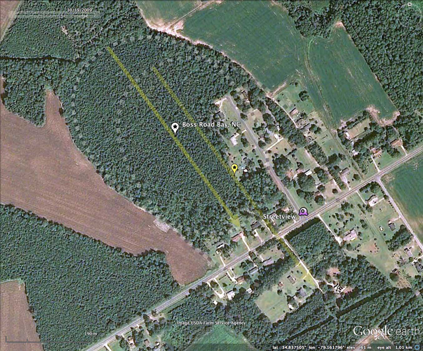
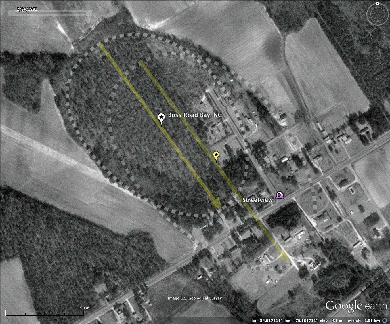
"Boss Road" is my designation, signifying the name of the NW-SE road extending into the bay from the lower right.
Google Streetview imagery can be browsed using this LINK.
The Carolina Bay Survey has identified and measured over 1,600 bays in _Octant 139316_, which puts the octant in the company of only a few with such a large concentration of bays. Their location and metrics can be referenced through a Fusion Table spatial visualization.
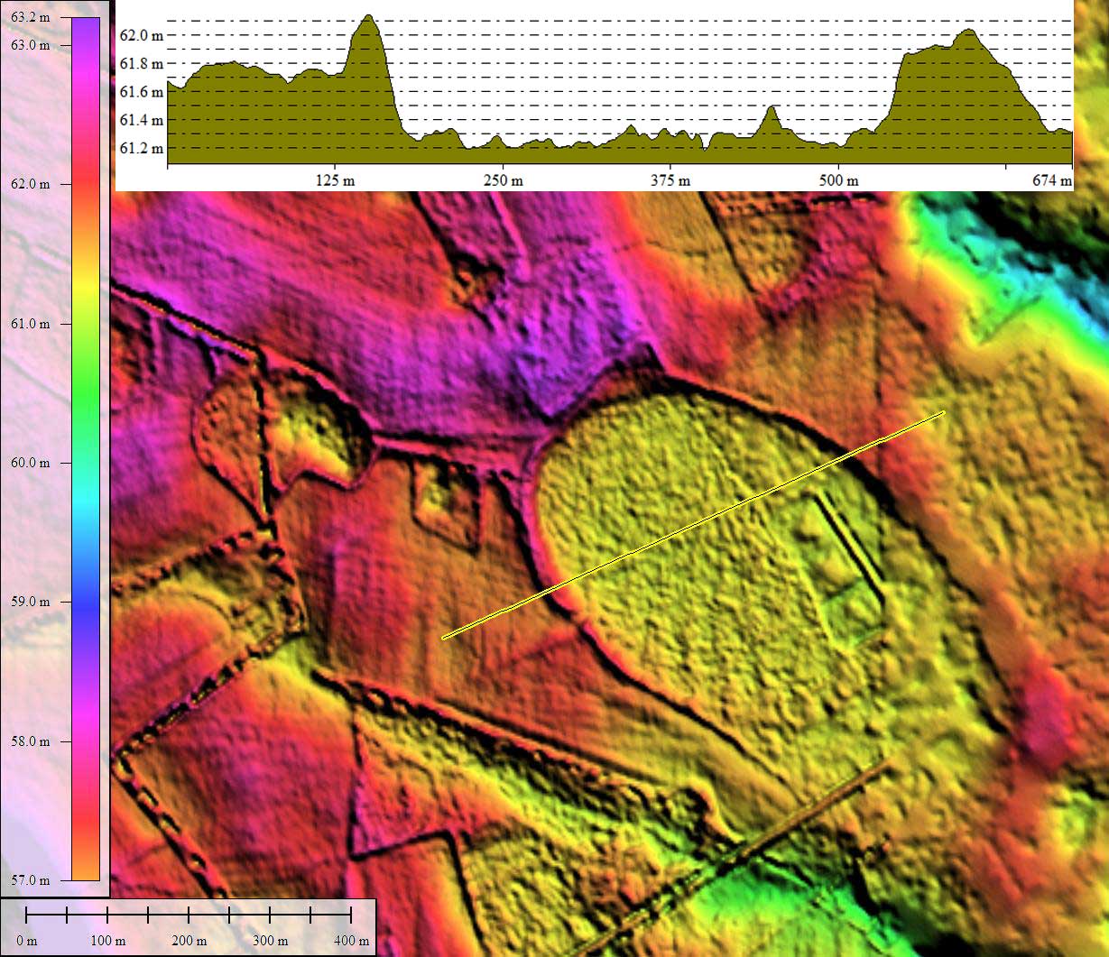
- Index #: 139316_3464
- Location: 34.83732510170353,-79.16178685944112
- Major: 0.5 km . . . Minor: 0.36 km
- Eccentricity: 0.703
- Area: 14.48 hectares
- Bearing: 143.72º
- Elevation: 61.26 m
- Archetype: bay
- Effective Diameter: 429.377 m
Copyright 2018 by Michael Davias