Greens Cut Bay, GA
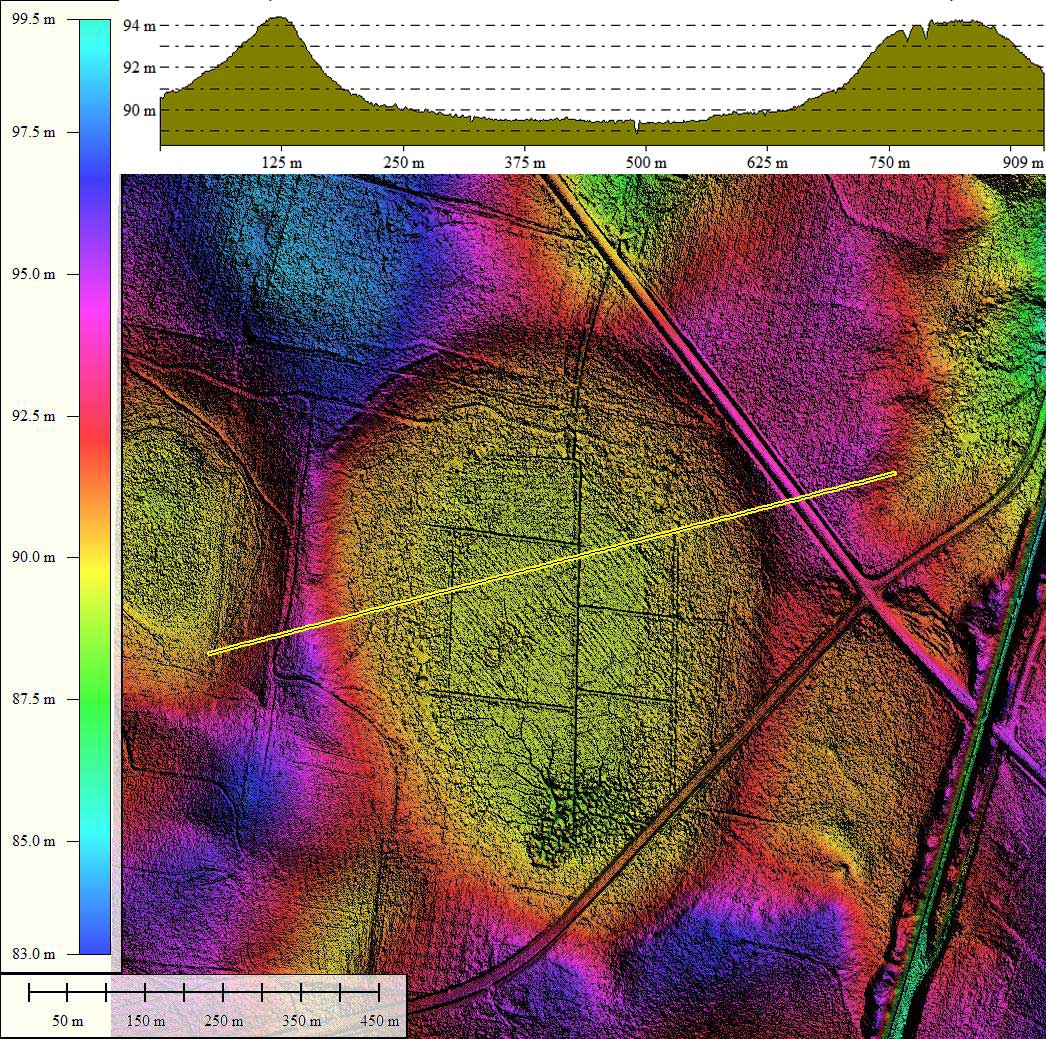
The sets of LiDAR-sourced elevation data from the State of Georgia are full LiDAR point clouds, which I sourced from NOAA. They contain 25cm gridded data, although the map tiles used in the referenced KMZ file were generated with a 1-meter grid. I did create a stunning 8x10" 300 dpi JPG graphic (9 Mb) that you can download from this LINK.
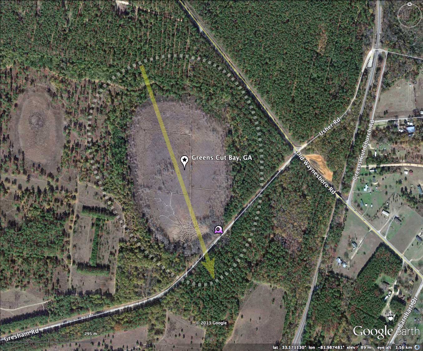
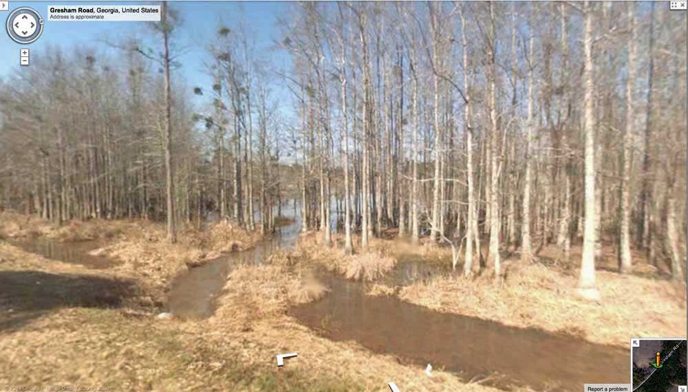
Google Streetview imagery is available along along Gresham Road, which passes across the southern tip of the bay floor along a raised roadbed. The album has an image showing the drainage pipe passing under the road, and at the time of the imagery, the bay had extensive open water. Explore the Streetview interactively in your browser HERE.
The Carolina Bay Survey has identified and measured about 200 bays in Octant 132327, which puts the octant in the company of only a few with such a large concentration of bays. Their location and metrics can be referenced through a Fusion Table spatial visualization.
Google Streetview imagery is available along along Gresham Road, which passes across the southern tip of the bay floor along a raised roadbed. The album has an image showing the drainage pipe passing under the road, and at the time of the imagery, the bay had extensive open water. Explore the Streetview interactively in your browser HERE.
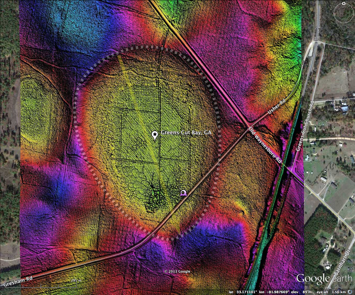
The Carolina Bay Survey has identified and measured about 200 bays in Octant 132327, which puts the octant in the company of only a few with such a large concentration of bays. Their location and metrics can be referenced through a Fusion Table spatial visualization.
- Index #: 132327_6895
- Location: 33.17081839645407,-81.98760552555694
- Major: 0.81 km . . . Minor: 0.59 km
- Eccentricity: 0.681
- Area: 38.48 hectares
- Bearing: 161.16º
- Elevation: 89.17 m
- Archetype: baySouth
- Effective Diameter: 699.958 m
Copyright 2018 by Michael Davias