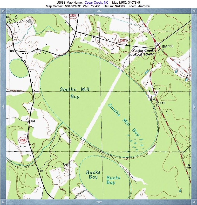
Smiths Mill Bay, NC
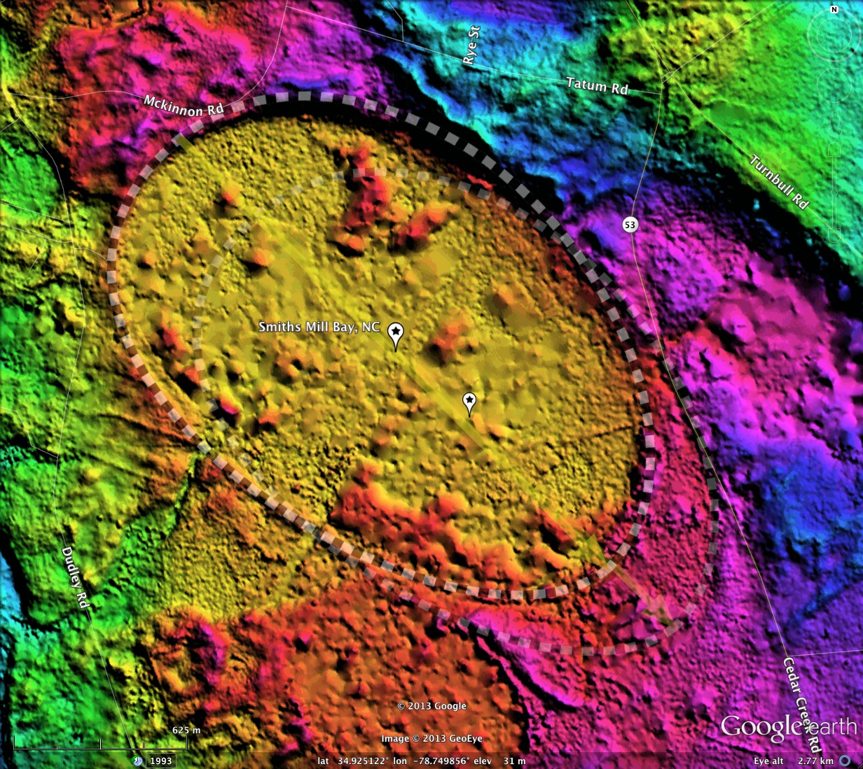
The bays within the Cape Fear River Valley are quite extensive, occupying large swaths of the area. I interpret Smiths Mill Bay to be comprised of two similar bay shapes, mostly overlapping each other. The shape is an exact match to the bayCarolina archetype, and the orientation is similar to that of other bays in the immediate area.
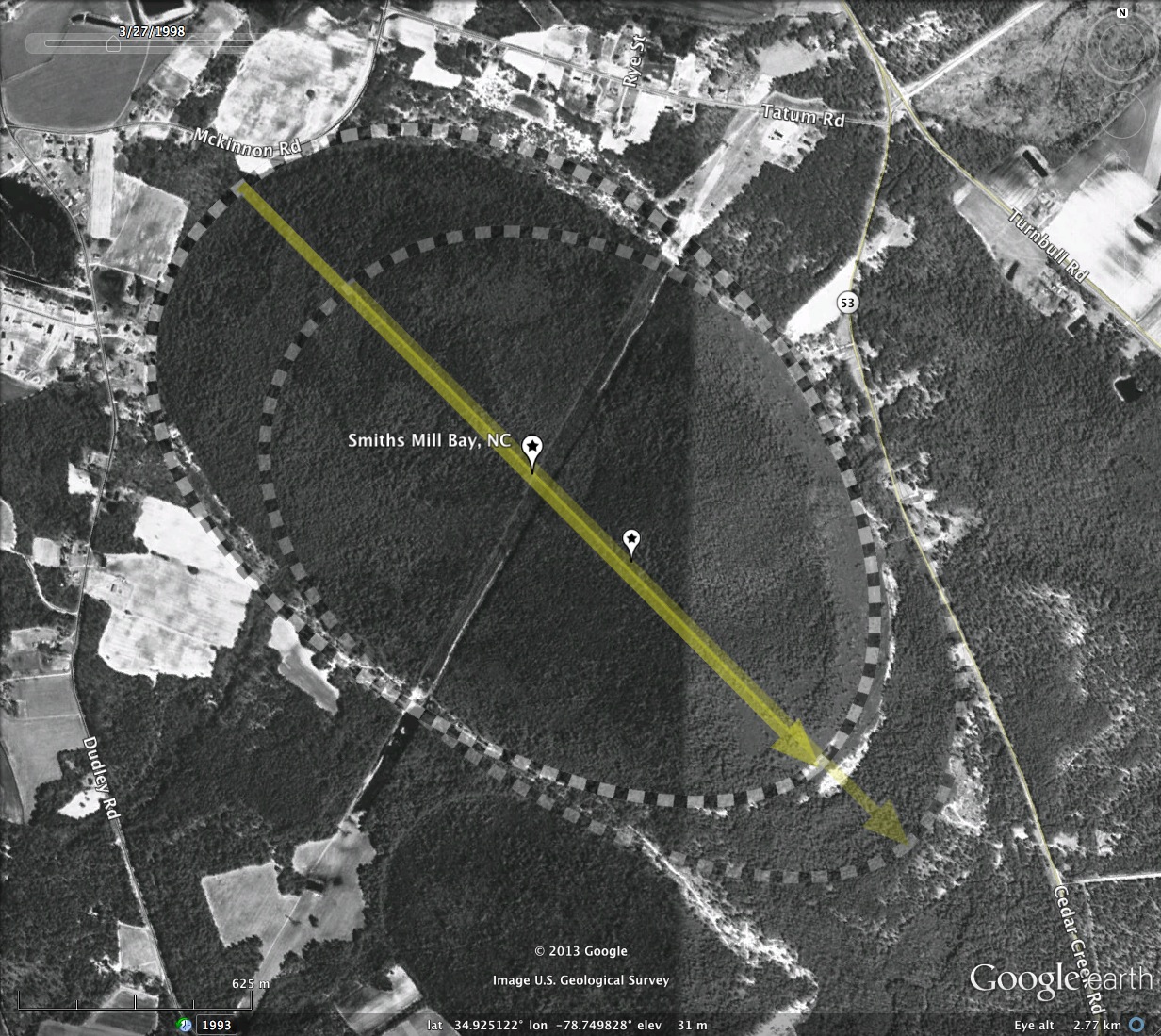
Identifying bays in this area is sometimes difficult, as dense tree canopy obstructs the LiDAR view of the bare earth, making some bays nearly impossible to see, and others hard to resolve their true shape. Sometimes, all that is visible is the sandy, un-vegetated rim, which shows itself as a ditch down between the trees tops. A 2 meter rim is easily obstructed by a 10-meter dense canopy. In this bay's case, the rims are easy to see in both the LiDAR and the orthophotography.
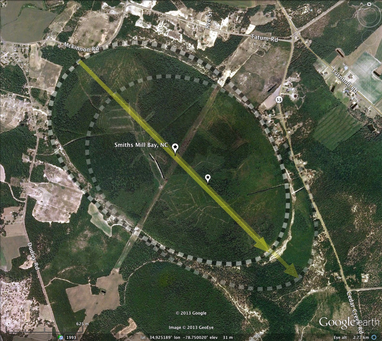
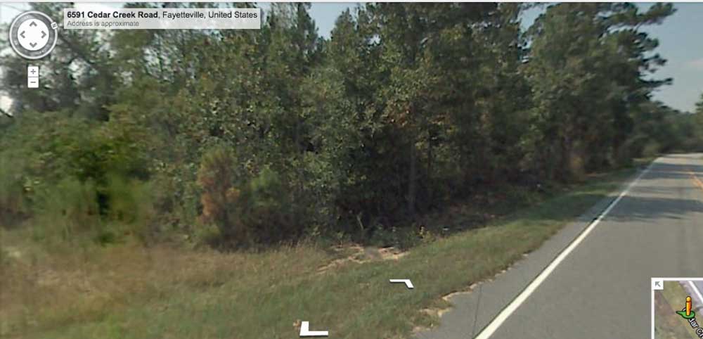
Google Streetview imagery is available in the area, and the album here contains an image of the rim from where Cedar Creek Road makes an approach to the rim on the southeastern end of the secondary bay. Visible is the drop off from the road, which is on the rim, down into the bay. Heavy vegetation blocks most of the Streetview opportunities. You can browse the area using this LINK.
Identifying bays in this area is sometimes difficult, as dense tree canopy obstructs the LiDAR view of the bare earth, making some bays nearly impossible to see, and others hard to resolve their true shape. Sometimes, all that is visible is the sandy, un-vegetated rim, which shows itself as a ditch down between the trees tops. A 2 meter rim is easily obstructed by a 10-meter dense canopy. In this bay's case, the rims are easy to see in both the LiDAR and the orthophotography.
Google Streetview imagery is available in the area, and the album here contains an image of the rim from where Cedar Creek Road makes an approach to the rim on the southeastern end of the secondary bay. Visible is the drop off from the road, which is on the rim, down into the bay. Heavy vegetation blocks most of the Streetview opportunities. You can browse the area using this LINK.
- Index #: 139314_6999
- Location: 34.924565089968766,-78.74991525549049
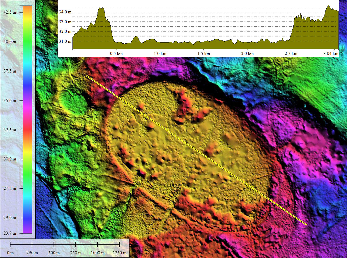
- Major: 2.2 km . . . Minor: 1.48 km
- Eccentricity: 0.738
- Area: 256.81 hectares
- Bearing: 135.2º
- Elevation: 30.94 m
- Archetype: bayCarolina
- Effective Diameter: 1,808.259 m
- Index #: 139314_6898
- Location: 34.92246345897503,-78.74702695925455
- Major: 2.12 km . . . Minor: 1.41 km
- Eccentricity: 0.747
- Area: 235.81 hectares
- Bearing: 135.2º
- Elevation: 31.14 m
- Archetype: bayCarolina
- Effective Diameter: 1,732.749 m
Copyright 2018 by Michael Davias