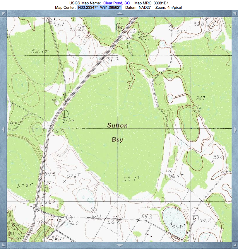
Sutton Bay, SC
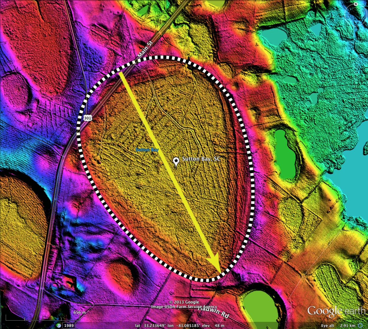
Sutton Bay is a USGS-identified Carolina bay landform in South Carolina. It is over 2 kilometers long, and presents a perfect baySouth archetype shape.
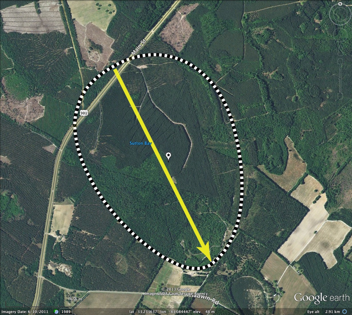
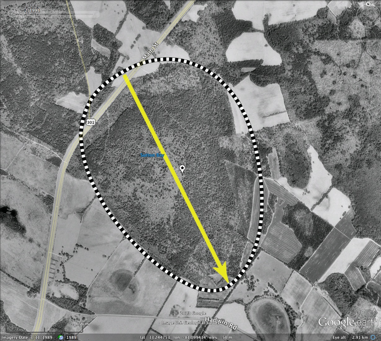
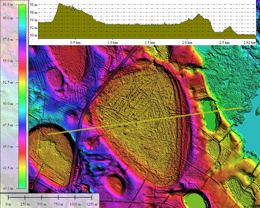
The bay is relatively unscathed by human activity, excepting the four-lane US 301 divided highway that travels 2,500 feet across the northwestern end, and a few dirt roads which lead into the interior, likely supporting the obvious logging and timber farming activity. A natural drainage seems to lead out near the northern-most rim section, although it is narrow enough to be a man-made cut. The bay floor is 4 to 6 meters below the surrounding pediments. The orientation is similar to that of surrounding bays.
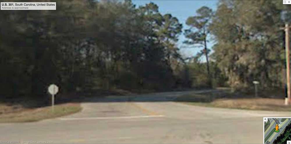
Google Streetview imagery is available along the 301 traverse, but the bay is heavily forested and little can be seen. A hint of the rim's relief can be perceived at the intersection with Voorhees Road, where it rises up from Rt301 and passes over the rim. The scene is captured in the attached album, and the location and image can be retrieved via a placemark in the reference KMZ file. You can browse the area yourself using this Streetview LINK.
The bay is relatively unscathed by human activity, excepting the four-lane US 301 divided highway that travels 2,500 feet across the northwestern end, and a few dirt roads which lead into the interior, likely supporting the obvious logging and timber farming activity. A natural drainage seems to lead out near the northern-most rim section, although it is narrow enough to be a man-made cut. The bay floor is 4 to 6 meters below the surrounding pediments. The orientation is similar to that of surrounding bays.
Google Streetview imagery is available along the 301 traverse, but the bay is heavily forested and little can be seen. A hint of the rim's relief can be perceived at the intersection with Voorhees Road, where it rises up from Rt301 and passes over the rim. The scene is captured in the attached album, and the location and image can be retrieved via a placemark in the reference KMZ file. You can browse the area yourself using this Streetview LINK.
- Index #: 132324_9334
- Location: 33.23325307468842,-81.08522423054703
- Major: 2.01 km . . . Minor: 1.41 km
- Eccentricity: 0.713
- Area: 223.05 hectares
- Bearing: 153.38º
- Elevation: 52.67 m
- Archetype: baySouth
- Effective Diameter: 1,685.216 m
Copyright 2018 by Michael Davias