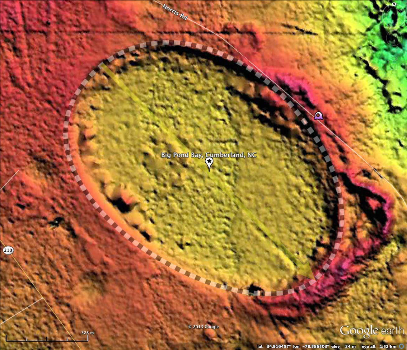
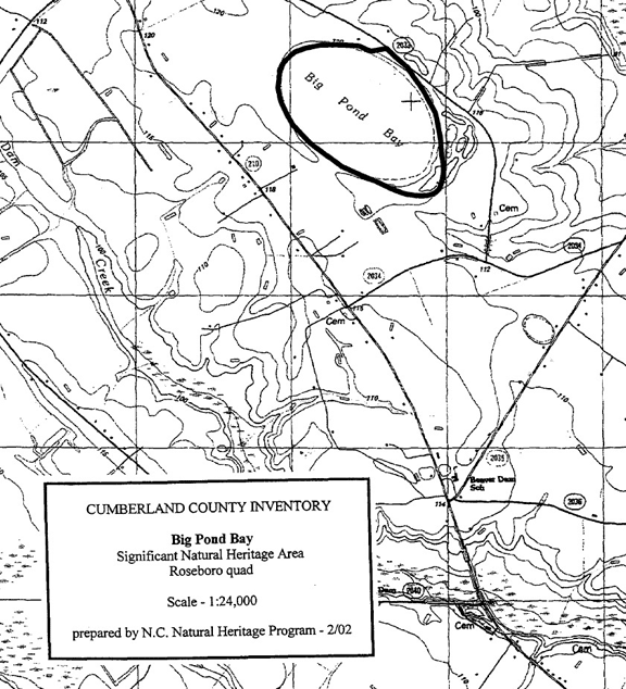
Big Pond Bay, Cumberland, NC
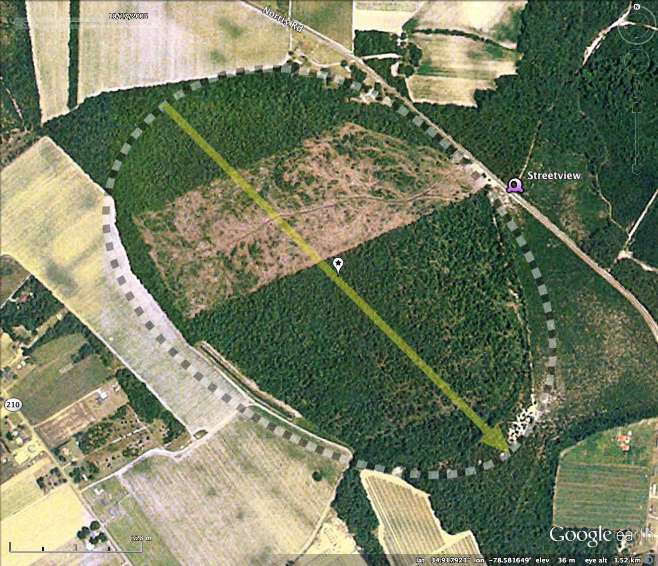
The historical imagery documents the construction between 1993 and 1998 of a borrow pit along the western rim. The pit was further extended between 1998 and 2005, but has not been expanded since. This activity may be an attempt to drain the bay along the western side. There is the vague suggestion of artificial drainage channel existing out the south end. None of this activity is visible in the LiDAR, flown in 2001.
Big Pond Bay has been researched by Ryan Robert Unks, who wrote a report entitled Environmental Controls of Reproduction and Early Growth of Lindera melissifolia (Lauraceae) (2011), available from this LINK. Here is an extract from Unks' description of the bay environs:
Lindera melissifolia adults were observed under a variety of overstory conditions at both sites ranging from 5.5—86.6% transmittance, and to co-occur with both sun and shade species. Leaves of adults present in the areas of highest transmittance had a curled form, similar to those described by Aleric and Kirkman (2005) under high light and presumed stress. Thirty-five seedlings were observed under conditions of 1.5—6.5% transmittance. Seedlings were all growing in a 2.5—5 cm thick layer of pine and deciduous leaf litter, indicating that leaf litter is not preventing germination. No clear patterns of hydrological or microtopographical affinity were indicated by a cursory survey.
Most of the surrounding bay rim habitat has been altered by timber management, but a small area of Xeric Sandhill Scrub Coastal Plain Variant in good condition persists at the southeast end of the site. An open to sparse canopy of longleaf pine (Pinus palustris) rises above a moderate turkey oak (Quercus laevis) understory. Canopy trees are mature, reaching 15 inches in diameter. The sparse to patchy shrub layer is dominated by deerberry (Vaccinium stamineum).
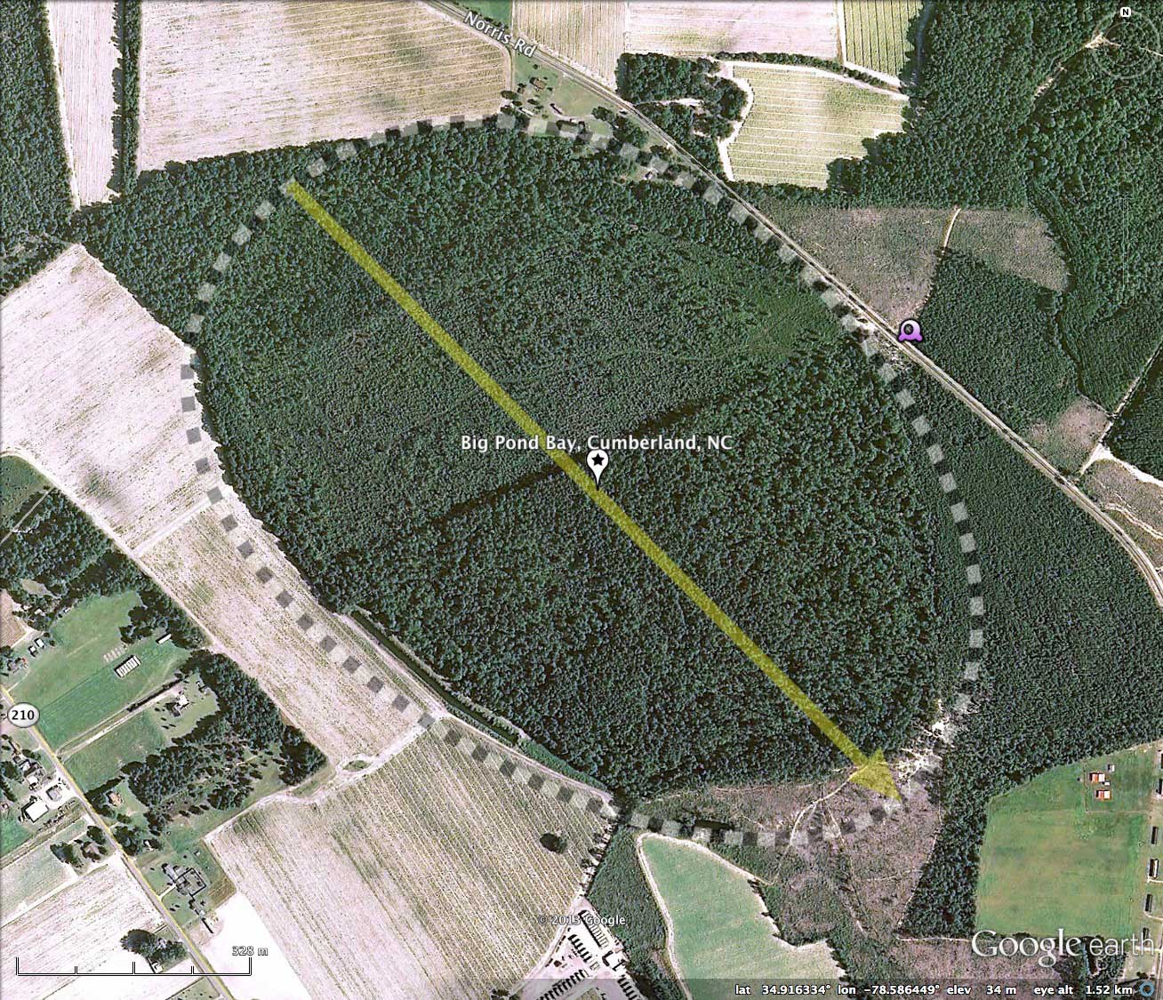
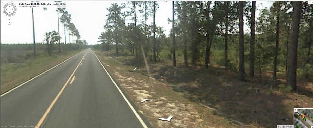
Google Streetview imagery is available along SR 2033 (Norris Road) as it passes southeast into the northeast side of the bay. An image in the album and placemarked in the KMZ file shows the roadway as it crosses into and rides along just the inside of the rim. The bay floor drops off on the right. Explore the Streetview interactively in your browser HERE.
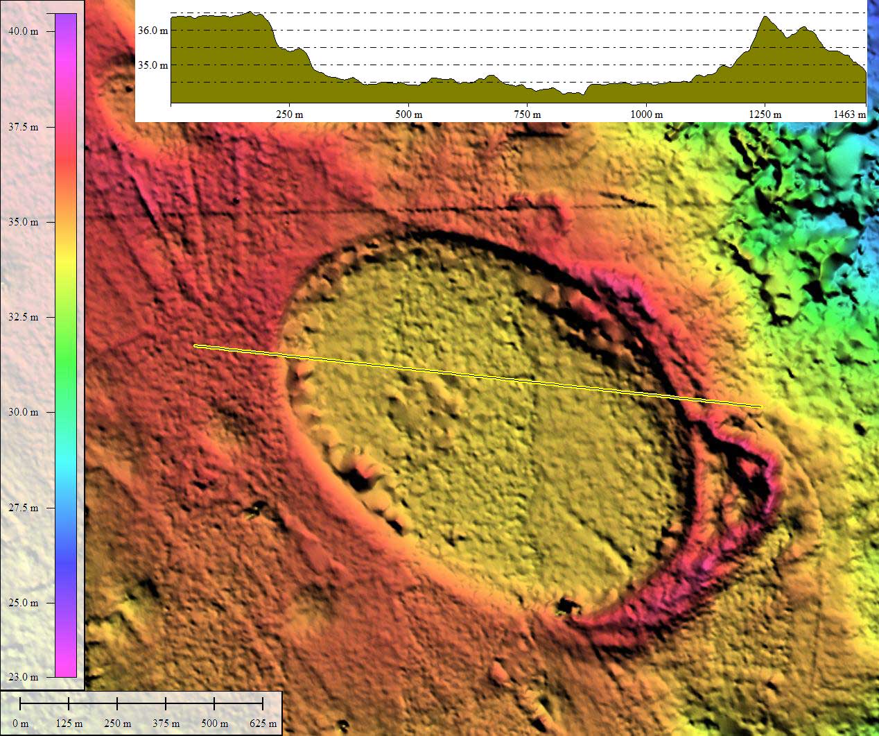
The Carolina Bay Survey has identified and measured over 150 bays in Octant 139314. Their location and metrics can be referenced through a Fusion Table spatial visualization.
- Index #: 139314_6634
- Location: 34.91606687306414,-78.58640575960658
- Major: 1.22 km . . . Minor: 0.86 km
- Eccentricity: 0.713
- Area: 83.06 hectares
- Bearing: 135.3º
- Elevation: 34.35 m
- Archetype: bay
- Effective Diameter: 1,028.373 m