Odd Fellows Bay, NJ
Today's bay was named by me after the local road which passes directly through the western portion of this gentle depression. It is located in northeastern Burlington County, NJ, at an elevation of 20 meters a.s.l. The basin is not identified in the USGS geoNames database.
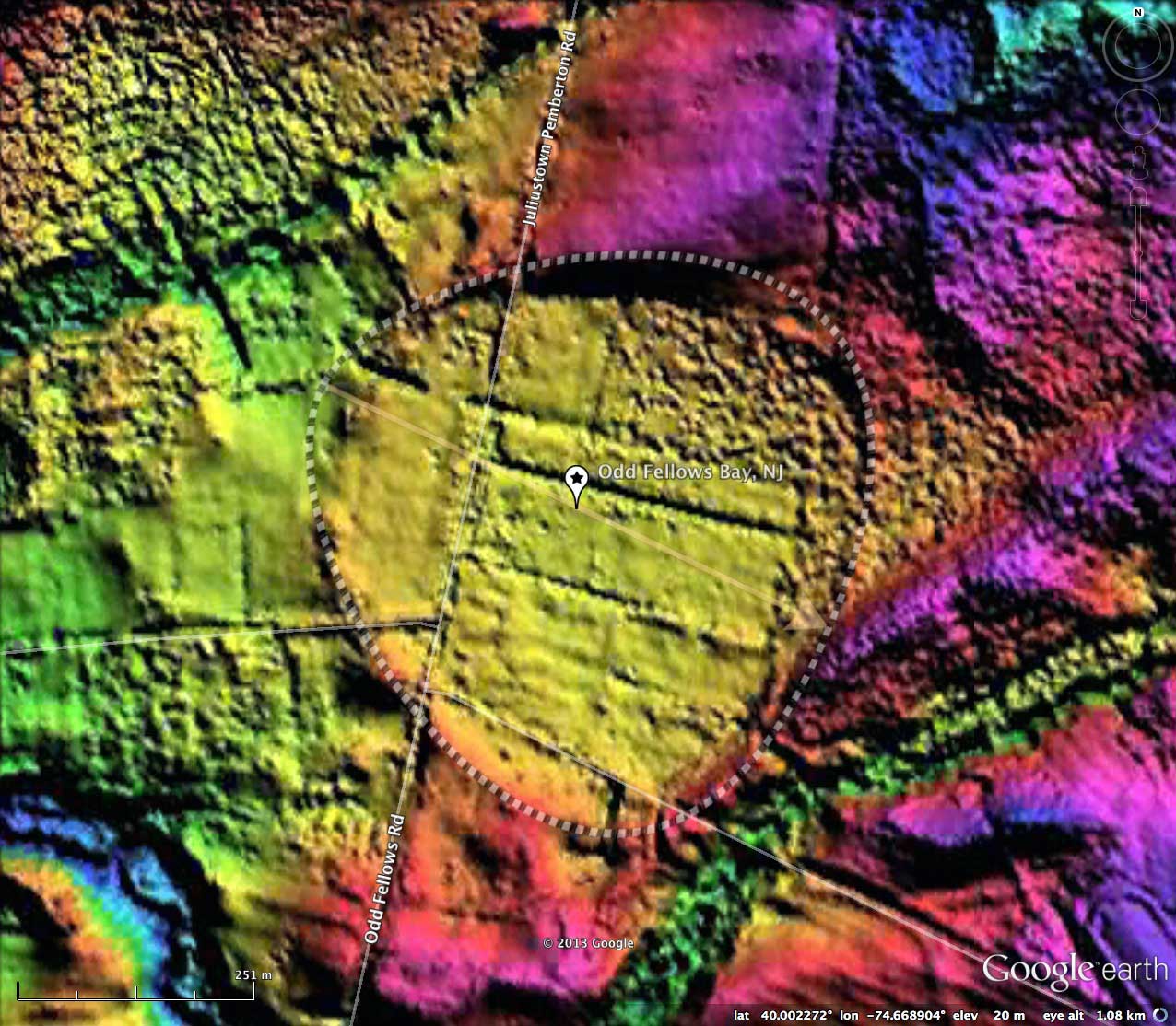
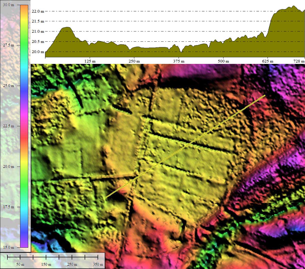
This bay was fitted with the bayBell archetype shape for measurement of the metrics shown here. The orientation is similar to other Carolina Bays in the area.
Landforms having many of the traits of "Carolina Bays" have been seen across New Jersey for many years. Perhaps one of the most interested geologists was William Charles Rasmussen, who studied the landforms while working on his Doctorate. His interest continued into his work at the USGS, where he researched the upper sediments in Maryland and Delaware.
…any comprehensive theory of the formation of these "bays" or "basins" must either account for their wide geographic distribution on the Atlantic Coastal Plain or show that somewhere along their spread the basins change in character or in origin.
W.C. Rasmussen, 1953
Reference: W.C. Rasmussen, 1953, Periglacial Frost-Thaw Basins in New Jersey: A Discussion, The Journal of Geology, Vol. 61, No. 5
Current thoughts about the source of these particular depressions in the Sandhills of New Jersey include blowouts of sand dunes during times of permafrost conditions on the flat surfaces beneath the dunes. Such a genesis is not appropriate for the Carolina Bays seen across the more southern coastal plain areas, however. Rasmussen wrote that the mere existence of Late-Pleistocene Thermokarst activity within the floors of these bays does not necessarily mandate that the bays were created by that activity. Indeed, if these depressions were pre-existing, their water-soaked flat floors would be expected to host frost-wedges and other cryogenic deformations during glacial times.
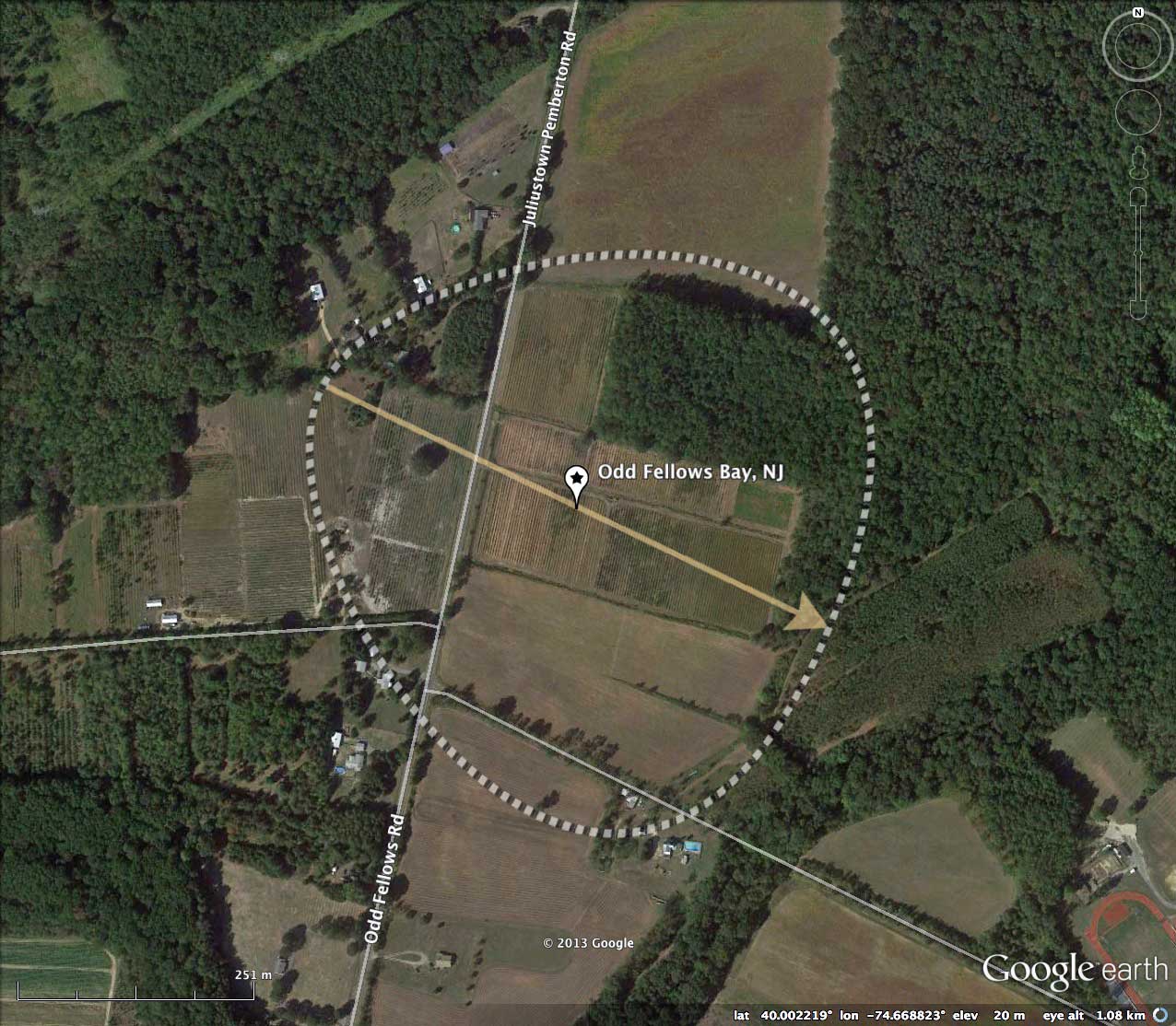
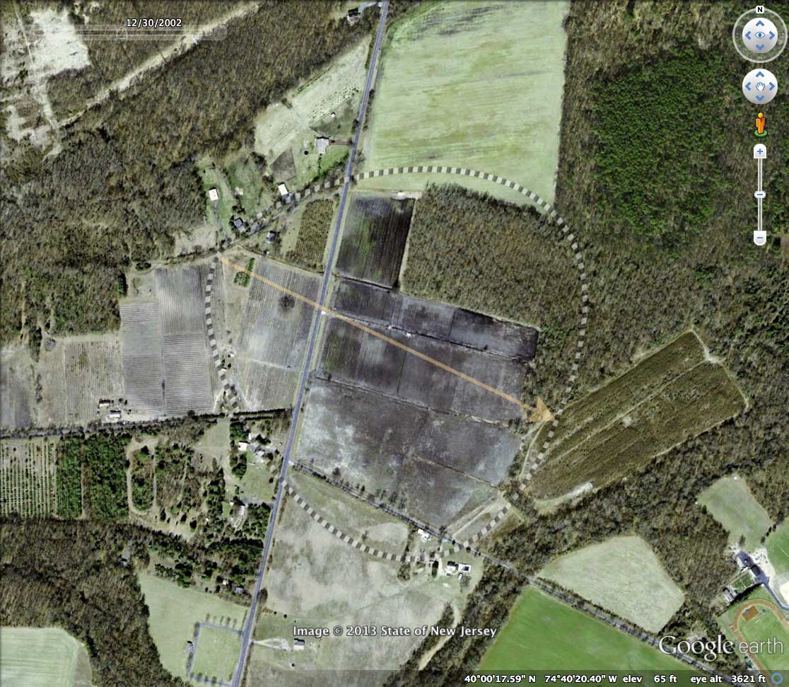
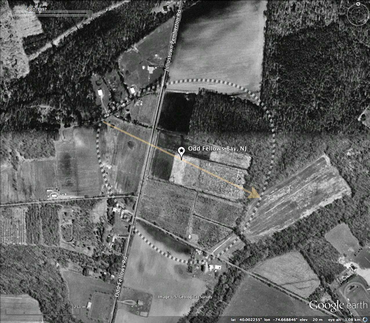
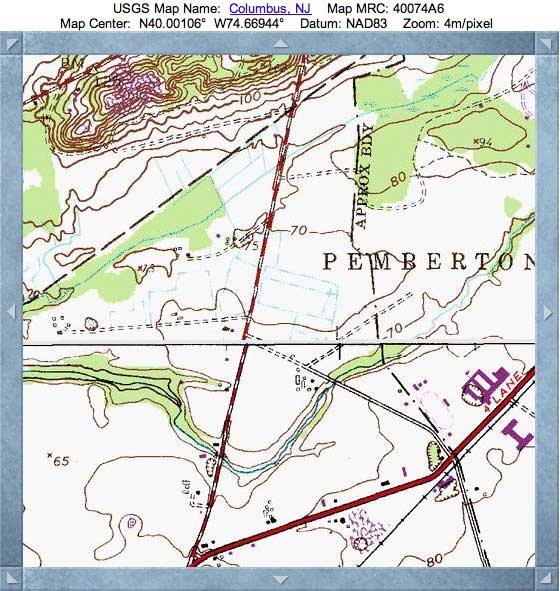
The USGS topographic map does not indicate the bay's rim relief, but the matrix of internal artificial drainage ditches is noted - reference the map in the attached Photo Album. Despite this drainage network, the center of the bay presents itself as "wet" in several fo the Google Satellite historical images, especial the one taken 12/30/2002. I encourage the reader to open the referenced KMZ file (@ top of post) in Google Earth and review the historical imagery with the available time slider.
The elevation profile map documents a delicate western rim having a relief of only 1 meter above the bay floor and the nearby landscape to the west. The eastern rim walls are more dramatically rendered, as the bay floor sets into the surrounding topography by 2 -3 meters. Although there are numerous cross-rim ditches, along with the traverse of Odd Fellows Road, the circumpherial bay rim remains easy to visualize in the LiDAR.
The Carolina Bay Survey has identified and measured over 100 bays in _Octant 160298_. Their location and metrics can be referenced through a Fusion Table spatial visualization.
Current thoughts about the source of these particular depressions in the Sandhills of New Jersey include blowouts of sand dunes during times of permafrost conditions on the flat surfaces beneath the dunes. Such a genesis is not appropriate for the Carolina Bays seen across the more southern coastal plain areas, however. Rasmussen wrote that the mere existence of Late-Pleistocene Thermokarst activity within the floors of these bays does not necessarily mandate that the bays were created by that activity. Indeed, if these depressions were pre-existing, their water-soaked flat floors would be expected to host frost-wedges and other cryogenic deformations during glacial times.
The USGS topographic map does not indicate the bay's rim relief, but the matrix of internal artificial drainage ditches is noted - reference the map in the attached Photo Album. Despite this drainage network, the center of the bay presents itself as "wet" in several fo the Google Satellite historical images, especial the one taken 12/30/2002. I encourage the reader to open the referenced KMZ file (@ top of post) in Google Earth and review the historical imagery with the available time slider.
The elevation profile map documents a delicate western rim having a relief of only 1 meter above the bay floor and the nearby landscape to the west. The eastern rim walls are more dramatically rendered, as the bay floor sets into the surrounding topography by 2 -3 meters. Although there are numerous cross-rim ditches, along with the traverse of Odd Fellows Road, the circumpherial bay rim remains easy to visualize in the LiDAR.
The Carolina Bay Survey has identified and measured over 100 bays in _Octant 160298_. Their location and metrics can be referenced through a Fusion Table spatial visualization.
- Index #: 160298_0067
- Location: 40.00199616421328,-74.6688396173215
- Major: 0.6 km . . . Minor: 0.62 km
- Eccentricity: 0.0
- Area: 29.87 hectares
- Bearing: 116.94º
- Elevation: 20.24 m
- Archetype: bayBell
- Effective Diameter: 616.697 m
Copyright 2018 by Michael Davias