Little Singletary Lake, NC
Ironically, Little Singletary Lake is almost the same size as its namesake, which is located 30 kilometers to the southeast. And, at over 3 kilometers in length, it is certainly not little.
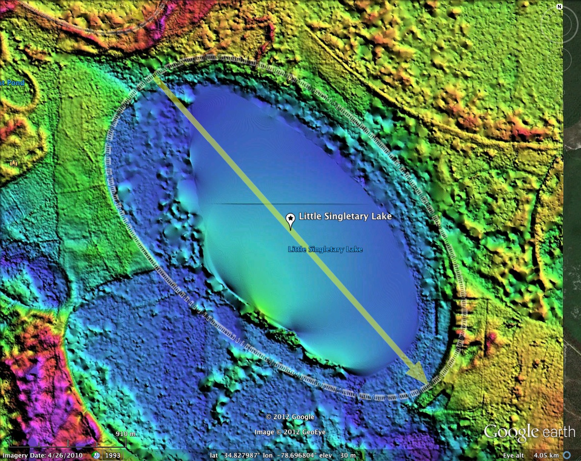
There is significant open water within the bay's bowl, but the lake's shoreline does not track the rim, and assuming the shape of the bay’s rim is consistent with the visual presentation of the lake from the air would be misleading. The perception of Carolina bays being a rag-tag collection of gradualistic lakes such as found in Southeastern Australia, the North American Arctic coast and southern Chili is shown in the LiDAR to be inaccurate. The actual bay shape is classic bayCarolina, to which the rim adheres robustly.
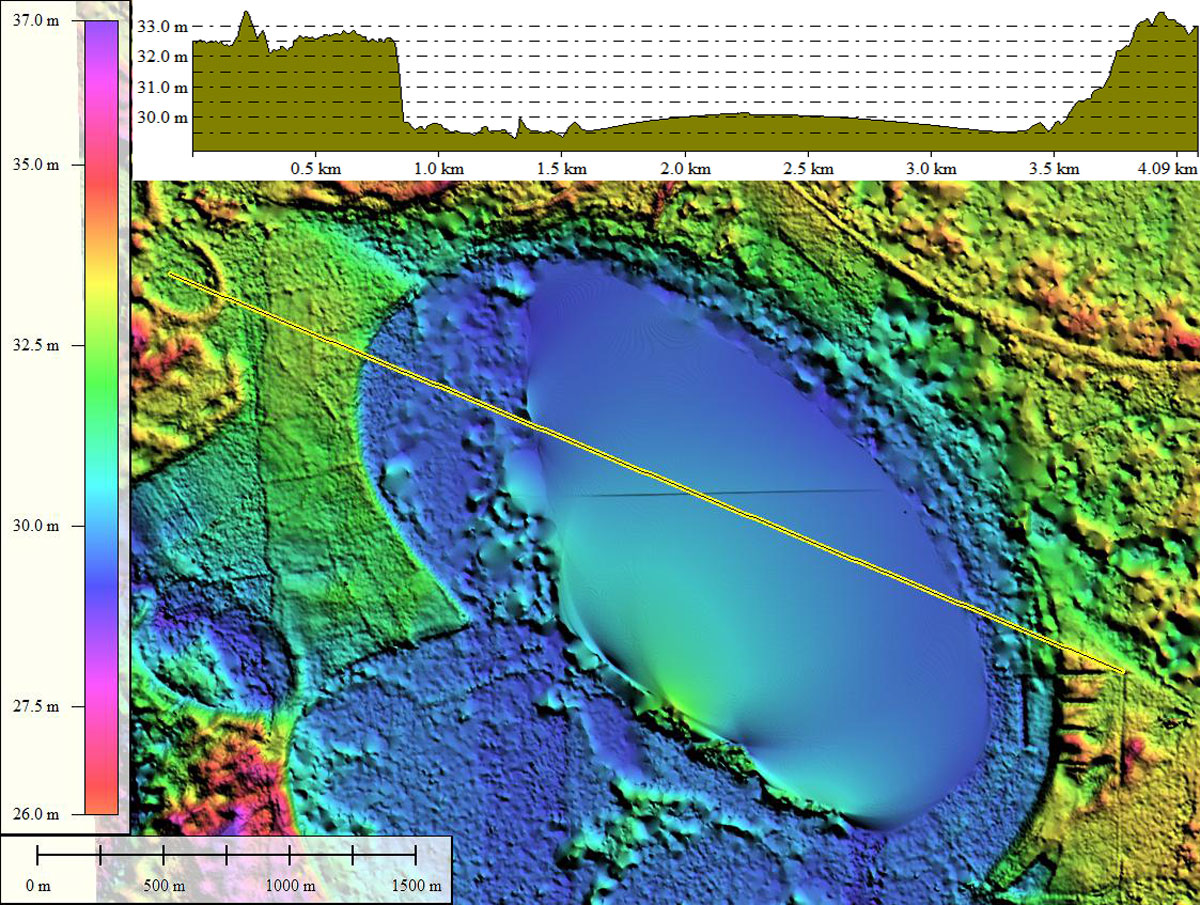
One of the LiDAR anomalies shows up here - the scanning laser beams of the airborne LiDAR instrument do not respond well to the presence of standing water. The back-reflection is chaotic and as a result, open water is usually seen as missing data. The DEM algorithms try to span that gap but end up with warped surfaces, such as the gentle upward swell in the middle of the lake, shown in the elevation profile map.
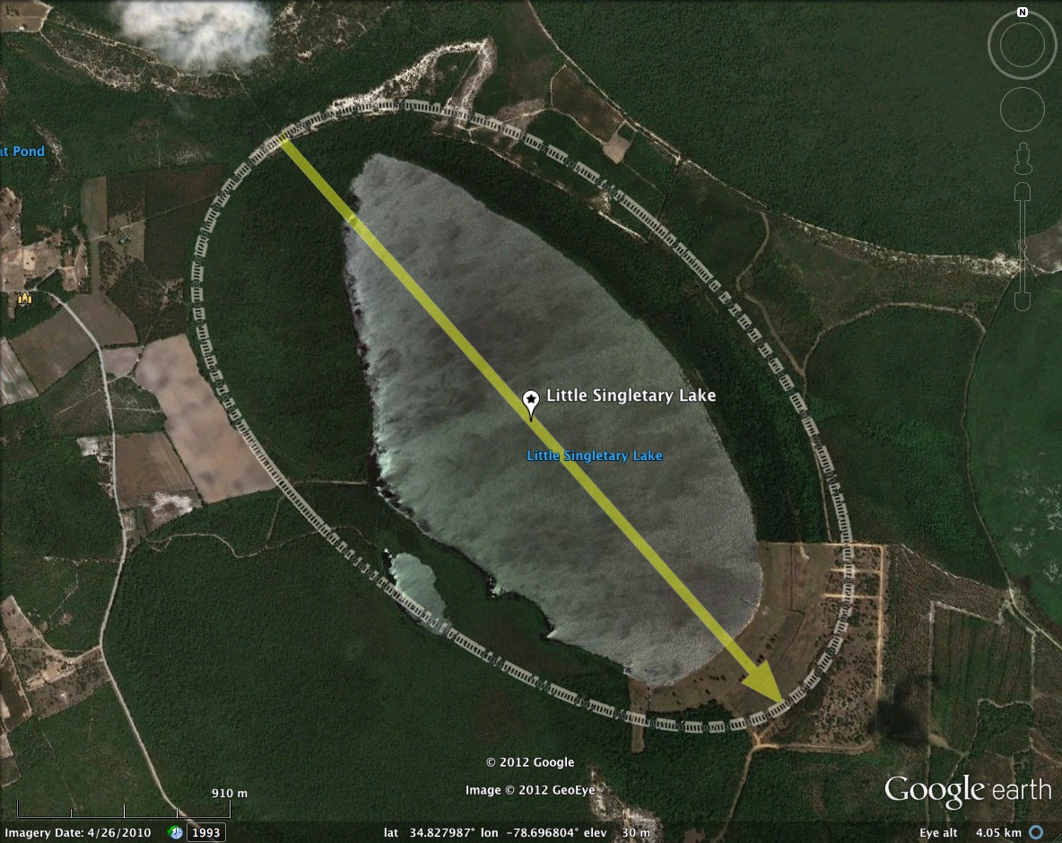
All bodies of open water larger than 50 acres are, by law, State Parks in North Carolina. Only this one has no easy public access. YouTube user voodoodancer has posted a video of what is to be found if you attempt to visit. I have embedded it below.
There is significant open water within the bay's bowl, but the lake's shoreline does not track the rim, and assuming the shape of the bay’s rim is consistent with the visual presentation of the lake from the air would be misleading. The perception of Carolina bays being a rag-tag collection of gradualistic lakes such as found in Southeastern Australia, the North American Arctic coast and southern Chili is shown in the LiDAR to be inaccurate. The actual bay shape is classic bayCarolina, to which the rim adheres robustly.
One of the LiDAR anomalies shows up here - the scanning laser beams of the airborne LiDAR instrument do not respond well to the presence of standing water. The back-reflection is chaotic and as a result, open water is usually seen as missing data. The DEM algorithms try to span that gap but end up with warped surfaces, such as the gentle upward swell in the middle of the lake, shown in the elevation profile map.
All bodies of open water larger than 50 acres are, by law, State Parks in North Carolina. Only this one has no easy public access. YouTube user voodoodancer has posted a video of what is to be found if you attempt to visit. I have embedded it below.
- Index #: 139314_3178
- Location: 34.82786842256072,-78.69727981165755
- Major: 3.33 km . . . Minor: 1.87 km
- Eccentricity: 0.826
- Area: 490.16 hectares
- Bearing: 135.69º
- Elevation: 30.28 m
- Planform: bayCarolina
- Effective Diameter: 2,498.179 m
Copyright 2018 by Michael Davias