Flamingo Bay, SC
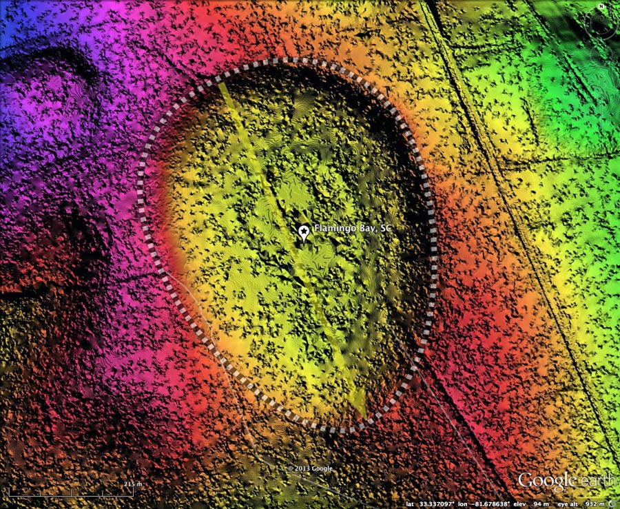
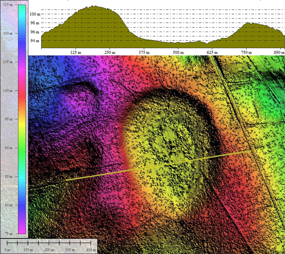
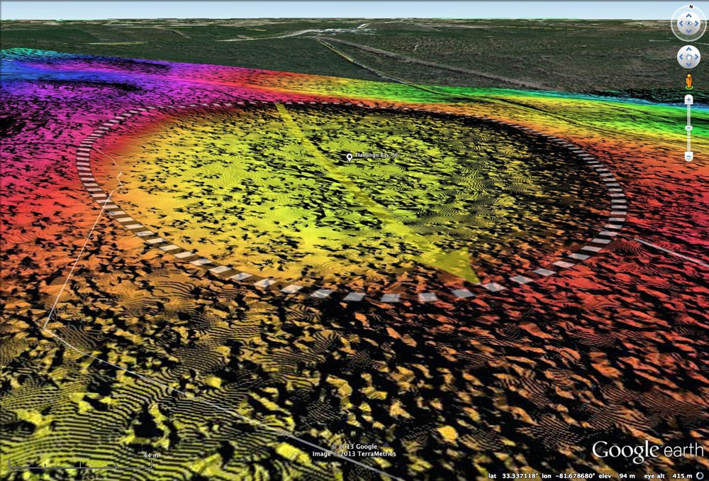
Flamingo Bay is located in south-central Aiken County, SC, within the US Government's Savannah River Site (SRS). The bay is presented here in a Digital Elevation Map, enhanced with hsv-shaded elevation data created from LiDAR. As is the case in many bays, the shape presented by the open-water area does not properly describe the planform of the actual depression, which matches the baySouth archetype perfectly.
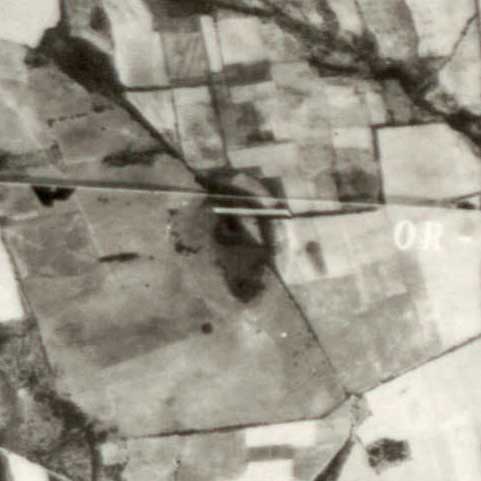
Included in the album is also a historical aerial photo from 1951, sourced from the SC University Libraries Digital Collection. In that image, the bay rim's footprint is visible within open farm fields, and there appears to have been no artificial drainage channel dug to drain the bay at that time.
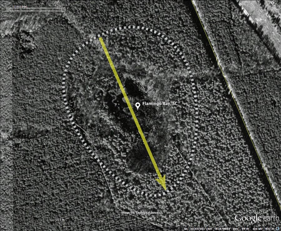
The attached Photo Album also includes a Google Earth historical image from 1999. The older b&w imagery often expresses the bay more clearly than newer color imagery, but in this case a dense forest has overgrown the landscape since the SRS was created in the early 1950s, shielding the bay's rim from view.
Native Americans referred to a Carolina bay as a "Pocosin". Interesting word. According to Wikipedia® The word pocosin comes from an Eastern Algonquian word meaning
According to archaeologists, the rim of Flamingo bay - perched high above the surrounding landscape - was frequented by prehistoric humans. The bay's water basin - currently only a small part of the bay's expanse - offered water and food, while the high position likely offered protection.
Margaret Shakespeare, in a 2012 Archaeology Magazine article (Volume 65 Number 6), wrote about the work of archaeologists at the Savannah River Archaeological Research Program:
Included in the album is also a historical aerial photo from 1951, sourced from the SC University Libraries Digital Collection. In that image, the bay rim's footprint is visible within open farm fields, and there appears to have been no artificial drainage channel dug to drain the bay at that time.
The attached Photo Album also includes a Google Earth historical image from 1999. The older b&w imagery often expresses the bay more clearly than newer color imagery, but in this case a dense forest has overgrown the landscape since the SRS was created in the early 1950s, shielding the bay's rim from view.
Native Americans referred to a Carolina bay as a "Pocosin". Interesting word. According to Wikipedia® The word pocosin comes from an Eastern Algonquian word meaning
Now, I may be a bit batty, but I can't for the life of me understand why that appellation has not raised the collective eyebrows of geologists. Swamps should exist in lowlands, not up on hills. Am I right?"swamp-on-a-hill".
According to archaeologists, the rim of Flamingo bay - perched high above the surrounding landscape - was frequented by prehistoric humans. The bay's water basin - currently only a small part of the bay's expanse - offered water and food, while the high position likely offered protection.
Margaret Shakespeare, in a 2012 Archaeology Magazine article (Volume 65 Number 6), wrote about the work of archaeologists at the Savannah River Archaeological Research Program:
The bay is one of several bays on the SRS discussed in a paper by M.J. Brooks, B.E. Taylor, and A.H. Ivester,(1) who report that:It's a shining example of an ancient landform, once a pond-like body of accumulated rainwater with the nontechnical name Carolina bay, where they are finding new knowledge of Middle Archaic hunter-gatherer sustenance, industry, and lifestyles.
The paper also provides some temporal context for the bay's creation and evolution:There is a nearly continuous 900-m archaeological distribution along the eastern sand rim from northeast to southeast, with Early Archaic deposits being most prevalent, followed by Late Archaic and Middle Archaic..
(1) 2010 Brooks, M.J., B.E. Taylor, and A.H. Ivester, Carolina Bays: Time Capsules of Culture and Climate Change, Southeastern Archaeology.Optically Stimulated Luminescence ... dates from Flamingo Bay on the SRS (Brooks et al. 2001a) indicate that the bay formed initially at 108.7 +/- 10.9 ka BP and was rejuvenated at 40.3 +/- 4.0 ka BP.
- Index #: 133326_3471
- Location: 33.336913042018736,-81.67865522673452
- Major: 0.66 km . . . Minor: 0.49 km
- Eccentricity: 0.658
- Area: 25.77 hectares
- Bearing: 156.62º
- Elevation: 93.35 m
- Archetype: baySouth
- Effective Diameter: 572.812 m
Copyright 2018 by Michael Davias