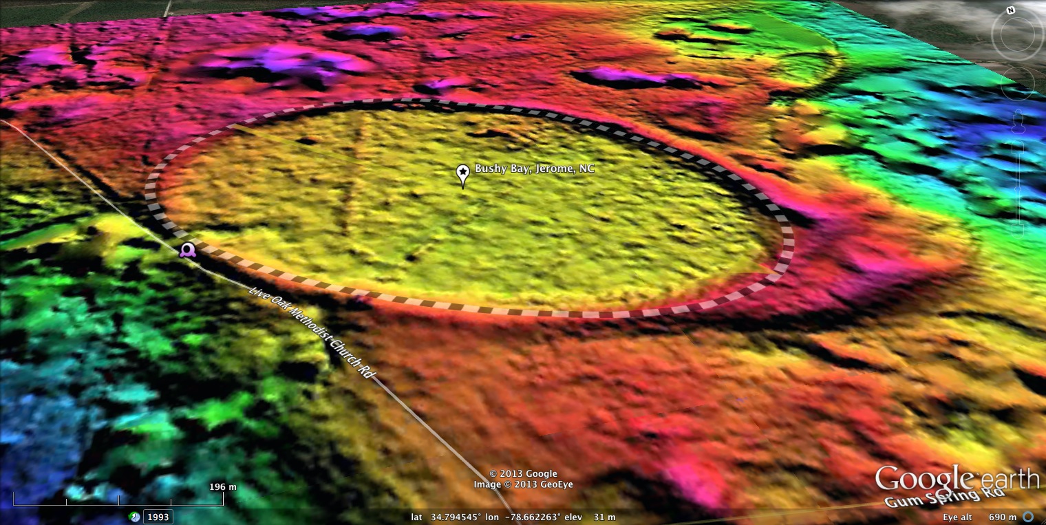
Bushy Bay, Jerome, NC
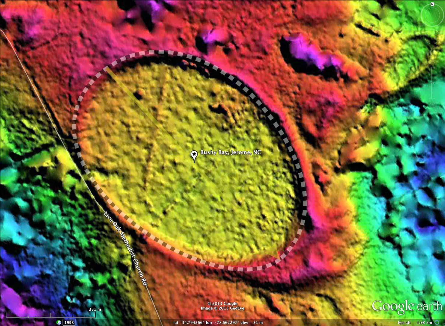
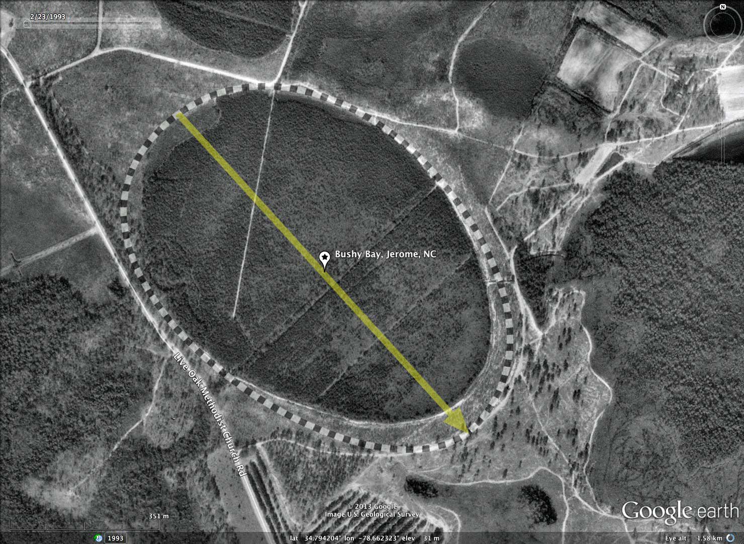
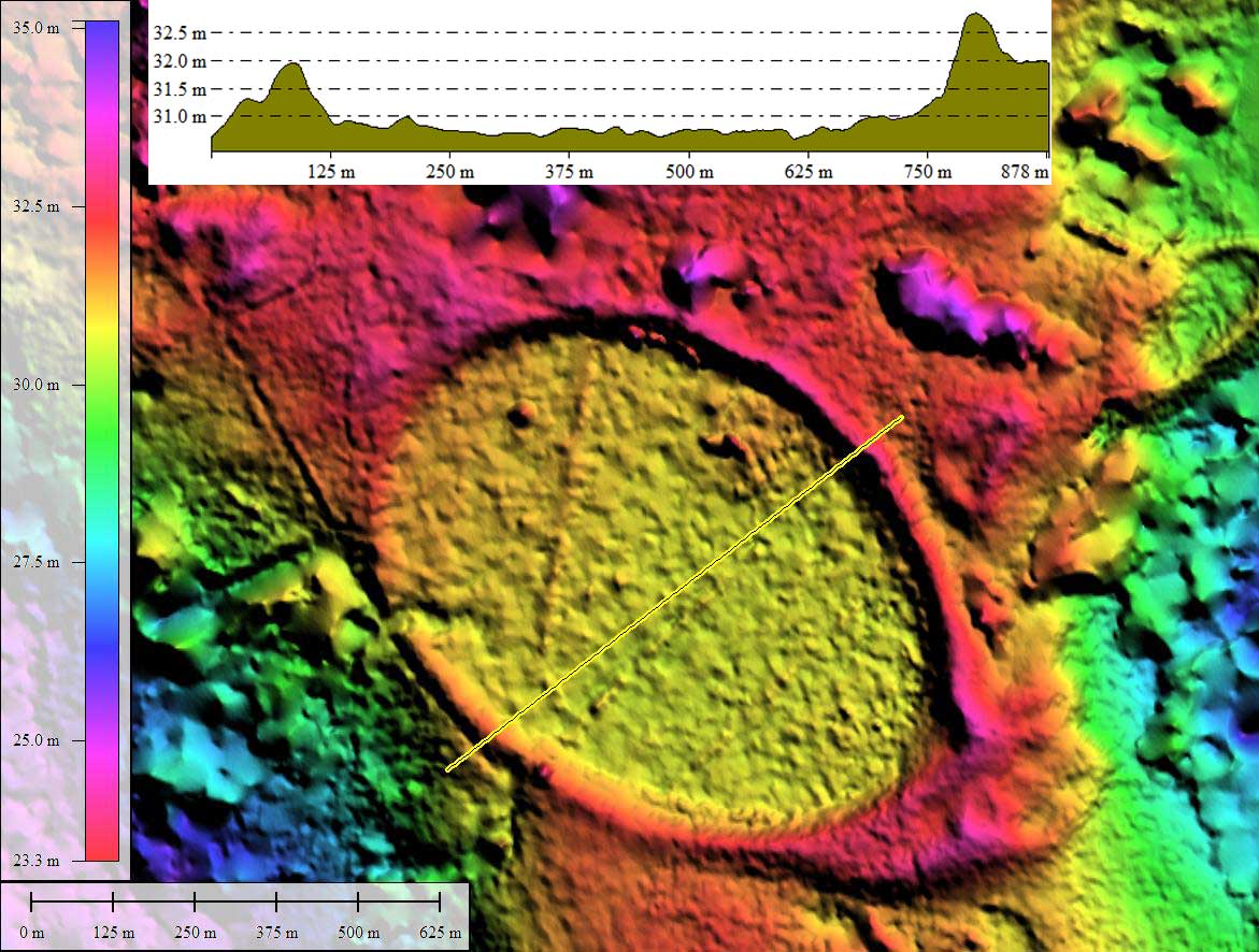
Bushy Bay is yet another of the many large bays populating the terraces of the Cape Fear River Valley in Bladen County, NC. The bay has been ditched and drained out through a cut in the western rim. It has been converted from a wetland area to a tree plantation.
The bay has been measured with the standard bayCarolina archetype shape, and sports an orientation similar to other nearby bays.
I have included the town name in the title here to help differentiate Bushy Bay from the much larger _Bushy Lake Bay_, located 10 kilometers to the north. Both landforms are formally named USGS geographic features.
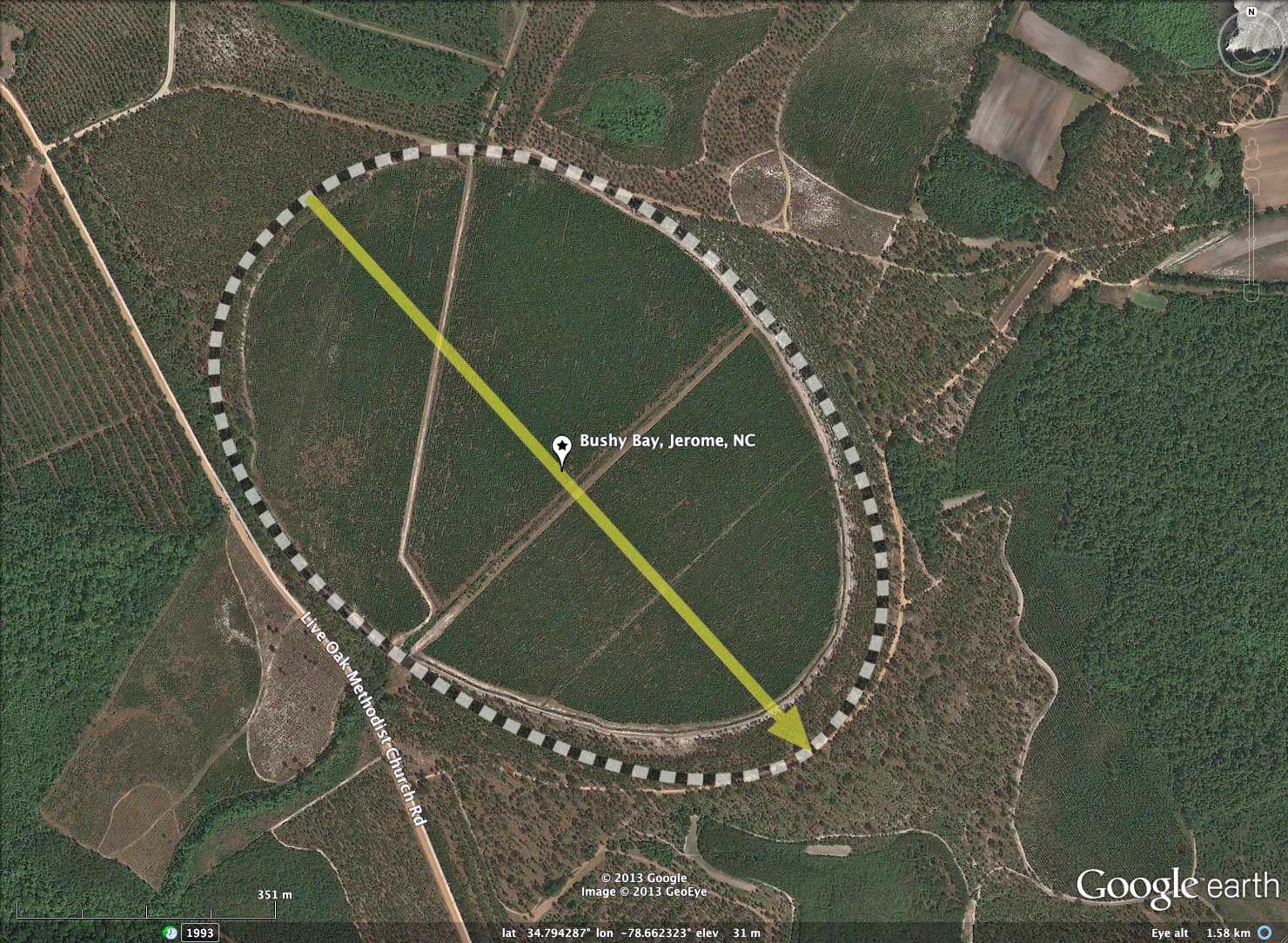
Google Streetview imagery is available along a section of Live Oak Methodist Church Road, which passes just outside a segment of the western rim. The bay's raised rim is clearly visible along east side of the road. The imagery can be seen in browser using this LINK , or by accessed by clicking on the camera icon in the referenced KMZ file.
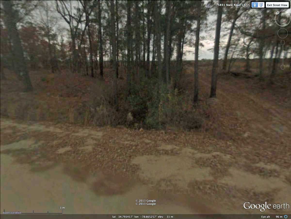
A second Streetview image shows Bushy Bay's drainage channel where it exits across rim at Live Oak Methodist Church Road. A dirt road leads up the rim's slope parallel to the ditch.
The bay has been measured with the standard bayCarolina archetype shape, and sports an orientation similar to other nearby bays.
I have included the town name in the title here to help differentiate Bushy Bay from the much larger _Bushy Lake Bay_, located 10 kilometers to the north. Both landforms are formally named USGS geographic features.
Google Streetview imagery is available along a section of Live Oak Methodist Church Road, which passes just outside a segment of the western rim. The bay's raised rim is clearly visible along east side of the road. The imagery can be seen in browser using this LINK , or by accessed by clicking on the camera icon in the referenced KMZ file.
A second Streetview image shows Bushy Bay's drainage channel where it exits across rim at Live Oak Methodist Church Road. A dirt road leads up the rim's slope parallel to the ditch.
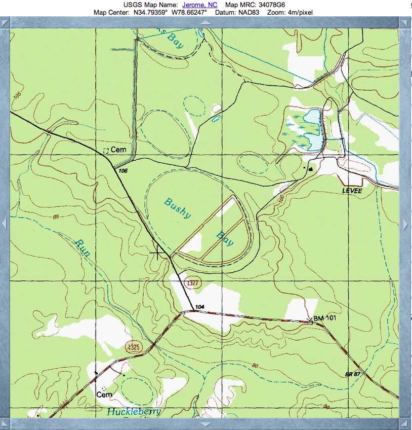
- Index #: 139314_1764
- Location: 34.79401056817938,-78.66238924109844
- Major: 1.0 km . . . Minor: 0.69 km
- Eccentricity: 0.722
- Area: 55.28 hectares
- Bearing: 137.79º
- Elevation: 30.67 m
- Archetype: bayCarolina
- Effective Diameter: 838.955 m
Copyright 2018 by Michael Davias