Juniper Bay, NC
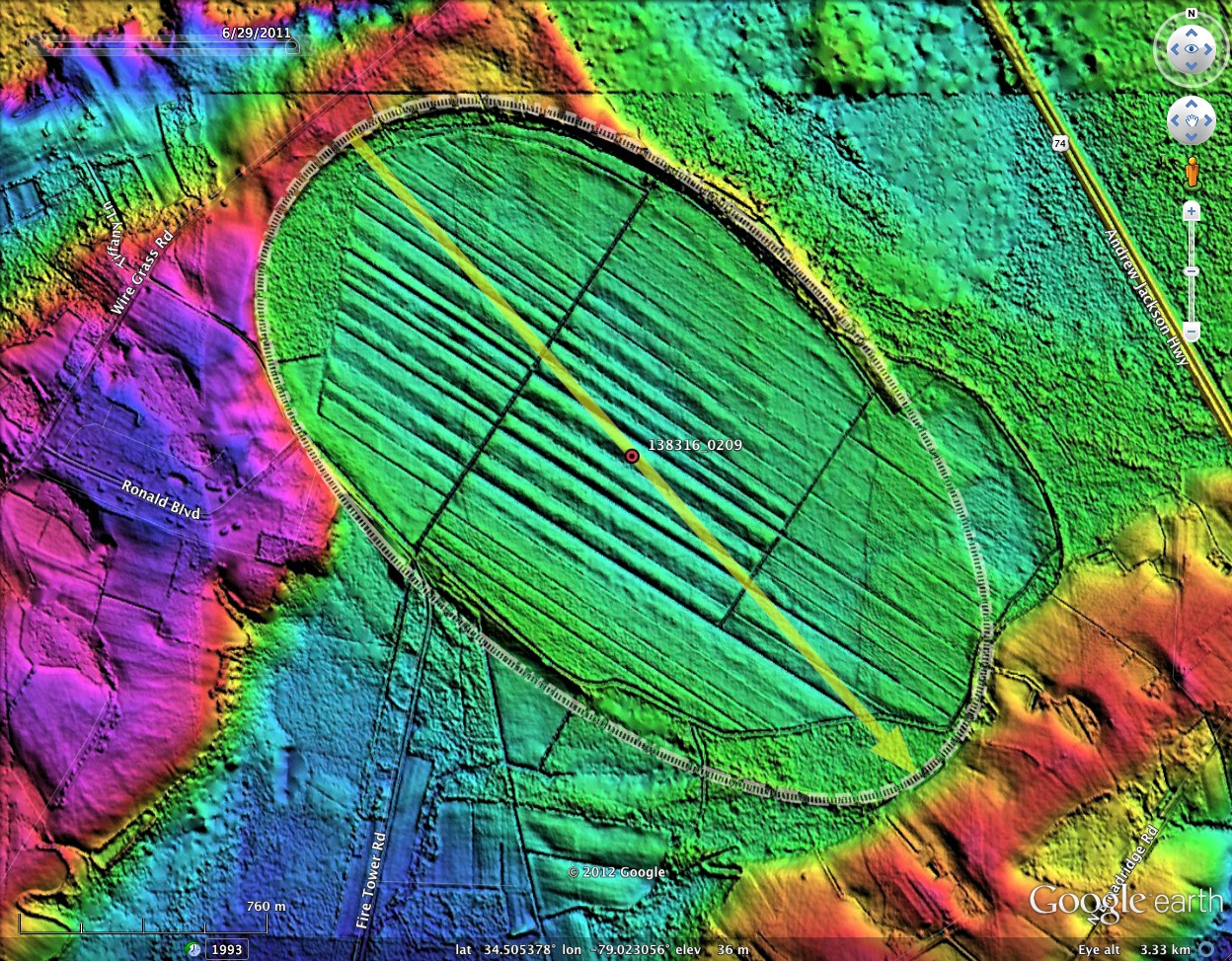
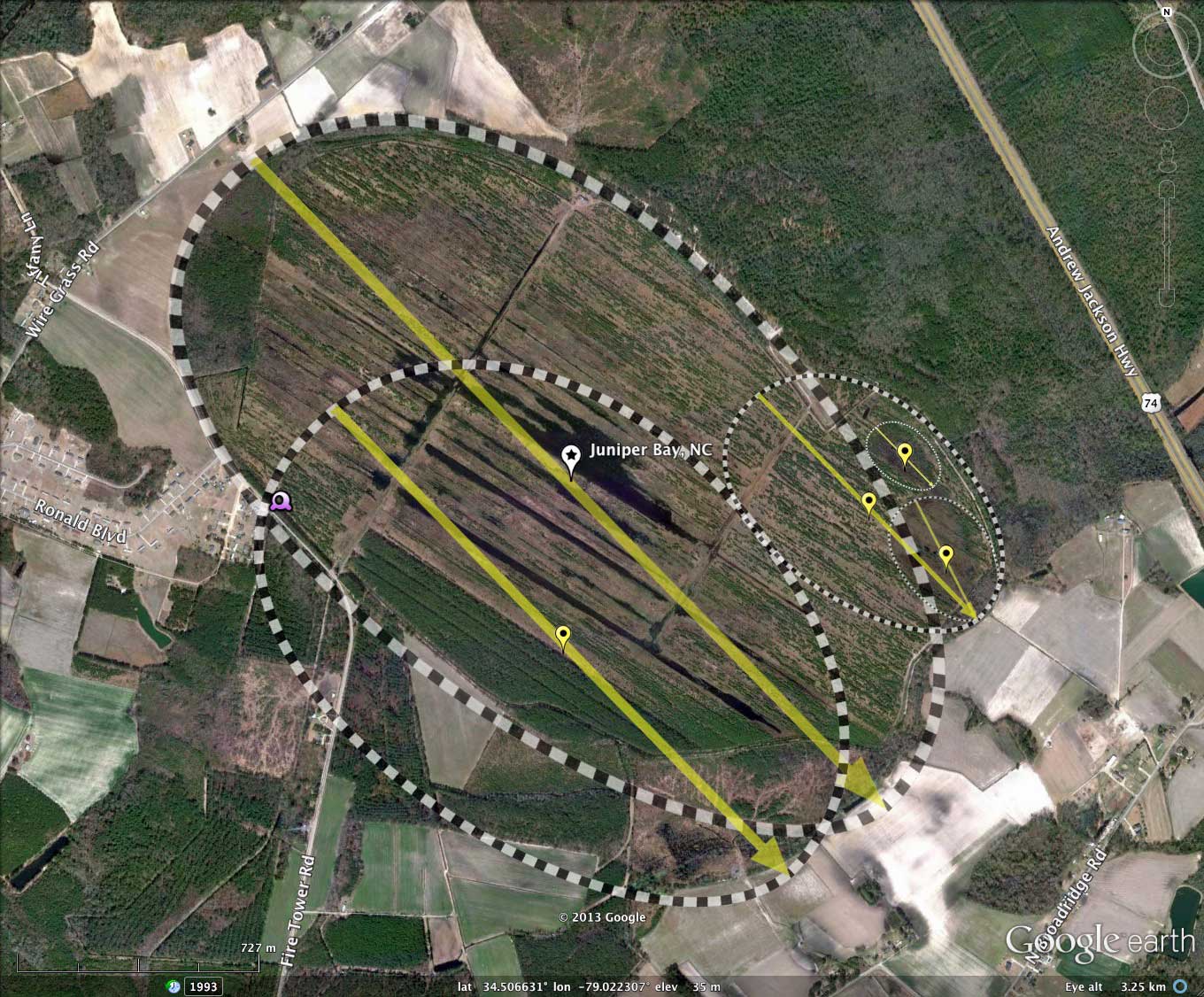
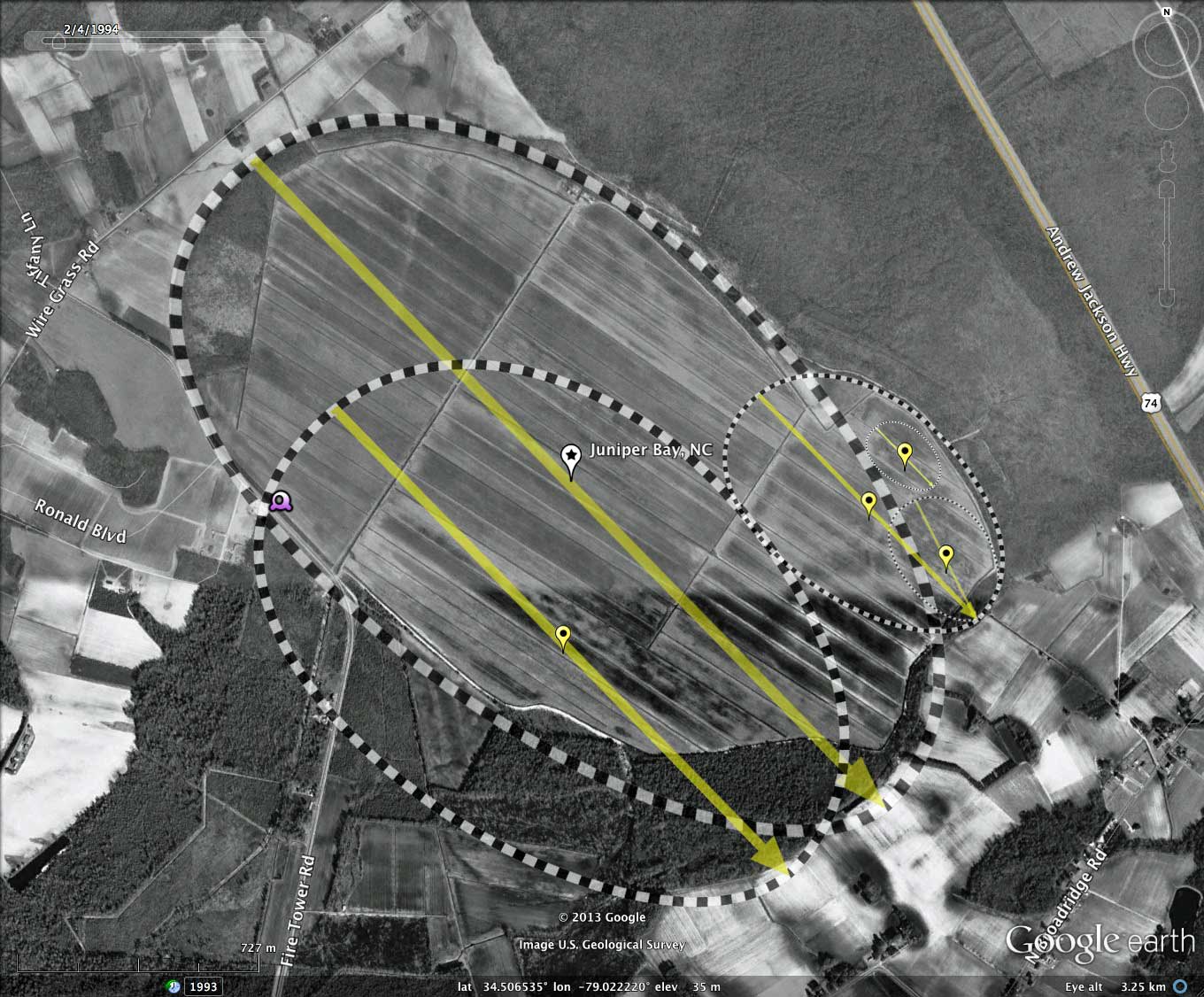
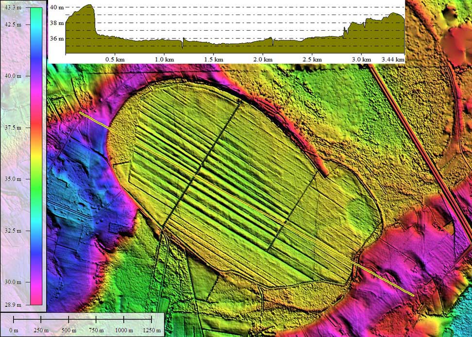
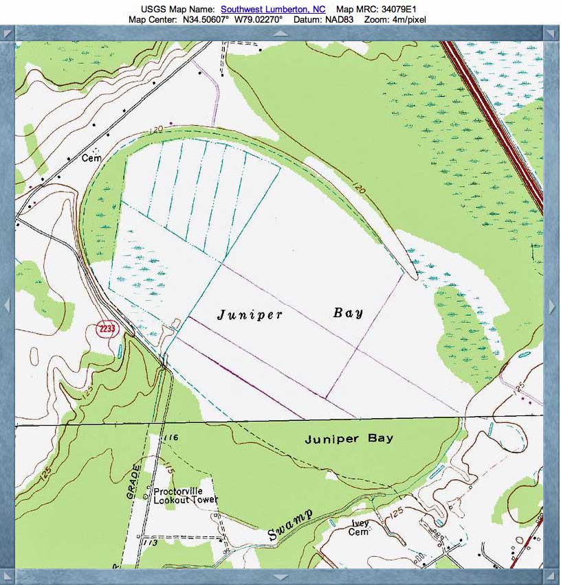
Juniper bay is located 12km south of Lumberton, NC. Its major axis is 2.6 km - quite a big piece of property. I interpret the shape of the landform to be comprised of a mash up of five common bayCarolina archetype shapes. While such a combination is far from unusual, what is quite interesting here is that the "toes" seen on the southeast side of the main bay are encapsulated inside of a larger bay's rim. Additionally, there are indications in the LiDAR of a large overlapping bayCarolina shape on the south western side of the main bay. The elements are listed below in order of decreasing size.
The bay was subjected to a period of ditching and draining to prepare it for farming, but the project was not successful. In the last 10 years, a project has been underway to return it to a more natural state. A doctoral dissertation was presented at NC State by Justin M. Ewing, in entitled "Characterization Of Soils In A Drained Carolina Bay Wetland Prior To Restoration". LINK
The bay, its constituent members, as well as nearby bays, all present the same bayCarolina archetype shape and are oriented in a similar direction.
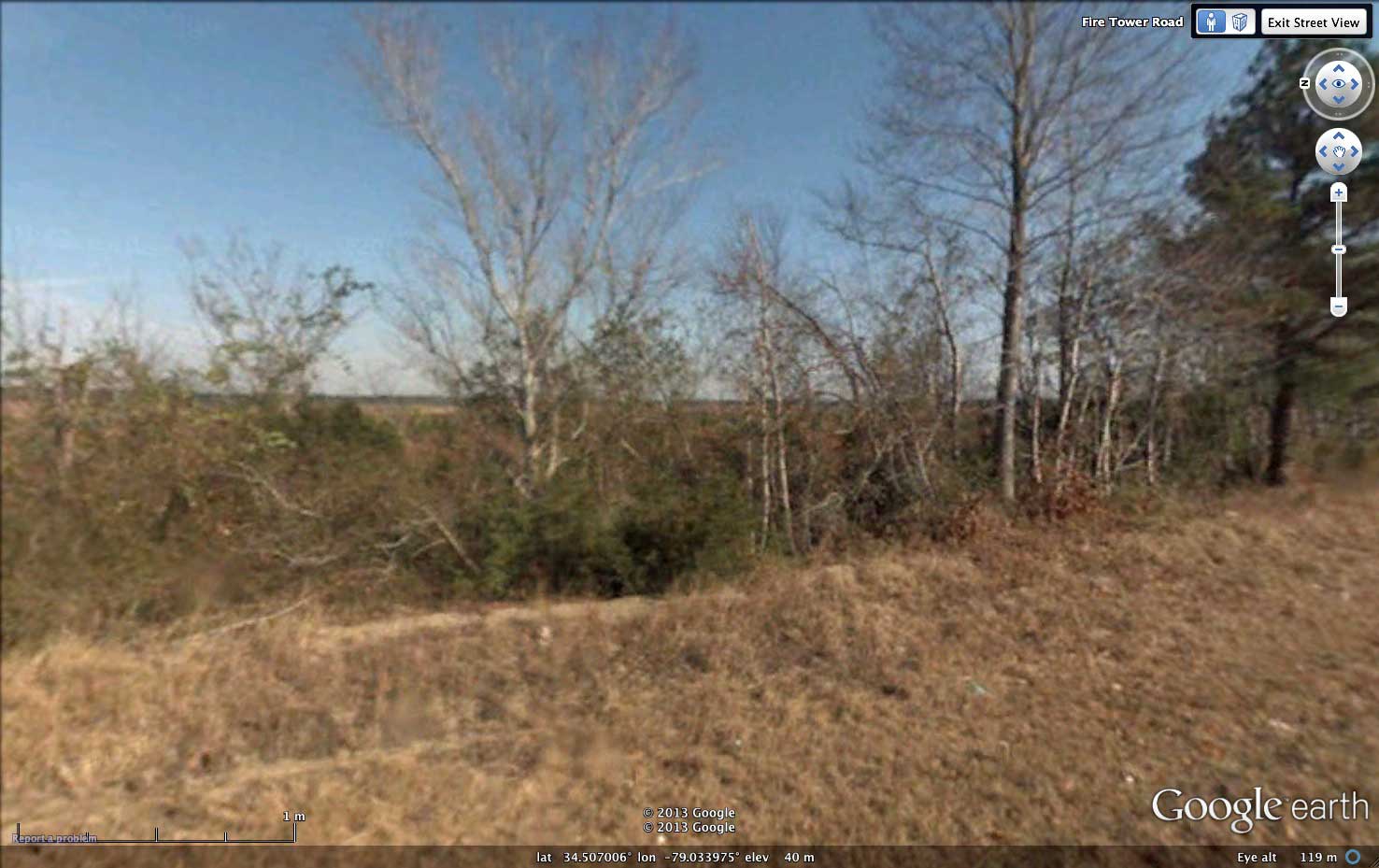
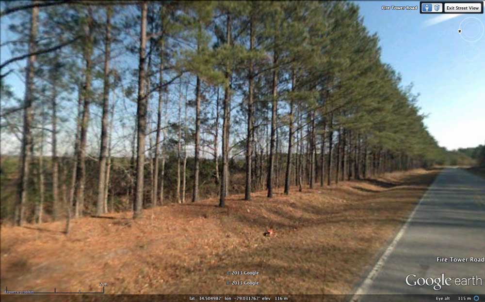
Google Earth has made Streetview imagery available along Fire Tower Road, which runs just outside of the western rim for almost a kilometer. The trees on the left of one image look to be set on a berm created when the road was cut - an understandable conclusion. However, the LiDAR shows that to be the naturally-created bay rim! In the second image, again from the bay rim, shows the nearby trees setting a lower elevation within the bay proper.
The imagery can be seen in your browser using this LINK. The location of the Streetview shown in the attached album is identified by a placemark in the referenced KMZ file at the top of this post. Clicking on that will take you to the Streetview imagery within Google Earth.
Ref: Vepraskas, Michael J., 2007, Methodology to assess soil, hydrologic, and site parameters that affect wetland restoration : Phase 2
The bay was subjected to a period of ditching and draining to prepare it for farming, but the project was not successful. In the last 10 years, a project has been underway to return it to a more natural state. A doctoral dissertation was presented at NC State by Justin M. Ewing, in entitled "Characterization Of Soils In A Drained Carolina Bay Wetland Prior To Restoration". LINK
The bay, its constituent members, as well as nearby bays, all present the same bayCarolina archetype shape and are oriented in a similar direction.
Google Earth has made Streetview imagery available along Fire Tower Road, which runs just outside of the western rim for almost a kilometer. The trees on the left of one image look to be set on a berm created when the road was cut - an understandable conclusion. However, the LiDAR shows that to be the naturally-created bay rim! In the second image, again from the bay rim, shows the nearby trees setting a lower elevation within the bay proper.
The imagery can be seen in your browser using this LINK. The location of the Streetview shown in the attached album is identified by a placemark in the referenced KMZ file at the top of this post. Clicking on that will take you to the Streetview imagery within Google Earth.
Ref: Vepraskas, Michael J., 2007, Methodology to assess soil, hydrologic, and site parameters that affect wetland restoration : Phase 2
Juniper Bay is a 750 acre Carolina Bay that was purchased by the NC Department of Transportation for wetland restoration. The experimental results reported here were completed at the site between 2003 and 2007, that were completed at Juniper Bay and at three reference bays. Hydrologic studies showed that a Pond Pine Woodland plant community is growing in reference bays where water ponds above the surface for 45 to 135 days per year. At Juniper Bay, such conditions may occur in the mineral soils along the bay's perimeter. The Nonriverine Swamp Forest community is found in organic soils that have water ponded on the surface for 300-320 days per year. This community may develop in the central portion of Juniper Bay. Because soil organic carbon levels in Juniper Bay soils generally exceed 3%, the soils should become anaerobic within a week after saturating. Other related biogeochemical reactions necessary for wetland functions should occur in Juniper Bay soils as well. Large storms (greater than 2 in. per day) cause relatively large quantities of dissolved organic carbon, phosphorus, calcium and magnesium to enter surface and ground waters at Juniper Bay. These chemical may be transported offsite in ditch water leaving the site. The quantity of phosphorus can exceed 1 ppm in organic soils because of the large amount of dissolved organic carbon produced in the soils. These phosphorus concentrations should be monitored because they may be large enough to contribute to eutrophication of downstream waters.
M. Vepraskas
- Index #: 138316_0208
- Location: 34.5059471270814,-79.02233279594834
- Major: 2.76 km . . . Minor: 1.52 km
- Eccentricity: 0.834
- Area: 329.93 hectares
- Bearing: 135.75º
- Elevation: 35.69 m
- Archetype: bayCarolina
- Effective Diameter: 2,049.583 m
- Index #: 138316_0009
- Location: 34.5016654668503,-79.02259348115453
- Major: 1.98 km . . . Minor: 1.35 km
- Eccentricity: 0.734
- Area: 210.83 hectares
- Bearing: 135.75º
- Elevation: 35.84 m
- Archetype: bayCarolina
- Effective Diameter: 1,638.403 m
- Index #: 138316_0205
- Location: 34.505272779623155,-79.01255180623016
- Major: 0.95 km . . . Minor: 0.61 km
- Eccentricity: 0.765
- Area: 46.57 hectares
- Bearing: 135.75º
- Elevation: 36.24 m
- Archetype: bayCarolina
- Effective Diameter: 770.03 m
Copyright 2018 by Michael Davias