Creek Farms Bay, Richmond Co, GA
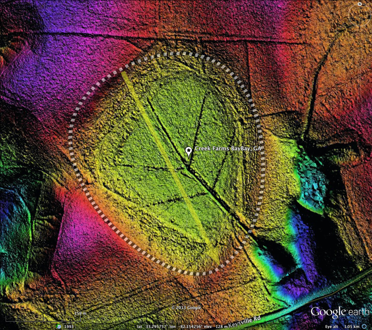
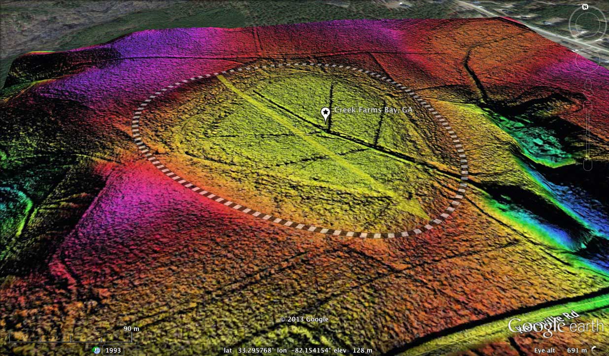
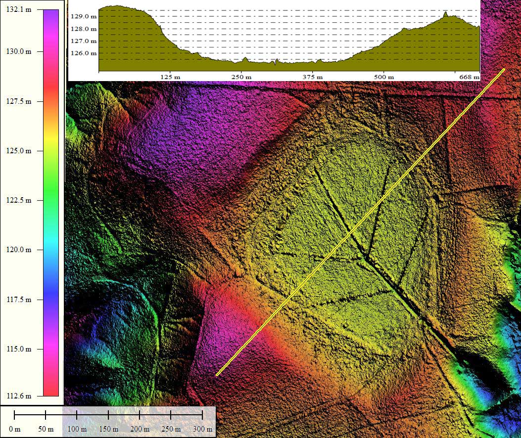
Creek Farms Bay is a perfectly formed baySouth archetype shaped Carolina Bay. It is located in Richmond County, 24 kilometers southwest of Augusta, GA. I named it after a subdivision located nearby.
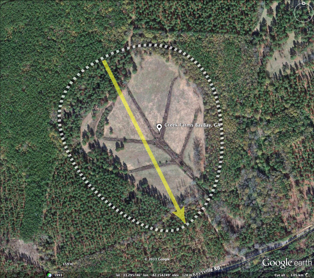
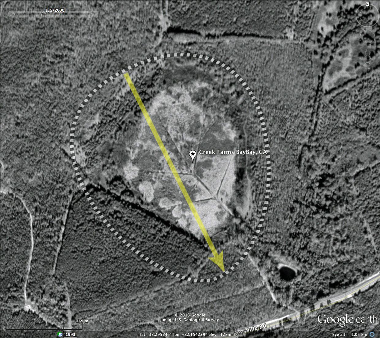
Although the bay has been ditched in an extensive branching system, the bay floor appears in the Satellite imagery to be in a natural state. It is likely that its trees have been harvested at some point, but the bay remains so wet as to discourage any ongoing agricultural activity.
Given that the drainage network has only one exit, the bay may be a candidate for restoration. The entire area surrounding the bay is reported as being owned by a single development company, and some small parcels exists on the southern end of the bay.
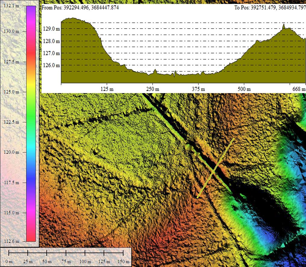
The LiDAR data set used here is from NOAA, and represents 25 cm grid data. The KMZ file references hsv-shaded data as jpeg graphics created on a 1 meter grid to keep file size down. The bay makes a stunning presentation in the LiDAR, if I do say so myself. The previously mentioned drainage system, with it's branching tree geometry, also looks quite attractive as an abstract piece.
This bay is a good example of why LiDAR is so important in determining actual basin size and orientation. The satellite imagery of the bay presents a substantially different picture of those two metrics.
Although the bay has been ditched in an extensive branching system, the bay floor appears in the Satellite imagery to be in a natural state. It is likely that its trees have been harvested at some point, but the bay remains so wet as to discourage any ongoing agricultural activity.
Given that the drainage network has only one exit, the bay may be a candidate for restoration. The entire area surrounding the bay is reported as being owned by a single development company, and some small parcels exists on the southern end of the bay.
The LiDAR data set used here is from NOAA, and represents 25 cm grid data. The KMZ file references hsv-shaded data as jpeg graphics created on a 1 meter grid to keep file size down. The bay makes a stunning presentation in the LiDAR, if I do say so myself. The previously mentioned drainage system, with it's branching tree geometry, also looks quite attractive as an abstract piece.
This bay is a good example of why LiDAR is so important in determining actual basin size and orientation. The satellite imagery of the bay presents a substantially different picture of those two metrics.
- Index #: 133328_1861
- Location: 33.29559856736095,-82.15423639212332
- Major: 0.34 km . . . Minor: 0.25 km
- Eccentricity: 0.685
- Area: 6.87 hectares
- Bearing: 155.35º
- Elevation: 127.46 m
- Archetype: baySouth
- Effective Diameter: 295.756 m
Copyright 2018 by Michael Davias