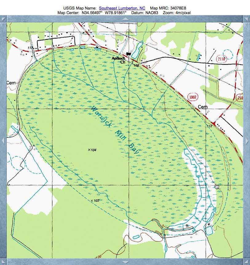
Warwick Mill Bay, NC
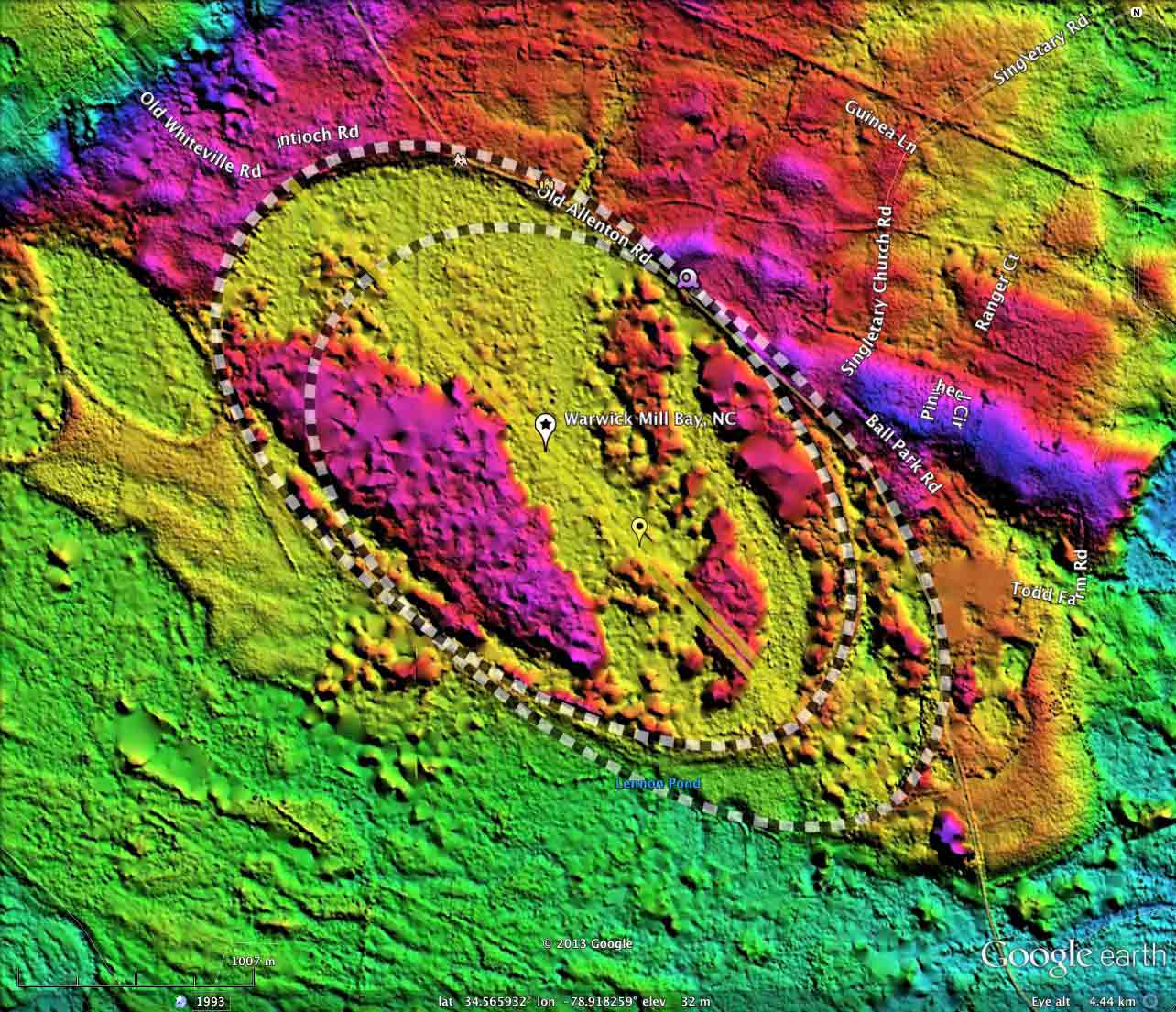
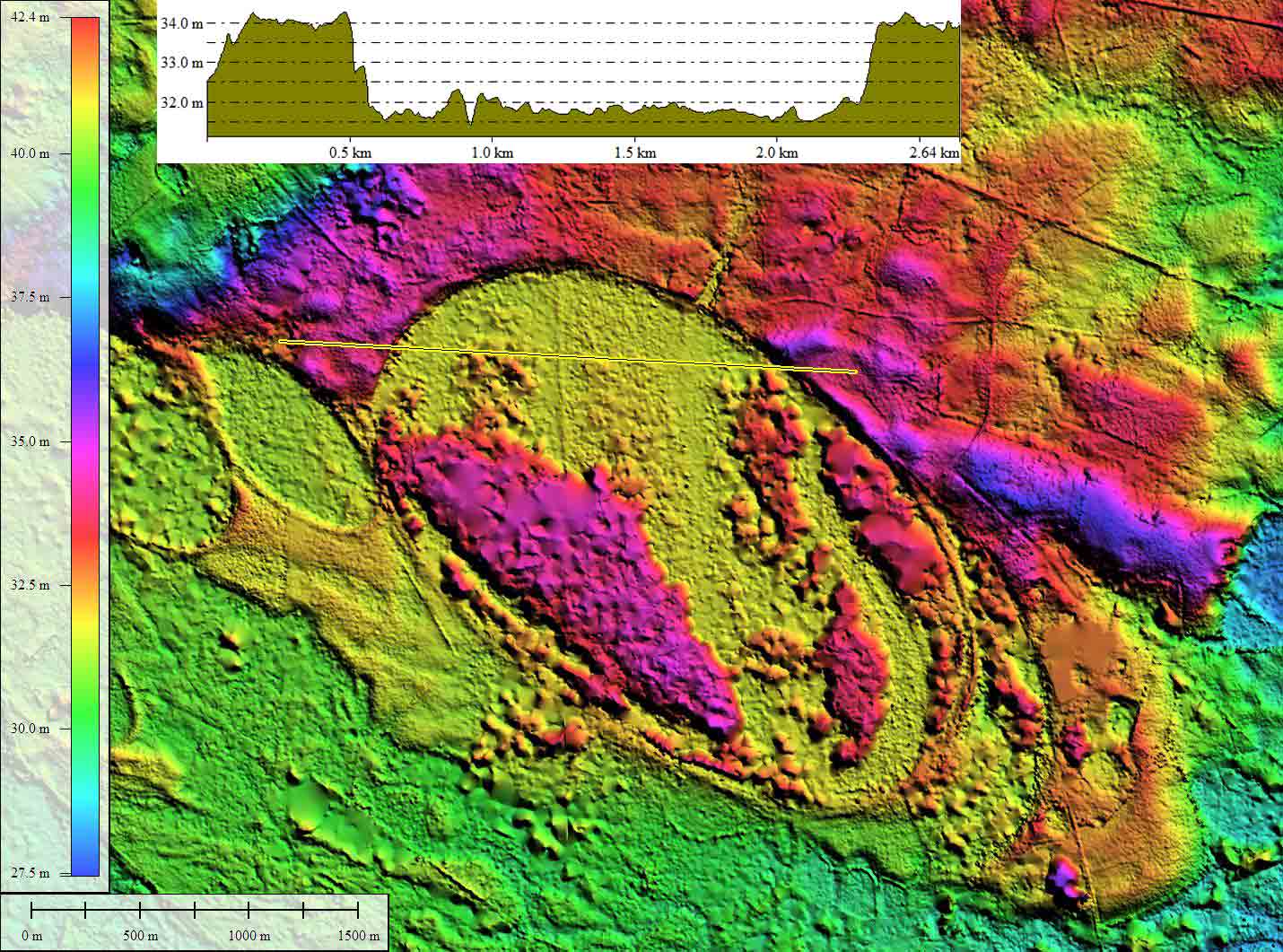
Warwick Mill Bay is a large landform which is located on the northeast bank of the Lumbar River at its confluence with the Big Swamp River in Eastern Robeson County, NC. The bay's shape is interpreted by me as being generated by two of the common bayCarolina archetype shapes, both of identical 3 kilometer size and 136.96º orientation, offset 500 meters along the major axis, such that the aggregate bay looks to be 1/2 kilometer longer than its component shapes.
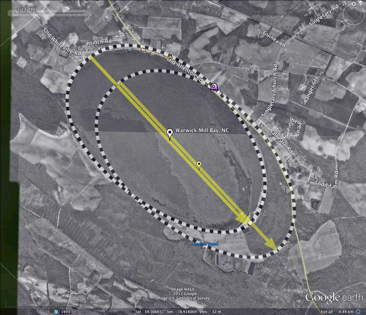
Please note that the LiDAR available from North Carolina, while spectacular in its day a decade ago, comes up a bit short in the area of vegetation removal. Thus, the heavy forest canopy along the Lumbar River obscures some of the details of Warwick Mills Bay, and others in the area.
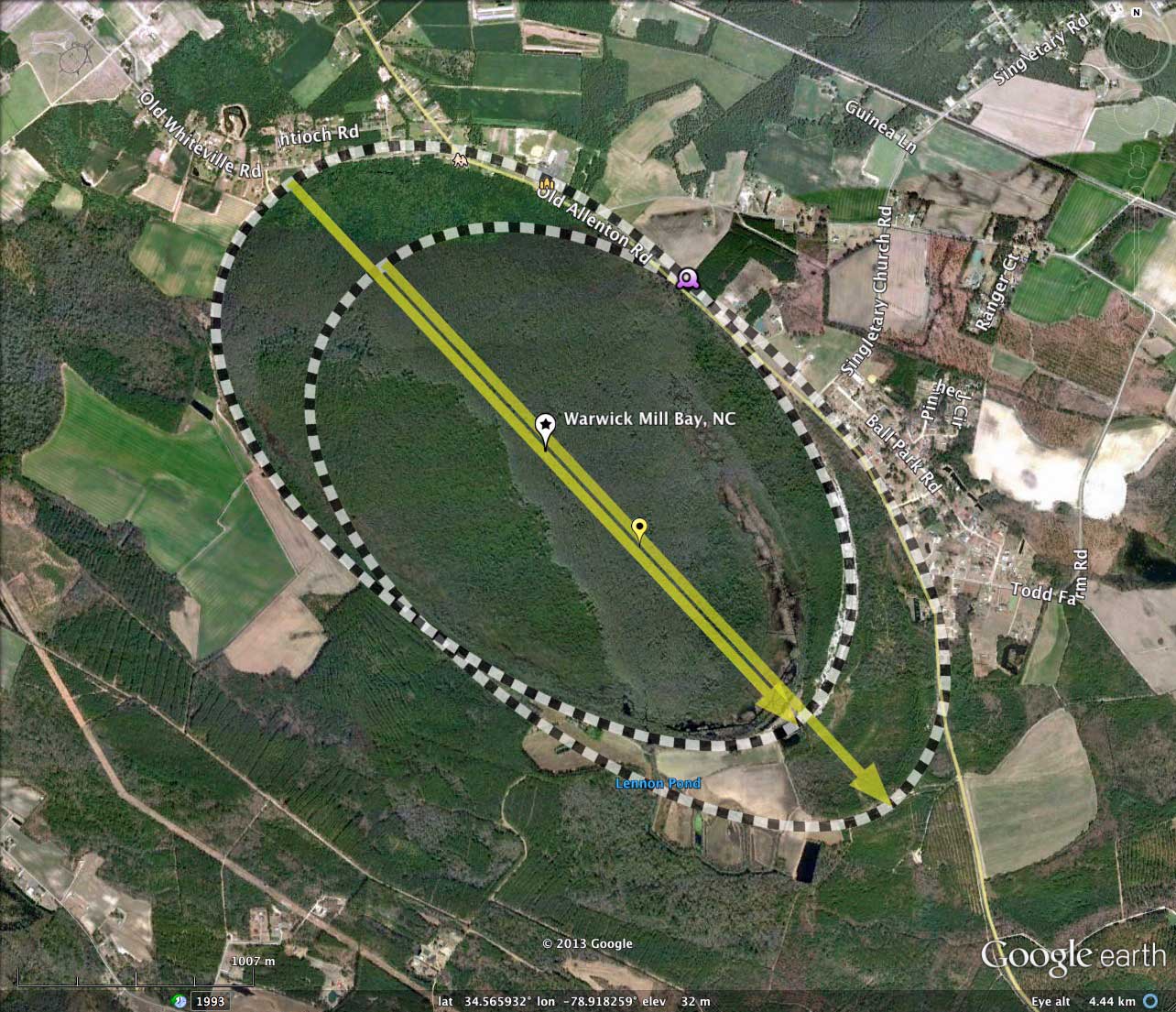
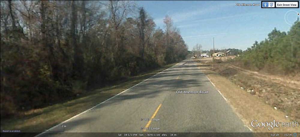
Google Streetview imagery is available along Old Allenton Road as it passes around the bay. The image in the attached album (location noted in the KMZ file) was taken looking northwest from the roadbed as it rides the shoulder of the bay. Rim rises off to right and bay floor drops off to the left. You can browse the Streetview using this LINK.
The Carolina Bay Survey has identified and measured over 500 bays in Octant 138315. Their location and metrics can be referenced through a Fusion Table spatial visualization.
Please note that the LiDAR available from North Carolina, while spectacular in its day a decade ago, comes up a bit short in the area of vegetation removal. Thus, the heavy forest canopy along the Lumbar River obscures some of the details of Warwick Mills Bay, and others in the area.
Google Streetview imagery is available along Old Allenton Road as it passes around the bay. The image in the attached album (location noted in the KMZ file) was taken looking northwest from the roadbed as it rides the shoulder of the bay. Rim rises off to right and bay floor drops off to the left. You can browse the Streetview using this LINK.
The Carolina Bay Survey has identified and measured over 500 bays in Octant 138315. Their location and metrics can be referenced through a Fusion Table spatial visualization.
- Index #: 138315_2667
- Location: 34.565162394778554,-78.91815004448173
- Major: 3.2 km . . . Minor: 1.92 km
- Eccentricity: 0.798
- Area: 484.79 hectares
- Bearing: 136.96º
- Elevation: 31.77 m
- Archetype: bayCarolina
- Effective Diameter: 2,484.456 m
- Index #: 138315_2465
- Location: 34.56206364836229,-78.91377741232715
- Major: 3.2 km . . . Minor: 1.92 km
- Eccentricity: 0.798
- Area: 484.8 hectares
- Bearing: 136.96º
- Elevation: 31.48 m
- Archetype: bay
- Effective Diameter: 2,484.482 m
Copyright 2018 by Michael Davias