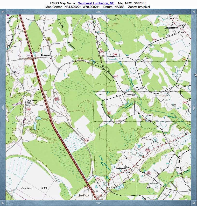
Tenmile Branch Bay, NC
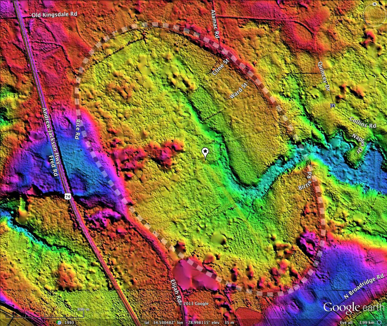
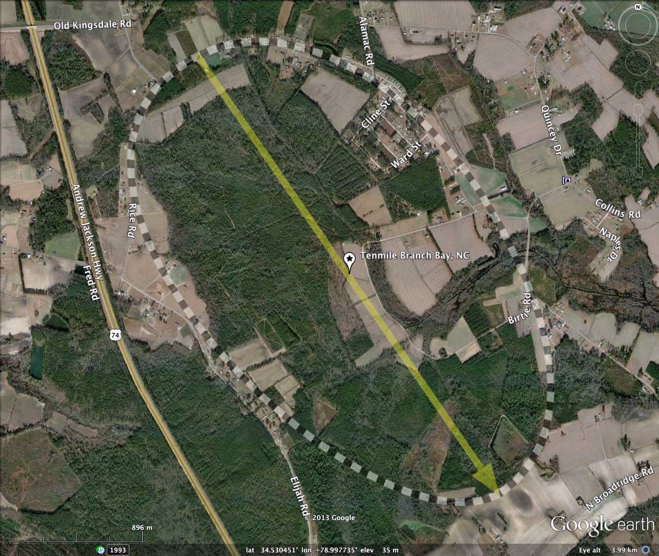
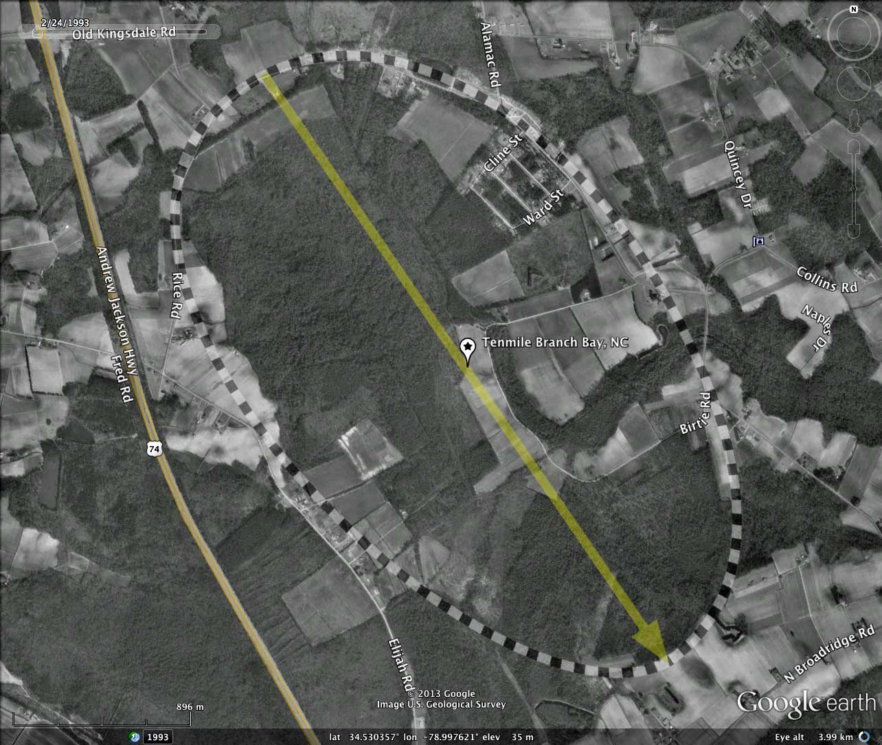
Tenmile Branch Bay is located nine kilometers south of Lumberton, in east-central Robenson County, NC. This bay was named by me after the Tenmile Branch of the Lumber River, which enters the bay from the north, penetrates deep into the bay, and exits across the rim on the eastern side, draining towards the Lumbar.
Due to the natural drainage, there has been little deep standing water in Tenmile Branch Bay, which is likely why it has not been recognized as a Carolina Bay despite the crisp bayCarolina archetype shaped rim. The orientation of TenMile Branch Bay is similar to the other bays in the immediate vicinity.
Columbia University geologist Douglas Johnson had noted the existence of well-developed natural drainage networks such as this within some bays. Occasionally, they fully transit a bay, suggesting that the drainage channel existed prior to the creation of the bay - which he interpreted as yet another feature dismissing direct impact formation. Johnson's review of bays was extensive, and situations such as this prompted him to declare in his 1942 book about the Bays:
No one has yet invented an explanation which will fully account for all the facts observed.
Douglas Johnson
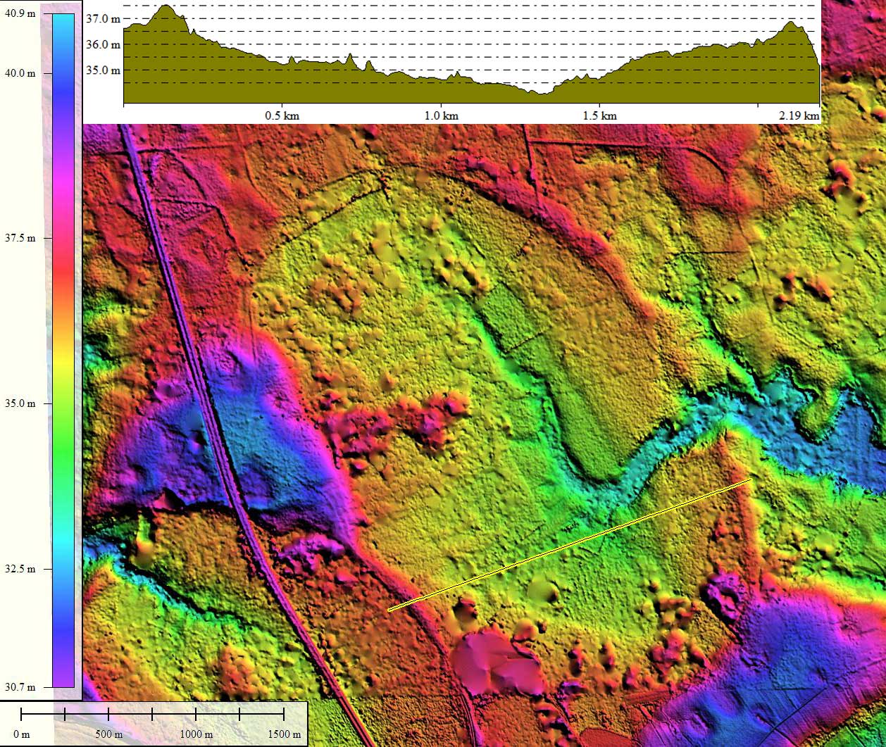
NC LiDAR from 2001 occasionally has difficulty getting through the dense tree cover, and artifacts show up in the DEM data as elevated geometric spots across the view.
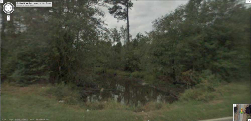
Google offers Streetview imagery along the roads which surround and pass through the bay, although it is hard to get any sense of the vertical relief offered by the rim topography. I have included one static image from the point where Tenmile Branch passes out of the bay under Collins Drive. This can be seen interactively with this browser url.
The Carolina Bay Survey has identified and measured over 500 bays in _Octant 138315. Their location and metrics can be referenced through a Fusion Table spatial visualization.
- Index #: 138315_1199
- Location: 34.529552585927306,-78.99797032252081
- Major: 3.66 km . . . Minor: 2.13 km
- Eccentricity: 0.812
- Area: 614.18 hectares
- Bearing: 145.53º
- Elevation: 35.28 m
- Archetype: bayCarolina
- Effective Diameter: 2,796.42 m
Copyright 2018 by Michael Davias