Wolf Pit Bay, Marion, SC
Differentiated from another USGA-named Wolf Pit Bay, this one being in Marion County.
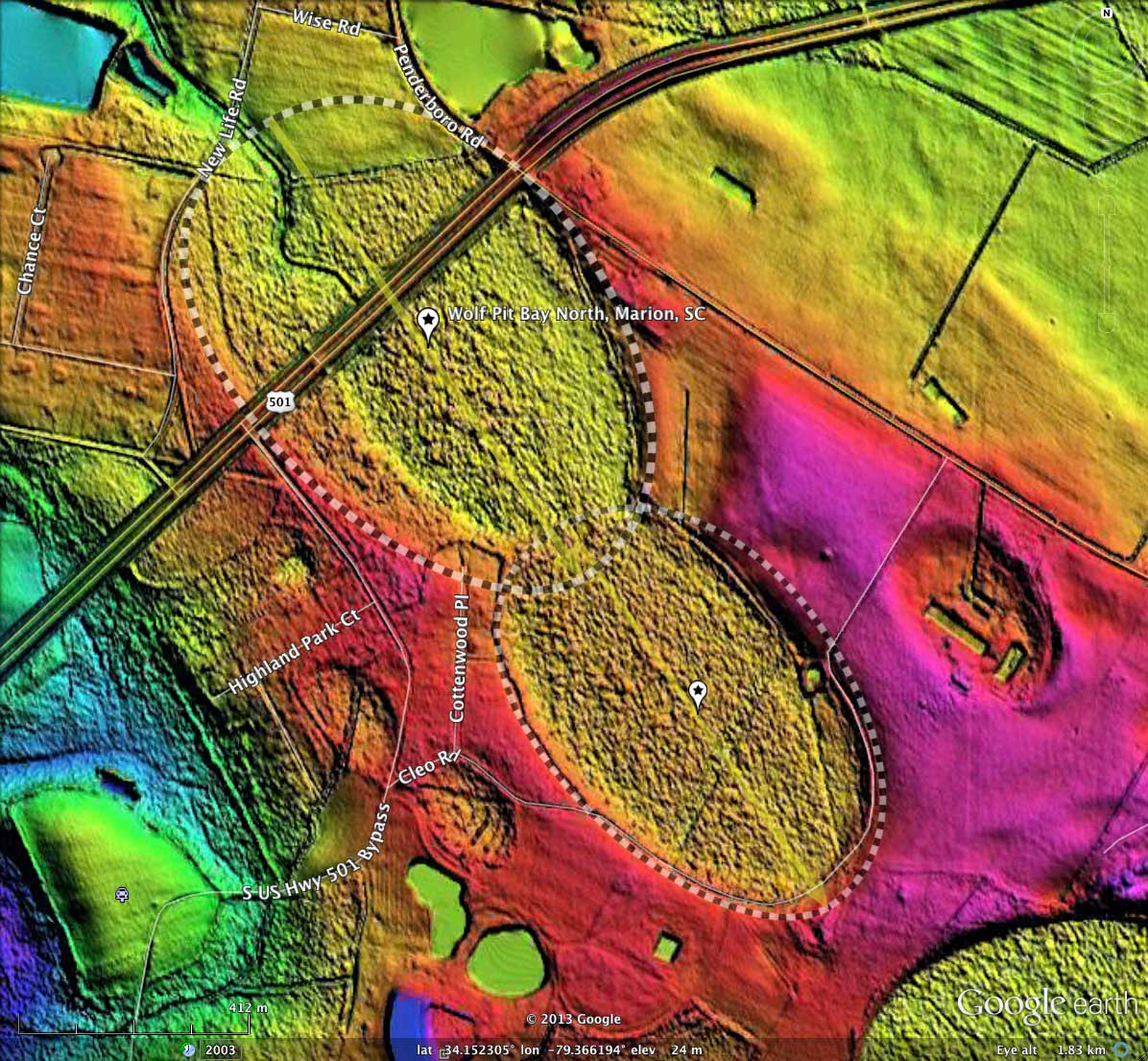
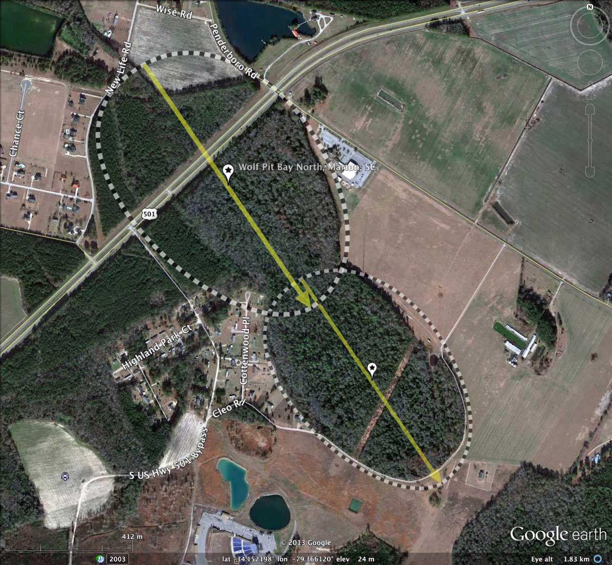
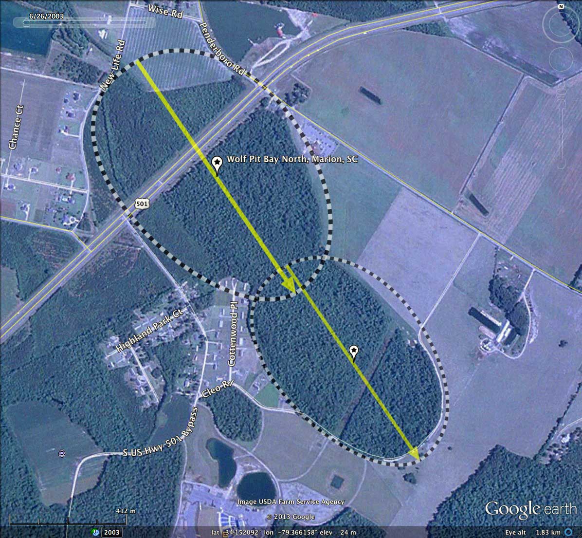
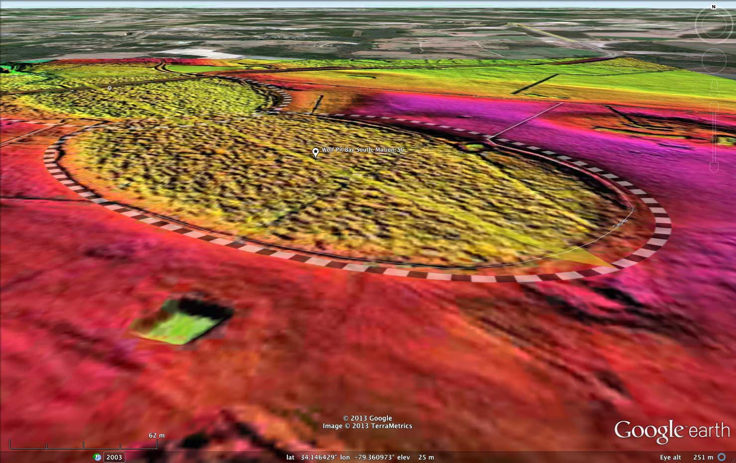
I interpret the shape of Wolf Pit Bay, in Marion County, SC, as being the mash-up of two identically oriented (145.69º) bayCarolina archetype shapes, joined nearly head-to-tail along the orientation axis. The more north-westerly landform is the larger of the two.
The bays do not show any signs of wind-blown sand dunes on the southeastern rim, which is set into the surrounding landscape rather than being raised. A small companion bay to the southeast is similarly fully set into the surrounding landscape. The consistent findings in the Survey of significant quantities of bays absent a raised southeast rim falsifies the often-repeated observation that Carolina Bays are characterized by one.
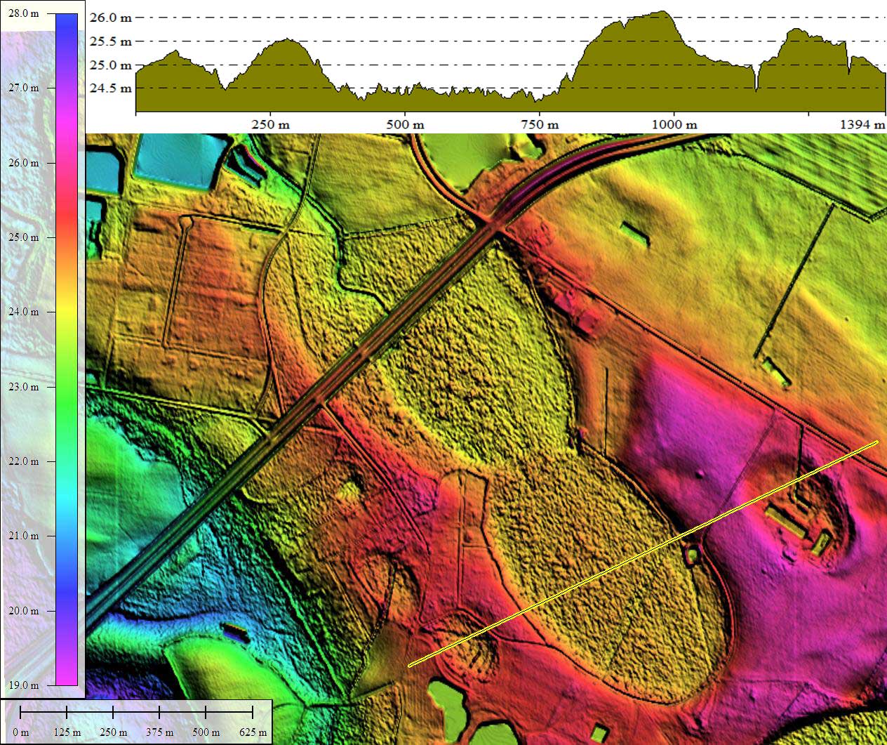
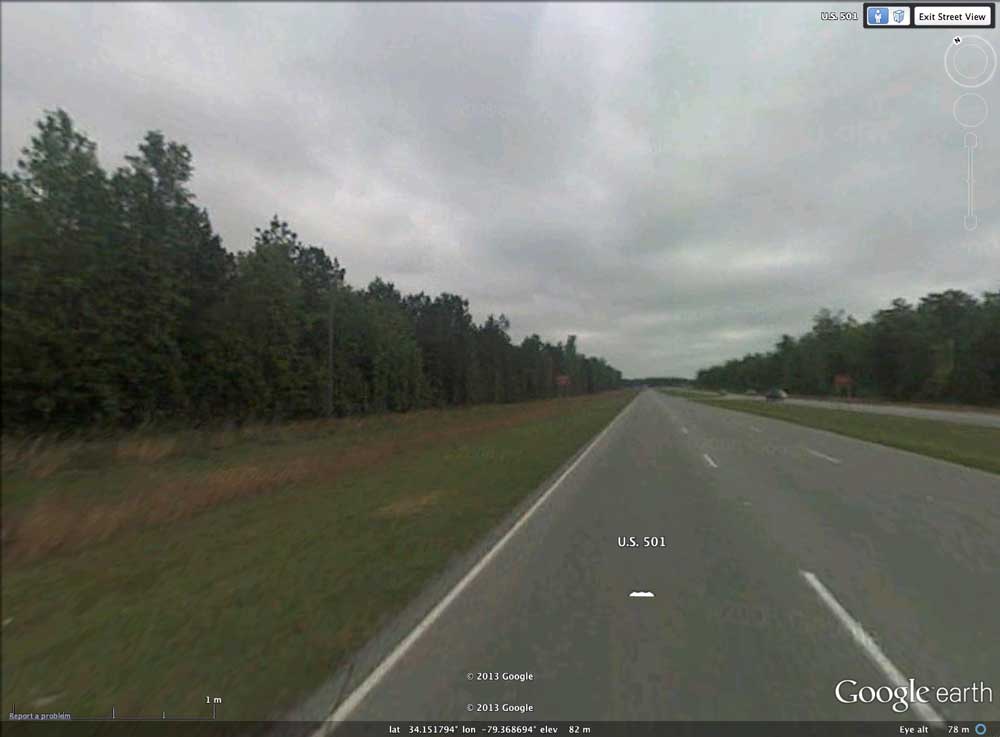
The northwestern end of the bay complex hosts a natural drainage channel, exiting to the northwest. There is Google Streetview imagery available along US 501 as it passes over the bay on a raised roadbed [LINK], where the bay floor and tree stand can be seen at a lower elevation.
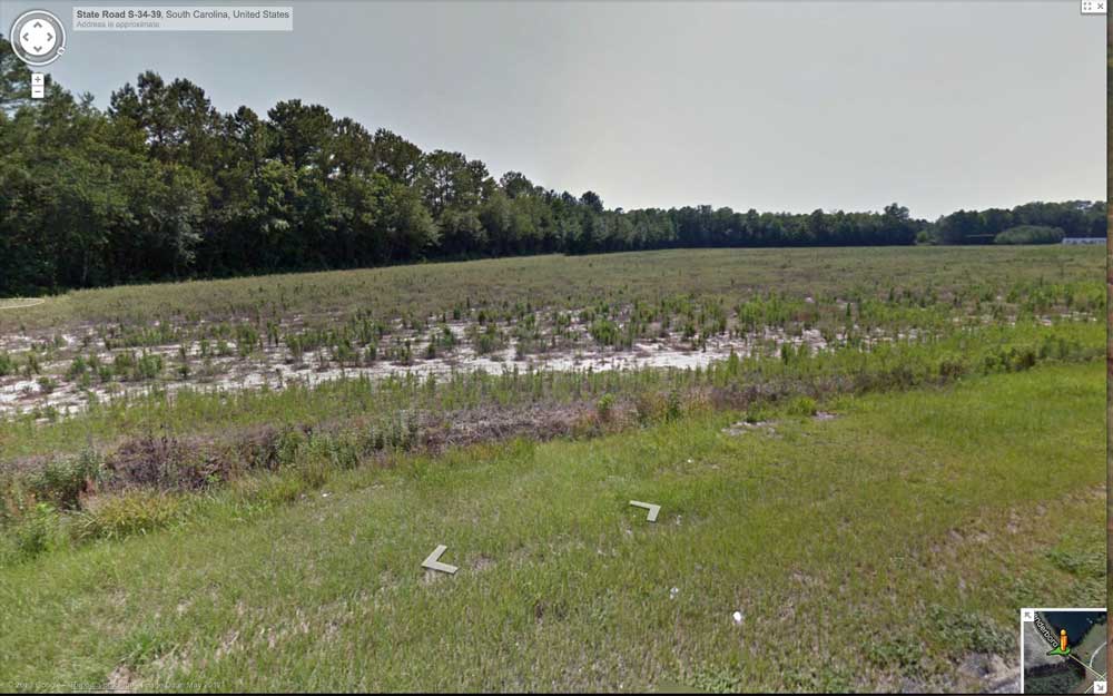
The bay floor is fully forested with the exception of the Rt 501 crossing and an area of farmland within the northwestern rim. The view from Penderboro Road [LINK ]suggest that particular parcel of farmland is surfaced in non-productive bright white sand.
The nearby area hosts several borrow pits which may have been used to quarry sand, some of which was probably used to build the raised apron viewing area at the nearby Charlotte Entertainment Complex, located off the southwestern side of the conjoined bays.
The Carolina Bay Survey has identified and measured 283 bays in _Octant 136317. Their location and metrics can be referenced through a Fusion Table spatial visualization.
I interpret the shape of Wolf Pit Bay, in Marion County, SC, as being the mash-up of two identically oriented (145.69º) bayCarolina archetype shapes, joined nearly head-to-tail along the orientation axis. The more north-westerly landform is the larger of the two.
The bays do not show any signs of wind-blown sand dunes on the southeastern rim, which is set into the surrounding landscape rather than being raised. A small companion bay to the southeast is similarly fully set into the surrounding landscape. The consistent findings in the Survey of significant quantities of bays absent a raised southeast rim falsifies the often-repeated observation that Carolina Bays are characterized by one.
The northwestern end of the bay complex hosts a natural drainage channel, exiting to the northwest. There is Google Streetview imagery available along US 501 as it passes over the bay on a raised roadbed [LINK], where the bay floor and tree stand can be seen at a lower elevation.
The bay floor is fully forested with the exception of the Rt 501 crossing and an area of farmland within the northwestern rim. The view from Penderboro Road [LINK ]suggest that particular parcel of farmland is surfaced in non-productive bright white sand.
The nearby area hosts several borrow pits which may have been used to quarry sand, some of which was probably used to build the raised apron viewing area at the nearby Charlotte Entertainment Complex, located off the southwestern side of the conjoined bays.
The Carolina Bay Survey has identified and measured 283 bays in _Octant 136317. Their location and metrics can be referenced through a Fusion Table spatial visualization.
- Index #: 136317_6046
- Location: 34.151858565736894,-79.36612028768371
- Major: 0.99 km . . . Minor: 0.67 km
- Eccentricity: 0.737
- Area: 52.73 hectares
- Bearing: 145.69º
- Elevation: 24.12 m
- Archetype: bayCarolina
- Effective Diameter: 819.376 m
- Index #: 136317_5844
- Location: 34.1460373099865,-79.36094240073777
- Major: 0.83 km . . . Minor: 0.54 km
- Eccentricity: 0.756
- Area: 35.69 hectares
- Bearing: 145.69º
- Elevation: 24.36 m
- Archetype: bayCarolina
- Effective Diameter: 674.105 m
Copyright 2018 by Michael Davias