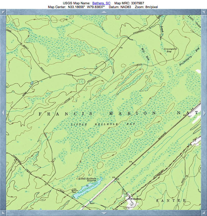
Little Hellhole Bay, SC
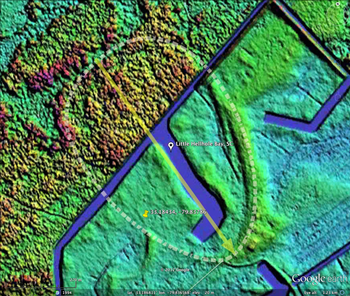
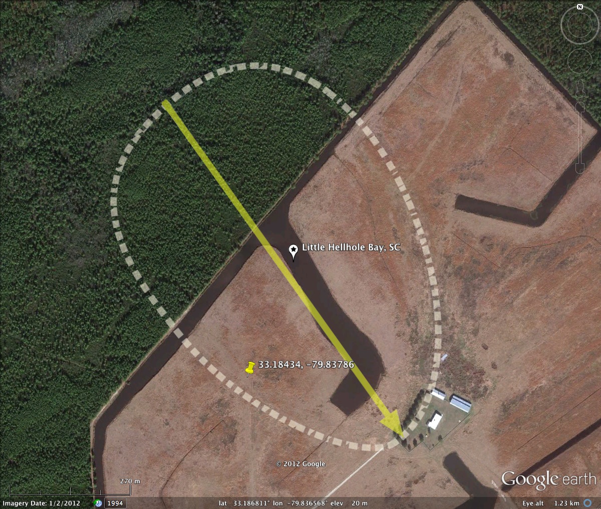
While there is certainly a well-formed Carolina bay landform in this area of the Francis Marion Forest Preserve, the USGS seems to include the surrounding swamp areas in their definition of Little Hellhole bay. This is true also for Hellhole Bay (the bigger one), which also looks to be a large area of swamp on the topographic maps. To be fair, the rim of this bay is vary faint and of low relief, making it hard to resolve in the satellite imagery. Even the LiDAR imagery is compromised by the thick vegetation on the northern half of the bay, which looks to be under a heavy forest canopy. That said, the rim does express itself as a Bay-South archetype in a satisfactory way. Hellhole bay has been partially consumed by an "enhancement project", or so it is proposed by the Ducks Unlimited folks:
The Little Hellhole Reserve Enhancement Project represents the third project to be completed in the Francis Marion National Forest. Two projects at North and South Tibwin were completed in 1999. This project is a result of the many conservation partnerships that have been formed under the North American Waterfowl Management Plan. Conservation partners included Ducks Unlimited, U.S. Forest Service, North American Wetlands Conservation Council, Atlantic Coast Joint Venture, U.S. Fish and Wildlife Service and South Carolina Department of Natural Resources all of which contributed services and/or funding toward the completion of the project.
See the full Ducks Unlimited discussion HERE.
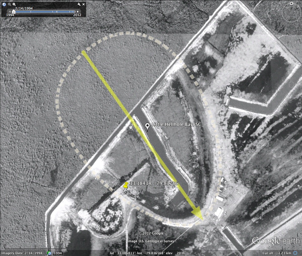
The photos in the attached album include one from 1994, showing the construction of the canals in progress.
Index #: 132319_7434
Location: 33.186661997668566,-79.83675045530589
Major: 0.93 km . . . Minor: 0.62 km
Eccentricity: 0.747
Area: 46.05 hectares
Bearing: 144.54º
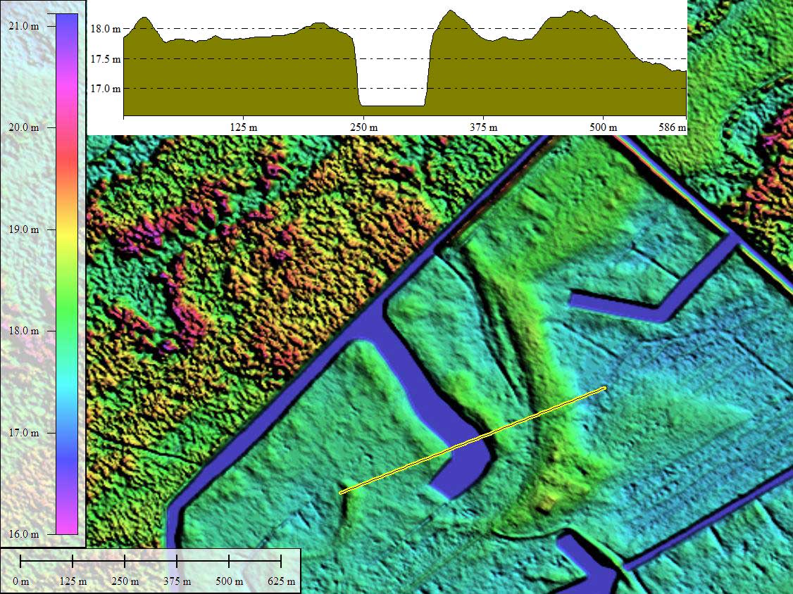
Elevation: 16.7 m
Planform: baySouth
Effective Diameter: 765.719 m
The Little Hellhole Reserve Enhancement Project represents the third project to be completed in the Francis Marion National Forest. Two projects at North and South Tibwin were completed in 1999. This project is a result of the many conservation partnerships that have been formed under the North American Waterfowl Management Plan. Conservation partners included Ducks Unlimited, U.S. Forest Service, North American Wetlands Conservation Council, Atlantic Coast Joint Venture, U.S. Fish and Wildlife Service and South Carolina Department of Natural Resources all of which contributed services and/or funding toward the completion of the project.
See the full Ducks Unlimited discussion HERE.
The photos in the attached album include one from 1994, showing the construction of the canals in progress.
Index #: 132319_7434
Location: 33.186661997668566,-79.83675045530589
Major: 0.93 km . . . Minor: 0.62 km
Eccentricity: 0.747
Area: 46.05 hectares
Bearing: 144.54º
Elevation: 16.7 m
Planform: baySouth
Effective Diameter: 765.719 m
Copyright 2018 by Michael Davias