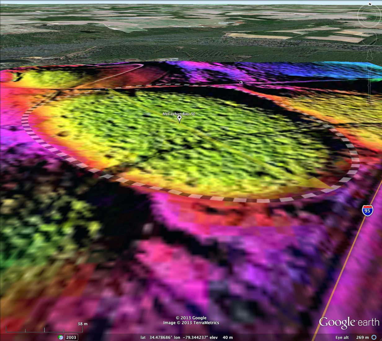
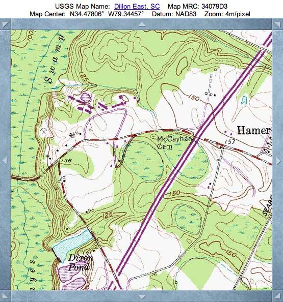
McCayhan Bay, SC
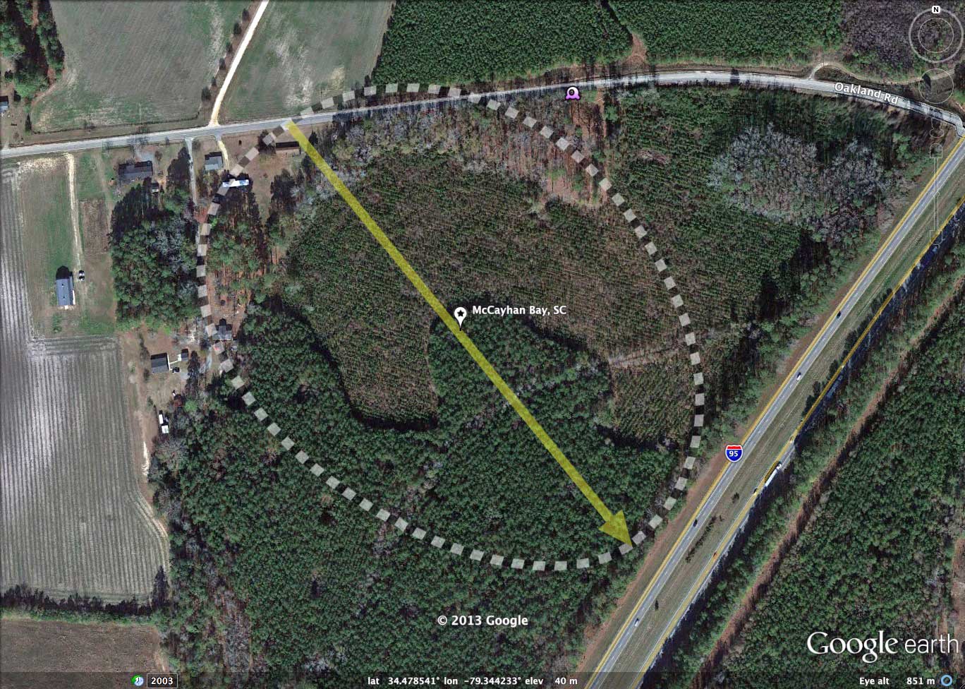
Today's bay was named by me after the historical cemetery which lies on its northwest rim. Google Streetview captures the scene from Oakland road towards the raised rim, upon which several tombstones are visible 50 meters in the distance. The view can be recreated in your browser with this LINK. The view can also be re-created in Google Earth by clicking on the camera icon in the KMZ file referenced in this post.
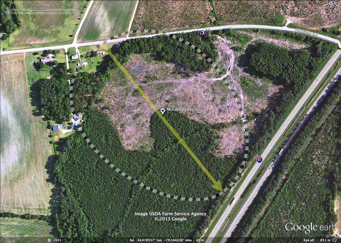
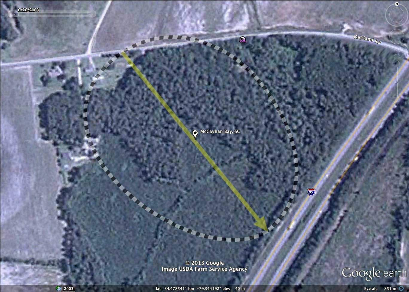
Our view in towards the bay, its rim, and the century was enabled by an extensive timber harvesting project which took place between 2003 and 2005, as evidenced in the Google Historical Imagery for those years. Since the harvesting operation the cut area has been replanted and is on its way back to a forested state, as seen in the 2011 imagery.
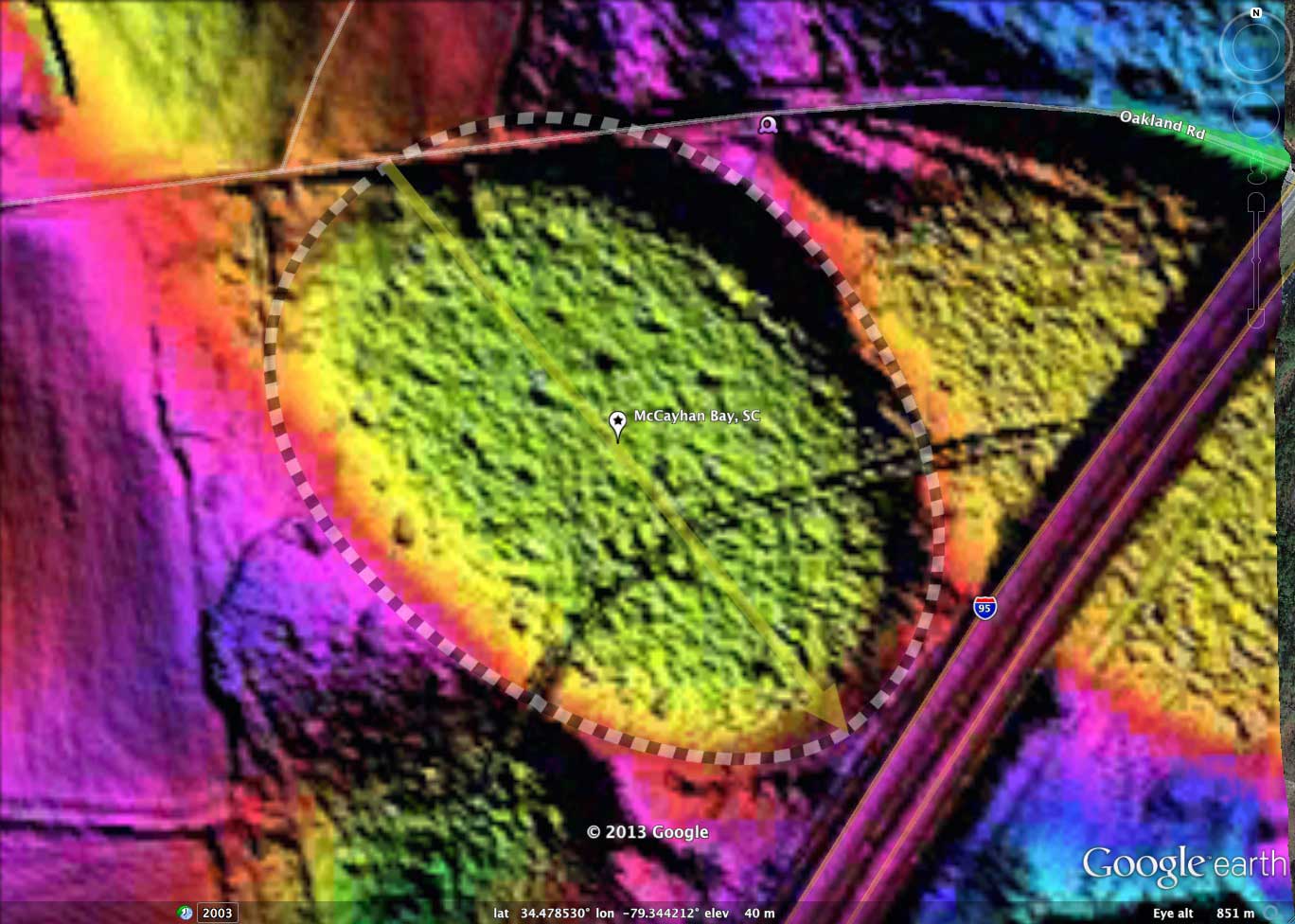
The bay is a perfect match to the common bayCarolina archetype shape, and its orientation is similar to that of other nearby bays. The LiDAR and elevation profile maps identify a deep drainage ditch which traverses the bay's east rim, across the bay floor and then the west rim in a 2-meter cut (see the elevation profile map), draining out into an adjacent bay to the south. This drainage channel actually begins at the I95 roadway to the northeast, and drains the adjacent bay into McCayhan Bay. That particular bay is traversed and split in half by the I95 roadway; yet another of hundreds of bays traversed by interstate highways and railways.
The location where the drainage ditch cuts through the southwestern rim looks to be a great location to take rim samples, as it is quite narrow at that point.
Streetview of Cemetery on the raised Rim of McCayhan Bay LINK.
Our view in towards the bay, its rim, and the century was enabled by an extensive timber harvesting project which took place between 2003 and 2005, as evidenced in the Google Historical Imagery for those years. Since the harvesting operation the cut area has been replanted and is on its way back to a forested state, as seen in the 2011 imagery.
The bay is a perfect match to the common bayCarolina archetype shape, and its orientation is similar to that of other nearby bays. The LiDAR and elevation profile maps identify a deep drainage ditch which traverses the bay's east rim, across the bay floor and then the west rim in a 2-meter cut (see the elevation profile map), draining out into an adjacent bay to the south. This drainage channel actually begins at the I95 roadway to the northeast, and drains the adjacent bay into McCayhan Bay. That particular bay is traversed and split in half by the I95 roadway; yet another of hundreds of bays traversed by interstate highways and railways.
The location where the drainage ditch cuts through the southwestern rim looks to be a great location to take rim samples, as it is quite narrow at that point.
Streetview of Cemetery on the raised Rim of McCayhan Bay LINK.
- Index #: 137317_9137
- Location: 34.47842665716717,-79.34421458964707
- Major: 0.47 km . . . Minor: 0.36 km
- Eccentricity: 0.645
- Area: 13.65 hectares
- Bearing: 140.85º
- Elevation: 40.38 m
- Archetype: bayCarolina
- Effective Diameter: 416.889 m

Copyright 2018 by Michael Davias