Dixon Bay, GA
Dixon Bay is the site of a Georgia State Wildlife Management Area.
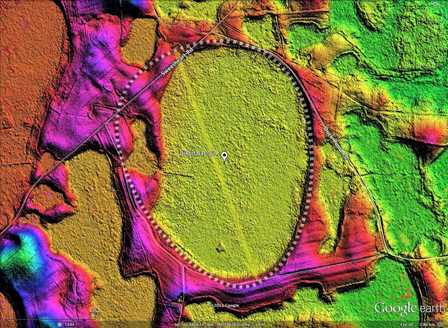
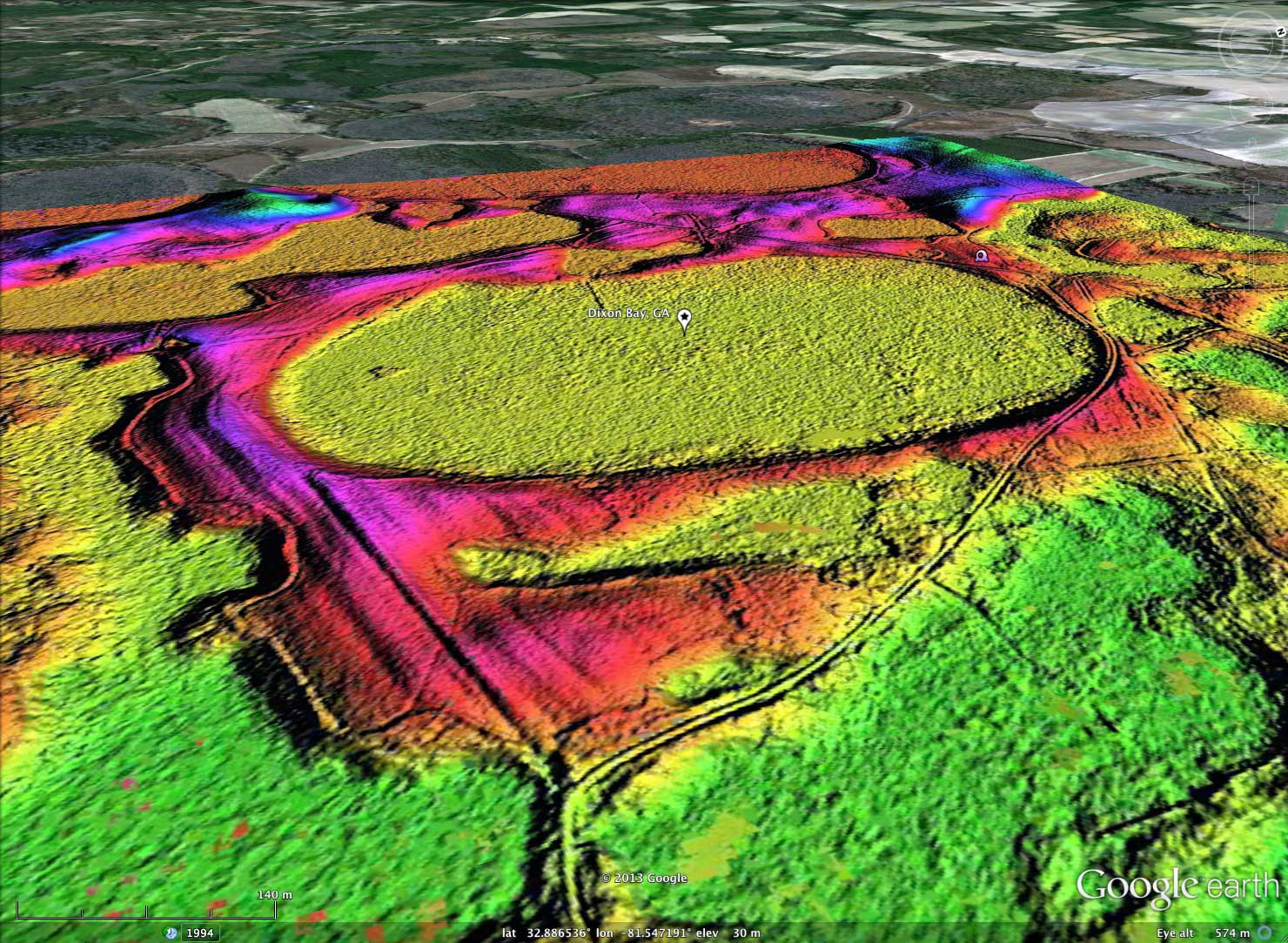
The bay is a fairly good fit to the baySouth archetype shape, although the north-west quadrant has an embedded pair of small bays which disrupt the rim across that arc.
An oblique view of the bay is included in the album, with the 20x LiDAR hsv elevation hinting and the 3x Google Earth elevation exaggeration combining to yield an engaging 3D visualization of the bay.
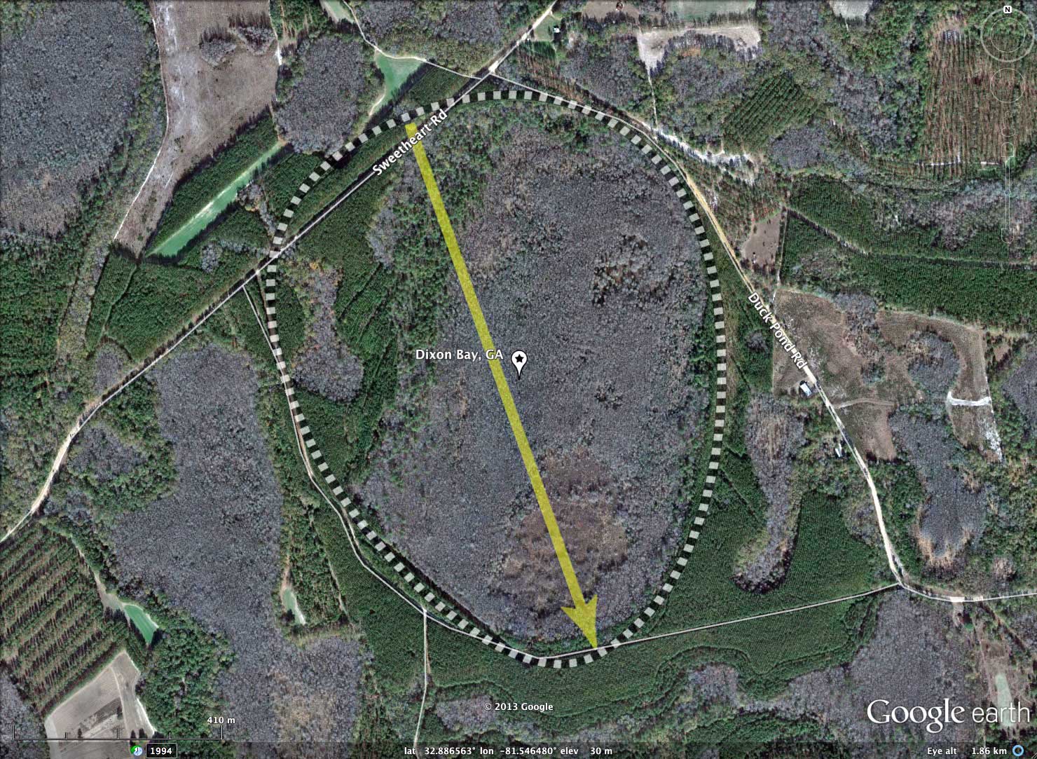
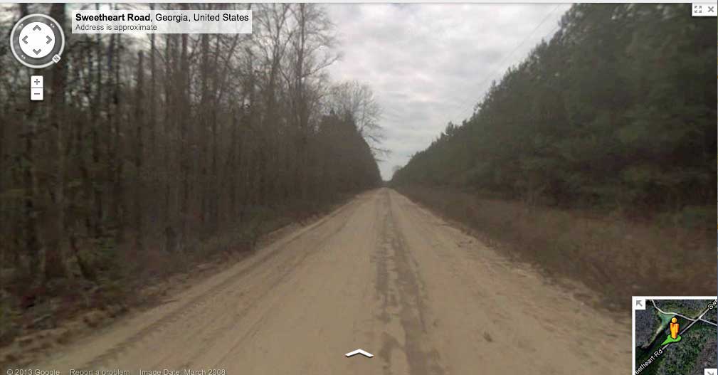
Sweetheart Road crosses the northwestern end of the bay, and there is Google Streetview Imagery available there. Unfortunately, due to the thick forest within the bay, it is hard to view into the bay from the road to get much of a sense of its vertical relief.
The attached album does have a Streetview image taken taken looking Northeast along Sweetheart Road, which is on the rim. Bay depression is visible within the natural woodland on right. Compare that vegetation with the plantation crop of pine seen on the left side of the road. The attached KMZ file has a placemark for the Streetview location for viewing within Google Earth, or you can browse the area interactively using this LINK.
The bay is a fairly good fit to the baySouth archetype shape, although the north-west quadrant has an embedded pair of small bays which disrupt the rim across that arc.
An oblique view of the bay is included in the album, with the 20x LiDAR hsv elevation hinting and the 3x Google Earth elevation exaggeration combining to yield an engaging 3D visualization of the bay.
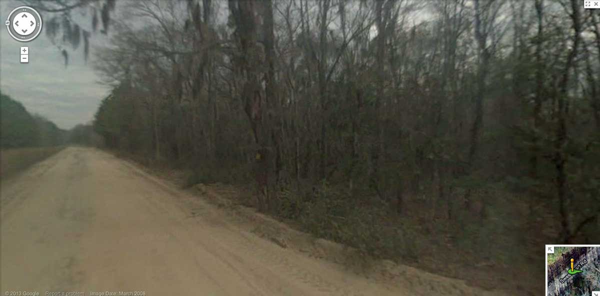
Sweetheart Road crosses the northwestern end of the bay, and there is Google Streetview Imagery available there. Unfortunately, due to the thick forest within the bay, it is hard to view into the bay from the road to get much of a sense of its vertical relief.
The attached album does have a Streetview image taken taken looking Northeast along Sweetheart Road, which is on the rim. Bay depression is visible within the natural woodland on right. Compare that vegetation with the plantation crop of pine seen on the left side of the road. The attached KMZ file has a placemark for the Streetview location for viewing within Google Earth, or you can browse the area interactively using this LINK.
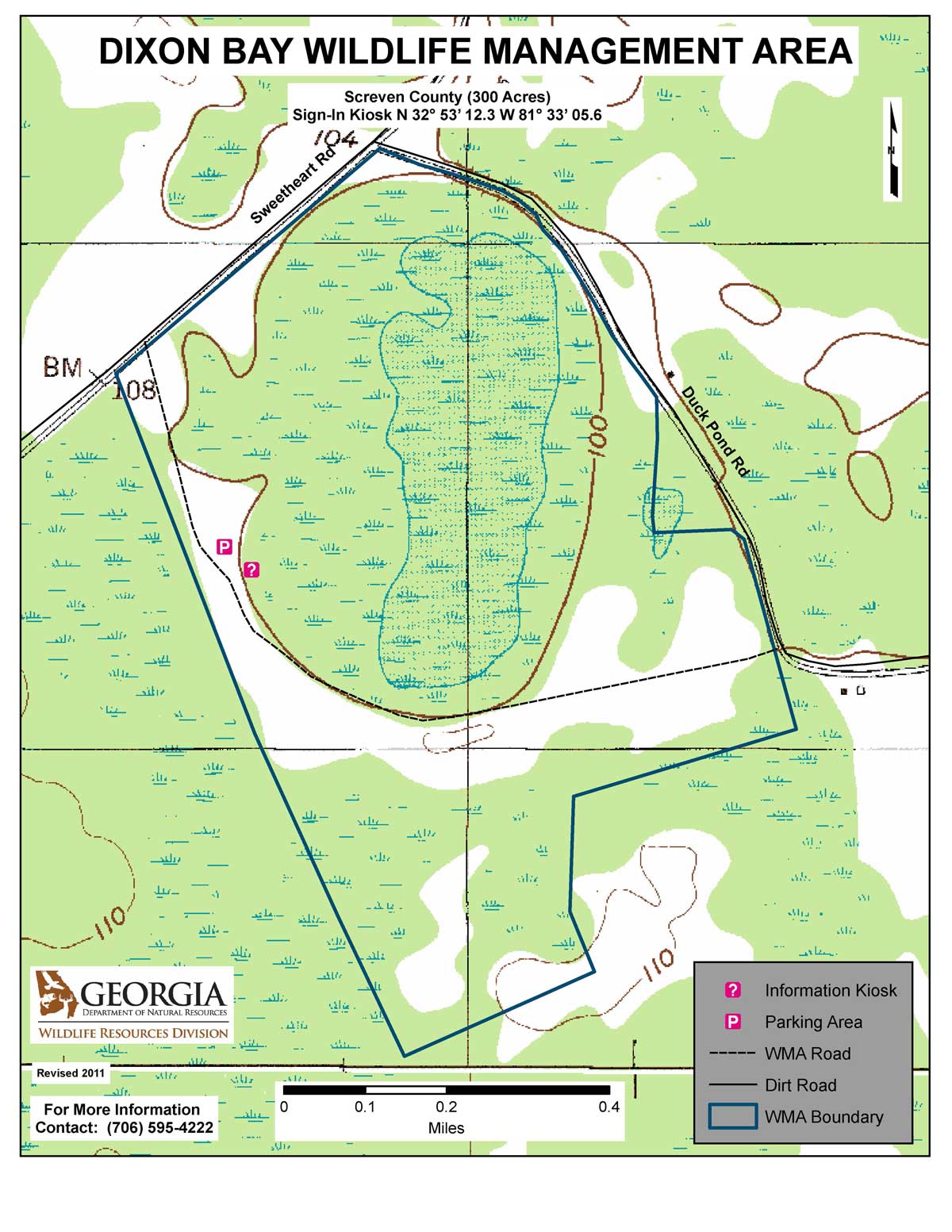
The 300 acre Wildlife Management Area open to hunting seasonally. Camping, pre-season scouting, hiking, picnicking, canoeing, and other recreational uses are allowed year-round, unless otherwise posted at the WMA check station or at a specific recreation site. However, horseback riding and bicycling are restricted to open, improved roads, designated trails or designated areas. Horse and bicycle trails and areas may be closed during certain hunting seasons to avoid user conflicts. Specific recreation sites can be closed as needed for management purposes by posting at the site. All WMA visitors are encouraged to wear hunter orange during hunting seasons. Refer to the annual hunting seasons and regulations to determine when specific WMA are open for hunting and what type of hunting is occurring.
OhRanger.com
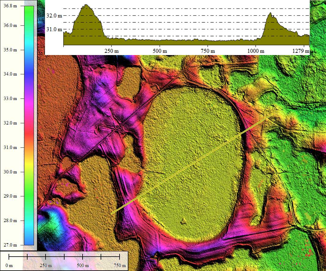
- Index #: 131326_5418
- Location: 32.88622199941557,-81.54642060942993
- Major: 1.13 km . . . Minor: 0.88 km
- Eccentricity: 0.631
- Area: 79.1 hectares
- Bearing: 160.43º
- Elevation: 30.18 m
- Archetype: baySouth
- Effective Diameter: 1,003.559 m
Copyright 2018 by Michael Davias