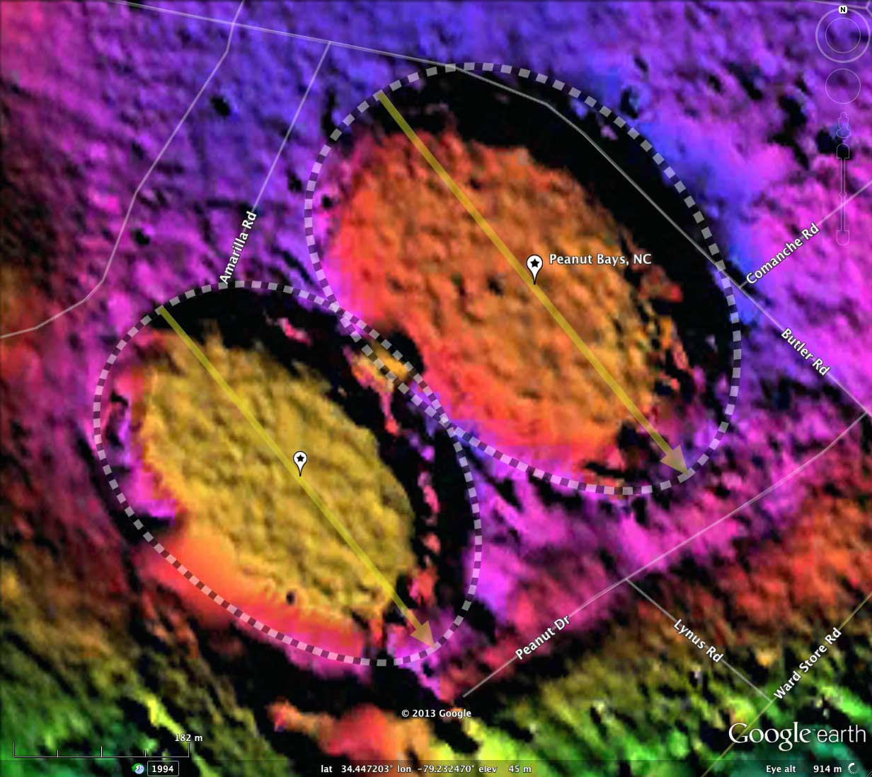
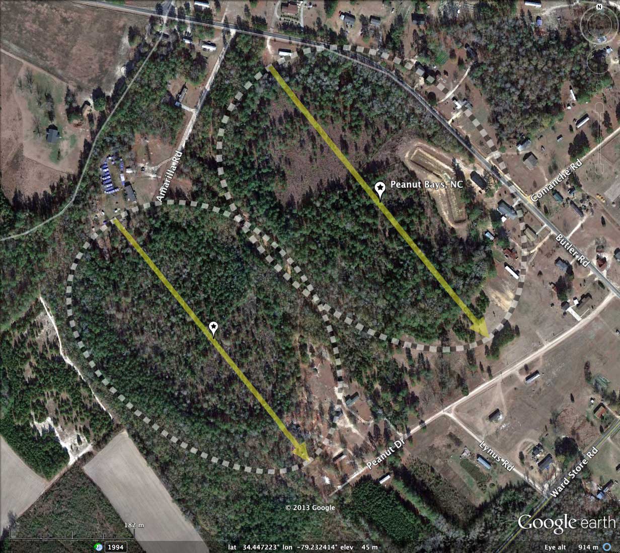
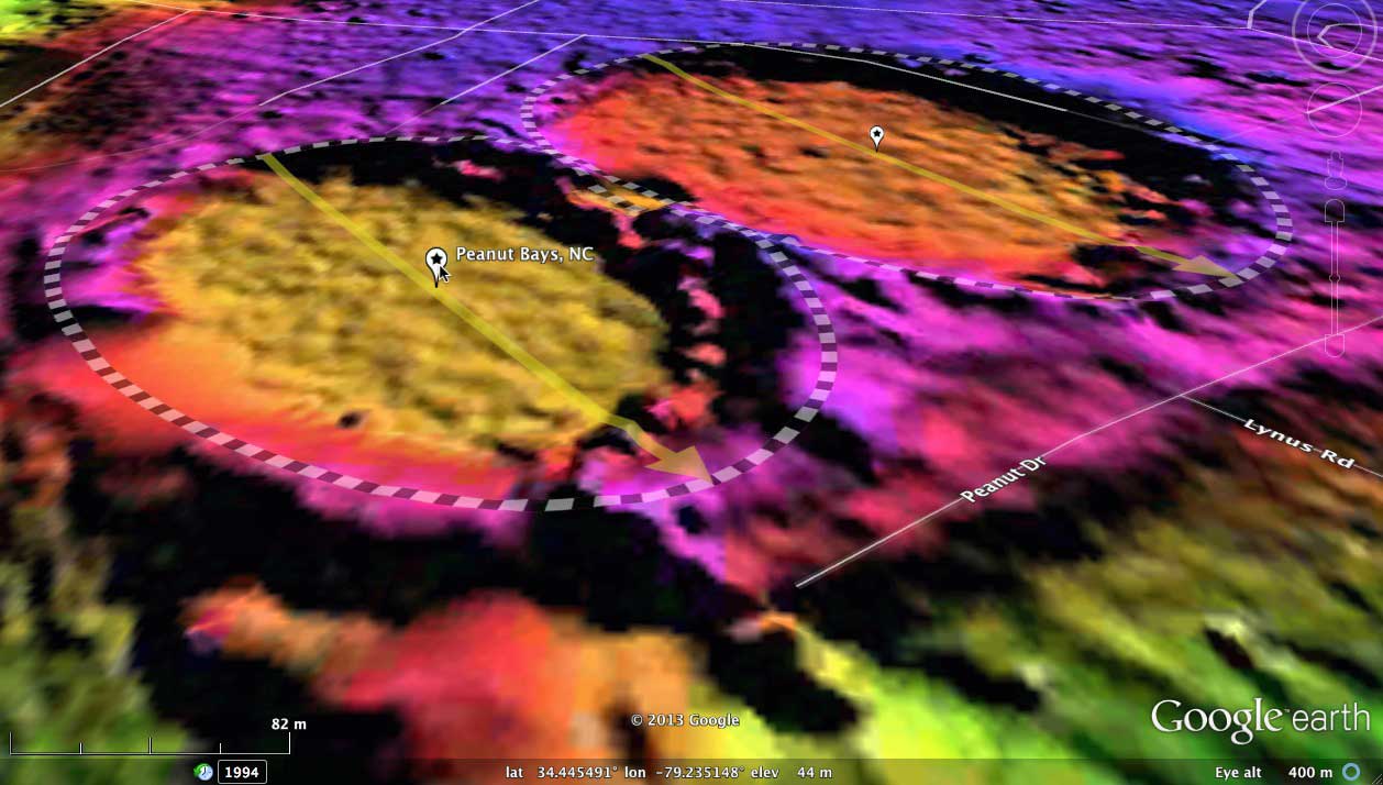
Peanut Bays, NC
Presented here are two bays which appear to be genetically similar. One is slightly larger than the other, but both have identical orientations (141.06º) and nearly the same eccentricity. I named them after the nearby road, and I also thought they looked like two small peanuts from the same shell when viewed.
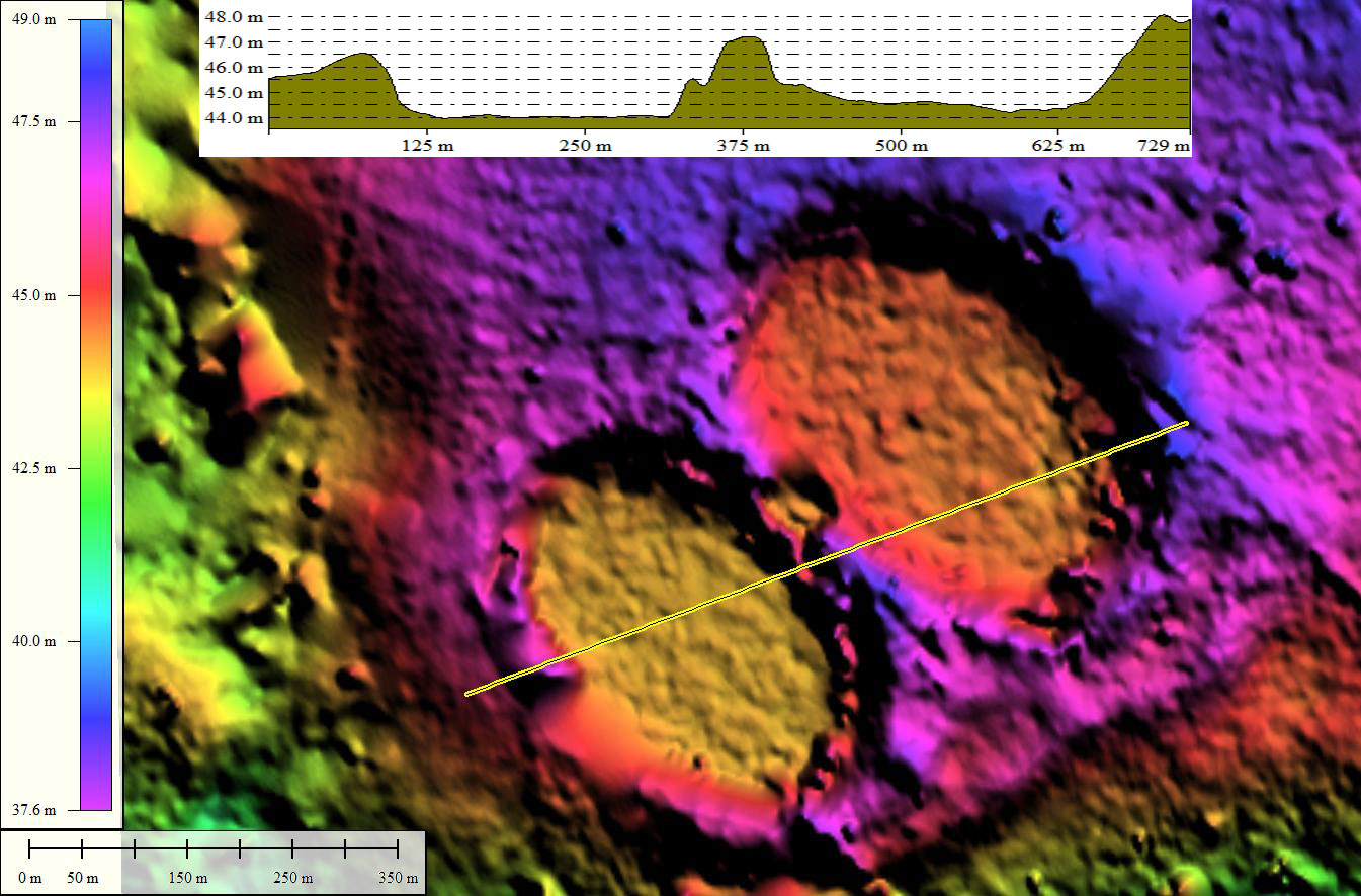
These are fairly small bays, being only 1/3 kilometers along the major axis, yet they present well in the LiDAR with the common bayCarolina archetype shape.
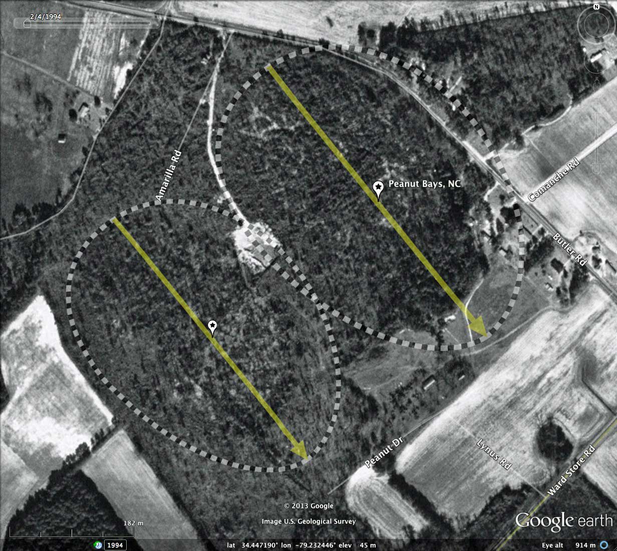
Within the past few years, a drainage holding pond has been dredged in the northern bay. It does not appear in the LiDAR. In spite of that, both bays appear to be in a fairly natural state, and no significant drainage channels appear to be present. There is either a borrow pit, or a very small bay, located within the narrow wall separating the two landforms.
These are fairly small bays, being only 1/3 kilometers along the major axis, yet they present well in the LiDAR with the common bayCarolina archetype shape.
Within the past few years, a drainage holding pond has been dredged in the northern bay. It does not appear in the LiDAR. In spite of that, both bays appear to be in a fairly natural state, and no significant drainage channels appear to be present. There is either a borrow pit, or a very small bay, located within the narrow wall separating the two landforms.
- Index #: 137316_7894
- Location: 34.44525263017624,-79.23510791561674
- Major: 0.45 km . . . Minor: 0.32 km
- Eccentricity: 0.698
- Area: 11.53 hectares
- Bearing: 141.06º
- Elevation: 44.02 m
- Archetype: bayCarolina
- Effective Diameter: 383.15 m
- Index #: 137316_7892
- Location: 34.44703214748197,-79.2324751333958
- Major: 0.5 km . . . Minor: 0.36 km
- Eccentricity: 0.701
- Area: 14.41 hectares
- Bearing: 141.06º
- Elevation: 44.5 m
- Archetype: bay
- Effective Diameter: 428.338 m
Copyright 2018 by Michael Davias