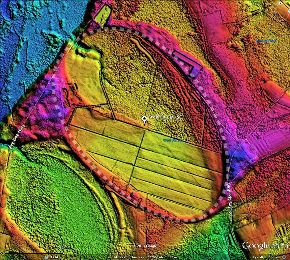
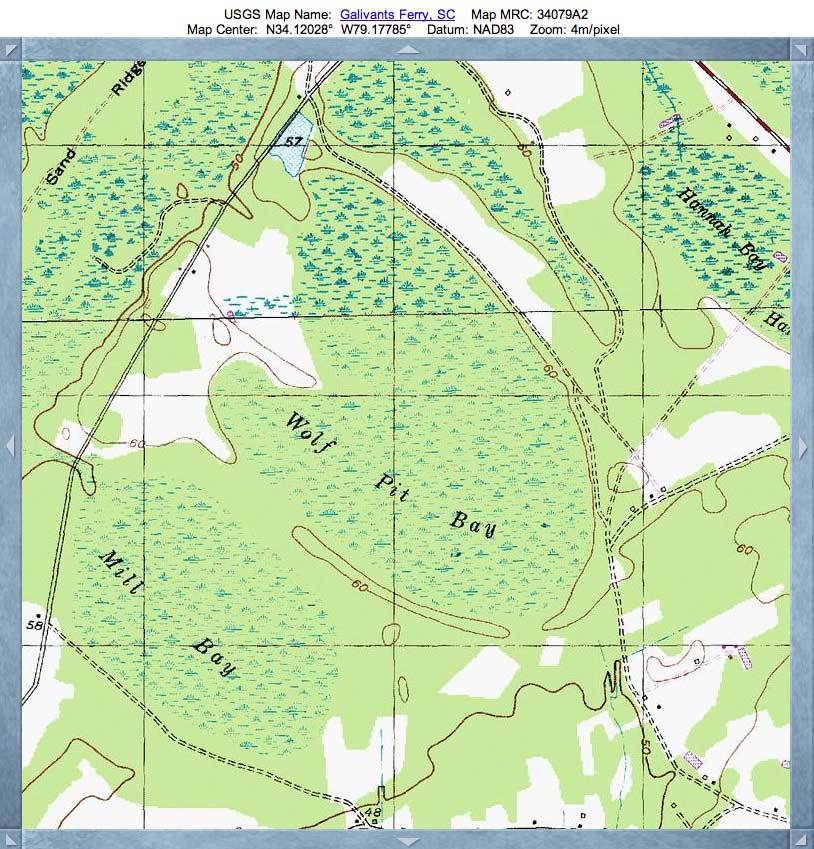
Wolf Pit Bay, SC
Wolf Pit Bay hangs on the banks of the Little Pee Dee River in Horry County, South Carolina. It is one of many swampy bays in the area, most of which compare well to the common bayCarolina archetype and have similar orientations. There actually is another "Wolf Pit Bay" in SC, according to the USGS database. That one is actually two connected bays located 17 kilometers further west in Marion County.
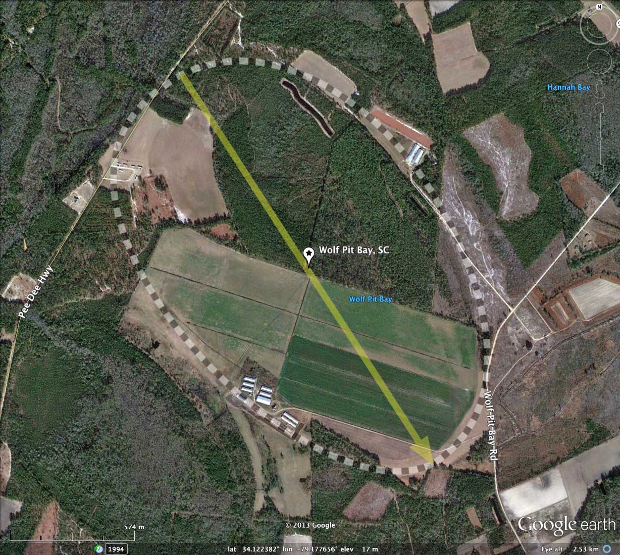
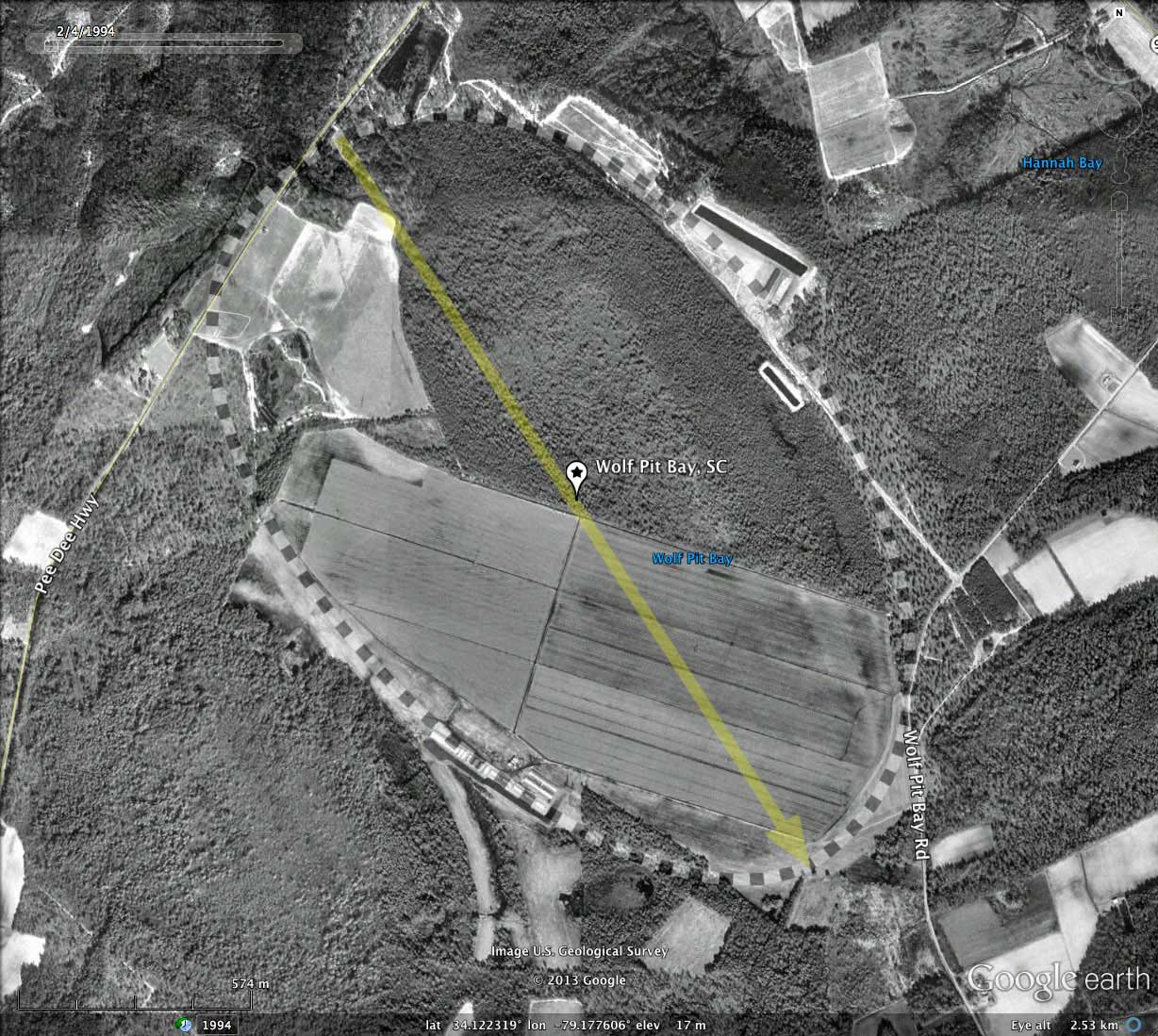
The bay is currently farmed over about half of its extent, while the northern half is forested. An extensive drainage network is in place, allowing water to flow out to the west in to the Pee Dee River flood plain.
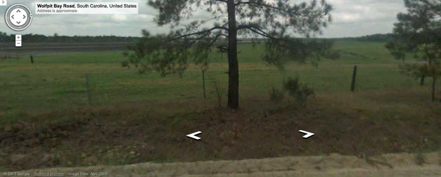
Streetview imagery is available along the northwestern end, as well as the eastern tip. The Streetview image shown in the album was taken from the rim along Wolf Pit Bay Road, at the point of its closest approach to the bay floor. You can browse the location using this LINK.
The bay is currently farmed over about half of its extent, while the northern half is forested. An extensive drainage network is in place, allowing water to flow out to the west in to the Pee Dee River flood plain.
Streetview imagery is available along the northwestern end, as well as the eastern tip. The Streetview image shown in the album was taken from the rim along Wolf Pit Bay Road, at the point of its closest approach to the bay floor. You can browse the location using this LINK.
- Index #: 136316_4871
- Location: 34.12184401222619,-79.17771795150857
- Major: 2.16 km . . . Minor: 1.36 km
- Eccentricity: 0.777
- Area: 231.18 hectares
- Bearing: 147.18º
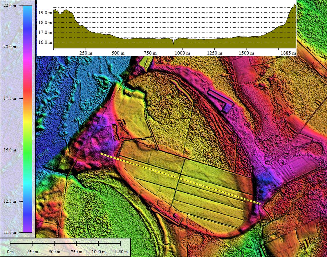
- Elevation: 16.8 m
- Archetype: bayCarolina
- Effective Diameter: 1,715.654 m
Copyright 2018 by Michael Davias