Tupelo Bay, NC
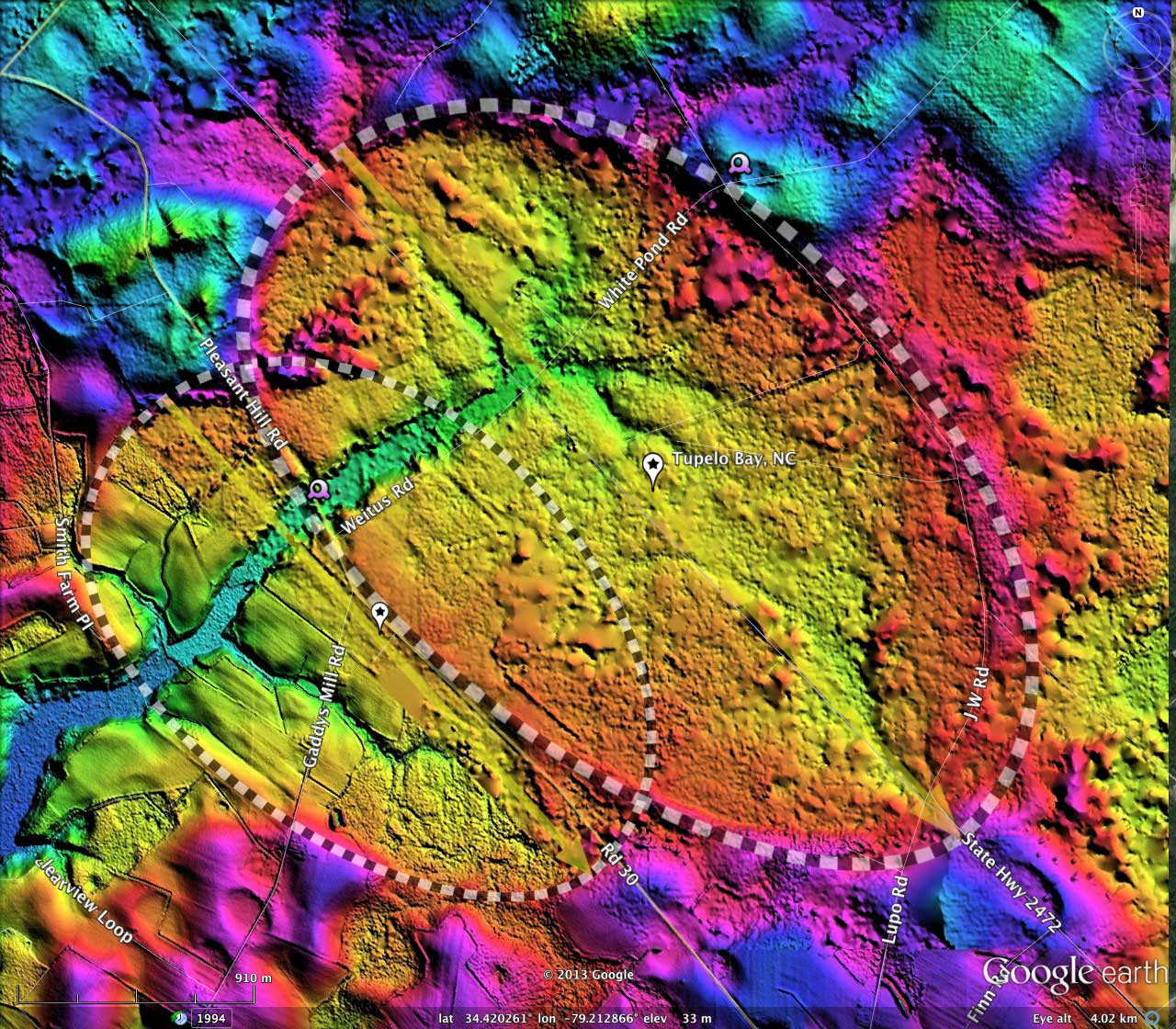
I interpret the gentle depression named Tupelo Bay in the USGS name database as being the mash-up of two Carolina Bays, overlapping side-by side along the major axis orientation. Both bays' shape ( bayCarolina ) and orientation (138.06º) are identical, and similar to numerous other nearby bays (there are over 500 bays in survey octant #137316).
Together, the bays almost recreate the "Heart" shape seen in our #CBOD from Valentines Day.
The North Carolina - South Carolina State line divides Tupelo Bay, along the major axis. This is just a coincidence, of course. In geographic context, the converged bay should probably be noted as a South Carolina landform, since a majority of its footprint is in SC. However, the larger bay's center placemark, and the USGS's database, places it in NC, so be it. Besides, there are numerous "Tupelo" bays, basins and swamps in SC already, the most significant one ( 33.63572, -79.23144° ) is in Georgetown County, which as of this date has no LiDAR data published from acquisitions made back in 2007.
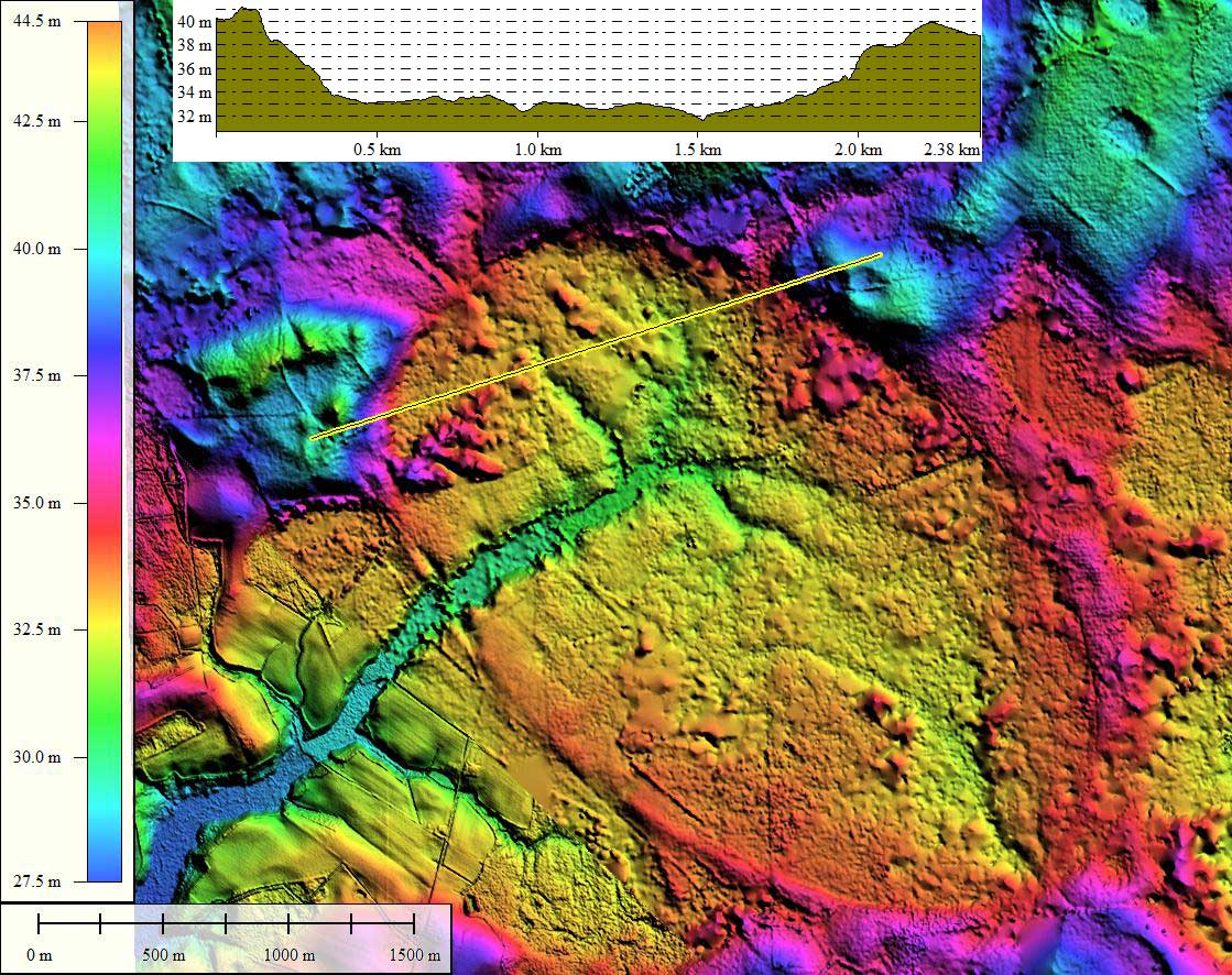
The entire basin is well-drained by natural channels. One question - asked by Douglas Johnson in his book about the bays: did the channels grew headward into the landforms after the bays were formed as closed depressions, or did the already exist while the bay's rim was formed around and over them? Considering how extensive that drainage network is, I interpret it as being eroded since bay creation.
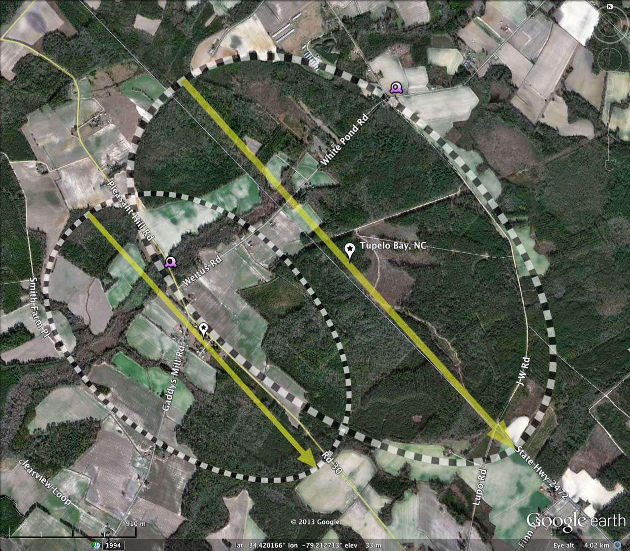
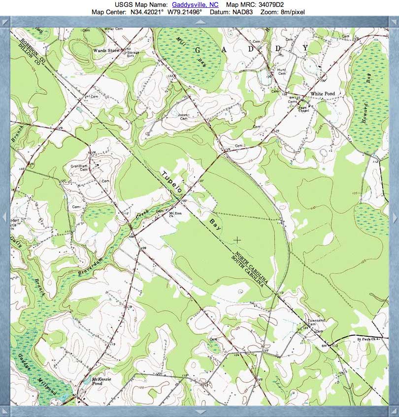
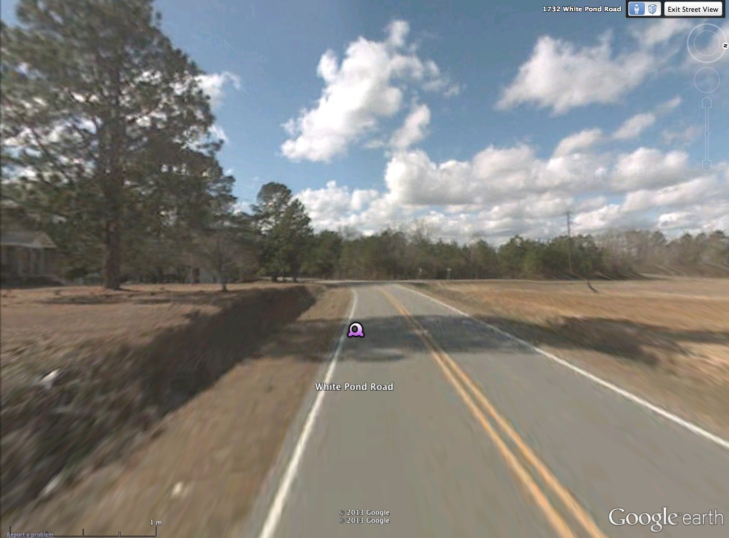
The attached KMZ includes two Streetview placemarks, which will take the viewer to interesting views of the bay from the ground. The first Streetview looking north from Pleasant Hill Road into bay where drainage channel passes under road. The other Streetview is viewed from White Pond Road as it approaches the bay from the east and cuts through the raised bay rim where it crosses the road. The new Google Earth update which zooms the viewer down into the normal satellite view and then transitions gracefully to the Streetview image is awe-inspiring.
Together, the bays almost recreate the "Heart" shape seen in our #CBOD from Valentines Day.
The North Carolina - South Carolina State line divides Tupelo Bay, along the major axis. This is just a coincidence, of course. In geographic context, the converged bay should probably be noted as a South Carolina landform, since a majority of its footprint is in SC. However, the larger bay's center placemark, and the USGS's database, places it in NC, so be it. Besides, there are numerous "Tupelo" bays, basins and swamps in SC already, the most significant one ( 33.63572, -79.23144° ) is in Georgetown County, which as of this date has no LiDAR data published from acquisitions made back in 2007.
The entire basin is well-drained by natural channels. One question - asked by Douglas Johnson in his book about the bays: did the channels grew headward into the landforms after the bays were formed as closed depressions, or did the already exist while the bay's rim was formed around and over them? Considering how extensive that drainage network is, I interpret it as being eroded since bay creation.
The attached KMZ includes two Streetview placemarks, which will take the viewer to interesting views of the bay from the ground. The first Streetview looking north from Pleasant Hill Road into bay where drainage channel passes under road. The other Streetview is viewed from White Pond Road as it approaches the bay from the east and cuts through the raised bay rim where it crosses the road. The new Google Earth update which zooms the viewer down into the normal satellite view and then transitions gracefully to the Streetview image is awe-inspiring.
- Index #: 137316_6785
- Location: 34.41931809434155,-79.21283995029643
- Major: 3.6 km . . . Minor: 2.19 km
- Eccentricity: 0.793
- Area: 620.78 hectares
- Bearing: 138.06º
- Elevation: 32.95 m
- Archetype: bayCarolina
- Effective Diameter: 2,811.405 m
- Index #: 137316_6589
- Location: 34.414362123557545,-79.2242716136753
- Major: 2.48 km . . . Minor: 1.68 km
- Eccentricity: 0.734
- Area: 329.61 hectares
- Bearing: 138.06º
- Elevation: 32.82 m
- Archetype: bayCarolina
- Effective Diameter: 2,048.589
Copyright 2018 by Michael Davias