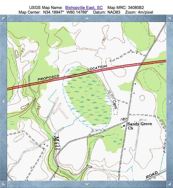
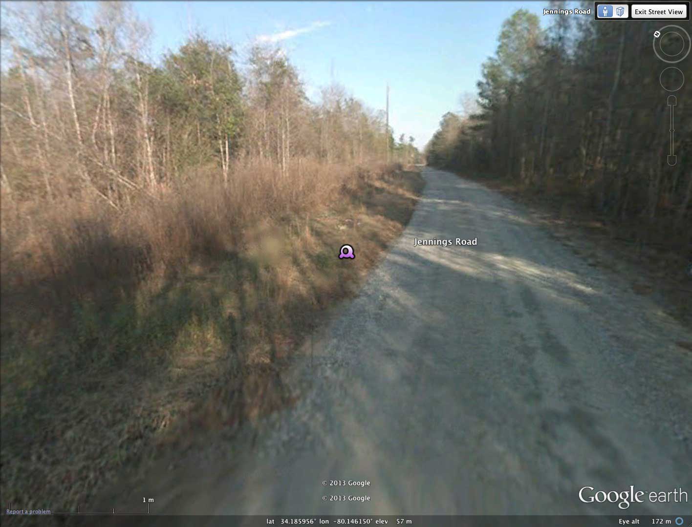
Jennings Bay, SC
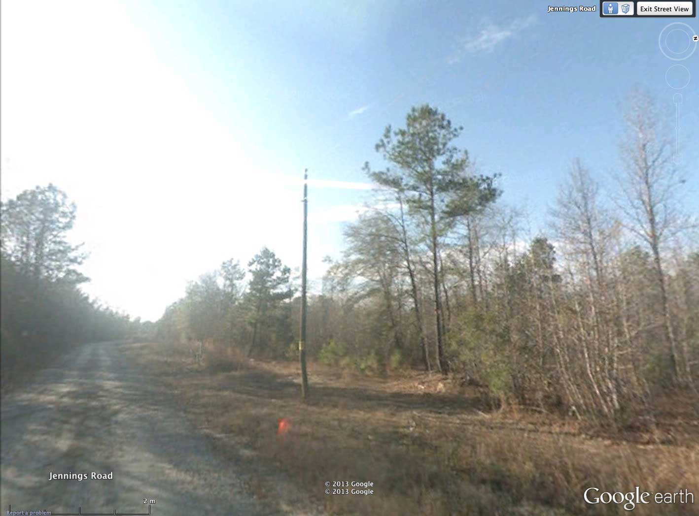
Jennings Bay is located in eastern Lee County, SC. I have named the bay after the road which skirts around its southern tip. Along that stretch, Google Streetview images are available, and two shots are included in the album at the locations shown as placemarks in the referenced KMZ file; #1: from Jennings Road approaching bay rim from south; #2: Looking southwest from road (on Rim) down into bay on right. selecting the placemark will take the viewer down into Streetview within the Google Earth browser.
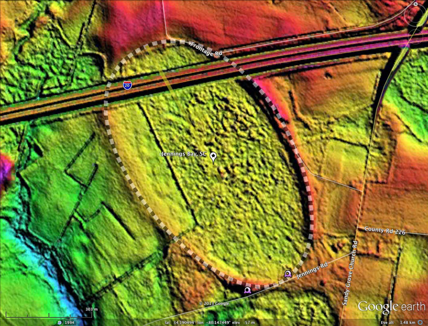
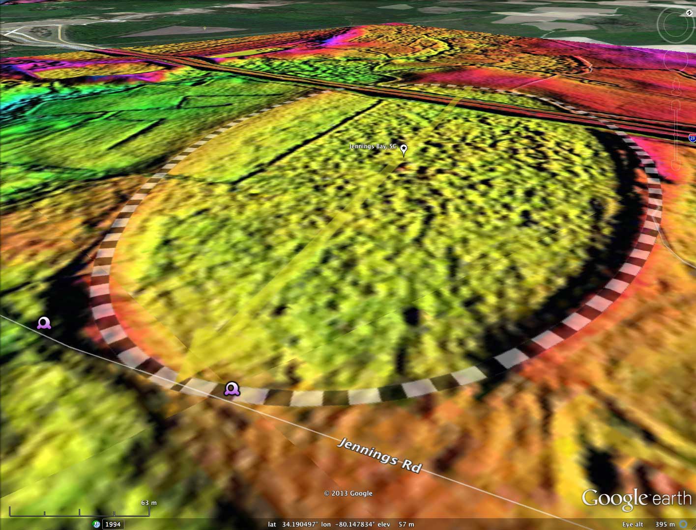
The bay's shape adheres robustly to the common bayCarolina archetype, and has an orientation similar to other bays nearby.
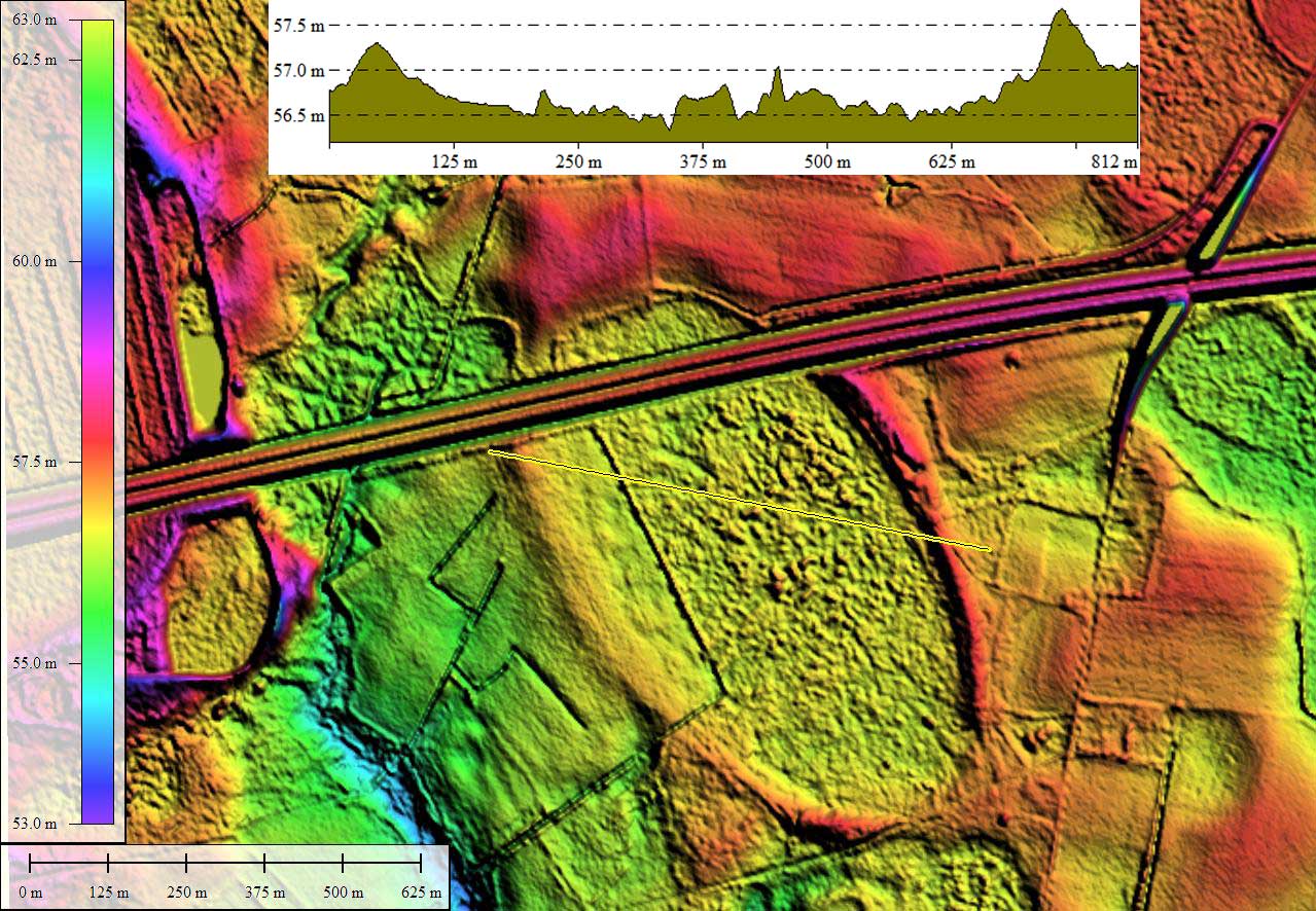
Interstate 20 cuts across the northern end of the bay. I wonder if any geological work was done to understand the structure of the bay while that 100 meter wide by 1/2 kilometer long swath was being cut. Other than that indignity, a majority of the bay looks to remain in a natural state. There is a rectangular area of farmland on the western side south of the I20 corridor, enabled by a ditch & berm system that isolates it from the remainder of the bay.
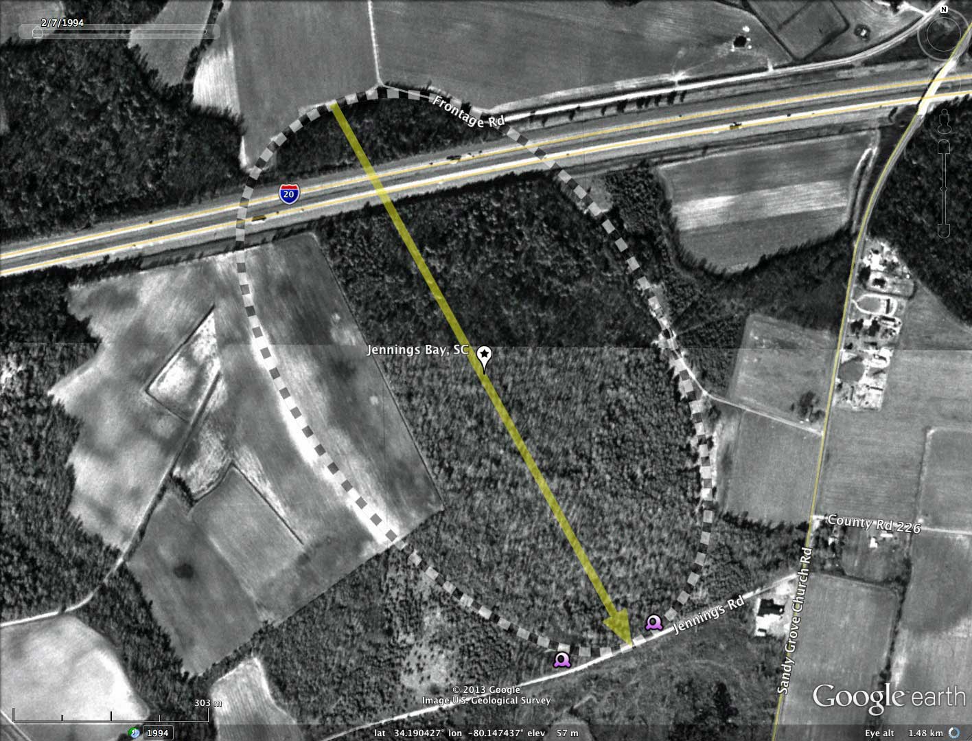
Looking at the historical Google Satellite Imagery from 1994, not much has happened across the bay's footprint in the past 18 years.
The bay's shape adheres robustly to the common bayCarolina archetype, and has an orientation similar to other bays nearby.
Interstate 20 cuts across the northern end of the bay. I wonder if any geological work was done to understand the structure of the bay while that 100 meter wide by 1/2 kilometer long swath was being cut. Other than that indignity, a majority of the bay looks to remain in a natural state. There is a rectangular area of farmland on the western side south of the I20 corridor, enabled by a ditch & berm system that isolates it from the remainder of the bay.
Looking at the historical Google Satellite Imagery from 1994, not much has happened across the bay's footprint in the past 18 years.
- Index #: 136320_7658
- Location: 34.190131612991806,-80.14746649919975
- Major: 0.97 km . . . Minor: 0.58 km
- Eccentricity: 0.8
- Area: 44.79 hectares
- Bearing: 151.17º
- Elevation: 56.54 m
- Archetype: bayCarolina
- Effective Diameter: 755.171 m

Copyright 2018 by Michael Davias