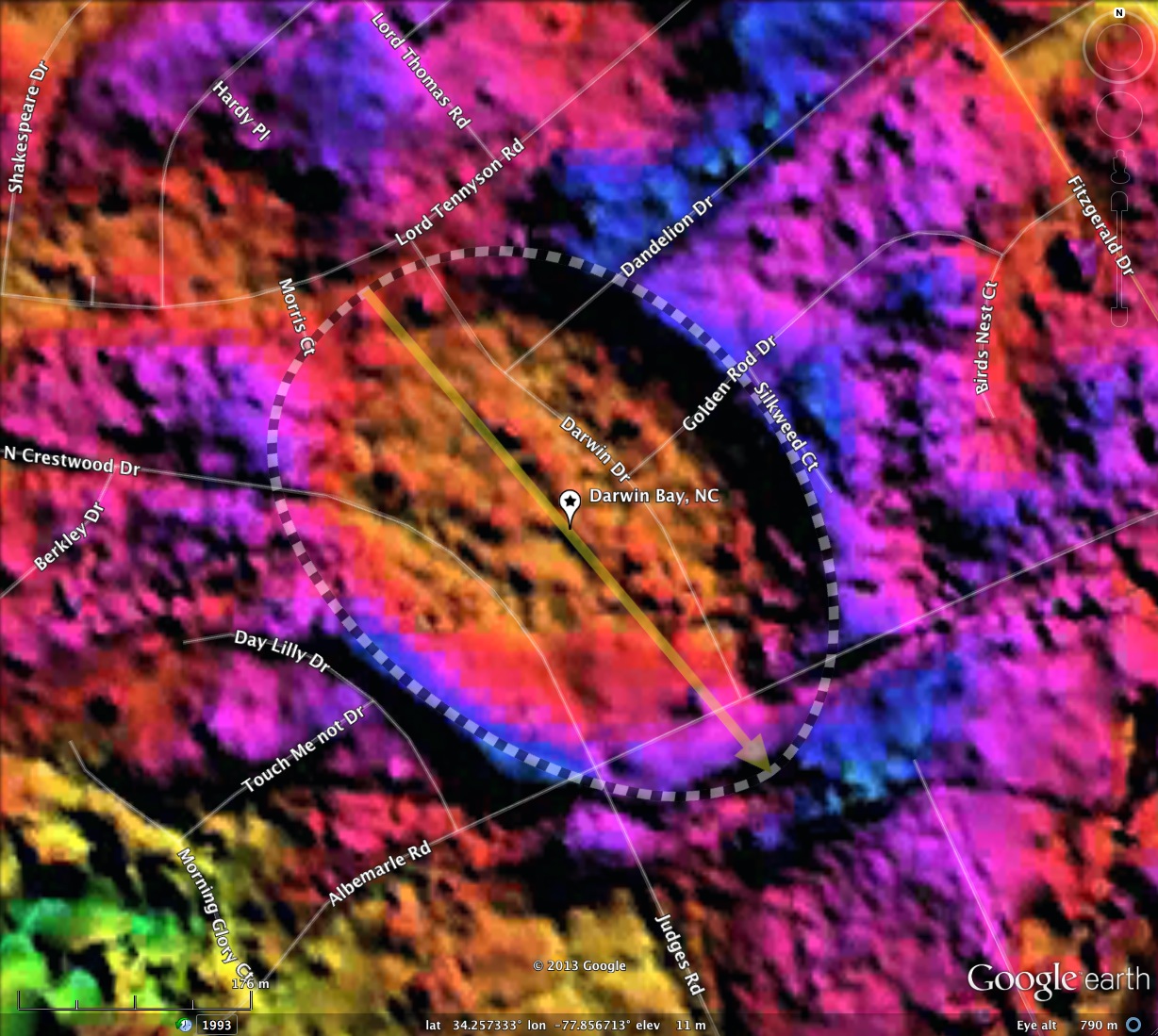
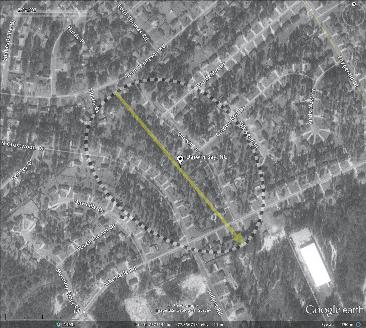
Darwin Bay, NC
Darwin bay is named by me after the road which runs across its floor. The bay is fully consumed by homes in the Kings Grant neighborhood of Wilmington, NC. Although the bay floor is over 2 meters below the surrounding rim, adequate drainage must be in place to allow close to 50 home to survive.
The bay matches the common bayCarolina archetype well, and its orientation is similar to other local bays, including the massive Blythe Bay which lies 8 kilometers to the south.
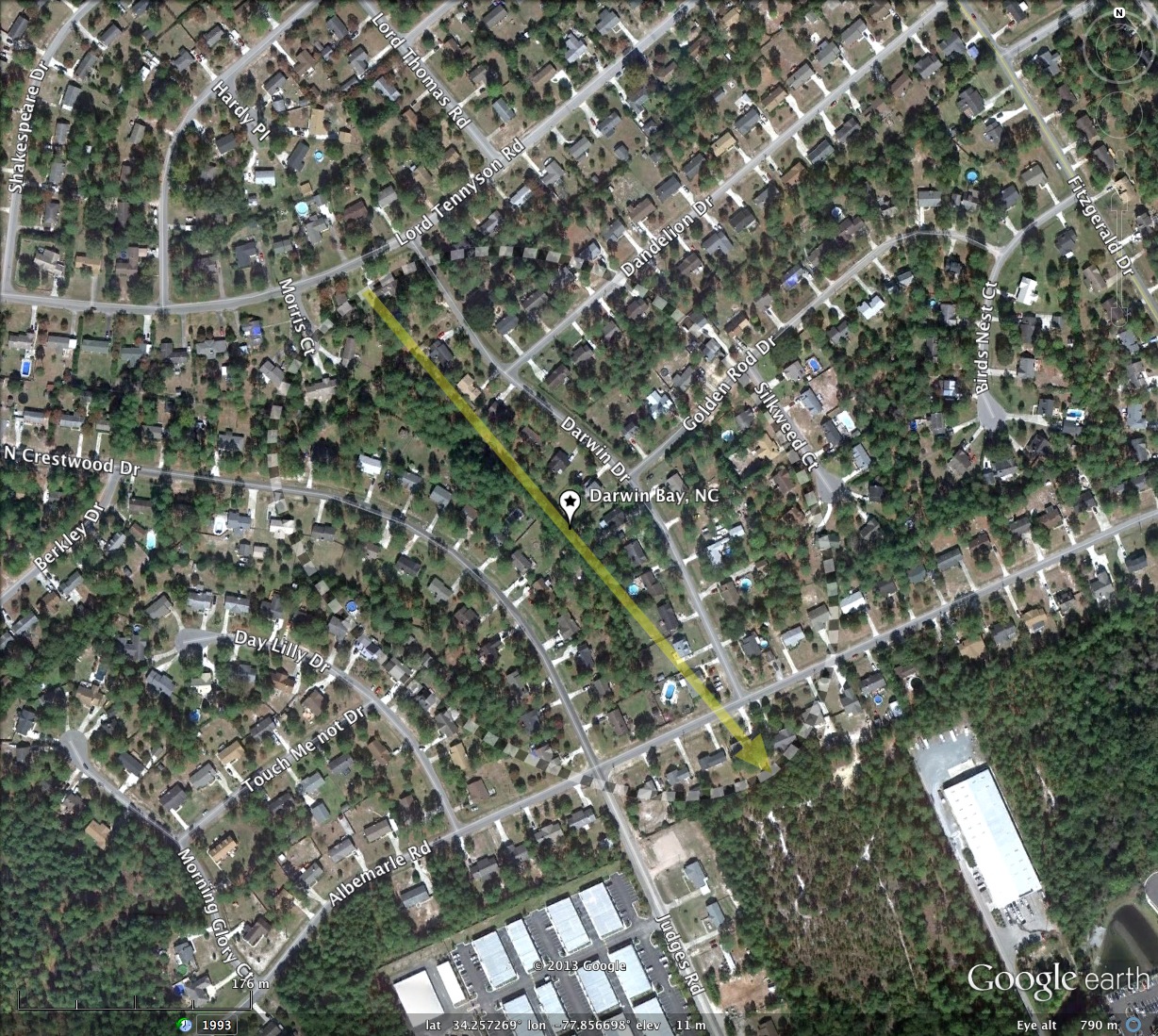
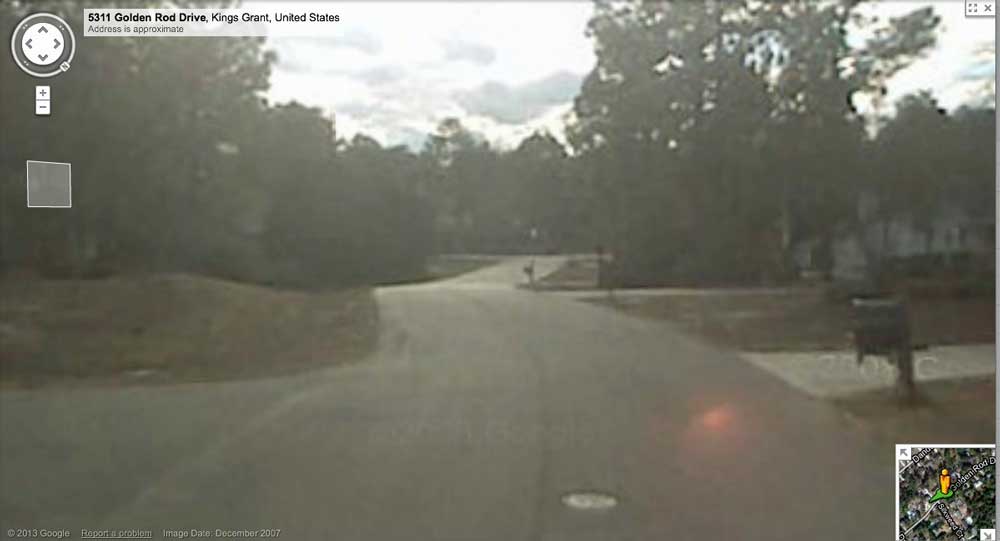
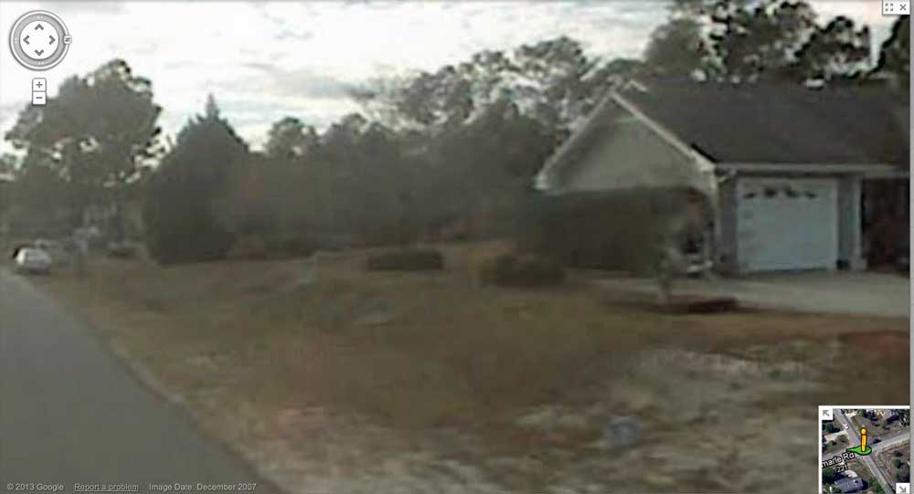
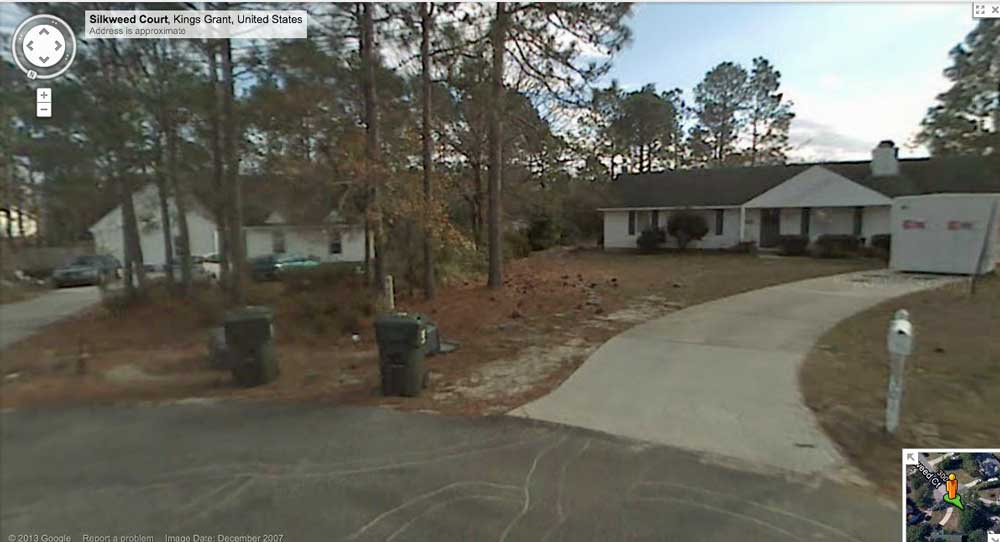
While the bay stands out in the LiDAR, it is virtually imperceptible on the ground. Streetview imagery is available across the bay along a few roads, and can be opened in you web browser using this link: http://goo.gl/maps/Kt5BY , and the attached album includes three streetview images. One looks down into the bay from the northeast rim, and the drop can be seen along Golden Road. Another was taken at the intersection of North Crestwood Drive and Albemarle Road, and shows the rise of the rim from the roadway. An image at the end of Silkweed Court shows the house on the right, which is on the rim, contrasted with the elevation of the house on the left, which is outside of the bay. The photos can also be seen using the placemarks in the KMZ file at the top of this post.
The bay matches the common bayCarolina archetype well, and its orientation is similar to other local bays, including the massive Blythe Bay which lies 8 kilometers to the south.
While the bay stands out in the LiDAR, it is virtually imperceptible on the ground. Streetview imagery is available across the bay along a few roads, and can be opened in you web browser using this link: http://goo.gl/maps/Kt5BY , and the attached album includes three streetview images. One looks down into the bay from the northeast rim, and the drop can be seen along Golden Road. Another was taken at the intersection of North Crestwood Drive and Albemarle Road, and shows the rise of the rim from the roadway. An image at the end of Silkweed Court shows the house on the right, which is on the rim, contrasted with the elevation of the house on the left, which is outside of the bay. The photos can also be seen using the placemarks in the KMZ file at the top of this post.
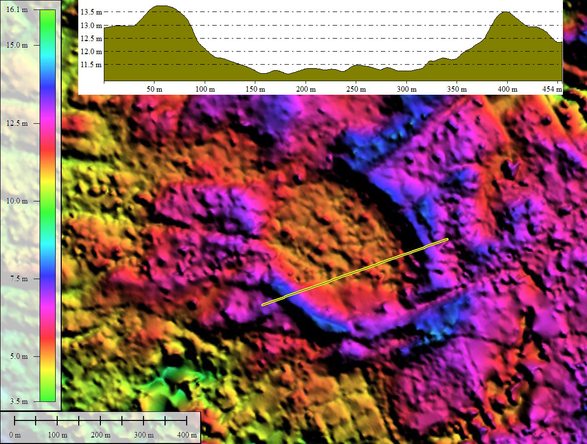
- Index #: 137311_0242
- Location: 34.25716547835205,-77.85674086905665
- Major: 0.47 km . . . Minor: 0.35 km
- Eccentricity: 0.678
- Area: 13.16 hectares
- Bearing: 139.93º
- Elevation: 11.3 m
- Archetype: bayCarolina
- Effective Diameter: 409.338 m
Copyright 2018 by Michael Davias