Quarter Horse Bay, NC
Today's bay is set into an old shoreline ridge 6 kilometers from the Atlantic shoreline at Topsail Beach, just north of Wilmington, NC. I have named the landform after the road which wraps around the northeastern side of the bay. That road, along with an extension name Old Lodge Road, support a thin string of homesites along the raised rim of the bay, extending west from US 17 into an otherwise swampy lowland area.
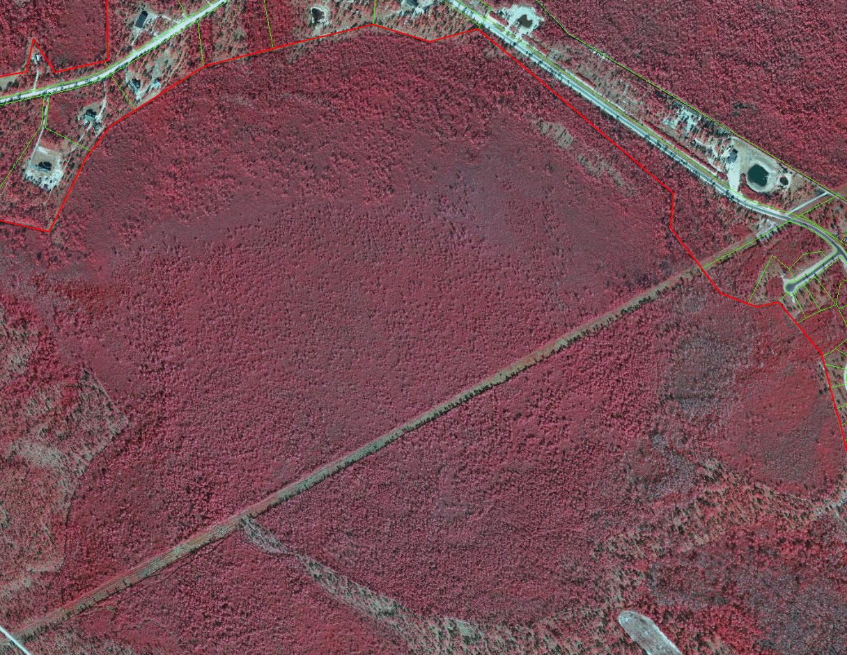
The bay area itself is in a natural state, and is likely to remain that way, as it is currently owned by The Nature Conservancy, along with thousands of nearby acres of swamp and bay land.
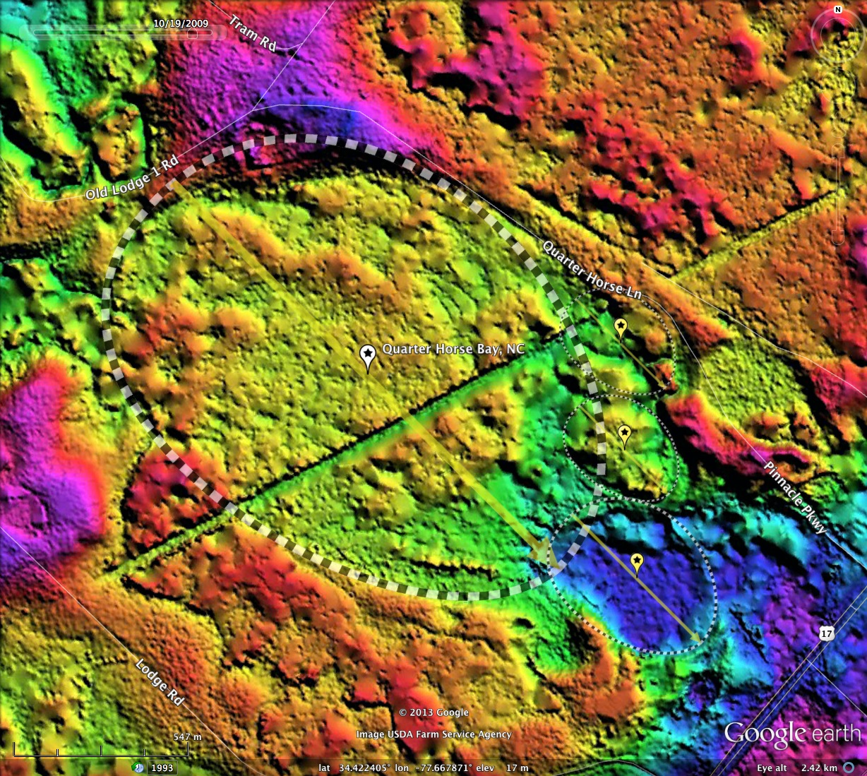
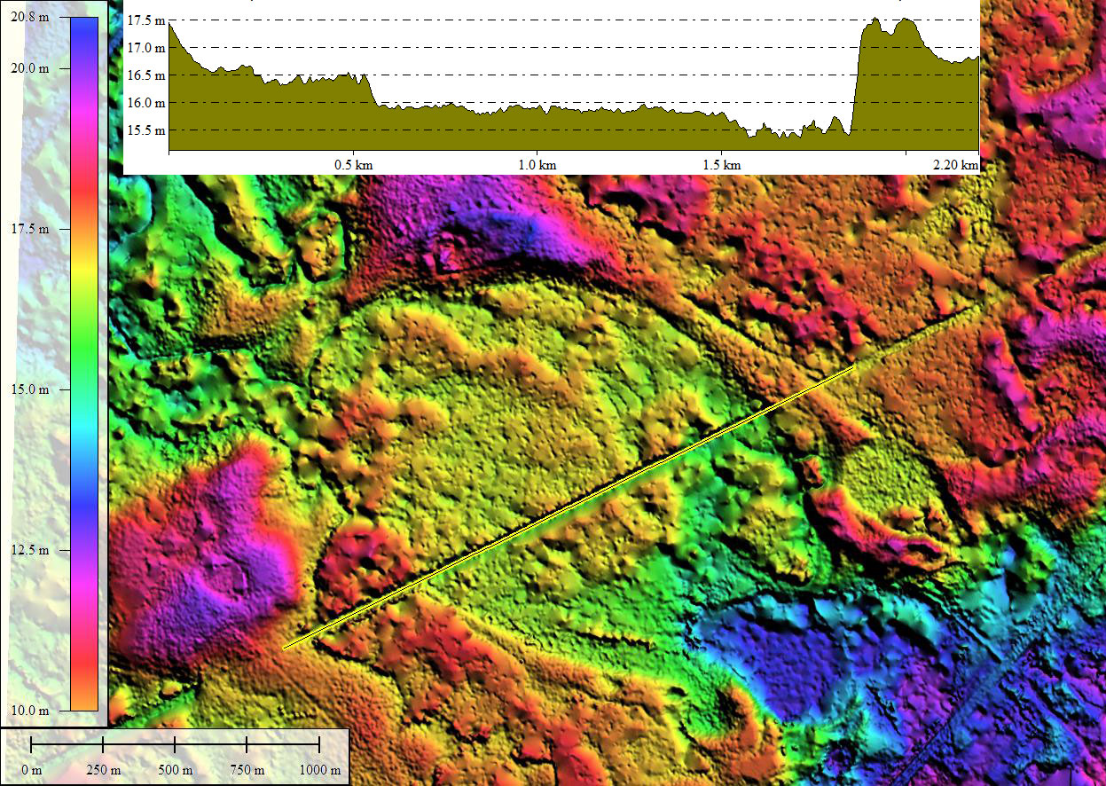
The bay shape conforms to the common bayCarolina archetype. Visualizing the bay is challenging. The LiDAR was obviously not able to penetrate the thick evergreen vegetative canopy, and as a result the bay floor presents a raised area rather than a depressed one, while the raise rim shows up as a ditch around the bay. Similarly, a transmission line right-of-way which has no trees also looks like a depression in the LiDAR. The LiDAR from NC, while game-changing when released over 10 years ago, was generated prior to today's more refined technology, which may well be able to penetrate that canopy and get back a better DEM.
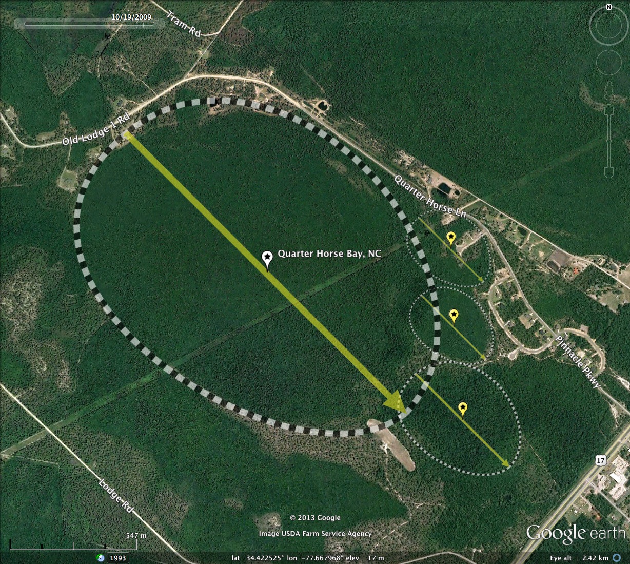
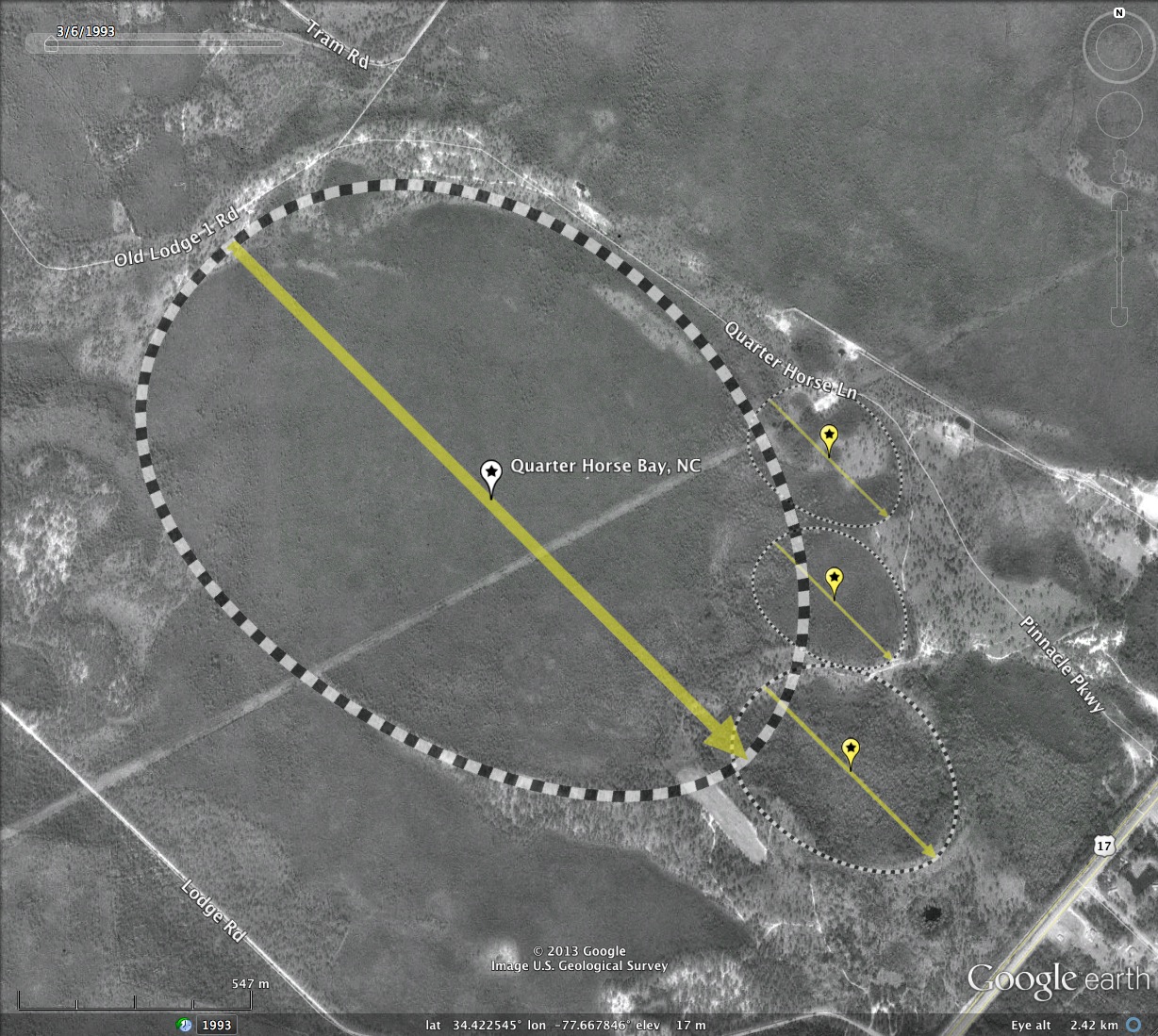
Viewing the bay in both current and historic Google Satellite imagery is quite helpful here. In fact, the black & white imagery revels the existence of three well-formed bay "Toes" in the southeastern end of the main bay.
The bay area itself is in a natural state, and is likely to remain that way, as it is currently owned by The Nature Conservancy, along with thousands of nearby acres of swamp and bay land.
The bay shape conforms to the common bayCarolina archetype. Visualizing the bay is challenging. The LiDAR was obviously not able to penetrate the thick evergreen vegetative canopy, and as a result the bay floor presents a raised area rather than a depressed one, while the raise rim shows up as a ditch around the bay. Similarly, a transmission line right-of-way which has no trees also looks like a depression in the LiDAR. The LiDAR from NC, while game-changing when released over 10 years ago, was generated prior to today's more refined technology, which may well be able to penetrate that canopy and get back a better DEM.
Viewing the bay in both current and historic Google Satellite imagery is quite helpful here. In fact, the black & white imagery revels the existence of three well-formed bay "Toes" in the southeastern end of the main bay.
- Index #: 137310_6867
- Location: 34.42205050700597,-77.6679205548547
- Major: 1.74 km . . . Minor: 1.26 km
- Eccentricity: 0.689
- Area: 173.12 hectares
- Bearing: 135.0º
- Elevation: 17.0 m
- Archetype: bayCarolina
- Effective Diameter: 1,484.664 m
- Quarter Horse Bay, Toe-1
- Index #: 137310_6963
- Location: 34.42293252180435,-77.65924242556277
- Major: 0.4 km . . . Minor: 0.29 km
- Eccentricity: 0.675
- Area: 9.33 hectares
- Bearing: 134.98º
- Elevation: 15.76 m
- Archetype: bayCarolina
- Effective Diameter: 344.664 m
- Quarter Horse Bay, Toe-2
- Index #: 137310_6763
- Location: 34.419906767547744,-77.65911433534345
- Major: 0.4 km . . . Minor: 0.29 km
- Eccentricity: 0.675
- Area: 9.33 hectares
- Bearing: 134.98º
- Elevation: 16.53 m
- Archetype: bayCarolina
- Effective Diameter: 344.664 m
- Quarter Horse Bay, Toe-3
- Index #: 137310_6663
- Location: 34.4162705787153,-77.65866473377608
- Major: 0.58 km . . . Minor: 0.44 km
- Eccentricity: 0.655
- Area: 20.21 hectares
- Bearing: 134.98º
- Elevation: 13.12 m
- Archetype: bayCarolina
- Effective Diameter: 507.268 m
Copyright 2018 by Michael Davias