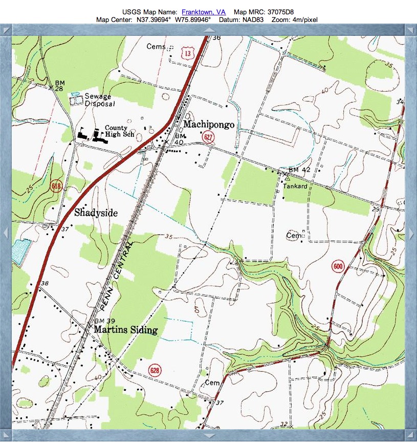
Machipongo Bay, VA
Here is another of the "Eastern Shore" bays, as seen across the lower DelMarVa Peninsula. I chose the name after the small USGS-listed populated place situated on its northern rim.
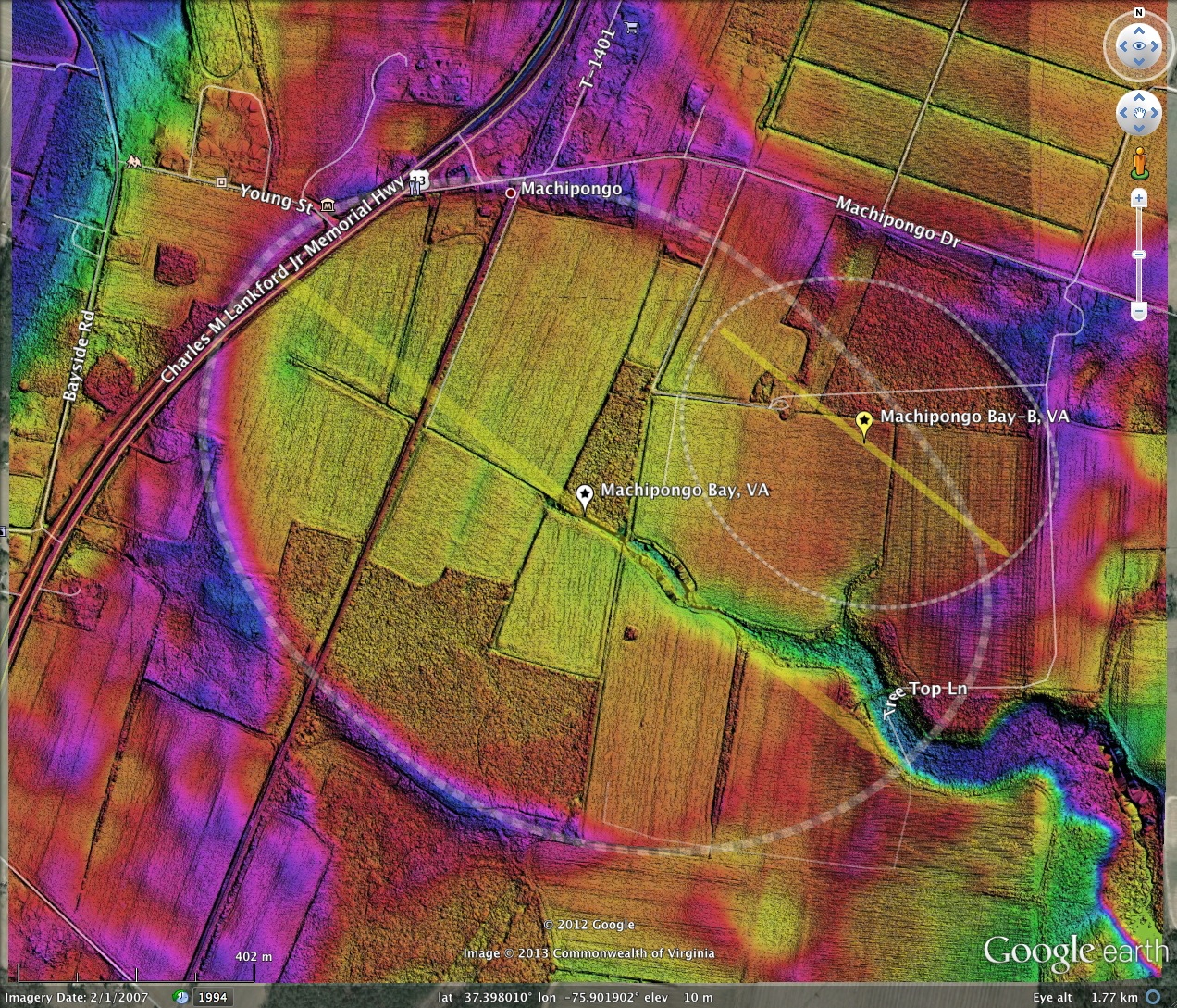
As visualized in the LiDAR, the survey has identified both the large, primary bay, and a smaller overlapping on on the north east side. The bay conforms well to the bayShore archetype, and presents an orientation similar to others in the area.
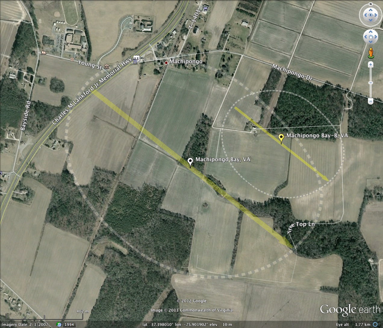
The bay is mostly open farmland, supported by both a natural drainage channel running out to the east, and an extensive network of drainage channels within which contact to the natural channel. A railroad right-of-way runs across the bay, while US Highway 13 takes a short trip across the northwestern tip.
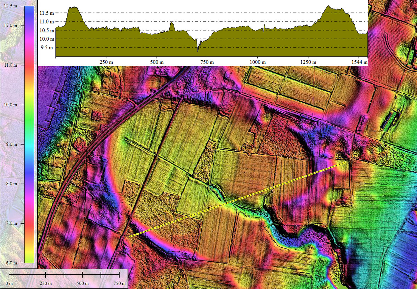
The hsv-shaded LiDAR elevation imagery presented for Machipongo Bay was produced with 25cm horizontal grid LiDAR point cloud data sourced from The College of William & Mary. The bare-earth component was extracted on a 1-meter grid to conserve data volume. This provides a higher-definition image compared to the 3-meter grid data usually supplied by the USGS for elevation data. A report which describes the source data LiDAR capture and processing is available from this LINK.
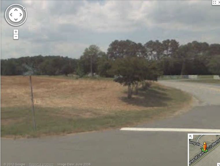
Google Streetview imagery is available along the RT 13 corridor. An image of the junction with Young Street displays the rim as a rise beneath a row of trees, as the roadway cuts across the rim. The location is noted in the KMZ file.
The Barrier Islands Center [ LINK ] is situated on the northwestern rim, just off Young Street.
As visualized in the LiDAR, the survey has identified both the large, primary bay, and a smaller overlapping on on the north east side. The bay conforms well to the bayShore archetype, and presents an orientation similar to others in the area.
The bay is mostly open farmland, supported by both a natural drainage channel running out to the east, and an extensive network of drainage channels within which contact to the natural channel. A railroad right-of-way runs across the bay, while US Highway 13 takes a short trip across the northwestern tip.
The hsv-shaded LiDAR elevation imagery presented for Machipongo Bay was produced with 25cm horizontal grid LiDAR point cloud data sourced from The College of William & Mary. The bare-earth component was extracted on a 1-meter grid to conserve data volume. This provides a higher-definition image compared to the 3-meter grid data usually supplied by the USGS for elevation data. A report which describes the source data LiDAR capture and processing is available from this LINK.
Google Streetview imagery is available along the RT 13 corridor. An image of the junction with Young Street displays the rim as a rise beneath a row of trees, as the roadway cuts across the rim. The location is noted in the KMZ file.
The Barrier Islands Center [ LINK ] is situated on the northwestern rim, just off Young Street.
- Index #: 149303_5960
- Location: 37.397813175905455,-75.90200064315167
- Major: 1.41 km . . . Minor: 1.02 km
- Eccentricity: 0.685
- Area: 113.9 hectares
- Bearing: 128.21º
- Elevation: 10.47 m
- Archetype: easternShore_archetype
- Effective Diameter: 1,204.249 m
Copyright 2018 by Michael Davias