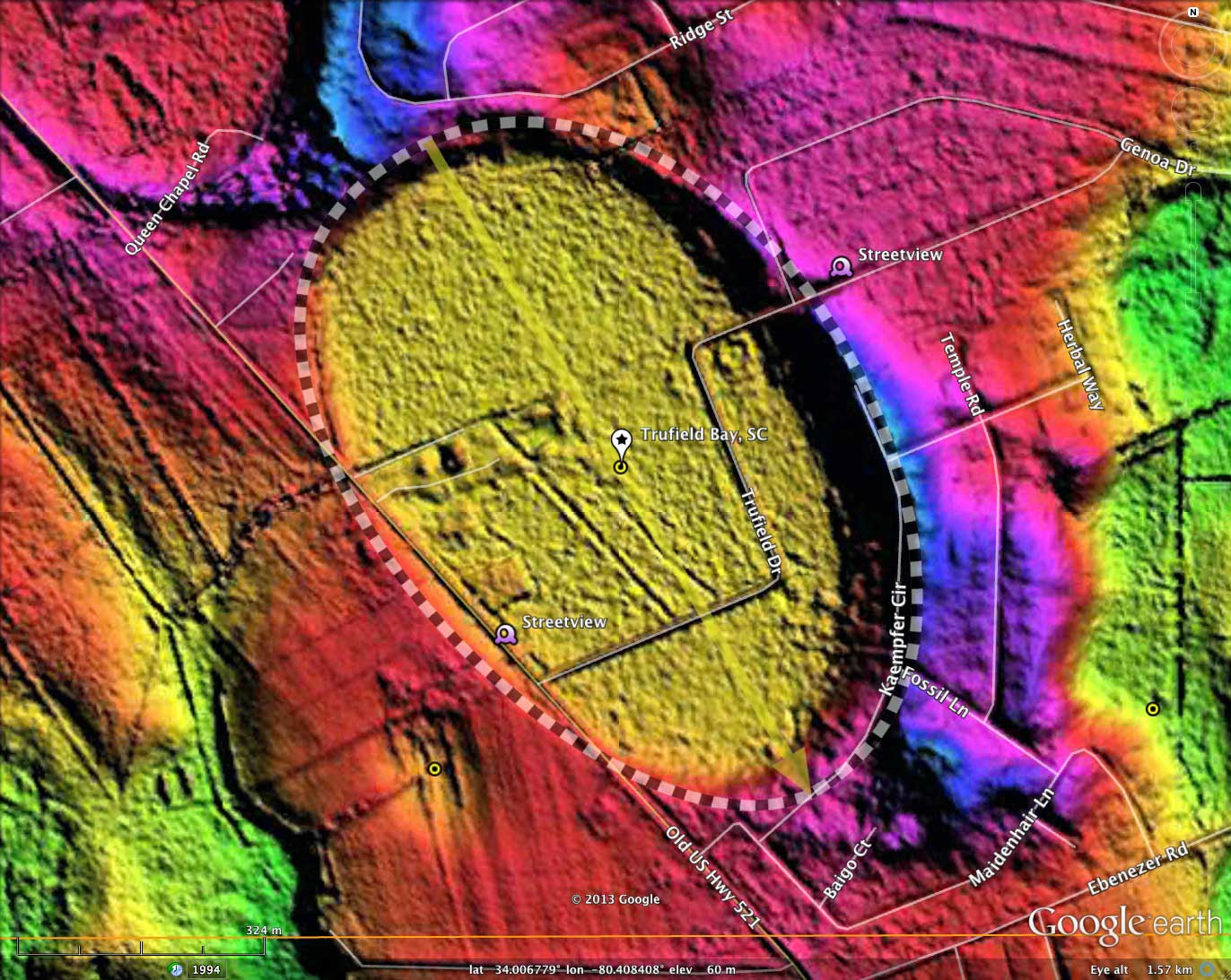
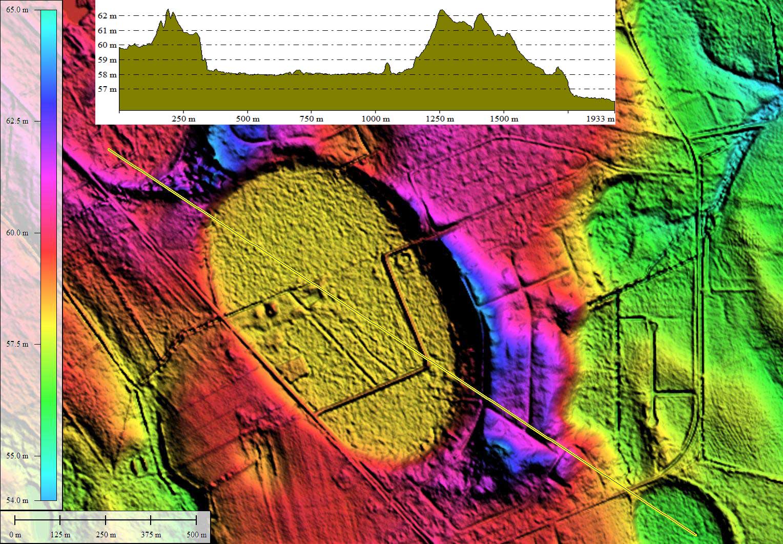
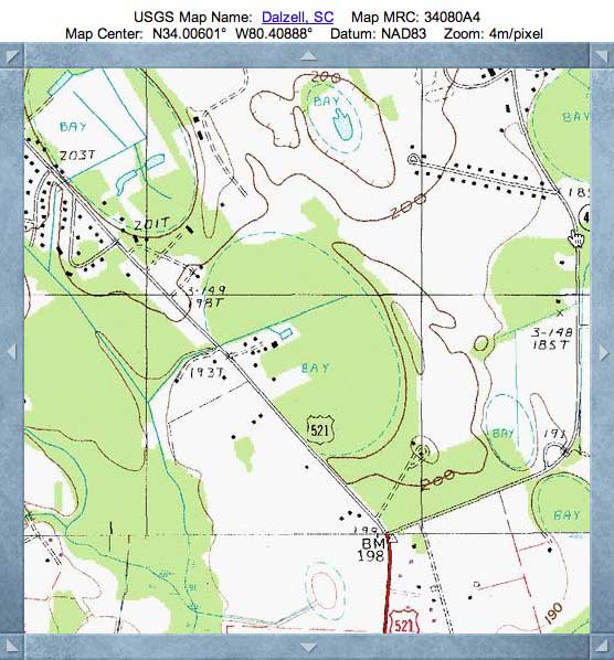
Trufield Bay, SC
Trufield Bay was named by me after the road which traverses the bay east-west. Obviously (at least in the LIDAR) this is not a true field, but a true Bay. The location is ~6 kilometers northeast from Shaw Air Force Base, in Sumter County, SC.
The bay is measured here using the common bayCarolina archetype shape, which it shares with other nearby bays. The alignment also correlates with other bays in the county.
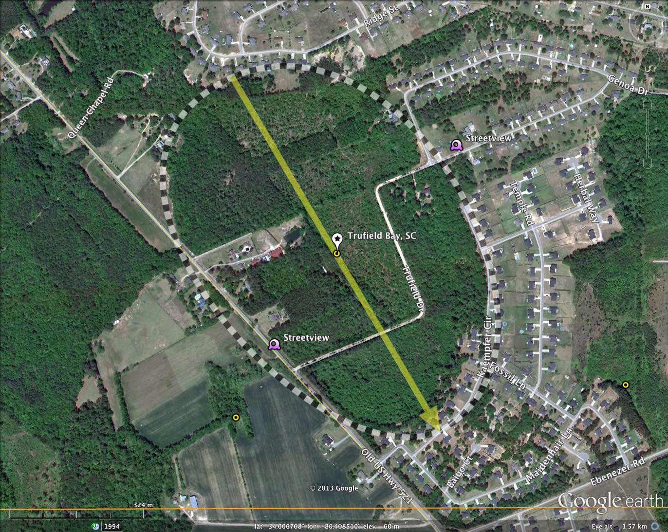
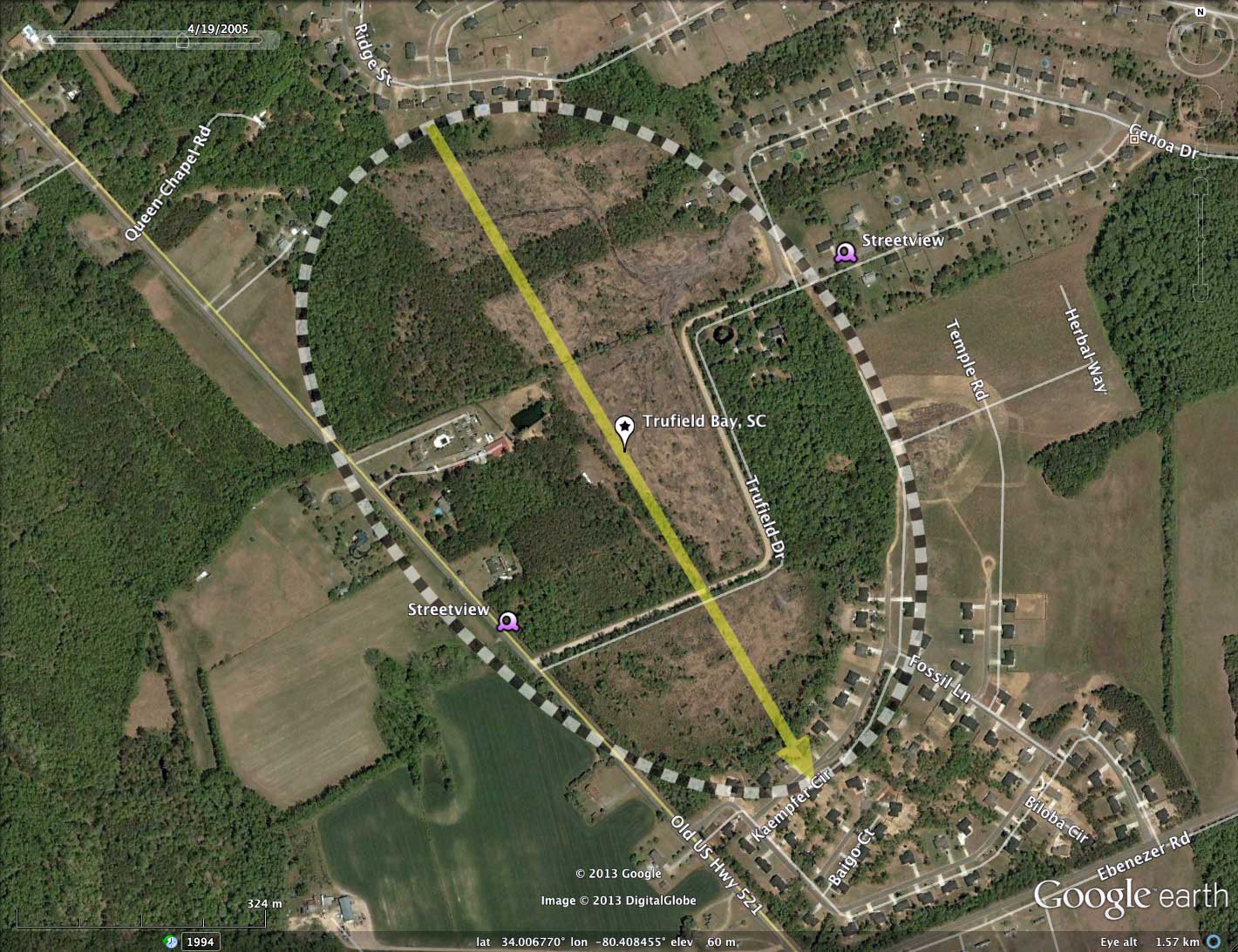
Despite a history of cross-bay drainage from a home site which extends 1/4 kilometer into the bay, the construction of Trufield Drive across the floor of the bay, and occasional clear-cutting tree harvesting events (see historical image from 2005), this bay is primarily forested.
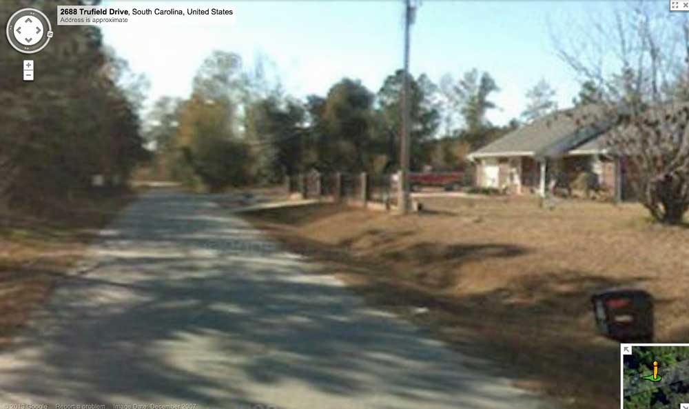
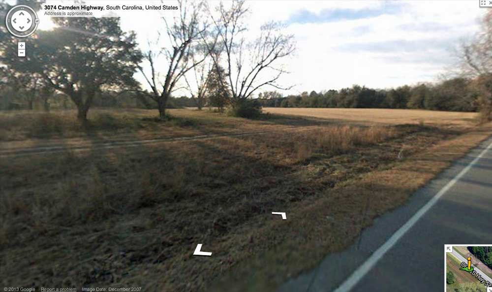
Google has Streeetview imagery available along the roads surrounding and traversing the bay. Take a look around using this LINK.
A Google Streetview image is offered in the attached Album, and placemarked in the referenced KMZ file. It was taken looking West along Camden Highway. The roadway here is inside the bay, traversing along the shoulder of the rim. Bay drops off to right. To the left, the terrain rises up to the rim at the tree line.
Second Google Streetview is taken from Trufield Drive as it heads into the bay from the east by cutting through the rim, upon which the house on the right rests.
Truefield bay is just one of over 800 Carolina Bays I have measured in octant 136321. Their location and metrics can be referenced through a Fusion Table spatial visualization. LINK
The bay is measured here using the common bayCarolina archetype shape, which it shares with other nearby bays. The alignment also correlates with other bays in the county.
Despite a history of cross-bay drainage from a home site which extends 1/4 kilometer into the bay, the construction of Trufield Drive across the floor of the bay, and occasional clear-cutting tree harvesting events (see historical image from 2005), this bay is primarily forested.
Google has Streeetview imagery available along the roads surrounding and traversing the bay. Take a look around using this LINK.
A Google Streetview image is offered in the attached Album, and placemarked in the referenced KMZ file. It was taken looking West along Camden Highway. The roadway here is inside the bay, traversing along the shoulder of the rim. Bay drops off to right. To the left, the terrain rises up to the rim at the tree line.
Second Google Streetview is taken from Trufield Drive as it heads into the bay from the east by cutting through the rim, upon which the house on the right rests.
Truefield bay is just one of over 800 Carolina Bays I have measured in octant 136321. Their location and metrics can be referenced through a Fusion Table spatial visualization. LINK
- Index #: 136321_0263
- Location: 34.006494419828854,-80.40844873576856
- Major: 1.0 km . . . Minor: 0.67 km
- Eccentricity: 0.742
- Area: 52.78 hectares
- Bearing: 149.67º
- Elevation: 58.04 m
- Archetype: bayCarolina
- Effective Diameter: 819.765 m
Copyright 2018 by Michael Davias