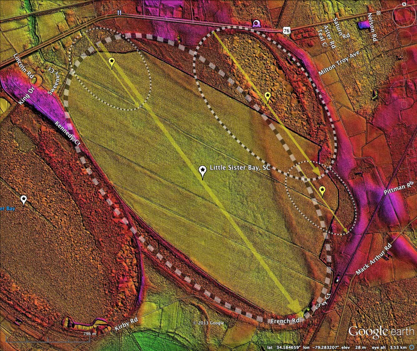
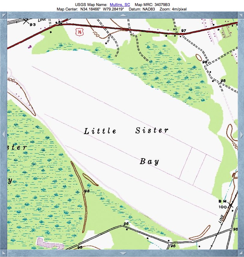
Little Sister Bay, SC
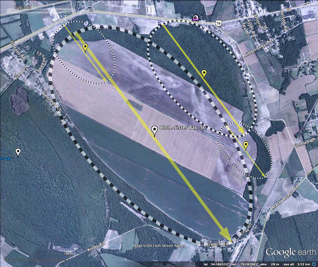
Despite the "Little" adjective, today's bay is considerably larger than yesterday's, Big Sister Bay. I'd like to understand that disconnect. Some Carolina bay landforms are naturally drained, and are therefore not identified as Carolina Bays, even today. But such is not the case here. The attached album contains aerial photographs from the late 1930s, which clearly show both bays as "oval" islands of dense vegetation.
The overall shape of Little Sister Bay is interpreted by me to be a mash up of four individual bayCarolina archetype overlays; one primary bay and three smaller ones melded onto its north, east and southern quadrants, with intervening rims absent.
In shark contrast to Big Sister Bay, Little Sister has had the vast majority of its floor trenched, drained and converted to open cropland. A significant exception is the northeastern half of the area occupied by the East bay, where dense forest cover is still present, and judging by the polygon surface of the sub-bay in the LiDAR, its center remains covered with water at the surface. This is likely a property ownership issue, as a deep drainage channel and berm running on a straight line for over 2 kilometers NW-SE isolates this area.
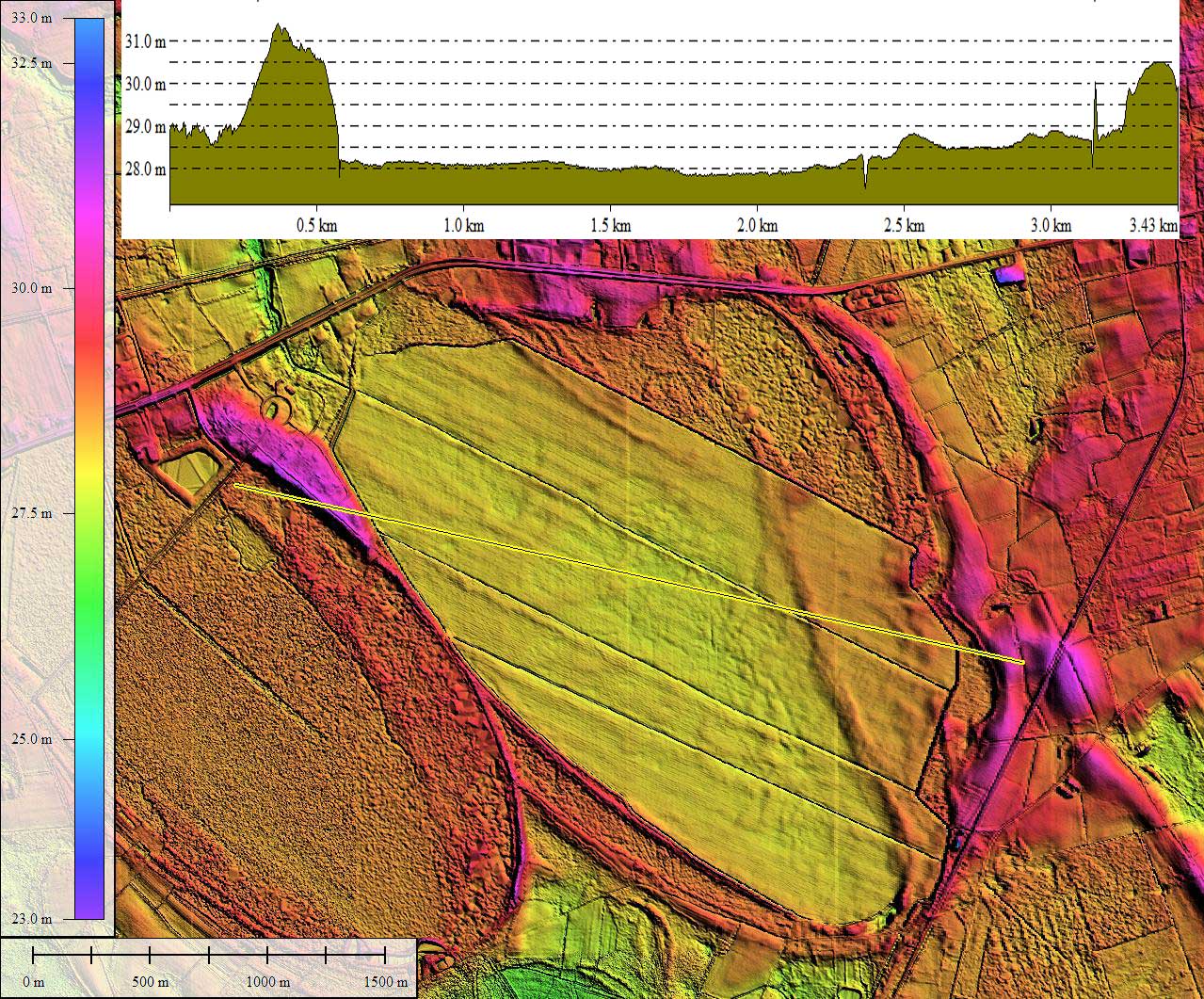
Notably, there is an 8 kilometer artificial peripheral drainage ditch encompassing the farmed area, which directs water out of the bay is to the north, where it connects to natural drainage outside the rim. Within the bay floor there are an additional 8 kilometers of drainage channels crossing the bay along the major axis, and interconnecting to the peripheral ditch.
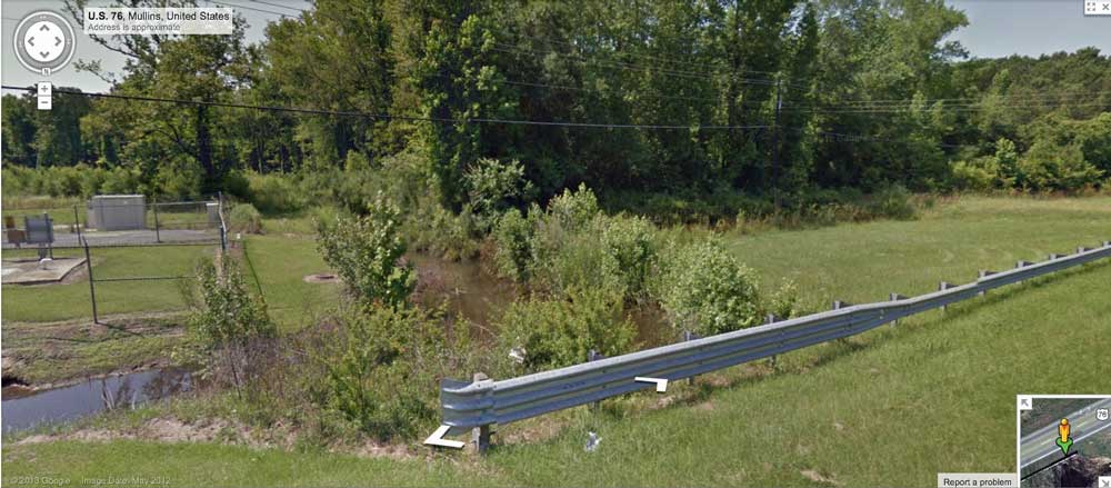
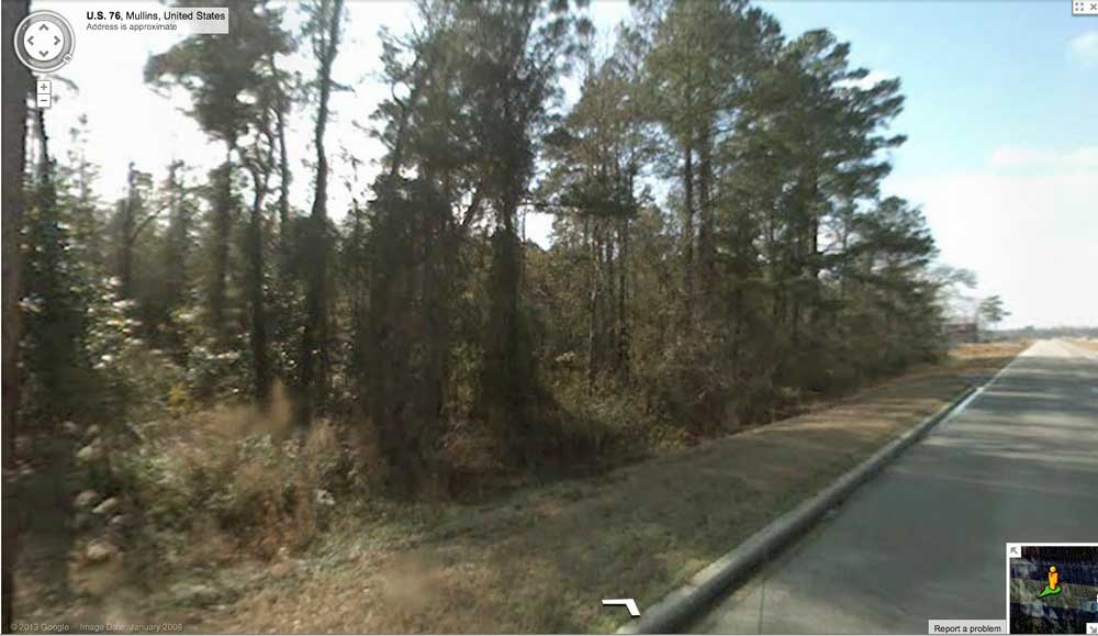
Google Streetview imagery is available, but not to the extent of Big Sister Bay. A static image taken from US Route 76 is looking down into the bay as the roadway passes on top of Little Sister East Bay's northern rim. Dense forest at lower elevation is visible. Browse interactively in Google maps using this LINK.
A second Streetview is provided, where the bay's artificial ditch out of the bay passes under US 76. Browse interactively in Google maps using this LINK.
Both Streetview scenes are also navigable in Google Earth using the placemarks found in the referenced site KMZ file.
The Carolina Bay Survey has identified and over 250 bays in Octant 136317. Their location and metrics can be referenced through a Fusion Table spatial visualization.
Primary Bay Landform
Little Sister East Bay, SC
The overall shape of Little Sister Bay is interpreted by me to be a mash up of four individual bayCarolina archetype overlays; one primary bay and three smaller ones melded onto its north, east and southern quadrants, with intervening rims absent.
In shark contrast to Big Sister Bay, Little Sister has had the vast majority of its floor trenched, drained and converted to open cropland. A significant exception is the northeastern half of the area occupied by the East bay, where dense forest cover is still present, and judging by the polygon surface of the sub-bay in the LiDAR, its center remains covered with water at the surface. This is likely a property ownership issue, as a deep drainage channel and berm running on a straight line for over 2 kilometers NW-SE isolates this area.
Notably, there is an 8 kilometer artificial peripheral drainage ditch encompassing the farmed area, which directs water out of the bay is to the north, where it connects to natural drainage outside the rim. Within the bay floor there are an additional 8 kilometers of drainage channels crossing the bay along the major axis, and interconnecting to the peripheral ditch.
Google Streetview imagery is available, but not to the extent of Big Sister Bay. A static image taken from US Route 76 is looking down into the bay as the roadway passes on top of Little Sister East Bay's northern rim. Dense forest at lower elevation is visible. Browse interactively in Google maps using this LINK.
A second Streetview is provided, where the bay's artificial ditch out of the bay passes under US 76. Browse interactively in Google maps using this LINK.
Both Streetview scenes are also navigable in Google Earth using the placemarks found in the referenced site KMZ file.
The Carolina Bay Survey has identified and over 250 bays in Octant 136317. Their location and metrics can be referenced through a Fusion Table spatial visualization.
Primary Bay Landform
- Index #: 136317_7313
- Location: 34.18390910187621,-79.28320210884976
- Major: 3.3 km . . . Minor: 1.7 km
- Eccentricity: 0.856
- Area: 442.97 hectares
- Bearing: 143.45º
- Elevation: 27.8 m
- Archetype: bayCarolina
- Effective Diameter: 2,374.88 m
Little Sister East Bay, SC
- Index #: 136317_7610
- Location: 34.19040854992122,-79.2764841155302
- Major: 1.74 km . . . Minor: 0.95 km
- Eccentricity: 0.838
- Area: 130.28 hectares
- Bearing: 143.45º
- Elevation: 28.98 m
- Archetype: bayCarolina
- Effective Diameter: 1,287.933 m
- Index #: 136317_7717
- Location: 34.19334334632815,-79.2925860612107
- Major: 0.9 km . . . Minor: 0.63 km
- Eccentricity: 0.71
- Area: 44.79 hectares
- Bearing: 143.45º
- Elevation: 28.11 m
- Archetype: bayCarolina
- Effective Diameter: 755.171 m
- Index #: 136317_7208
- Location: 34.18234672384267,-79.27083868417395
- Major: 0.82 km . . . Minor: 0.5 km
- Eccentricity: 0.786
- Area: 32.92 hectares
- Bearing: 143.45º
- Elevation: 28.55 m
- Archetype: bayCarolina
- Effective Diameter: 647.418 m
Copyright 2018 by Michael Davias