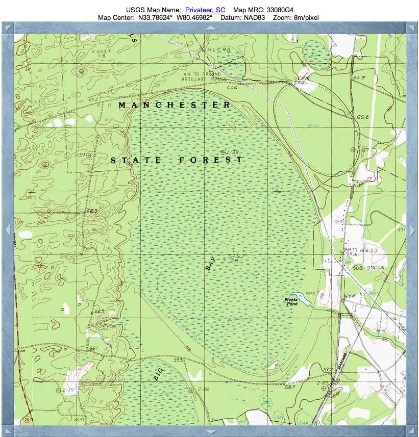
Big Bay, SC
The area is under the protection of South Carolina's Manchester State Forest, but it might not be wise to venture into the area west of Routes 261 and east of 120, which encompasses the location of Big Bay. According to the Wildlife Management Area map [ LINK ], the bay is part of an extensive US Air Force Gunnery range.
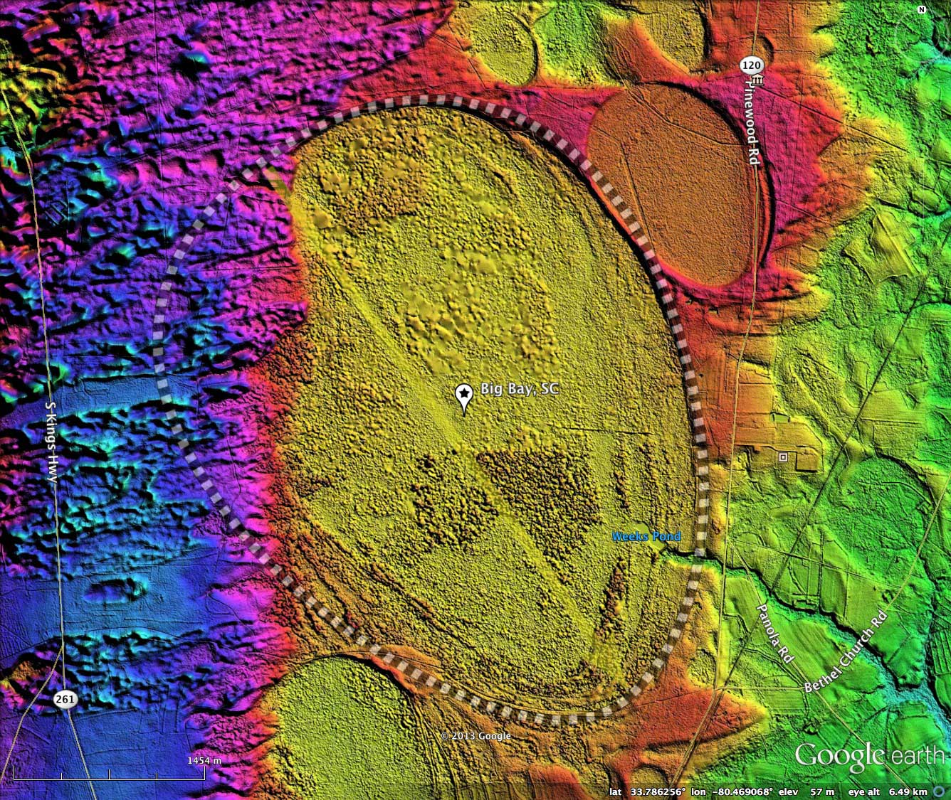
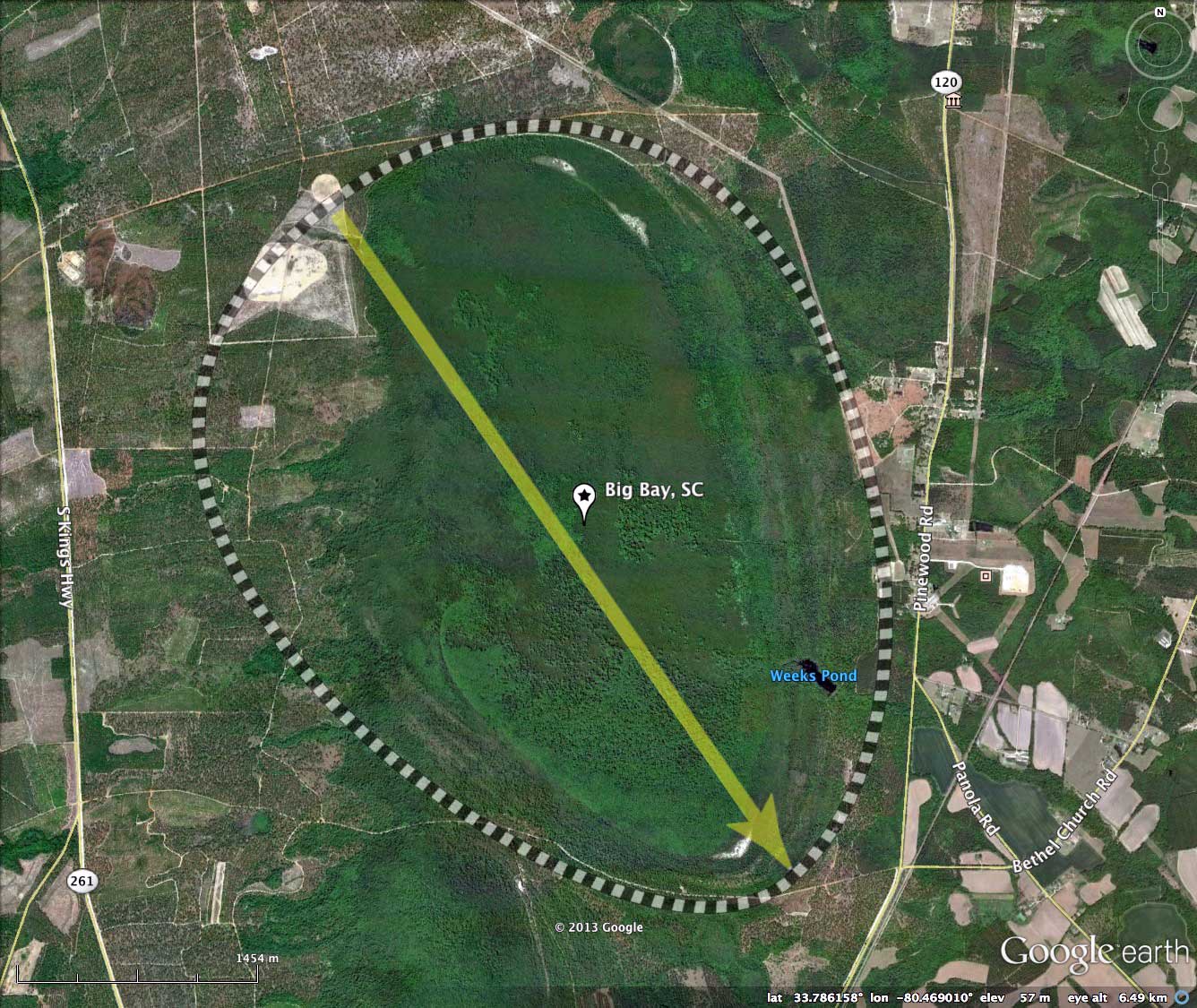
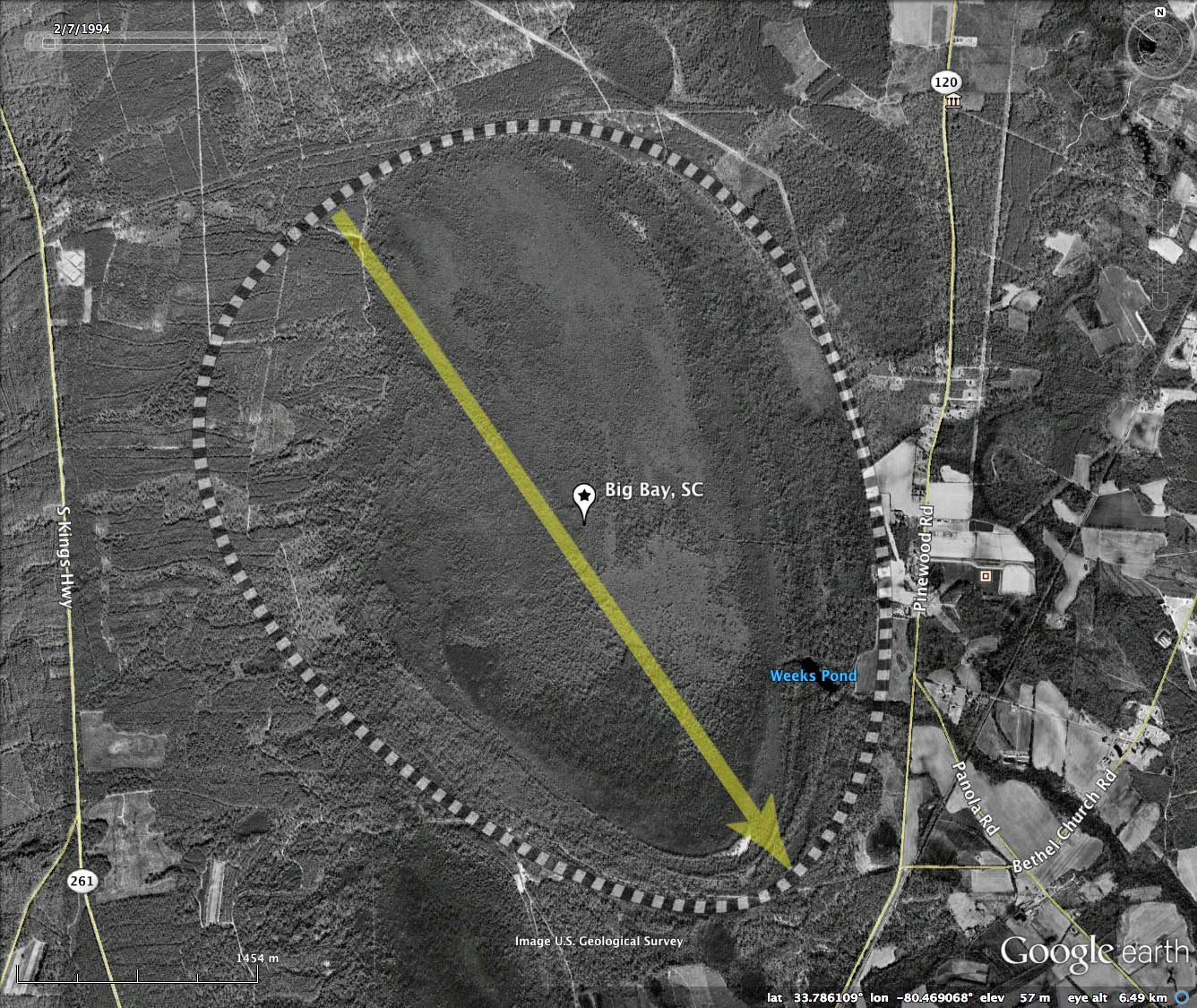
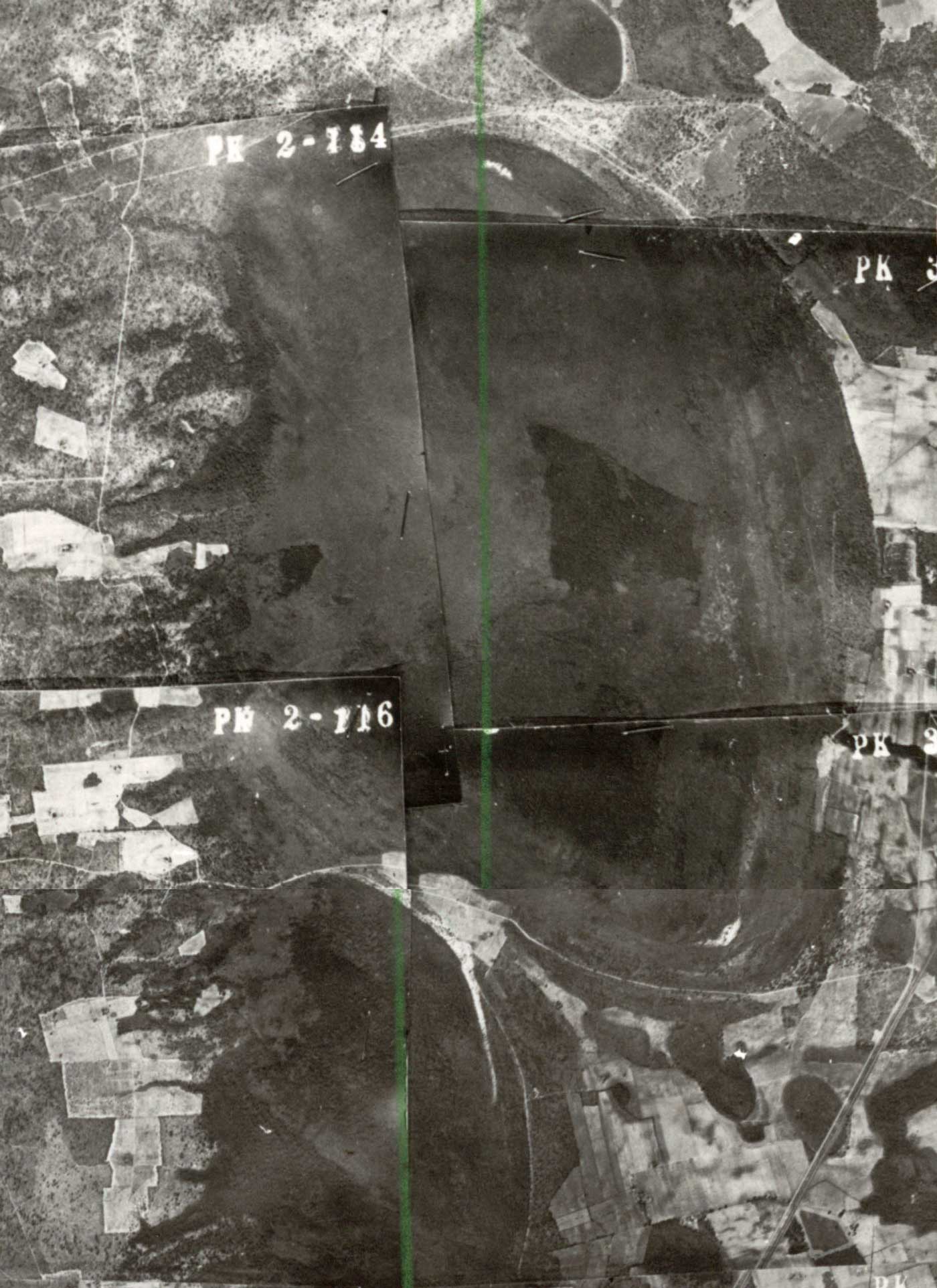
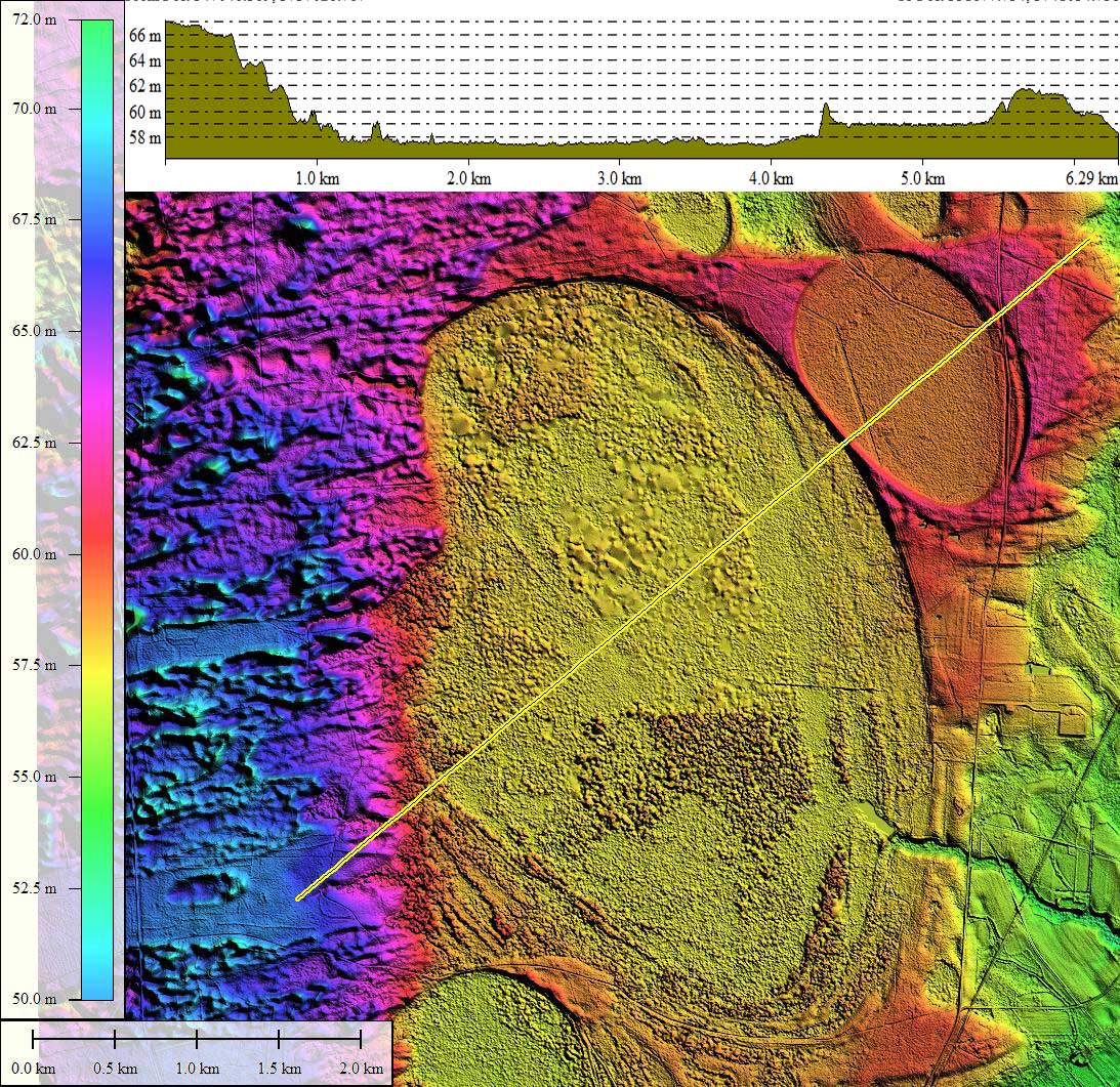
Great sheets of sand have been driven by wind off the nearby Wateree River basin, and have partially infilled this large bay. In the same geological context, however, there are other bays in the immediate vicinity whose similar archetype shaped-rim have no sign of being compromised by infilling sand dunes. What gives? I have seen several similar scenarios, and in all cases bay infilling is only seen where the rim is broached by a natural drainage channel. Such a situation allows the bay floor proper to be dry enough for sand to accumulate in place as the dune marches forward. Conversely, in bays which retain a circumpherial rim and therefor can hold water, the encroaching sand is distributed across the bay floor by wind and wave action, and can't accumulate at the entry point. In this case, Sammy Swamp Brook extends into Big Bay through a natural 100 meter-wide channel, which is also clearly visible on the historic SC 1937 aerial photograph, included in the attached photo album.
The Survey has identified large numbers of bays which possess natural drainage channels into (and sometimes through) their bay floors and rims. Douglas Johnson, in his 1942 book on the Bay geomorphology, proposed that such a juxtaposition of bay landform and natural drainage channel indicated antecedent drainage, thus predating the formation of the bay.
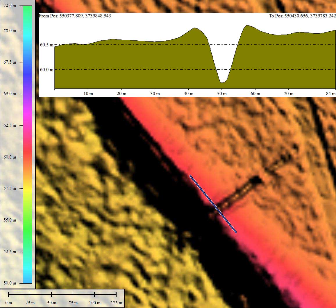
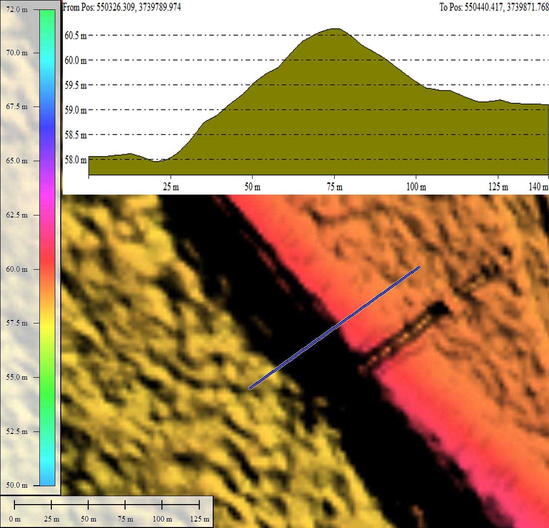
The attached Photo Album contains four elevation profile maps. First is the standard cross-bay map, which documents a freestanding rim on the east side of the typical 2 meters relief, while the sand sheet on the western side of the bay stands a full 10 meters above the bay floor. A second elevation profile map details the delicate rim which exists between Big Bay and its small neighboring bay in the northeast quadrant. That rim segment has been cut by a drainage ditch, the site of which may prove to be a good location to extract samples for OSL dating. Elevations profile maps for both across-the-rim and along-the-rim document an exposure of 1.5 to 2 meters, allowing for deep-rim characterization.
In a 2010 paper (1), Brooks, et al, discussed their interpretation of Big Bay's stratigraphy, which documents that Big Bay may have existed since at least the Penultimate Glaciation 135,000 years ago:
A drill hole at the leading edge of the sand sheet, where it encroaches into the western side of Big Bay, revealed clays of the Duplin Formation overlain by 4.5 m of organically enriched bay-fill sediments (>48,000 radiocarbon yr B.P.) and 4.5 m of eolian sand. Pollen assemblages from the lower part of the bay fill indicate that the adjacent terrestrial vegetation was open and dominated by grasses. Oak and hickory suggest warm conditions, perhaps Oxygen Isotope Stage 5 (134-75 ka B.P.), an interval that spans the Sangamon interglacial to the early Wisconsinan, or early Oxygen Isotope Stage 3 (6532 ka B.P.), during the Wisconsinan._
Pollen assemblages from the middle of the bay dill indicate an open, pine-dominated terrestrial community, plausibly associated with cool climate, perhaps Oxygen Isotope Stage 4 (75-65 ka B.P.), a period of early Wisconsinan glacial advance. Buried soil horizons in the upper half of the bay fill suggest that encroachment of the sand sheet was episodic, with a major episode occurring before 48,000 radiocarbon yr B.P. Conifer macrofossils suggest relatively dry conditions in the basin at that time; dry climate is also requisite for massive transport of sand. This major episode may thus have occurred under cool, dry climate in Oxygen Isotope Stage 4 or under warm, dry climate early in Oxygen Isotope Stage 3.
Archaeological evidence indicates that redistribution of sediment on the sand sheet continued at least intermittently into the Holocene, although activity may have slowed after 4000-3000 yr B.P.
The Carolina Bay Survey has identified and measured over 900 bays in Octant 135321. Their location and metrics can be referenced through a Fusion Table spatial visualization.
Index #: 135321_1387
Location: 33.78476484932319,-80.46918645583546
Major: 5.03 km . . . Minor: 3.88 km
Eccentricity: 0.635
Area: 1535.54 hectares
Bearing: 145.35º
Elevation: 57.36 m
Archetype: baySouth
Effective Diameter: 4,421.658 m