Salters Bay, SC
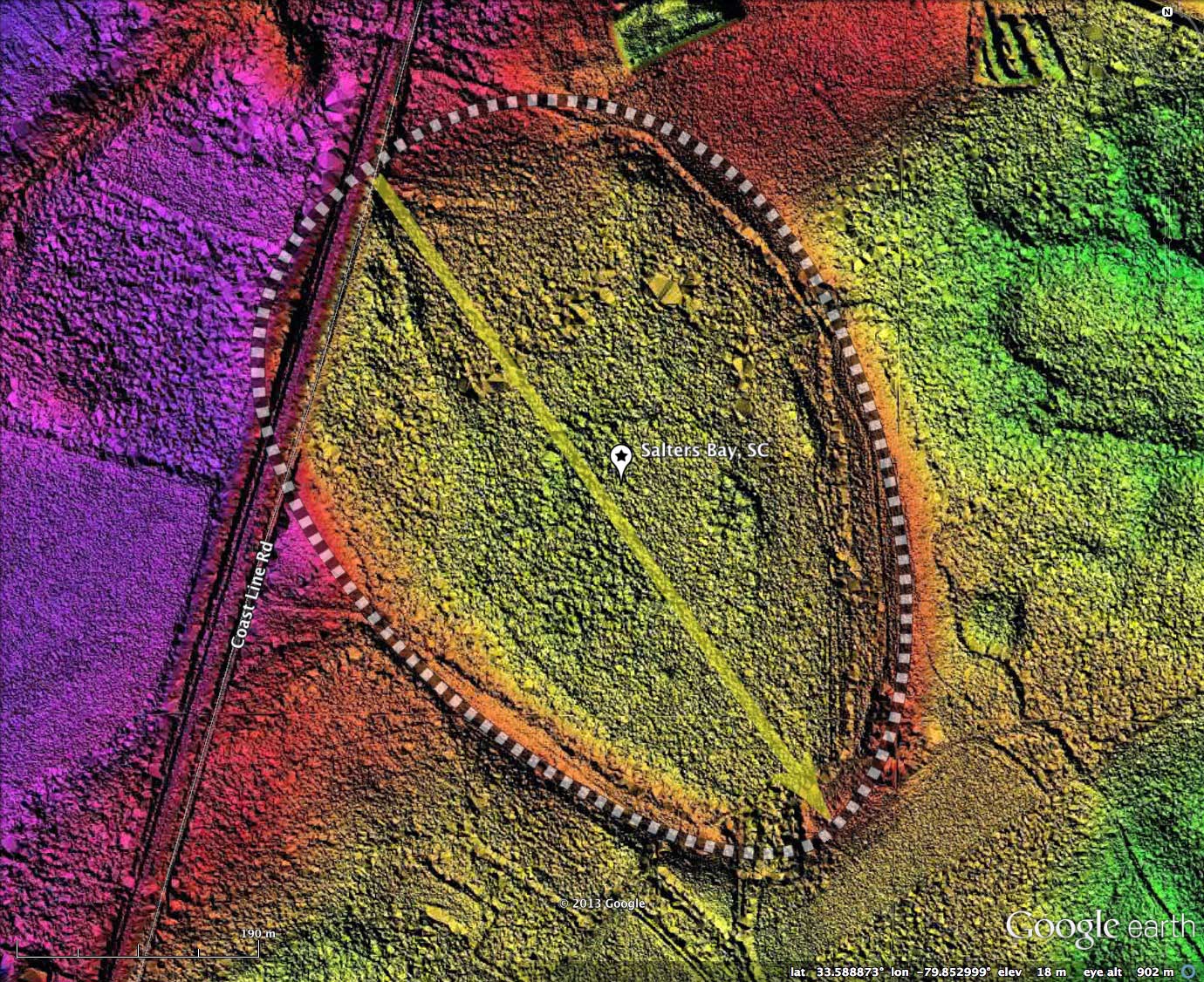
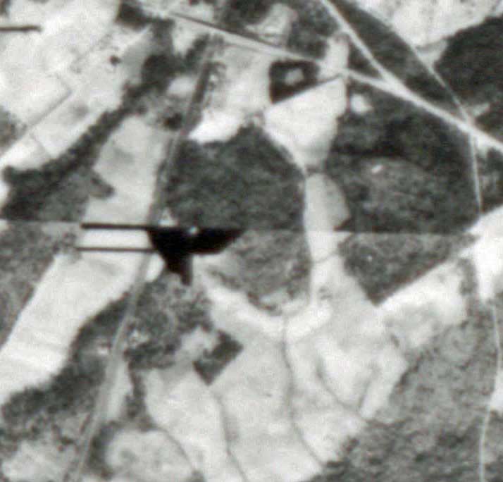
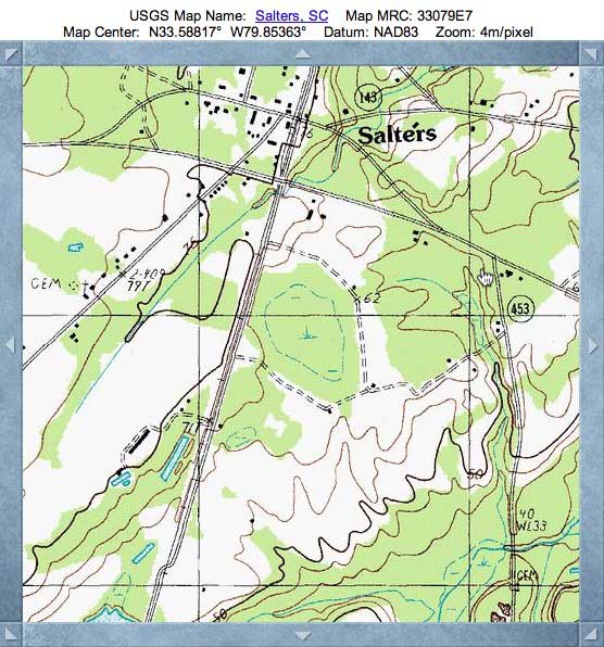
Salters Bay is a very nice Carolina Bay located just south of the town of Salters in Williamsburg County, South Carolina. The bay fits the baySouth archetype shape very well, and sports an orientation similar to other nearby bays. I chose the bay name based on the nearby USGS populated placename. The bay's shape does appear on the USGS Topographic map.
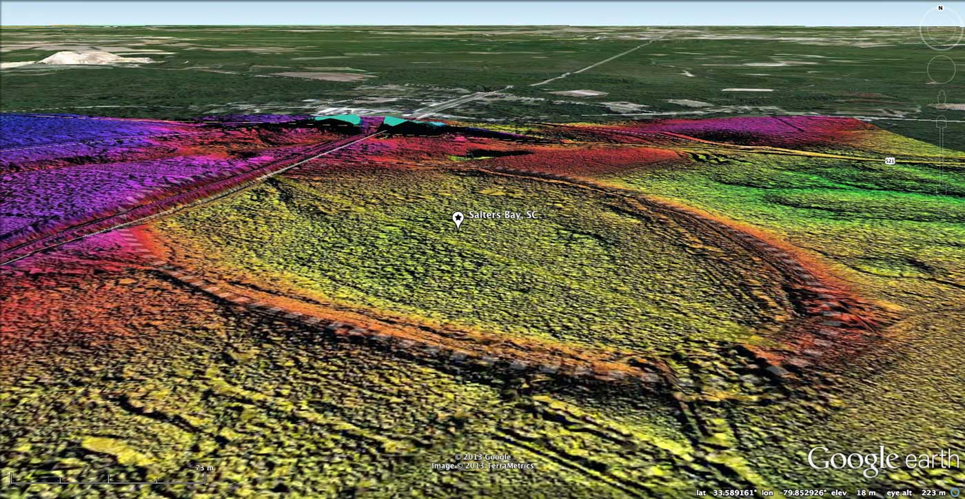
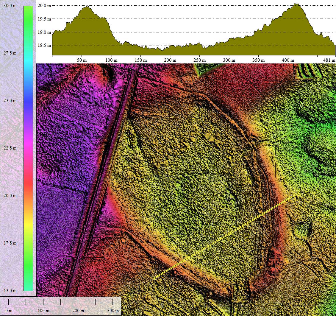
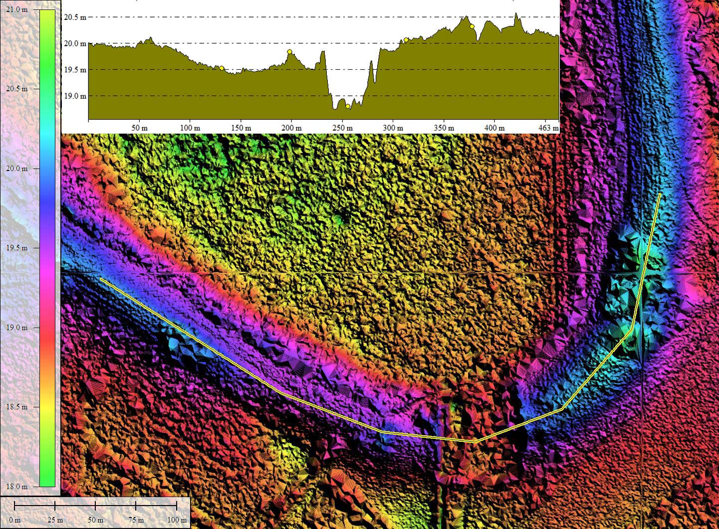
Salters Bay looks to be in a vary natural state with a few exceptions. First, the Atlantic Coast rail corridor passes across a section of the northwestern rim. While that is a bit of an intrusion, it occurs at a location where the bay rim backs into the nearby upland, so it does not open much of an outbound drainage opportunity for water within the bay. On the southern tip of the bay, however, a 50-meter wide channel has been dug across the bay rim. The spatial detail of this cut is shown in one of the attached Photo Album elevation profile images. The location might serve to provide a deep cross-rim exposure for OSL dating of the rim structure.
There looks to be another small artificial drainage ditch at about 2 o'clock on the northeast rim, but it may be inactive, or even a natural drainage break.
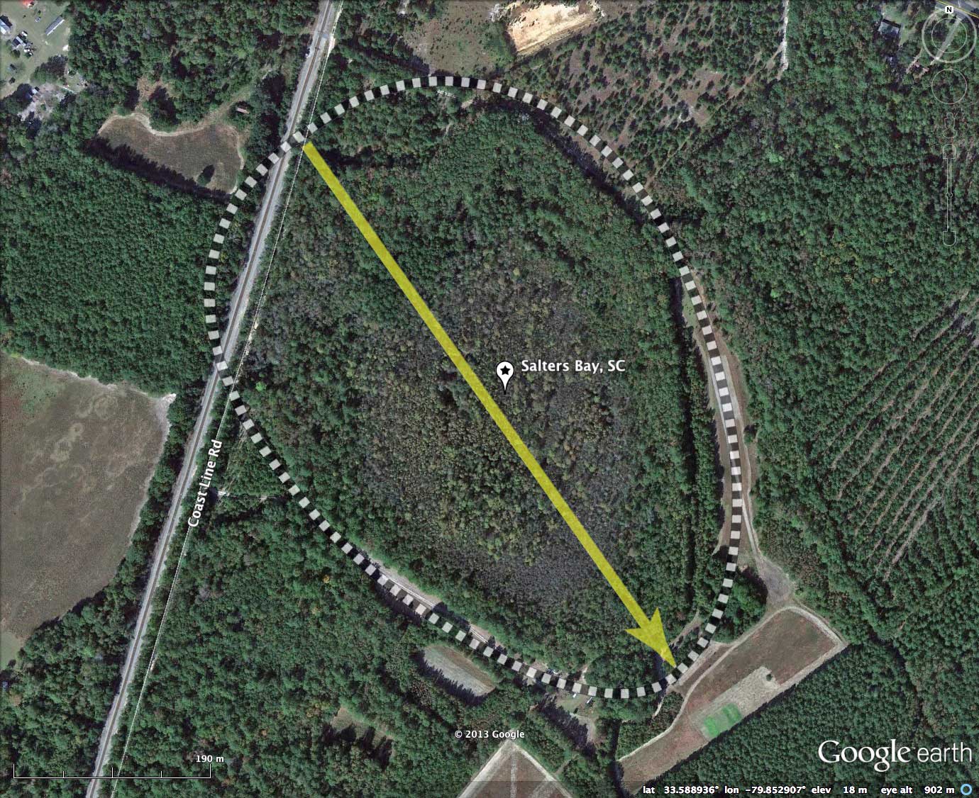
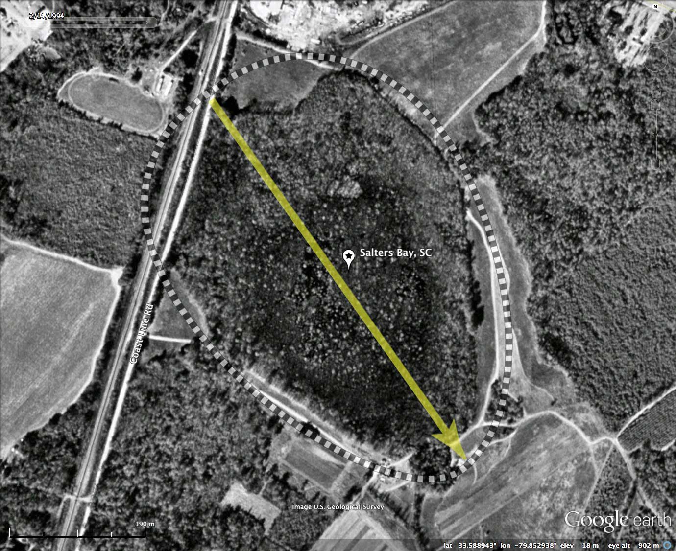
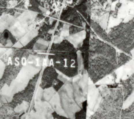
As demonstrated by historical imagery in the attached Album, the bay does not seem to have been clearcut or farmed between the early SC State Aerial Survey of 1945 and today's Google satellite imagery. As such, closing a few rim gaps might well bring Salters Bay back into a natural state.
The Carolina Bay Survey has identified and measured over 100 bays in Octant 134319. Their location and metrics can be referenced through a Fusion Table spatial visualization.
Salters Bay looks to be in a vary natural state with a few exceptions. First, the Atlantic Coast rail corridor passes across a section of the northwestern rim. While that is a bit of an intrusion, it occurs at a location where the bay rim backs into the nearby upland, so it does not open much of an outbound drainage opportunity for water within the bay. On the southern tip of the bay, however, a 50-meter wide channel has been dug across the bay rim. The spatial detail of this cut is shown in one of the attached Photo Album elevation profile images. The location might serve to provide a deep cross-rim exposure for OSL dating of the rim structure.
There looks to be another small artificial drainage ditch at about 2 o'clock on the northeast rim, but it may be inactive, or even a natural drainage break.
As demonstrated by historical imagery in the attached Album, the bay does not seem to have been clearcut or farmed between the early SC State Aerial Survey of 1945 and today's Google satellite imagery. As such, closing a few rim gaps might well bring Salters Bay back into a natural state.
The Carolina Bay Survey has identified and measured over 100 bays in Octant 134319. Their location and metrics can be referenced through a Fusion Table spatial visualization.
- Index #: 134319_3541
- Location: 33.58873870033018,-79.85293135551007
- Major: 0.66 km . . . Minor: 0.46 km
- Eccentricity: 0.716
- Area: 23.88 hectares
- Bearing: 144.75º
- Elevation: 18.36 m
- Archetype: baySouth
- Effective Diameter: 551.406 m
Copyright 2018 by Michael Davias