Little Junkyard Bay, SC
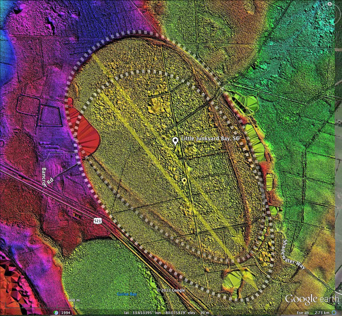
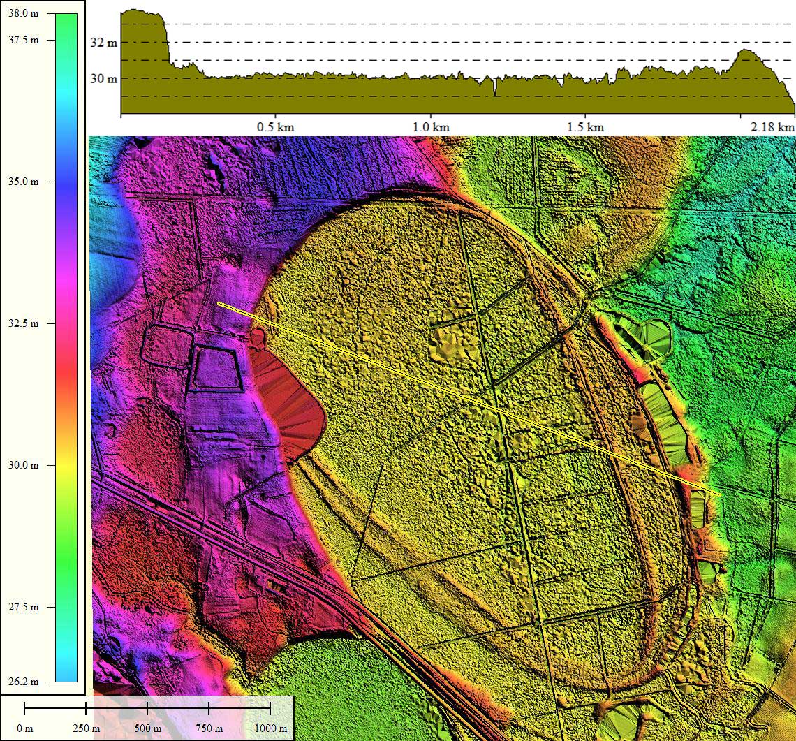
Little Junkyard Bay is a companion landform to yesterday's CBoD, Bennette's Bay -which was originally know as Junkyard Bay. Ironically, the LiDAR data now informs us that "Little" Junkyard bay is actually bigger than Junkyard Bay, with an average diameter of ~1.8 kilometer vs ~1.4 for the complex to the southwest.
So the two bays have different spatial extents, but they share some other important metrics. In an intriguing "coincidence", the two bays are both "constructed" of two identically shaped baySouth archetype templates, and all four of these templates are oriented at 141.54º, and are slightly offset N-S and E-W within the pairs.
Seen in numerous other locations, the robust fit of conjoined templates such as these to the actual shape of a bay's rim may be a clue to their formation. I have not identified another "pair" of bays, both of which have such a robust adherence to shape, orientation and juxtaposition.
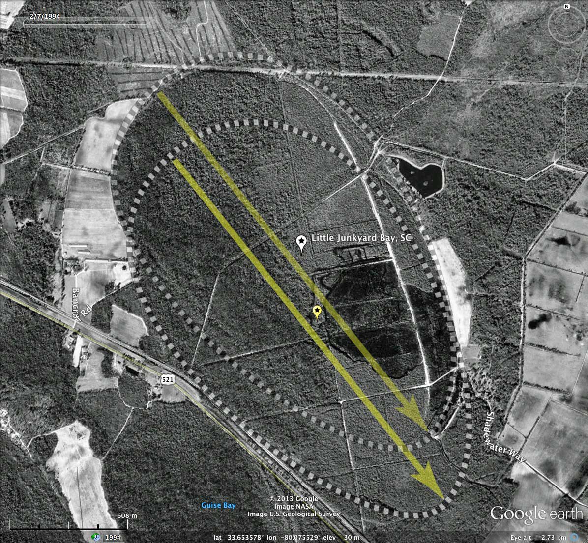
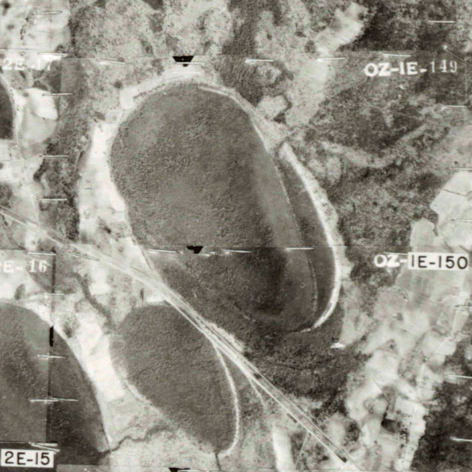
The attached album includes an historical 1948 aerial photo taken by Pennsylvania Aerial Surveys, Inc., and sourced from the South Carolina Aerial Photograph site.
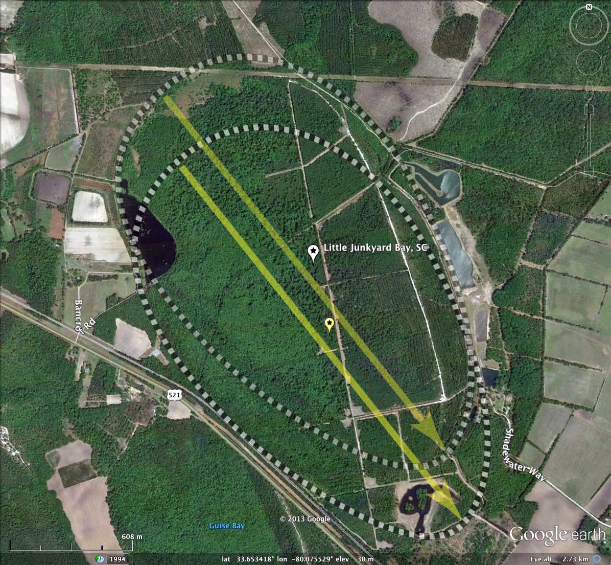
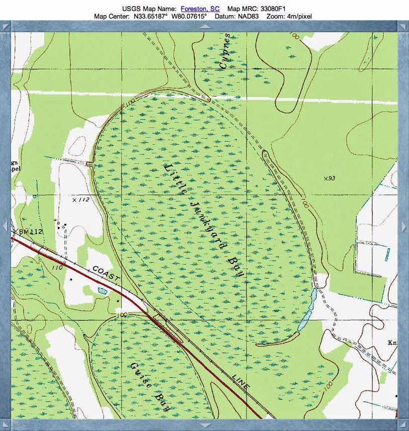
While Bennette's Bay is now protected by a State Heritage Preserve status, Little Junkyard bay is extensively ditched and drained. Much of it is under tree plantation growing use. There is open water in the northwest area of the bay, in the area where the two baySouth shapes intersect. The narrow southeast rim of the bay has been repeatedly mined for the prized quartz rim sand, leaving many open borrow pits along its circumference.
The Carolina Bay Survey has identified and measured 792 bays in Octant 134320. Their location and metrics can be referenced through a Fusion Table spatial visualization.
So the two bays have different spatial extents, but they share some other important metrics. In an intriguing "coincidence", the two bays are both "constructed" of two identically shaped baySouth archetype templates, and all four of these templates are oriented at 141.54º, and are slightly offset N-S and E-W within the pairs.
Seen in numerous other locations, the robust fit of conjoined templates such as these to the actual shape of a bay's rim may be a clue to their formation. I have not identified another "pair" of bays, both of which have such a robust adherence to shape, orientation and juxtaposition.
The attached album includes an historical 1948 aerial photo taken by Pennsylvania Aerial Surveys, Inc., and sourced from the South Carolina Aerial Photograph site.
While Bennette's Bay is now protected by a State Heritage Preserve status, Little Junkyard bay is extensively ditched and drained. Much of it is under tree plantation growing use. There is open water in the northwest area of the bay, in the area where the two baySouth shapes intersect. The narrow southeast rim of the bay has been repeatedly mined for the prized quartz rim sand, leaving many open borrow pits along its circumference.
The Carolina Bay Survey has identified and measured 792 bays in Octant 134320. Their location and metrics can be referenced through a Fusion Table spatial visualization.
- Index #: 134320_6130
- Location: 33.65289680318203,-80.07541656836591
- Major: 2.33 km . . . Minor: 1.36 km
- Eccentricity: 0.809
- Area: 250.63 hectares
- Bearing: 141.54º
- Elevation: 30.13 m
- Archetype: baySouth
- Effective Diameter: 1,786.369
- Index #: 134320_5929
- Location: 33.64977789397955,-80.07454528347321
- Major: 2.33 km . . . Minor: 1.36 km
- Eccentricity: 0.809
- Area: 250.64 hectares
- Bearing: 141.54º
- Elevation: 29.9 m
- Archetype: baySouth
- Effective Diameter: 1,786.404 m
Copyright 2018 by Michael Davias