Raymond Daniels Bay, Goldsboro Ridge, NC
This bay was among those examined in the Daniels/Gambler/Wheeler 1971 paper The Goldsboro Ridge, An Enigma (1). I took the liberty of naming the bay after Dr. Daniels, as a sign of gratitude to him and his associates for putting forth this body of work. It was the fundamental inspiration for my speculation on the mechanism behind Carolina Bay genesis.
…the Carolina Bays do not disturb the underlying Sunderland materials.... The sand in the bay rim is not different from the Goldsboro sand. Therefore, these Carolina Bays are merely surface features associated with the formation of the ridge.
Raymond Daniels
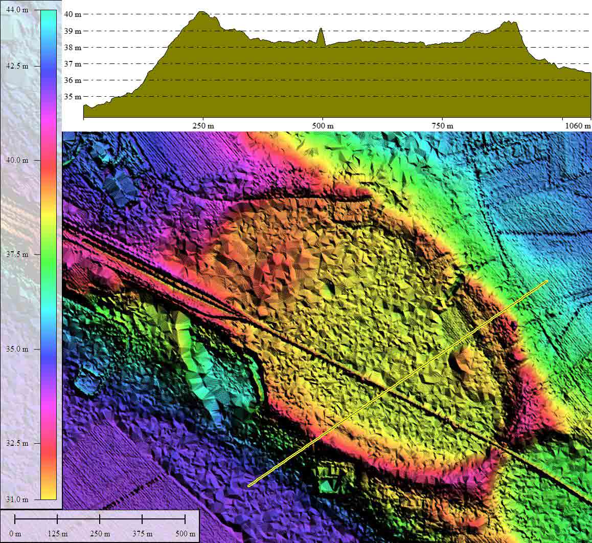
The attached imagery displays the bay (along with a smaller partner to the southeast) setting up on the ridge, with slender side walls that seemingly defy the power of gravity - especially if one was to consider these to have been formed by standing lake waters rotating within a basin under the power of hurricane-force winds. Whatever the mechanism, this landform has been created with the bayCarolina archetype shape, and given an orientation similar to other bays nearby, seen at various elevations.The Global Mapper elevation profiles shown in the attached album document the bay to be an unlikely candidate for a natural-occurring lake.
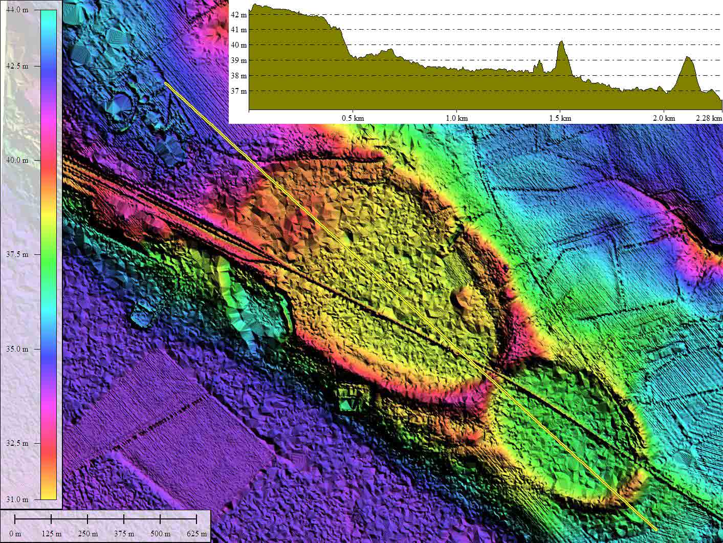
The transects of coring samples examined in the Daniels/Gambler/Wheeler paper are displayed on the Google Earth imagery, and are included in the KMZ file referenced at the top of the post. Figure # 3 from the paper is included in the imagery for reference, and documents the locations of cores A thru F within this bay.
I must comment that the coring activity undertaken for the 1971 paper remains the most extensive attempted across a Carolina Bay landform. That was over 40 years ago, which is a sad commentary on the interest of the Geological Community to solve the Carolina Bay riddle. Noted science historian Thomas Kuhn proposed that scientific progress stalls when all the models allowed by the then-concensus paradigm fail to provide a satisfactory solution, and researchers look elsewhere for a game they can win. At that point, a novel and (usually) outrageous paradigm is required.
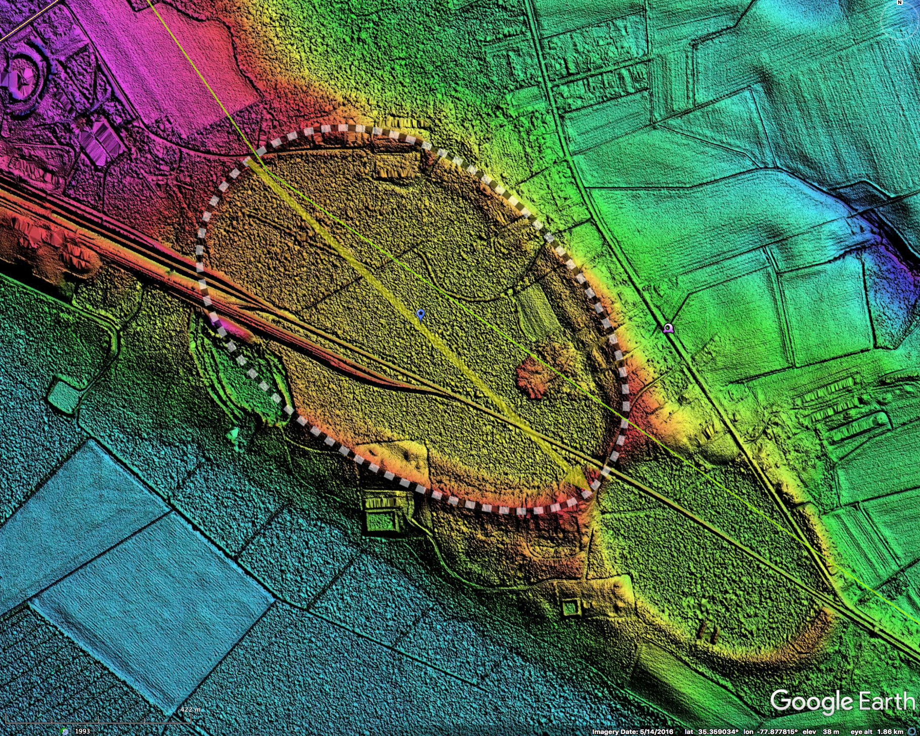
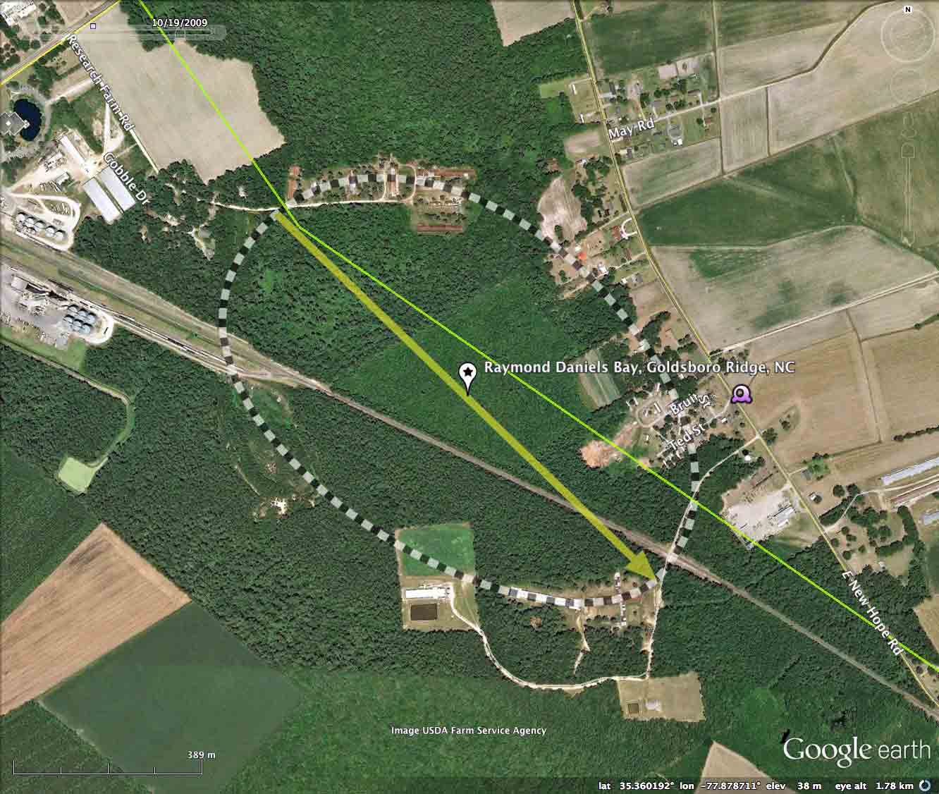
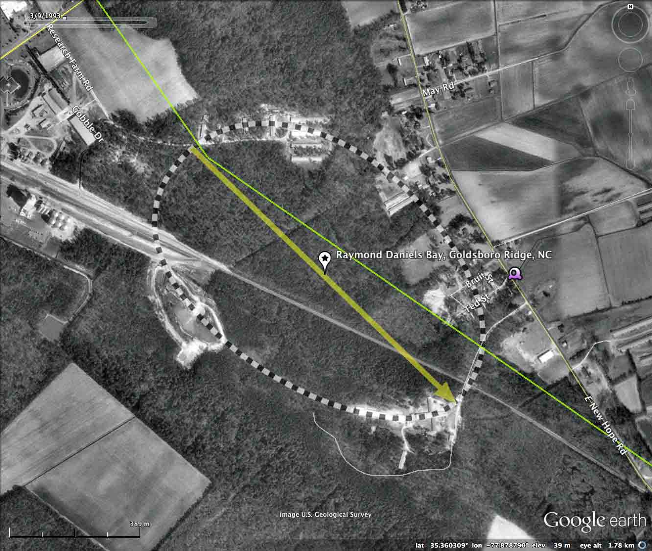
Today's Carolina Bay of the Day has been subjected to many indignities, the most important being a major rail corridor which cuts across its length. The LiDAR from 2001 does not document an extension of the rail line side yard into the bay that was completed sometime after 2009. A large borrow pit has excised 1/4 kilometer of the southwestern rim, just below the rail corridor, has been in existence since prior to any available imagery. In addition, numerous artificial drainage channels and road cuts have been made. As usual, all this commotion does not obscure the crisp rim expression in the LiDAR!
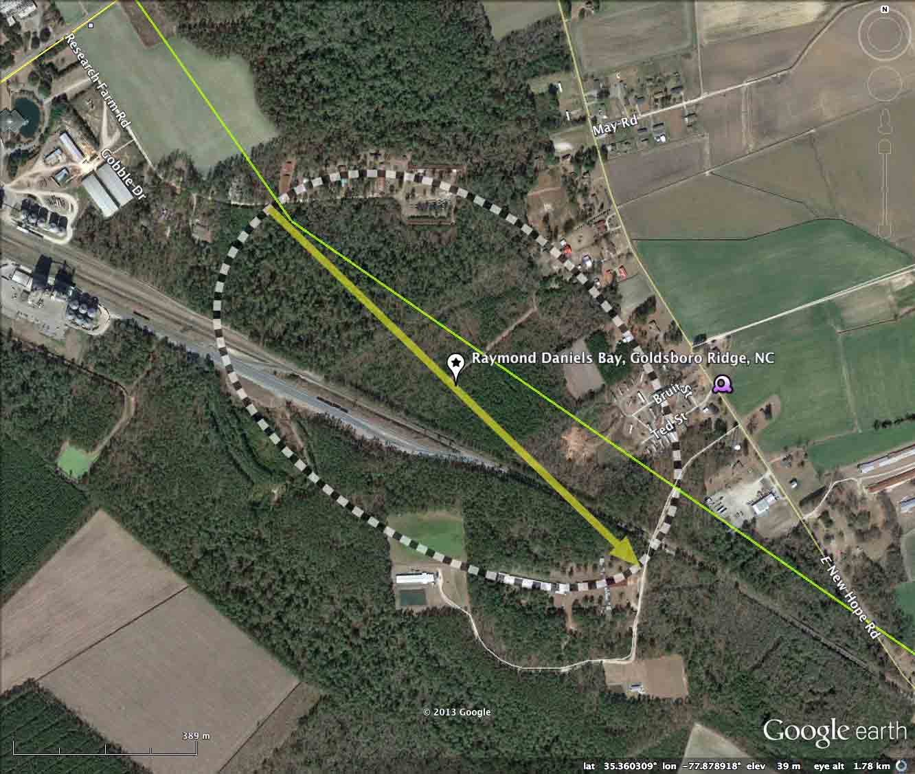
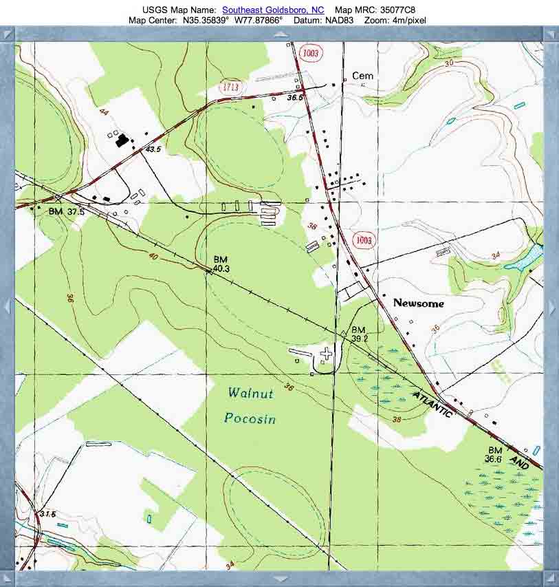
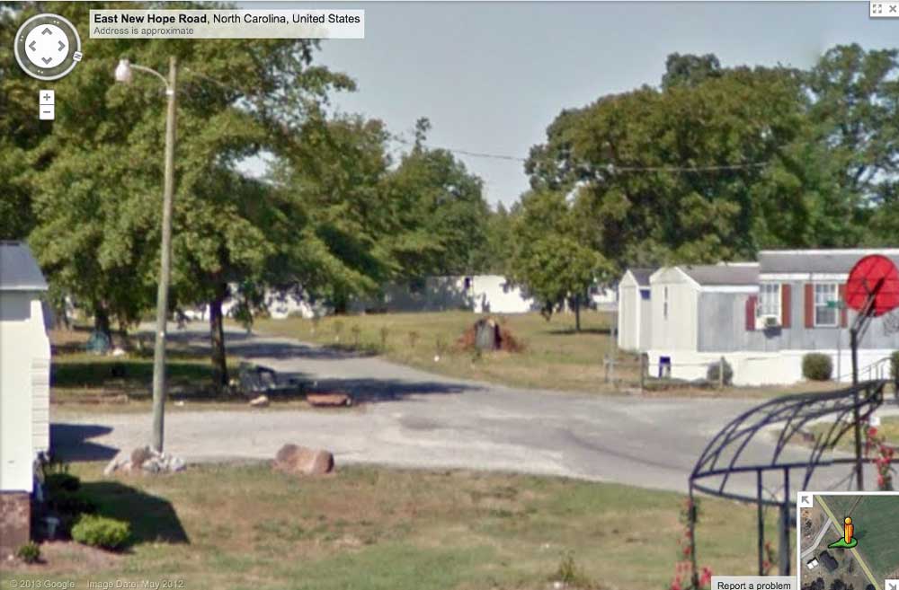
Google Streetview imagery is available along E. New Hope Road as it passes along the eastern side of the bay. An image in the album and placemarked in the KMZ file shows a side road (Ted Street) as it rides up to the rim, seen behind the buildings in the center. Explore the Streetview interactively in your browser HERE.
The Carolina Bay Survey has identified and measured over 100 bays in Octant 141311. Their location and metrics can be referenced through a Fusion Table spatial visualization.
The transects of coring samples examined in the Daniels/Gambler/Wheeler paper are displayed on the Google Earth imagery, and are included in the KMZ file referenced at the top of the post. Figure # 3 from the paper is included in the imagery for reference, and documents the locations of cores A thru F within this bay.
I must comment that the coring activity undertaken for the 1971 paper remains the most extensive attempted across a Carolina Bay landform. That was over 40 years ago, which is a sad commentary on the interest of the Geological Community to solve the Carolina Bay riddle. Noted science historian Thomas Kuhn proposed that scientific progress stalls when all the models allowed by the then-concensus paradigm fail to provide a satisfactory solution, and researchers look elsewhere for a game they can win. At that point, a novel and (usually) outrageous paradigm is required.
Today's Carolina Bay of the Day has been subjected to many indignities, the most important being a major rail corridor which cuts across its length. The LiDAR from 2001 does not document an extension of the rail line side yard into the bay that was completed sometime after 2009. A large borrow pit has excised 1/4 kilometer of the southwestern rim, just below the rail corridor, has been in existence since prior to any available imagery. In addition, numerous artificial drainage channels and road cuts have been made. As usual, all this commotion does not obscure the crisp rim expression in the LiDAR!
Google Streetview imagery is available along E. New Hope Road as it passes along the eastern side of the bay. An image in the album and placemarked in the KMZ file shows a side road (Ted Street) as it rides up to the rim, seen behind the buildings in the center. Explore the Streetview interactively in your browser HERE.
The Carolina Bay Survey has identified and measured over 100 bays in Octant 141311. Their location and metrics can be referenced through a Fusion Table spatial visualization.
- Index #: 141311_4351
- Location: 35.3598945035924,-77.8787657498804
- Major: 1.09 km . . . Minor: 0.71 km
- Eccentricity: 0.758
- Area: 61.24 hectares
- Bearing: 134.02º
- Elevation: 38.38 m
- Archetype: bay
- Effective Diameter: 883.023 m
Copyright 2018 by Michael Davias