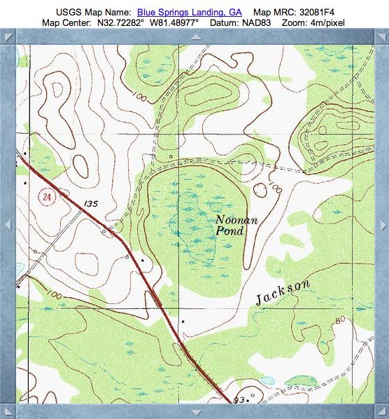
Noonan Pond Bay, GA
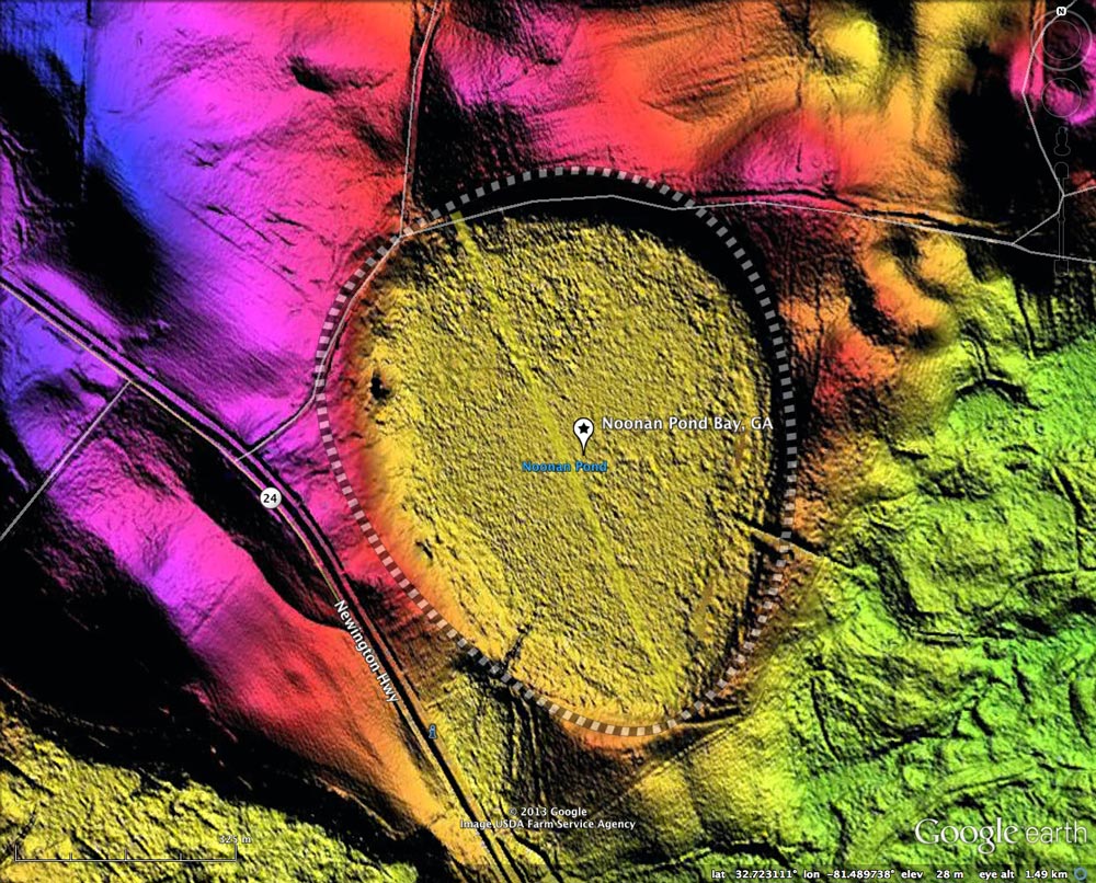
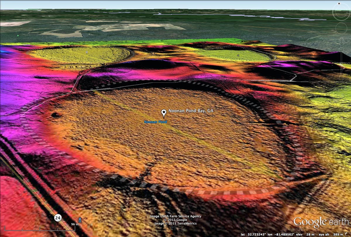
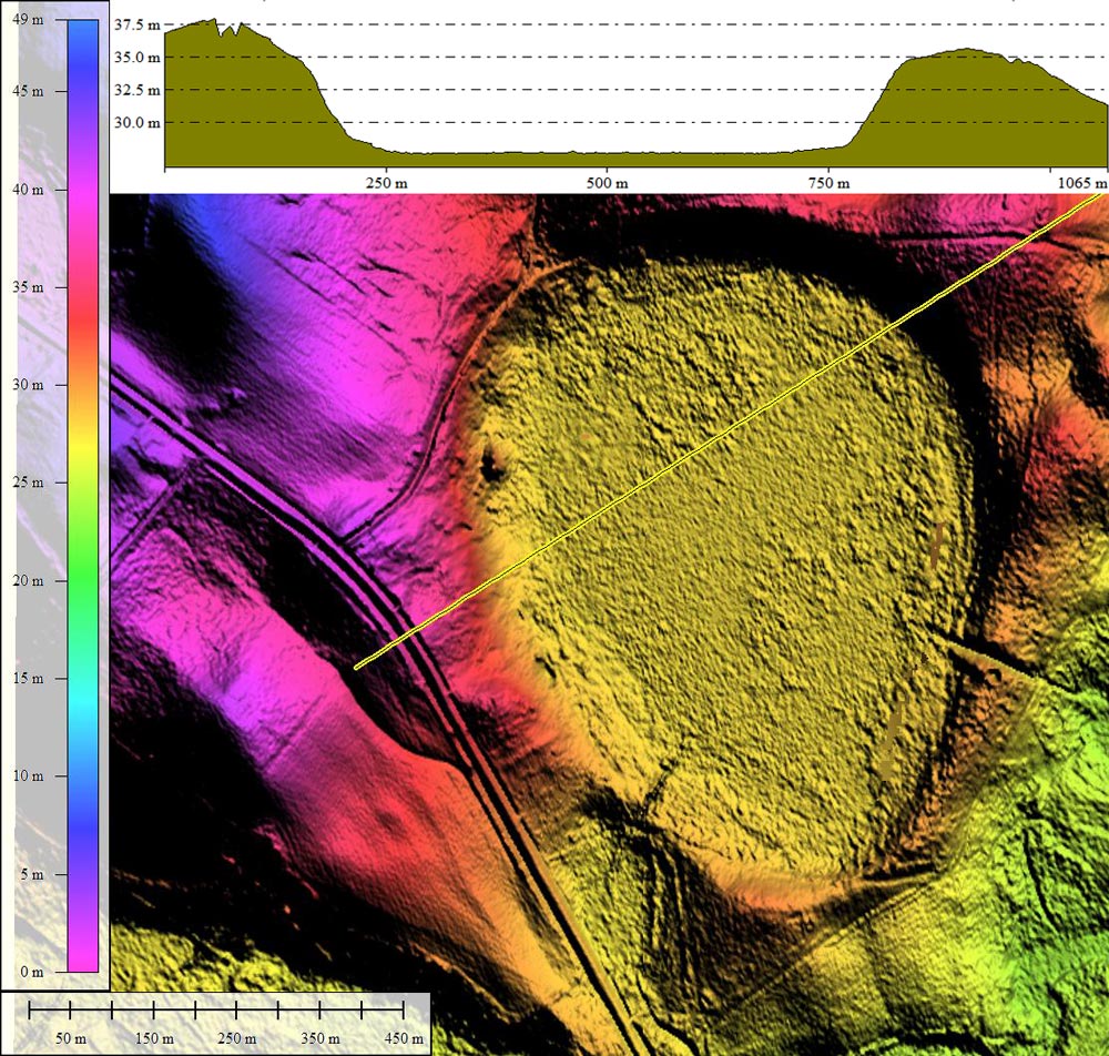
Today's Carolina Bay of the Day is located in east-central Screven County, Georgia, 14 kilometers east of Sylvania. The bay conforms well to the baySouth archetype shape. Noonan Pond does not have the "Bay" term in its USGS geoname, but it most certainly qualifies as one in every measure.
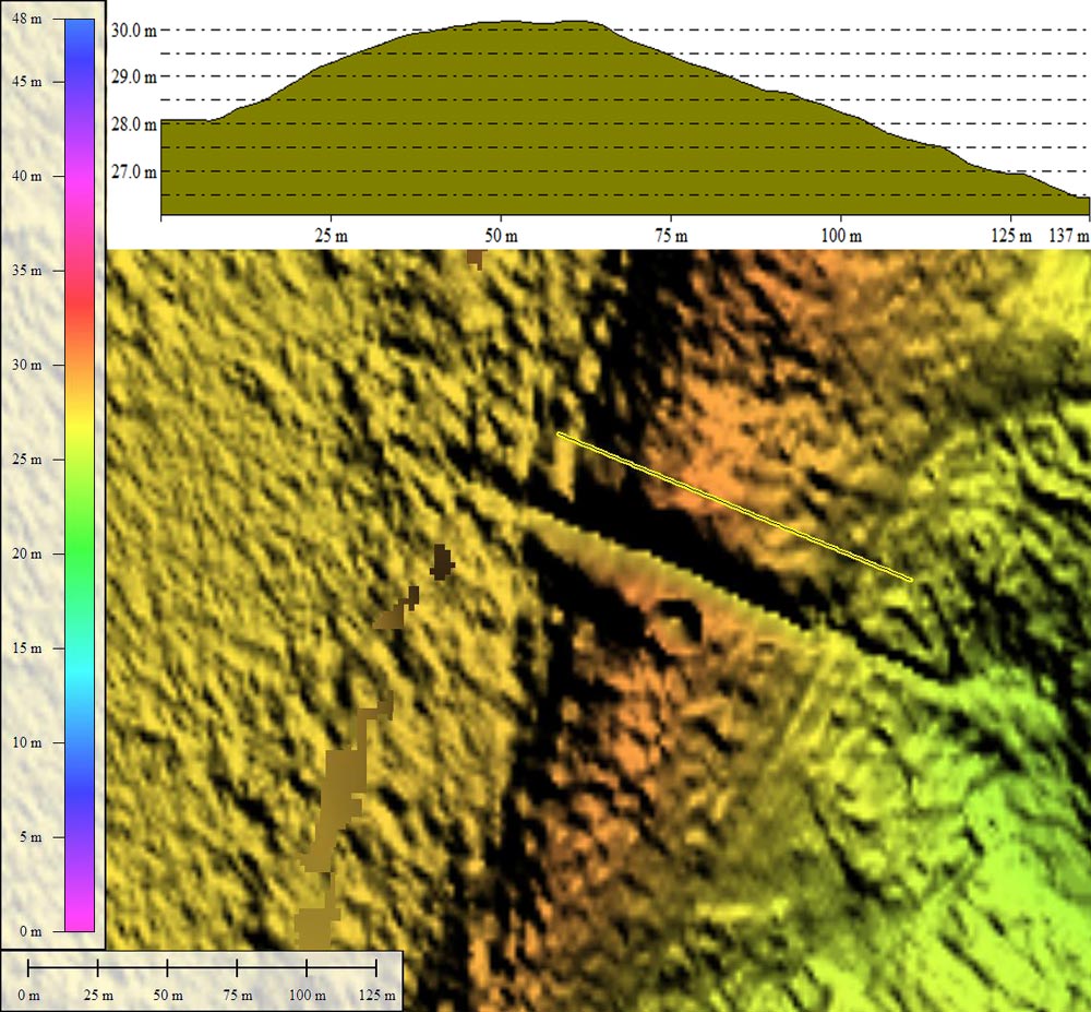
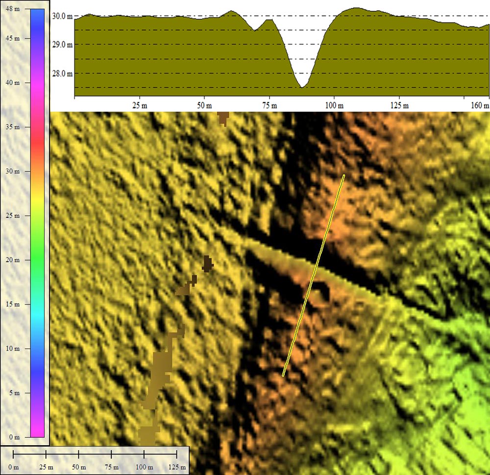
The bay's rim has been breached at two locations, as identified in the LiDAR. Two elevation profile maps of the southeastern rim ditch document the structure of the rim and the depth of the channel cut. The exposure is measured by the LiDAR as having ~3 meters of vertical relief across a 25 meter-wide artificial channel. I suspect the location may offer a good source of deep-rim sand samples for OSL dating.
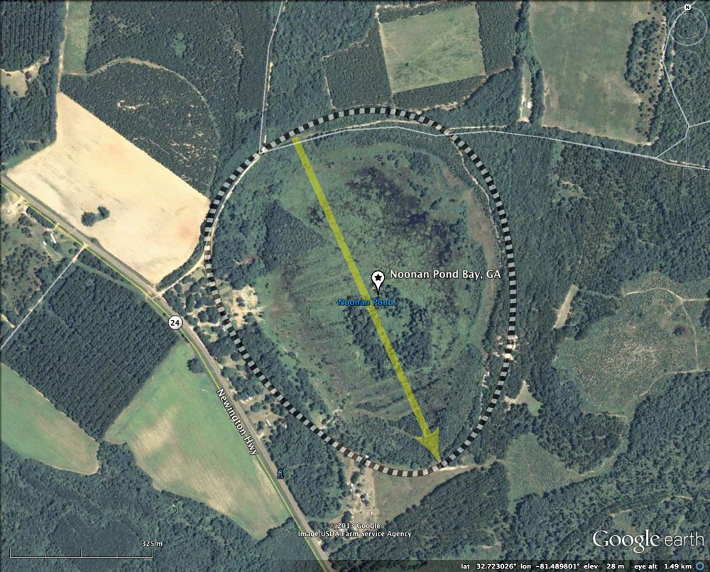
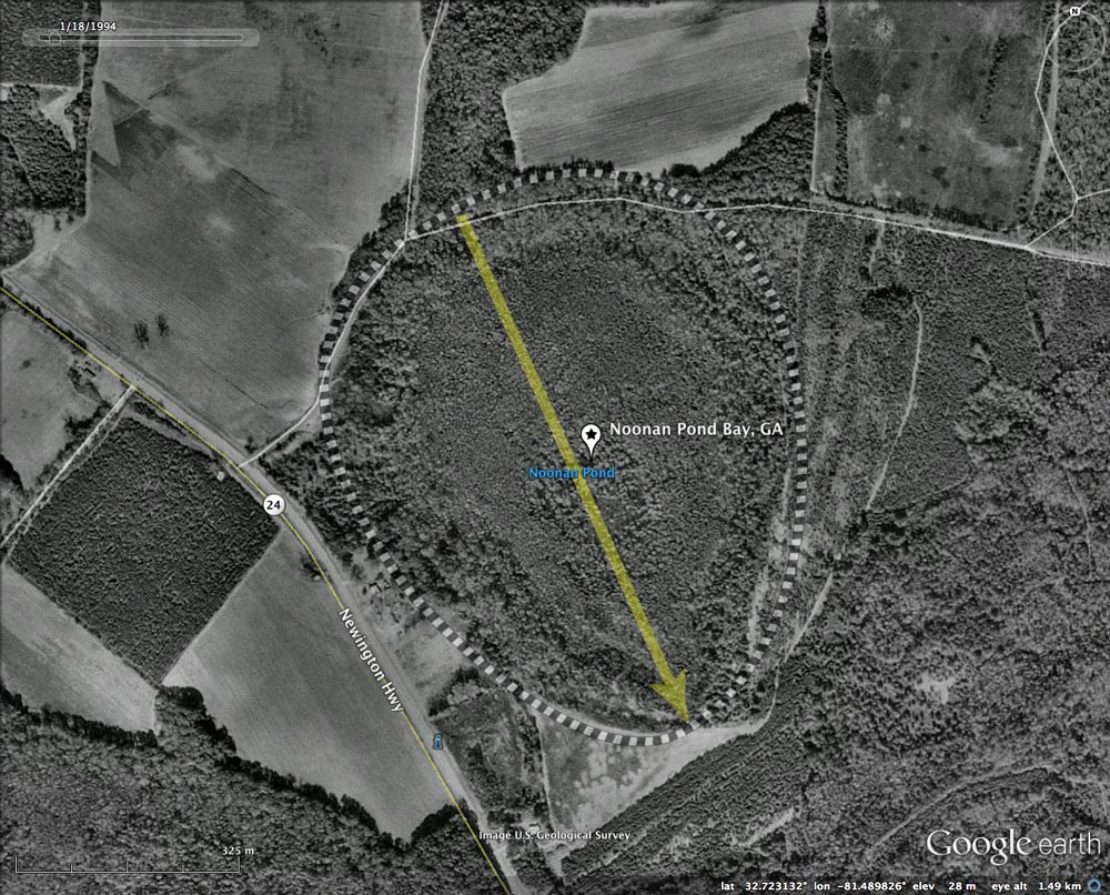
The 1999 Google historical satellite imagery shows the bay to be fully forested, but by 2005 the northern half of the bay and been clear-cut. As of the latest imagery (2010), the bay's tree contents has been almost completely harvested, but it retains a marshy, wet landscape.
Over the next few days, I will also feature two of its neighboring bays: Beaver Pond and Stink Pond. All three present the same orientation, and are almost identical in size. Any hypothesis as to the nature of the process which formed these baySouth landforms needs to explain the robust "cookie cutter" precision shown in the LiDAR. And it is not just these three localized bays, as the baySouth planform has been used to measure almost 16,000 bays in our database of ~50,000 bays.
I must use this opportunity to share a bit of exasperation about the "Internet". One would think that searching for an obscure phrase such as "Noonan Pond" would return some interesting information. If I told you it returned 268 hits on 27 pages using Google, you would certainly expect some meaty details. Not. Truth is that any name in the USGS genomes database has been co-oped by hundreds of websites such as hobohideout, picturepastime, noonan.homequotesus, reservetravel, satelliteviews, everysingleplace, myfishmaps, etc, etc etc. The value of such a search is nill, because all they do is auto-generate a page based on the slim data provided by the USGS's listing.
The Carolina Bay Survey has identified and measured ~125 bays in Octant 130325.
The bay's rim has been breached at two locations, as identified in the LiDAR. Two elevation profile maps of the southeastern rim ditch document the structure of the rim and the depth of the channel cut. The exposure is measured by the LiDAR as having ~3 meters of vertical relief across a 25 meter-wide artificial channel. I suspect the location may offer a good source of deep-rim sand samples for OSL dating.
The 1999 Google historical satellite imagery shows the bay to be fully forested, but by 2005 the northern half of the bay and been clear-cut. As of the latest imagery (2010), the bay's tree contents has been almost completely harvested, but it retains a marshy, wet landscape.
Over the next few days, I will also feature two of its neighboring bays: Beaver Pond and Stink Pond. All three present the same orientation, and are almost identical in size. Any hypothesis as to the nature of the process which formed these baySouth landforms needs to explain the robust "cookie cutter" precision shown in the LiDAR. And it is not just these three localized bays, as the baySouth planform has been used to measure almost 16,000 bays in our database of ~50,000 bays.
I must use this opportunity to share a bit of exasperation about the "Internet". One would think that searching for an obscure phrase such as "Noonan Pond" would return some interesting information. If I told you it returned 268 hits on 27 pages using Google, you would certainly expect some meaty details. Not. Truth is that any name in the USGS genomes database has been co-oped by hundreds of websites such as hobohideout, picturepastime, noonan.homequotesus, reservetravel, satelliteviews, everysingleplace, myfishmaps, etc, etc etc. The value of such a search is nill, because all they do is auto-generate a page based on the slim data provided by the USGS's listing.
The Carolina Bay Survey has identified and measured ~125 bays in Octant 130325.
- Index #: 130325_8995
- Location: 32.722719340021456,-81.48973616375929
- Major: 0.84 km . . . Minor: 0.68 km
- Eccentricity: 0.579
- Area: 45.42 hectares
- Bearing: 155.85º
- Elevation: 27.55 m
- Archetype: baySouth
- Effective Diameter: 760.463 m
Copyright 2018 by Michael Davias