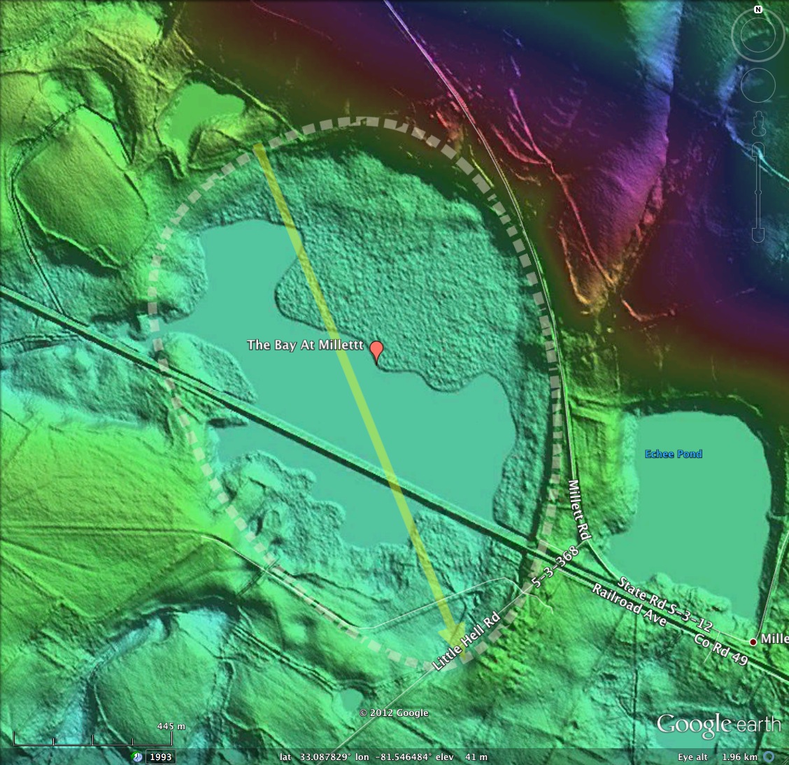
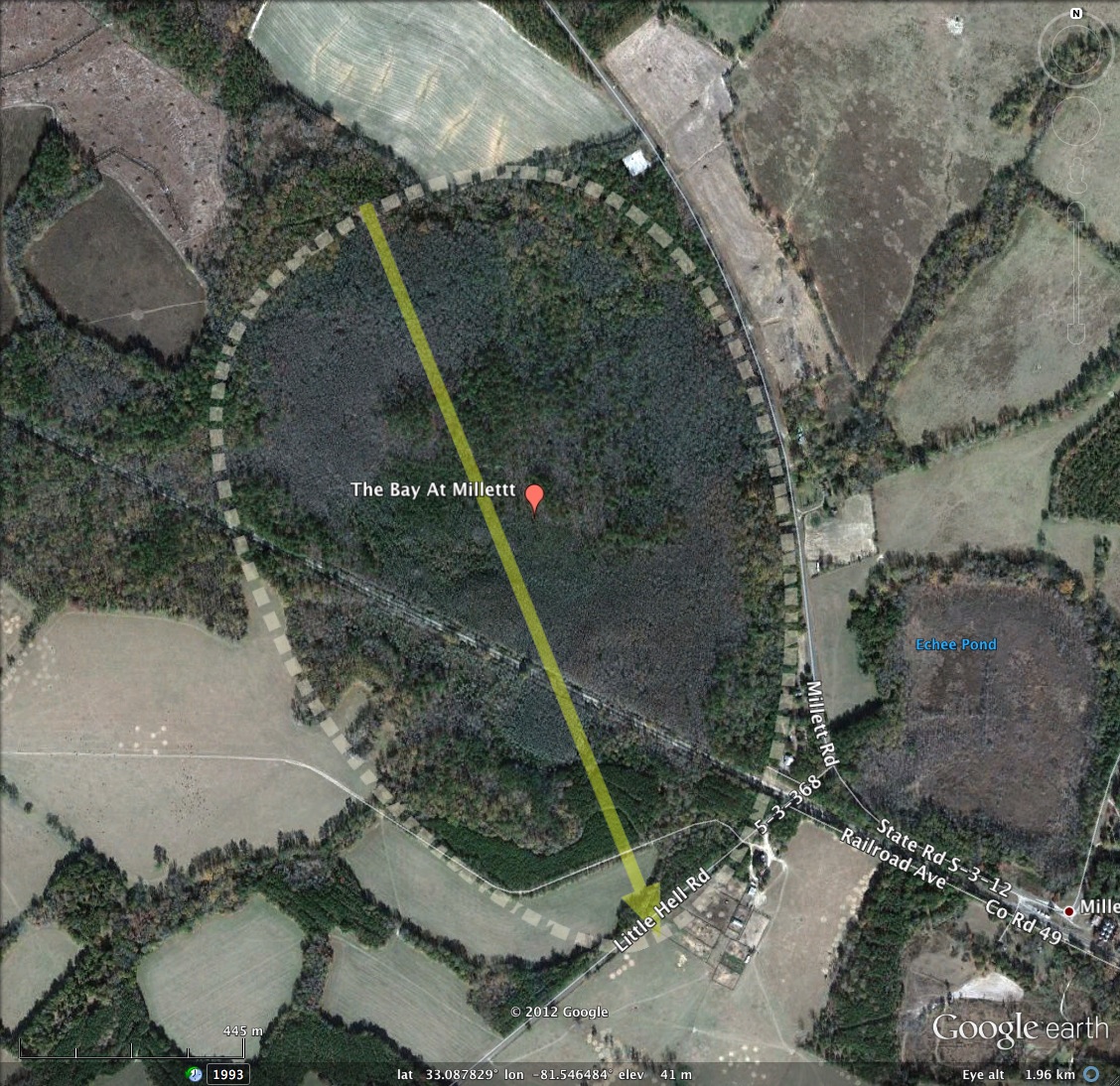
The Bay at Millett, SC
Presented here is a bay which actually carries the simple USGS place name of "The Bay". It is located a bit northwest of Millett, SC, hence my applied name here.
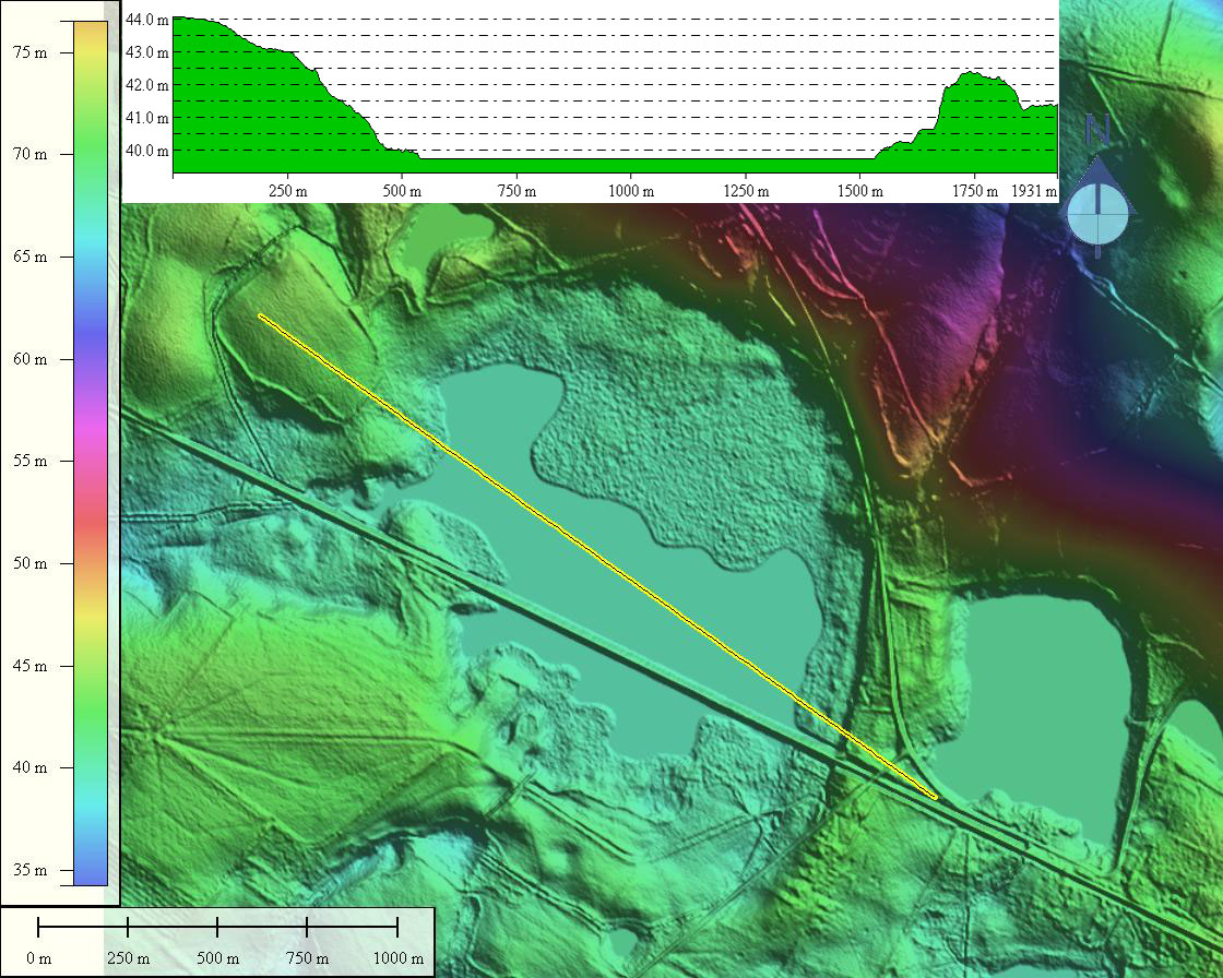
The physical structure of the bay looks, in the LiDAR and the Satellite imagery, to be fairly intact, with no agricultural workings seen. However, there is the issue with a railroad passing summarily across it, along with the attendant "Railroad Avenue." This might suggest that simply plugging the gaping drainage channel seen on the western side might yield a restoration candidate.
The physical structure of the bay looks, in the LiDAR and the Satellite imagery, to be fairly intact, with no agricultural workings seen. However, there is the issue with a railroad passing summarily across it, along with the attendant "Railroad Avenue." This might suggest that simply plugging the gaping drainage channel seen on the western side might yield a restoration candidate.
- Index #: 132326_3518
- Location: 33.088255202447,-81.5470163095134
- Major: 1.36 km . . . Minor: 1.08 km
- Eccentricity: 0.608
- Area: 116.23 hectares
- Bearing: 149.68º
- Elevation: 40.93 m
- Planform: baySouth
- Effective Diameter: 1,216.504 m
Copyright 2018 by Michael Davias