Pivot Arc Bay, GA
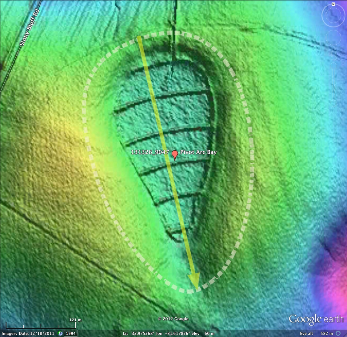
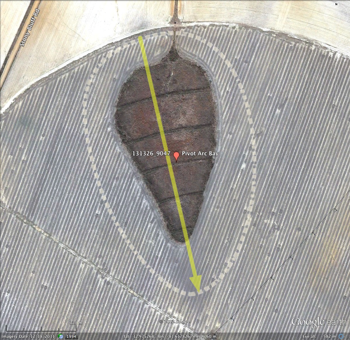
Here is a bay which presents an interesting man-made artifact. The area surrounding this bay has been under agricultural use, and a irrigation gantry system was has been "walking" across it for a number of years. The major axis of the bay and its pointed end are almost perfectly aligned towards the center pivot of the gantry, and as five of the gantry wheels rolled across the bay, the left an strikingly ordered geometric set of arcs along the bays length, ending with a perfect match with the bay's northwest rim curve.
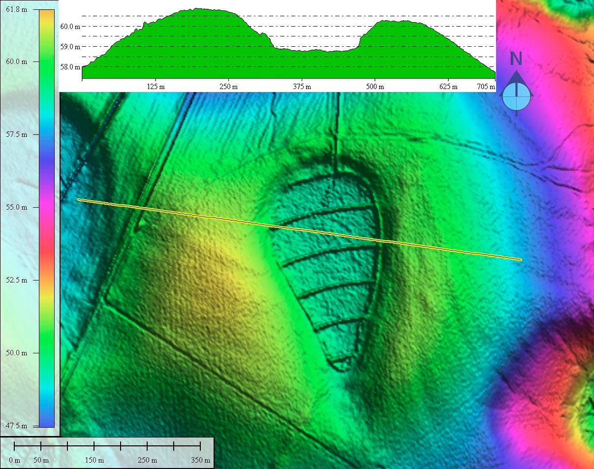
The KMZ contains an overlay for an adjacent bay, whose rim lies just 170 meters to the north and west. That bay is identically sized, shaped and oriented, but lacks the gantry track traces. In fact, the overlay is an exact copy of the one used for Pivot Arc Bay.
The twin bays follow the baySouth archetype, with a fairly high eccentricity value.
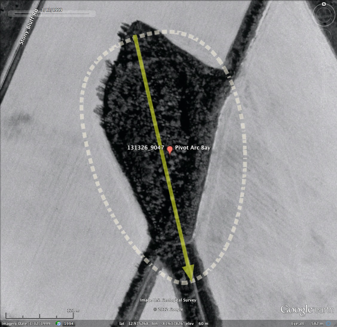
The Google Earth historical imagery from 1999, as shown in the attached album, suggest that as of that date the irrigation gantry was shorter and did not envelop this bay.
The KMZ contains an overlay for an adjacent bay, whose rim lies just 170 meters to the north and west. That bay is identically sized, shaped and oriented, but lacks the gantry track traces. In fact, the overlay is an exact copy of the one used for Pivot Arc Bay.
The twin bays follow the baySouth archetype, with a fairly high eccentricity value.
The Google Earth historical imagery from 1999, as shown in the attached album, suggest that as of that date the irrigation gantry was shorter and did not envelop this bay.
- Index #: 131326_9047
- Location: 32.97538103424573,-81.61779799088518
- Major: 0.45 km . . . Minor: 0.28 km
- Eccentricity: 0.779
- Area: 10.37 hectares
- Bearing: 166.99º
- Elevation: 58.8 m
- Planform: baySouth
- Effective Diameter: 363.366 m
- Pivot Arc Bay Twin
- Index #: 131326_9049
- Location: 32.976290676550946,-81.62274731970273
- Major: 0.45 km . . . Minor: 0.28 km
- Eccentricity: 0.779
- Area: 10.37 hectares
- Bearing: 166.99º
- Elevation: 58.11 m
- Planform: baySouth
- Effective Diameter: 363.366 m
Copyright 2018 by Michael Davias