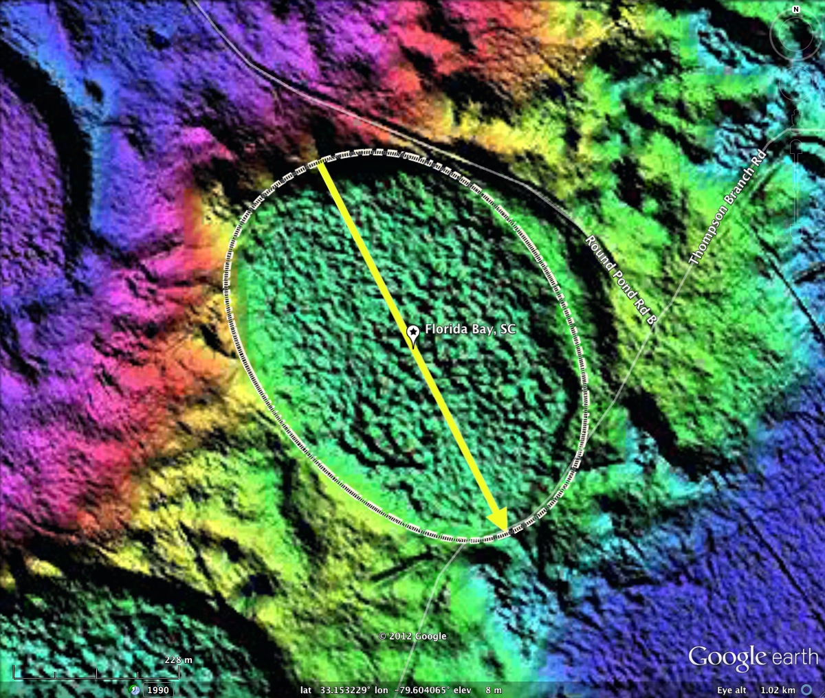
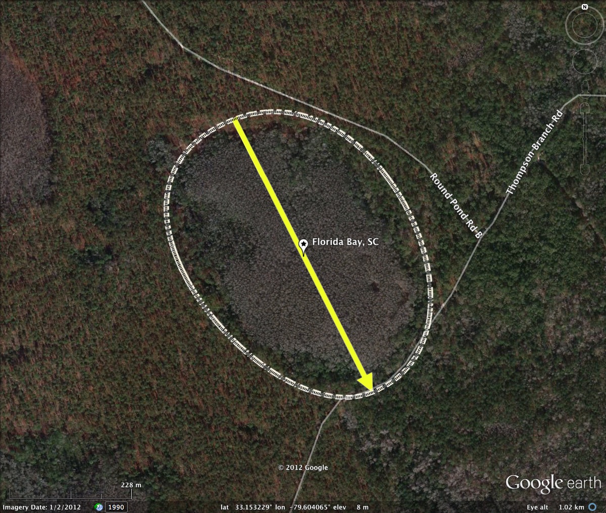
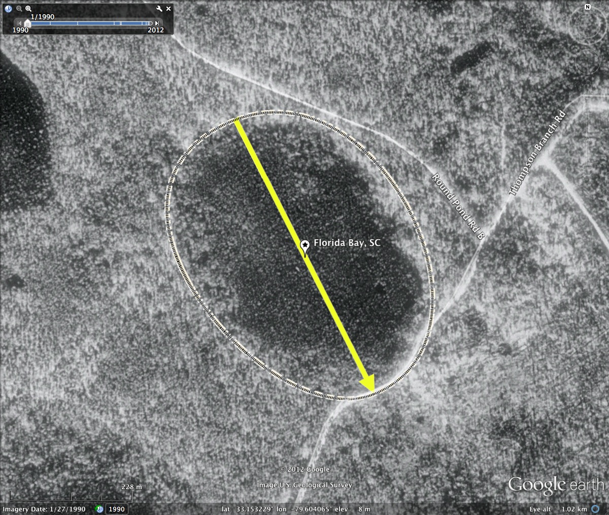
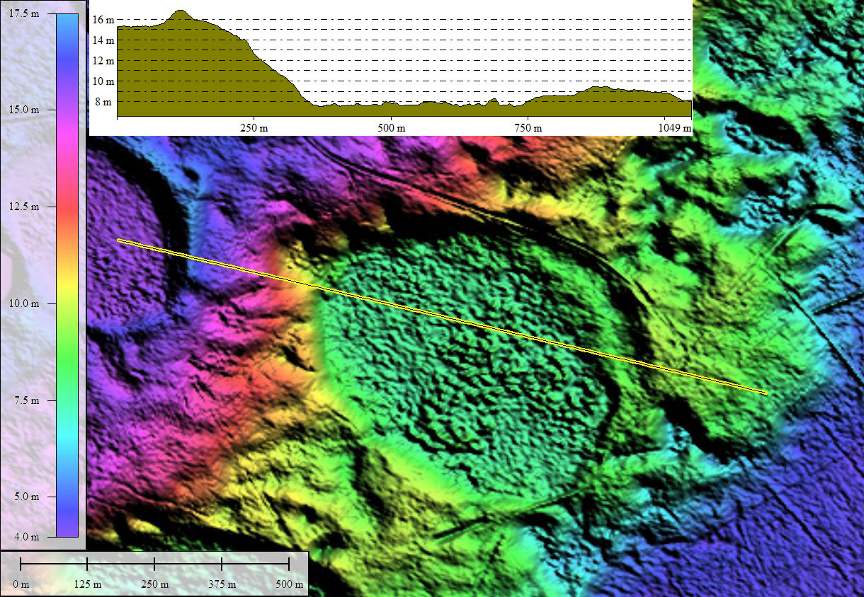
Florida Bay, SC
This bay is located in the protected Francis Marion National Forest. The flora and fauna are among the least compromised by human activity among all the bays.
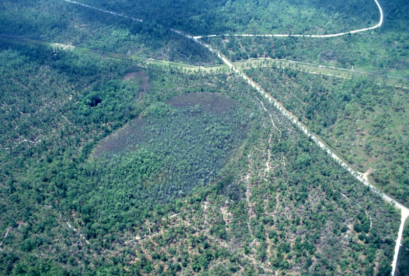
I have come upon the bay's name by way of a blog entry, but it is not registered in the USGS topographic naming system.
…Florida Bay the best Carolina Bay anywhere. Enough said. It is a shallow bay with a clay based lens underneath and is surrounded by xeric woods sloping down to the bay. There is no ground water charge. Typically it contains twelve to eighteen inches of water. Unfortunately because of the drought it is now dry. Wayne and I scouted it twice this year and both times were able to walk in it without getting our feet wet. When wet it is surrounded by various rings of vegetation including different Sarracenia, Hypericum fasiculatum, Pagonia and Cleistes orchids, various Rhynchospra species, and Eriocaulon compressum among others. The interior of the bay has pond cypress, Ilex myrtifolia, Ilex cassina and other typical bay plants. Close by are several sinkholes several of which still have water despite the drought.
DIRECTIONS TO FLORIDA BAY: Take I-26 towards Charleston. Before Charleston take exit 212C for I-526 toward Mr. Pleasant. Stay on I-526 until exit 29 (to Isle of Palms and Georgetown). Exit at exit 29. Turn left on 17 North toward Georgetown. Go approximately four miles on 17 North. Turn left on Highway 41 (Seels Marine is at the intersection of 17 North and Highway 41). Go approximately six miles (you will cross a steel bridge over the Wando River). Turn fight at Halfway Creek Road (State Highway S-8-100). Go 11.5 miles and you come to the intersection of Halfway Creek Road and Steed Creek Road. Go straight through the intersection. After approximately 8 miles, at the second power line crossing over the road, turn right into the road that runs under the power line. Park approximately fifty yards down the road. Florida Bay is to the left down a slope. Be careful not to park blocking the Wambaw cycle trail which runs by the bay.
The bay is the general area of a "Wambaw Creek Bay" listed in the Francis Marion bay locator flyer, which you can retrieve HERE, or from our site at this LINK.
- Index #: 132318_6141
- Location: 33.15322879169308,-79.60406475236127
- Major: 0.59 km . . . Minor: 0.44 km
- Eccentricity: 0.664
- Area: 20.45 hectares
- Bearing: 153.17º
- Elevation: 7.76 m
- Planform: bayCarolina
- Effective Diameter: 510.271 m
Copyright 2018 by Michael Davias