Beaver Pond Bay, GA
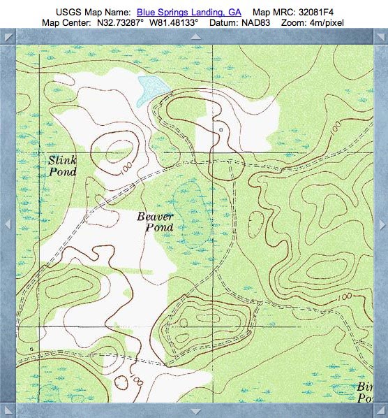
Today's Carolina Bay of the Day is located in east-central Screven County, Georgia, 14 kilometers east of Sylvania. Beaver Pond does not have the "Bay" term in its USGS geoname, but it most certainly qualifies as one in every measure.
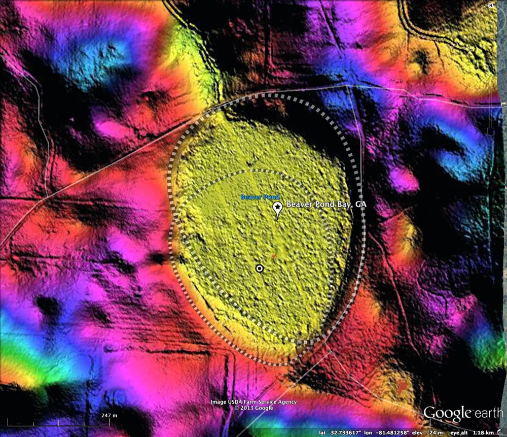
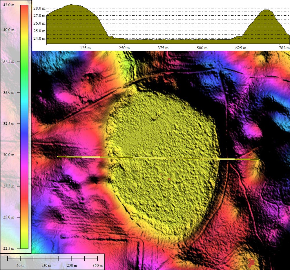
I interpret the shape of Beaver Pond Bay to be the aggregate of two baySouth archetype shapes, with the smaller of the two being slightly offset to the southwest. The break point between the two shapes can be clearly seen in the LiDAR halfway long the western rim; the satellite imagery also supports this conjunction.
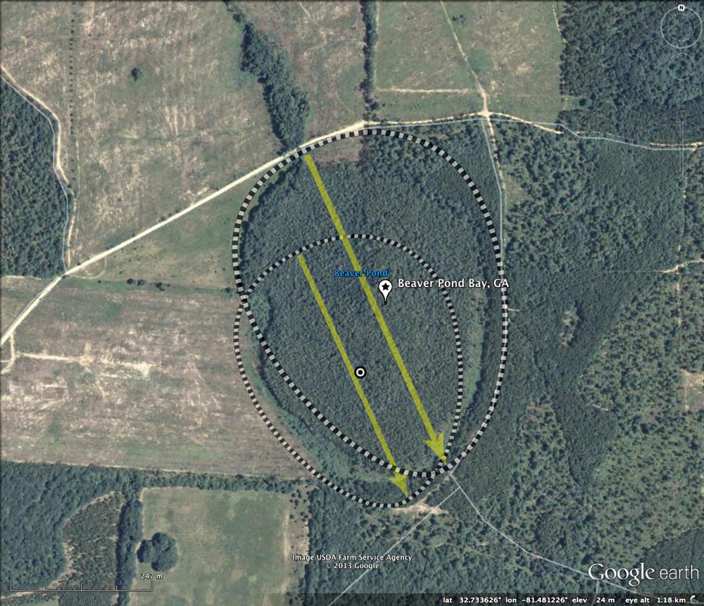
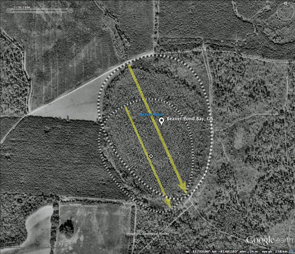
Beaver Pond Bay has what appears to be a natural drainage channel out the northern end of the bay, but that depressed area only extends a 1/4 km to the north. An artificial channel is visible in the LiDAR, extending through the natural depression and on through the elevated area beyond. The 1999 Google historical satellite imagery shows the bay to be fully forested. As of the latest imagery (2010), the tree canopy remains intact.
Given the drainage channel, I suspect the bay had been drained, its water-tolerant hardwoods harvested, and allowed to become reforested with pine. When these types of habitats are restored, the line is often clear-cut, the artificial drainage channels blocked, and original plant communities are reestablished through seed and transplant.
Over several days, I am also featuring two of its neighboring bays, Noonan Pond and Stink Pond. All three present the same orientation, and are almost identical in size. Any hypothesis as to the nature of the process which formed these baySouth landforms needs to explain the robust "cookie cutter" precision shown in the LiDAR.
I interpret the shape of Beaver Pond Bay to be the aggregate of two baySouth archetype shapes, with the smaller of the two being slightly offset to the southwest. The break point between the two shapes can be clearly seen in the LiDAR halfway long the western rim; the satellite imagery also supports this conjunction.
Beaver Pond Bay has what appears to be a natural drainage channel out the northern end of the bay, but that depressed area only extends a 1/4 km to the north. An artificial channel is visible in the LiDAR, extending through the natural depression and on through the elevated area beyond. The 1999 Google historical satellite imagery shows the bay to be fully forested. As of the latest imagery (2010), the tree canopy remains intact.
Given the drainage channel, I suspect the bay had been drained, its water-tolerant hardwoods harvested, and allowed to become reforested with pine. When these types of habitats are restored, the line is often clear-cut, the artificial drainage channels blocked, and original plant communities are reestablished through seed and transplant.
Over several days, I am also featuring two of its neighboring bays, Noonan Pond and Stink Pond. All three present the same orientation, and are almost identical in size. Any hypothesis as to the nature of the process which formed these baySouth landforms needs to explain the robust "cookie cutter" precision shown in the LiDAR.
- The Carolina Bay Survey has identified and measured ~125 bays in Octant 130325.
- Index #: 130325_9392
- Location: 32.733354435170476,-81.48116293149451
- Major: 0.63 km . . . Minor: 0.47 km
- Eccentricity: 0.672
- Area: 23.64 hectares
- Bearing: 155.85º
- Elevation: 23.84 m
- Archetype: baySouth
- Effective Diameter: 548.628 m
- Index #: 130325_9292
- Location: 32.73226500593384,-81.48163323201823
- Major: 0.49 km . . . Minor: 0.4 km
- Eccentricity: 0.591
- Area: 15.68 hectares
- Bearing: 155.85º
- Elevation: 23.85 m
- Archetype: baySouth
- Effective Diameter: 446.815 m
Copyright 2018 by Michael Davias