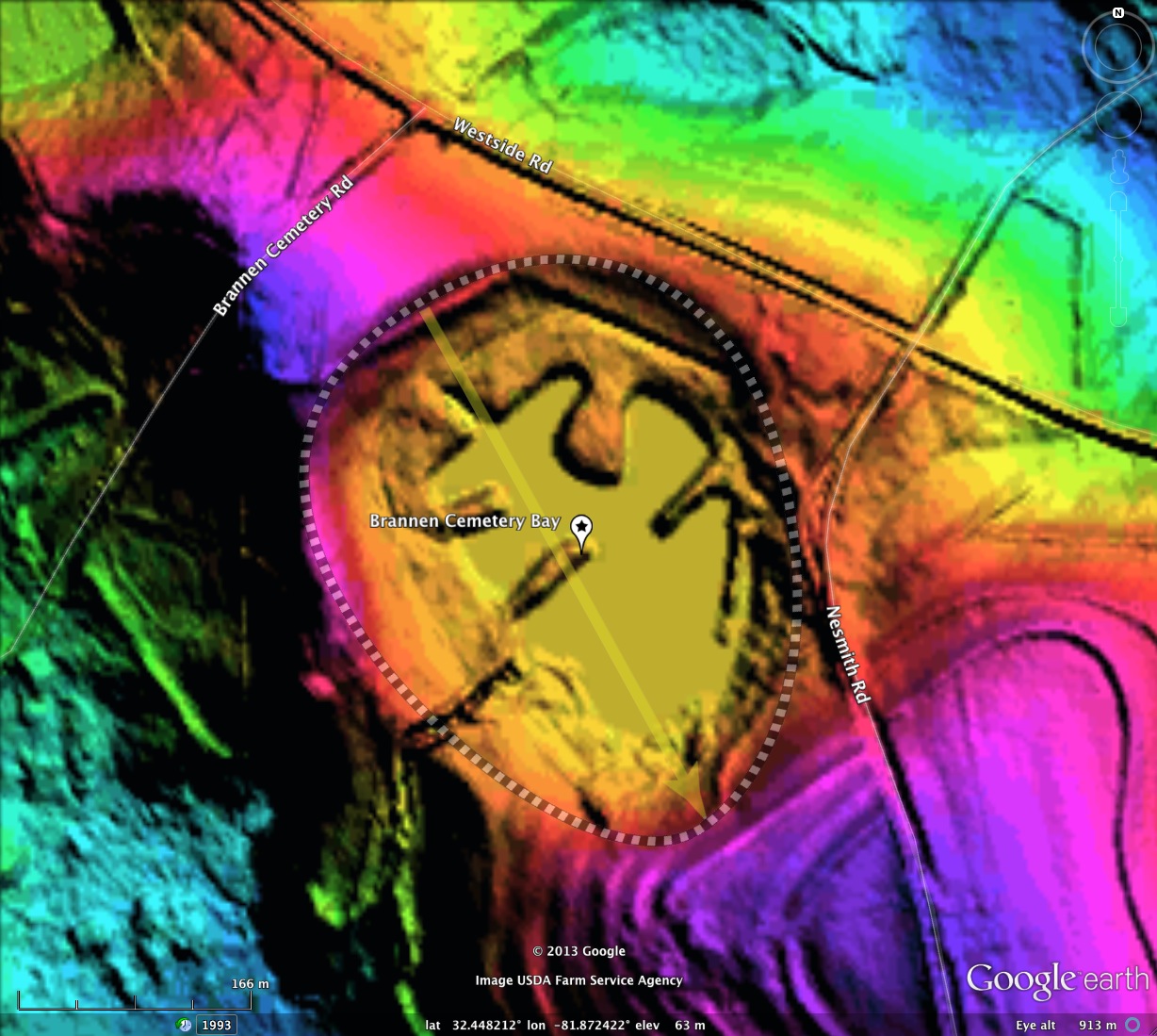
Brannen Cemetery Bay, GA
I have named this bay after the cemetery which resides on the northwestern rim. The bay conforms well to the baySouth archetype, and presents an orientation similar to other bays in the area.
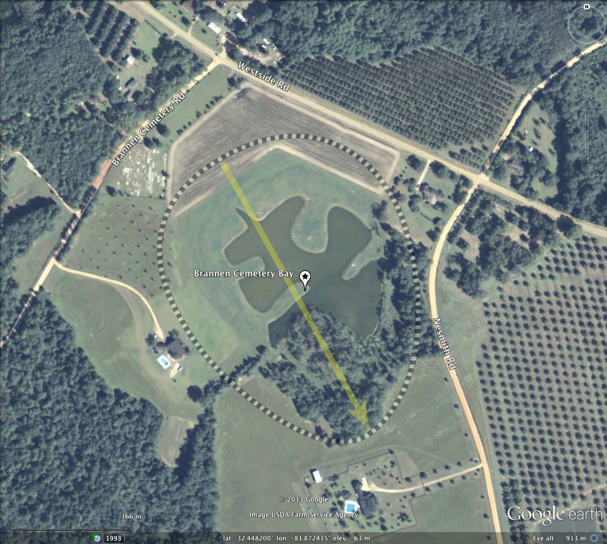
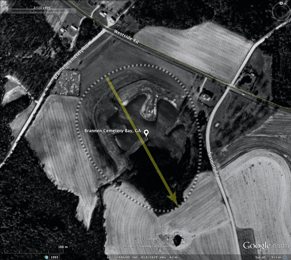
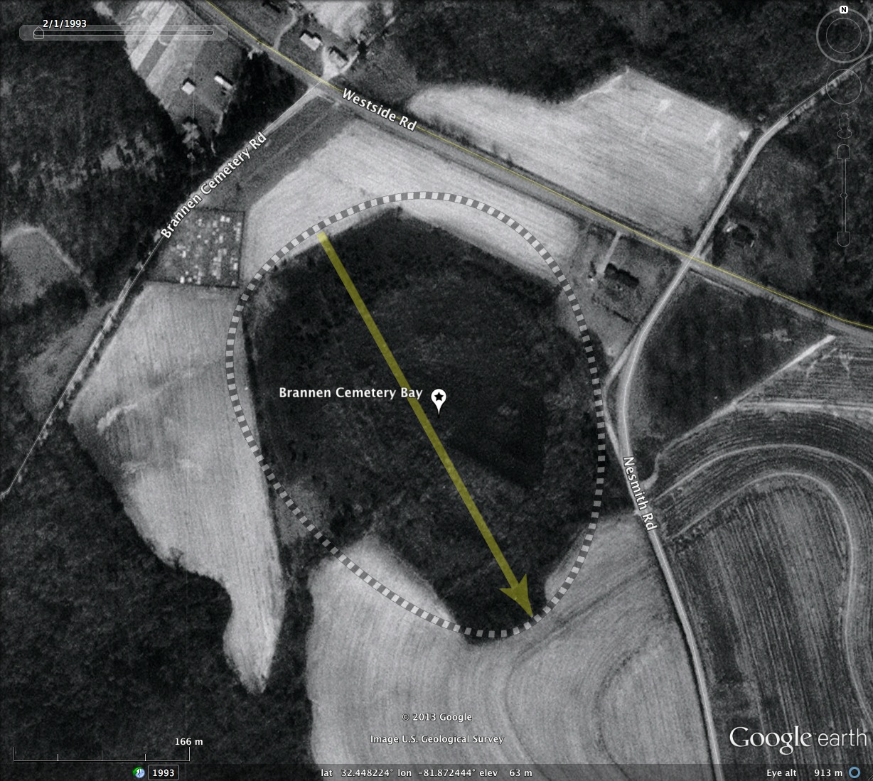
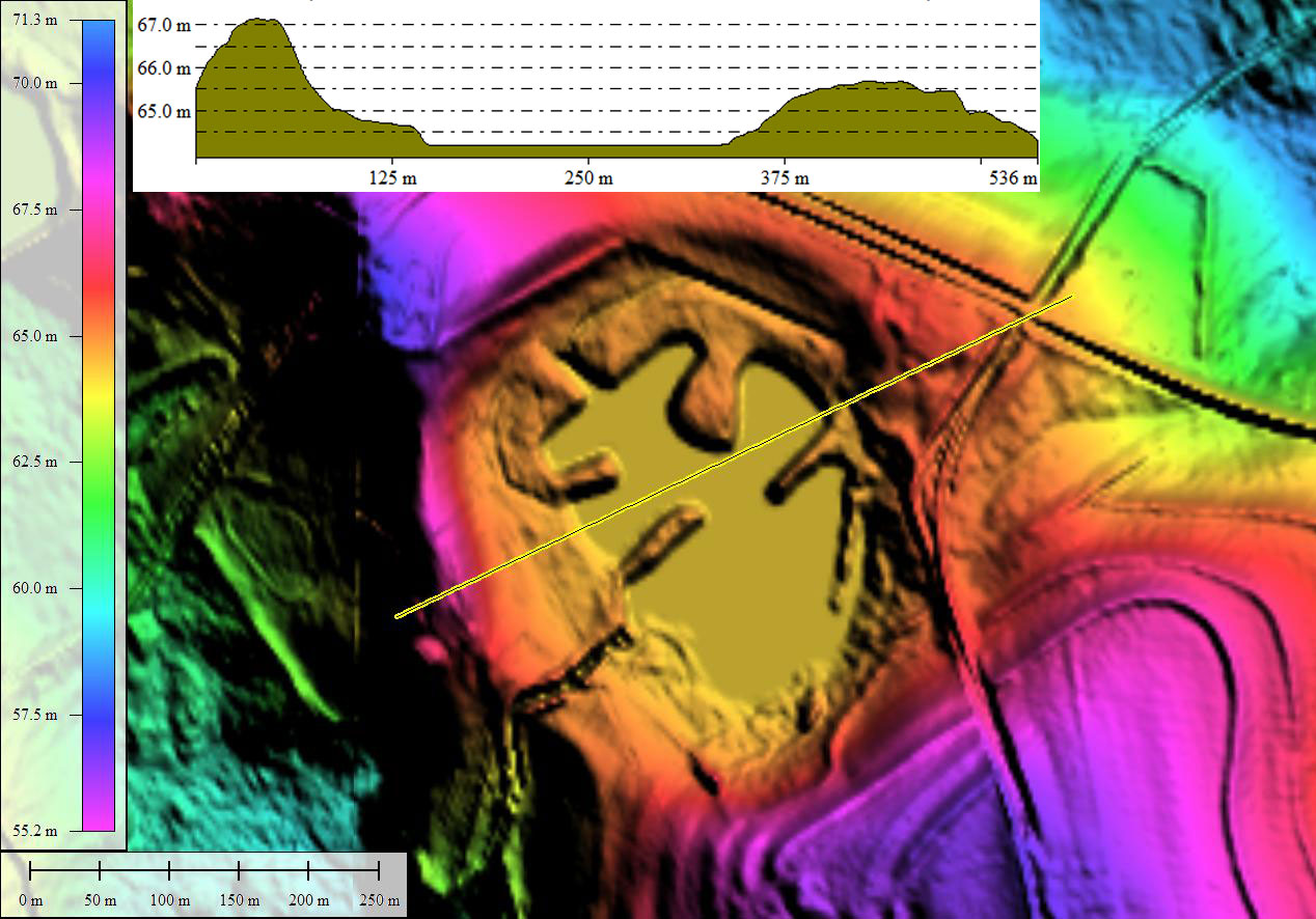
The Google Earth historical imagery from the 1990s documents the conversion of a classic Carolina Bay environment into a park-like landscape, with a puzzle-piece-like lake in the middle. When I first noticed this development, I assumed it was done to create a more "restful" landscape surrounding the cemetery. However, reviewing the property records, it was more likely done to beautify the landscape of the adjoining home. This makes it the first bay I have seen which was converted to a private park-like environment. Perhaps the owners someday hope to subdivide the 24 acre parcel for homesites surrounding the new "lake".
The Google Earth historical imagery from the 1990s documents the conversion of a classic Carolina Bay environment into a park-like landscape, with a puzzle-piece-like lake in the middle. When I first noticed this development, I assumed it was done to create a more "restful" landscape surrounding the cemetery. However, reviewing the property records, it was more likely done to beautify the landscape of the adjoining home. This makes it the first bay I have seen which was converted to a private park-like environment. Perhaps the owners someday hope to subdivide the 24 acre parcel for homesites surrounding the new "lake".
- Index #: 129327_7948
- Location: 32.44805945694465,-81.87242111312378
- Major: 0.43 km . . . Minor: 0.34 km
- Eccentricity: 0.614
- Area: 11.51 hectares
- Bearing: 151.09º
- Elevation: 63.38 m
- Archetype: baySouth
- Effective Diameter: 382.818 m
Copyright 2018 by Michael Davias