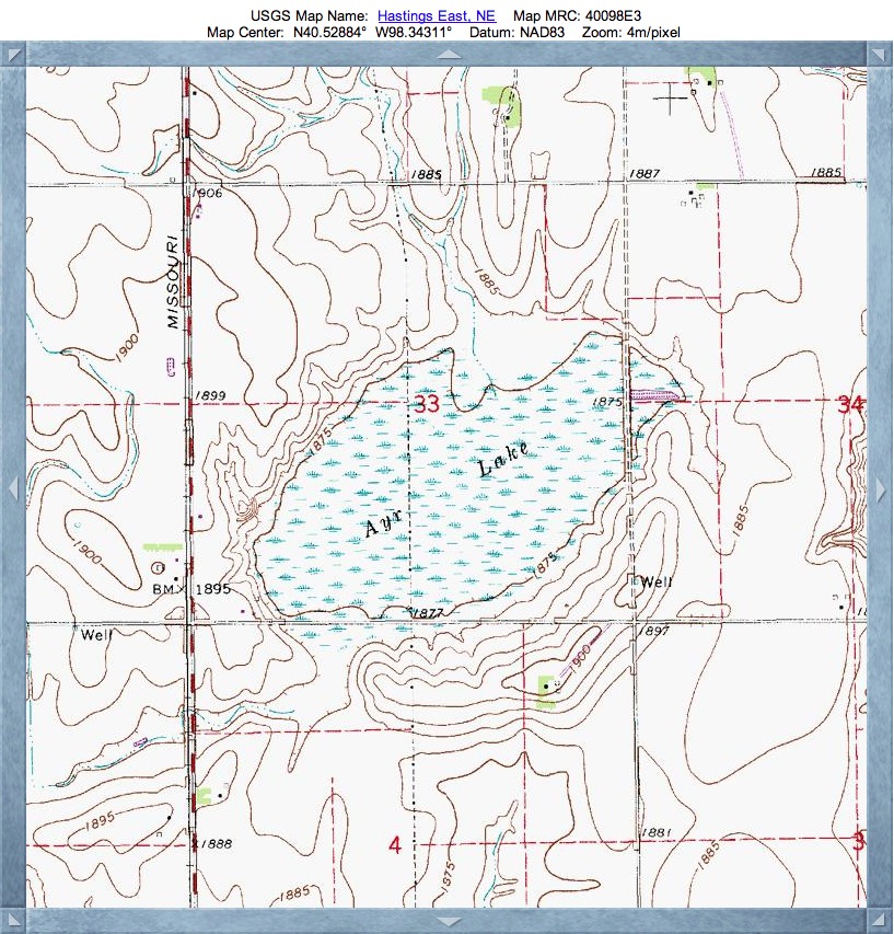
Ayr Lake Basin, NE
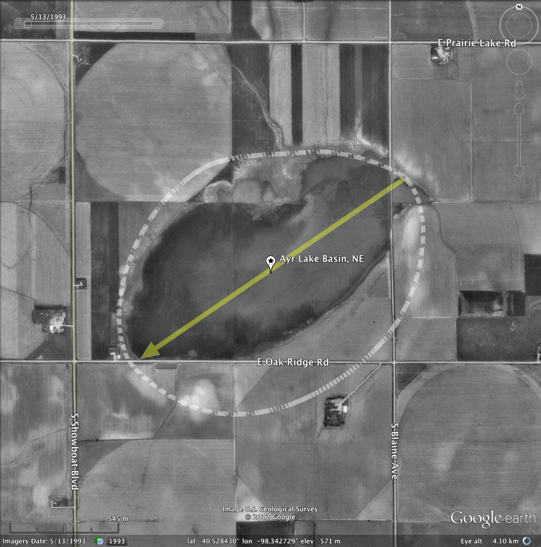
Todays's Carolina Bay offering is home to the 160 acre Ayr Lake Wildlife Management Area. It is located in Adams County, Nebraska, 4miles South of U.S. Hwy. 6 and 1 mile East of. Hastings.
As described by Nebraska Birding Trails at this LINK :
"This is a large, privately owned seasonal basin that is often good for viewing large numbers of migrating water birds. Access is limited to the peripheral road. Most noted for shorebirds and wading birds and to a lesser extent, waterfowl. April and May are the best times to find American golden-plovers, American avocets, and many other species."
I am carrying forward the local naming conventions for these "Rainwater Basins", and casting the Basin moniker on them vs. Bay.
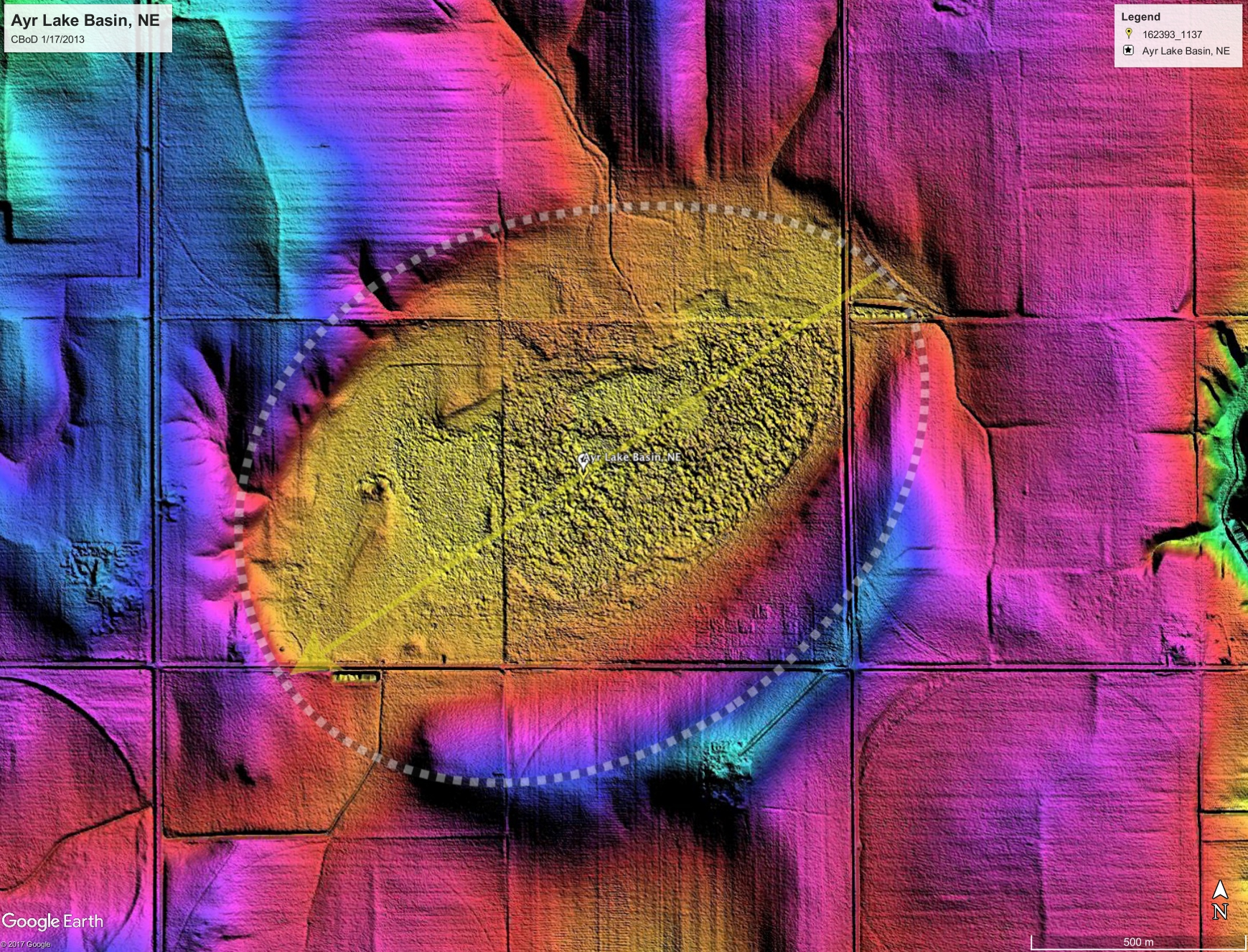
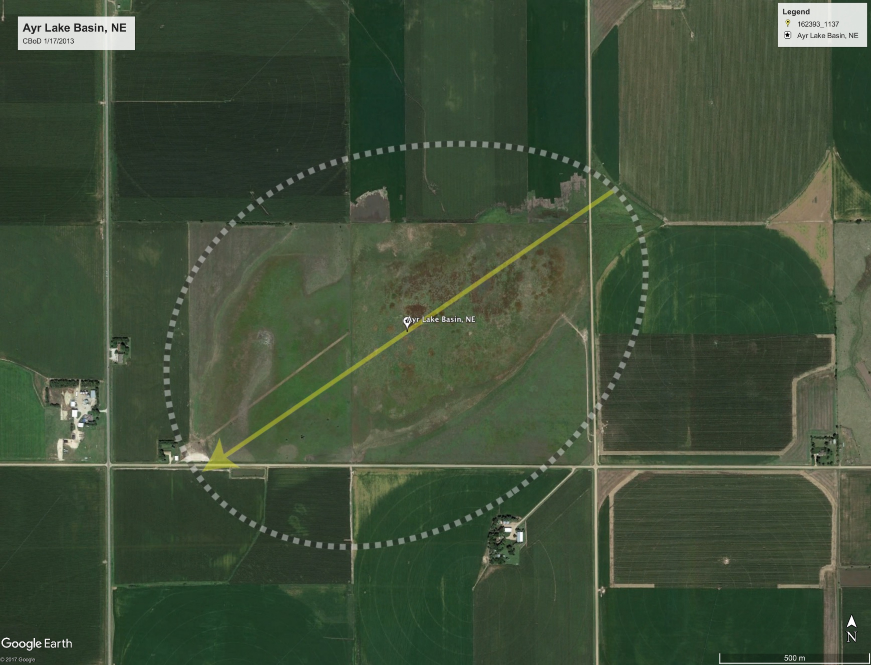
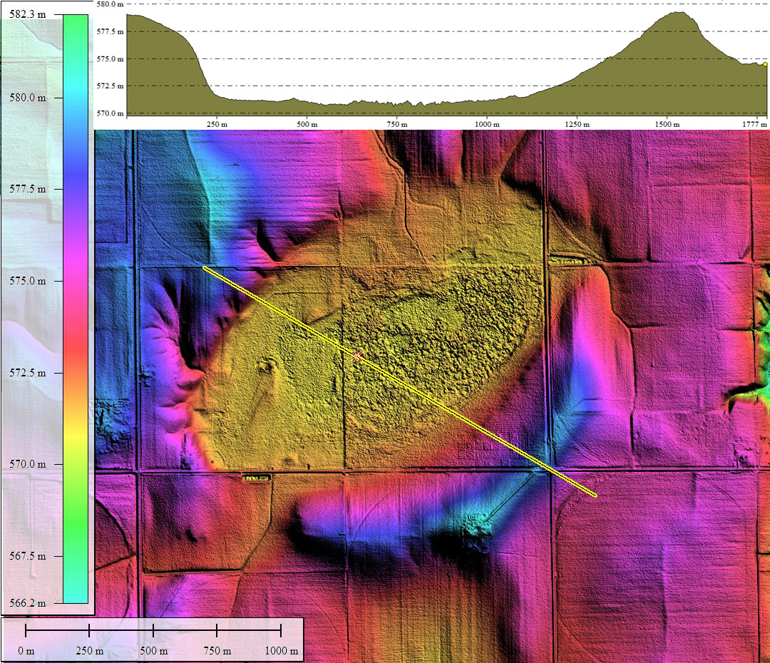
In a similar fashion as the eastern bays, the signature of the lake on the landscape in orthophotography does not properly represent the actual rimmed depression's shape. Here, the LiDAR once again does the trick in teasing out the true shape, which conforms well to our Bay-West archetype.
A Streetview visit can be obtained from along South Showboat Boulevard near the center of the bay through this link, initially not much except wide open agricultural fields can be seen. Rotating the view to the north or to the south, one can see the roadbed rising over the northern and southern rims in the distance: LINK.
As described by Nebraska Birding Trails at this LINK :
"This is a large, privately owned seasonal basin that is often good for viewing large numbers of migrating water birds. Access is limited to the peripheral road. Most noted for shorebirds and wading birds and to a lesser extent, waterfowl. April and May are the best times to find American golden-plovers, American avocets, and many other species."
I am carrying forward the local naming conventions for these "Rainwater Basins", and casting the Basin moniker on them vs. Bay.
In a similar fashion as the eastern bays, the signature of the lake on the landscape in orthophotography does not properly represent the actual rimmed depression's shape. Here, the LiDAR once again does the trick in teasing out the true shape, which conforms well to our Bay-West archetype.
A Streetview visit can be obtained from along South Showboat Boulevard near the center of the bay through this link, initially not much except wide open agricultural fields can be seen. Rotating the view to the north or to the south, one can see the roadbed rising over the northern and southern rims in the distance: LINK.
- Index #: 162393_1137
- Location: 40.52843040441103,-98.34272887142996
- Major: 1.7 km . . . Minor: 1.28 km
- Eccentricity: 0.652
- Area: 172.33 hectares
- Bearing: 235.7º
- Elevation: 570.8 m
- Planform: bayWest
- Effective Diameter: 1,481.273
Copyright 2018 by Michael Davias