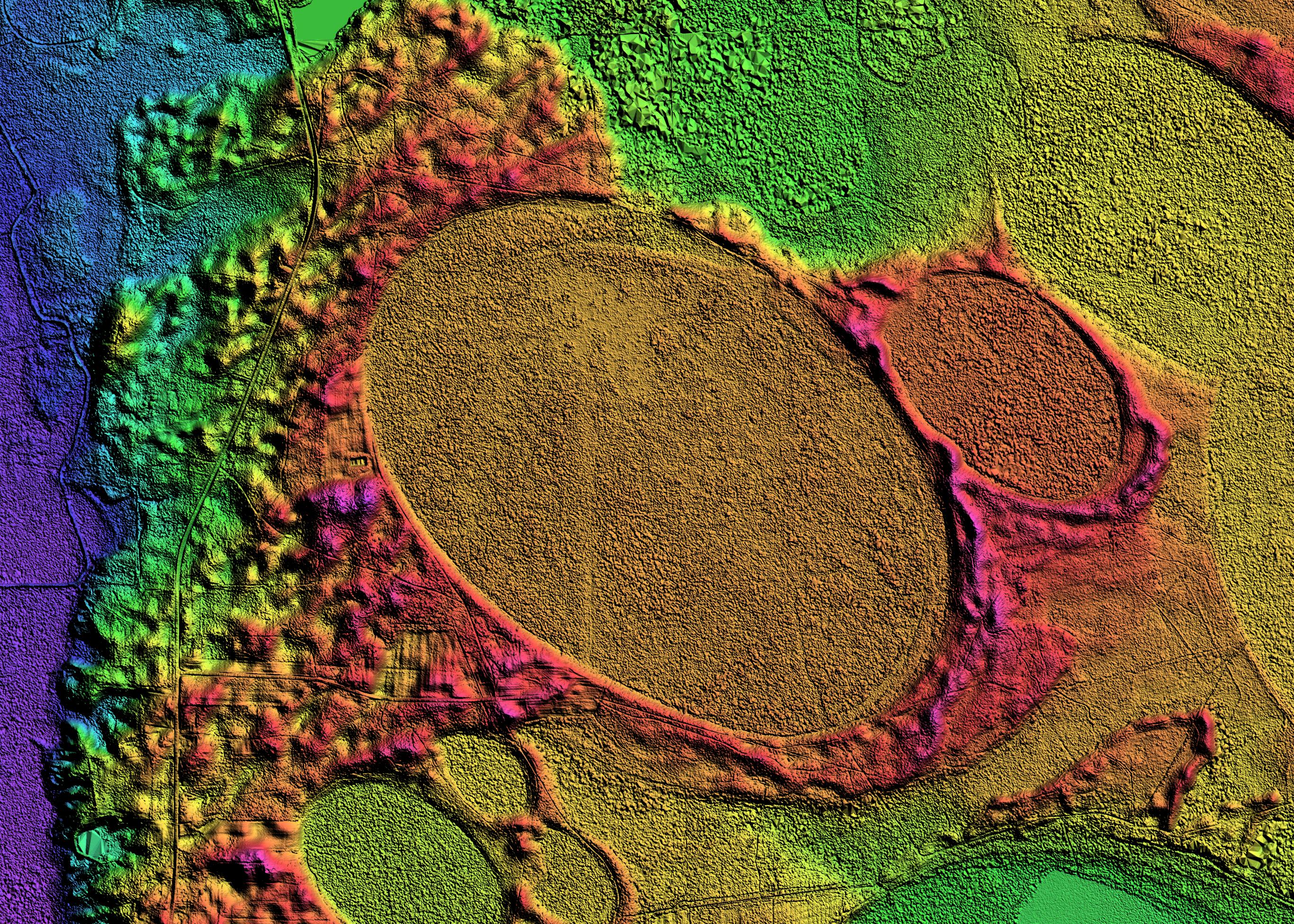
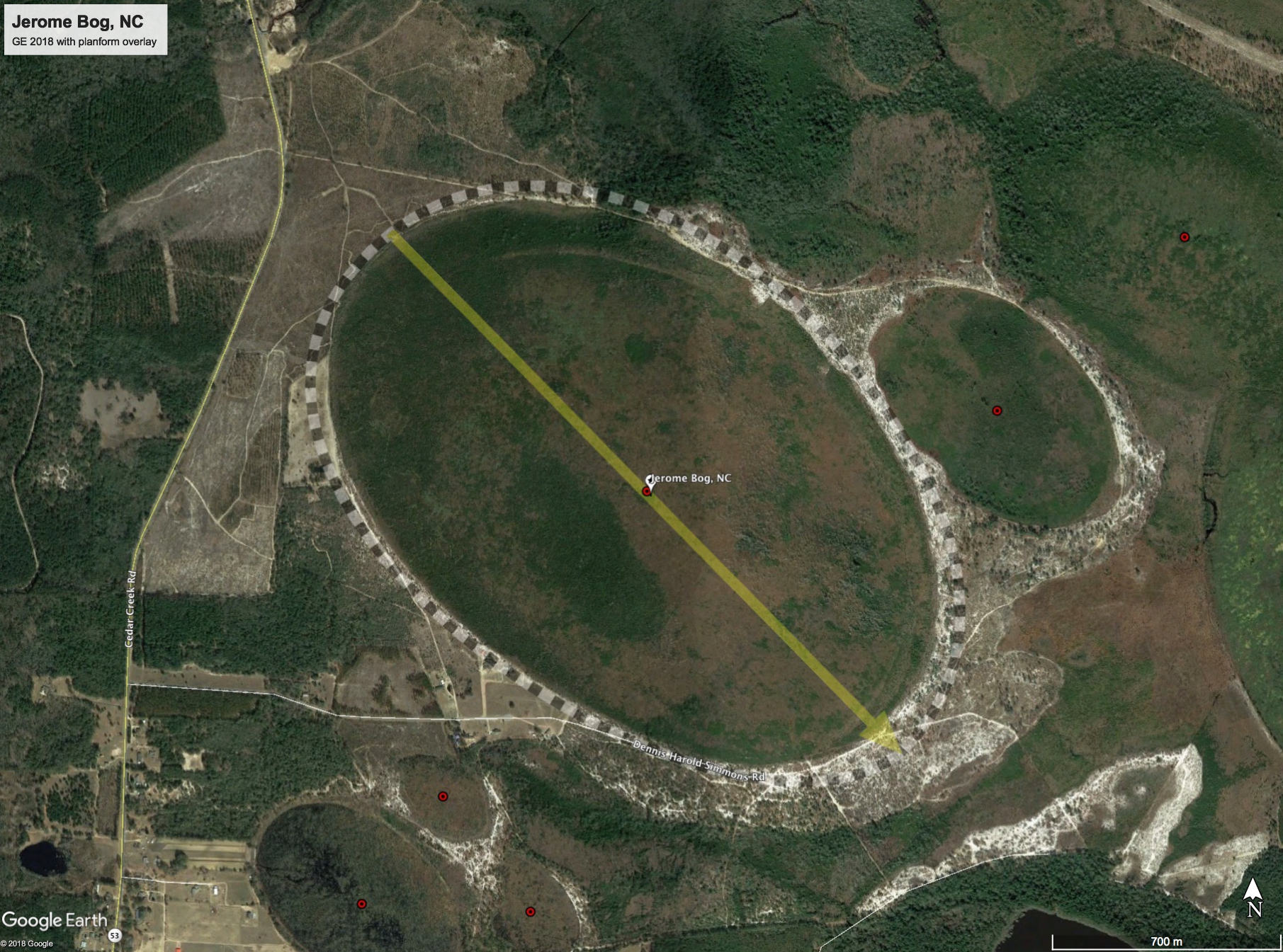
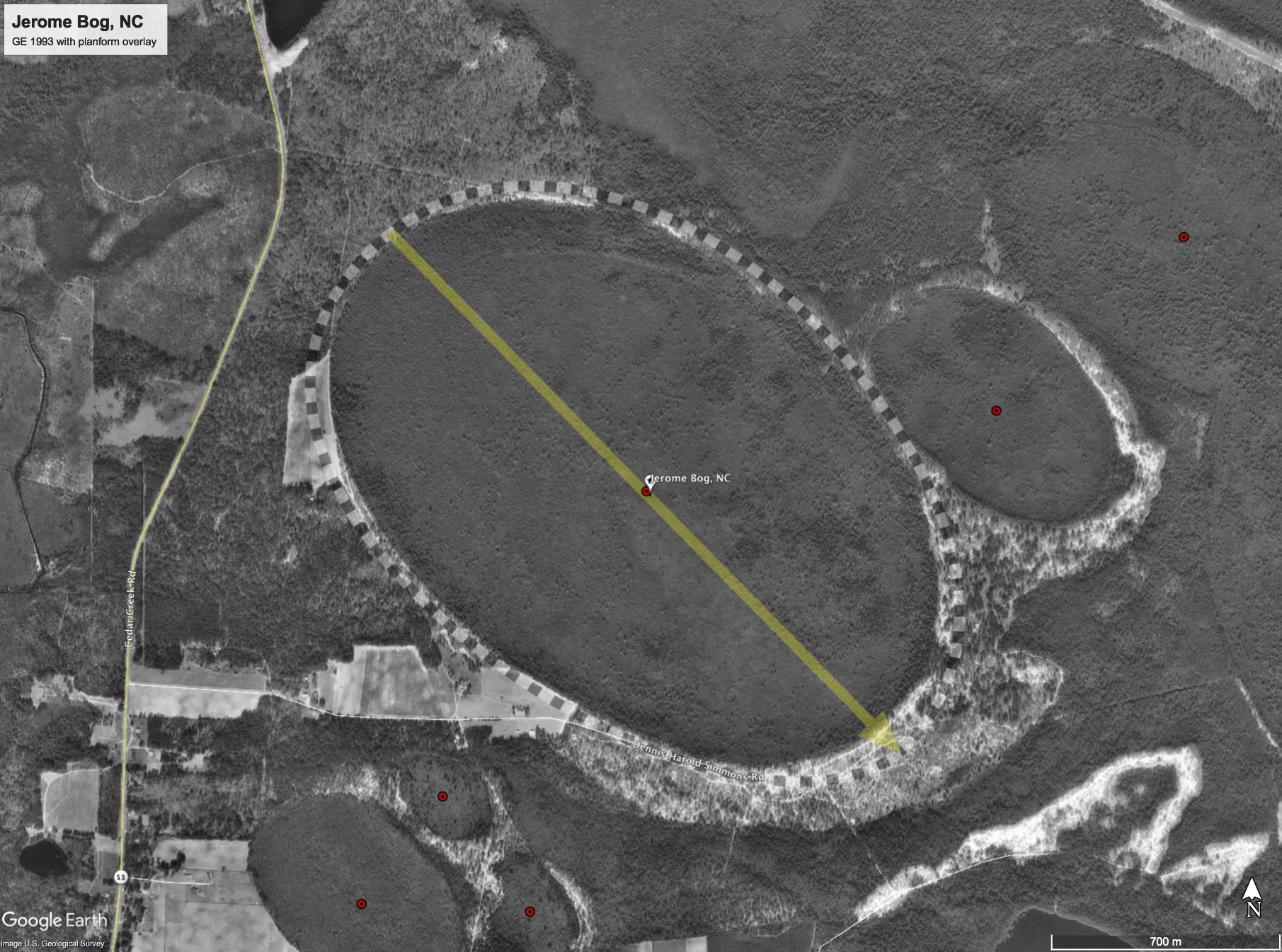
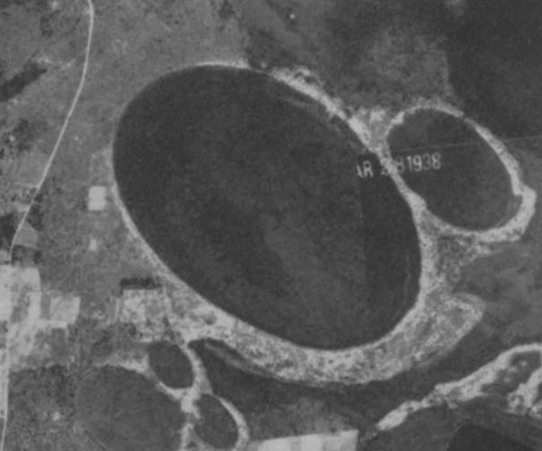
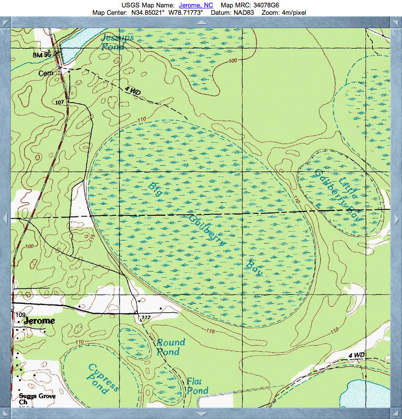
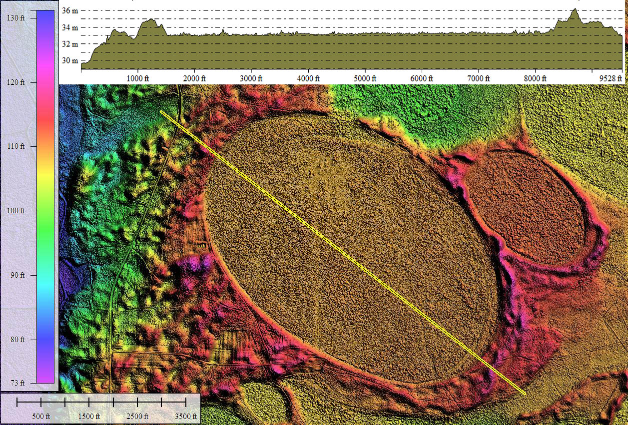
Jerome Bog, NC

Download KMZ for Google Earth
0
  • Jerome bog makes one spectacular Carolina bay! In both the satellite imagery and the LiDAR, it presents a crisp elongated oval, holding tight to the Bay archetype measurement overlay.
  • Jerome Bog was investigated back in the 1930's by Murrary F. Buel, who was a researcher at North Carolina State College. Among the photos in the attached album is an aerial photo from 1938 of the bay, which Buel used in one of his papers, Jerome Bog, a Peat-Filled "Carolina Bay", published in the Bulletin of the Torrey Botanical Club, Vol. 73, No. 1 (Jan. - Feb., 1946), pp. 24-33.
  • Buel also wrote a short note The Age of Jerome Bog, "A Carolina Bay" , which was published in Science in 1946 (Vol. 103, No. 2662, pp 14-15). Using pollen samples he had extracted from Jerome Bog, he stated that:
  • …one is led to the conclusion that at the time the lake sediments first began to accumulate in this bog the climate was moderately cold and was becoming increasingly colder, soon reaching a maximum and persisting only long enough for the accumulation of scarcely more than a foot of clay.
  • Drawing a conclusion, he stated: On the basis of the data now at hand it seems safe to say that at least the depression under consideration was formed during Wisconsin time and, specifically, about the time of the Wisconsin maximum glaciation in the East.
  • Dr. Buel did not have LiDAR, of course, but he also did not have the benefit of carbon isotope dating. If he had, he would have noted that his samples from deep in the bay were all "carbon dead", meaning they were older than 45,000 years, as has been seen in bay peat deposits sampled over the past few decades. Combining those two facts might lead one to propose the bay started to accumulate deposits during the Illinoian Glaciation, over 100,000 years ago.
  • Dr. Buel's 1946 paper in Science is one of but a handful of Carolina Bay research articles that have appeared in that publication over the past 70 years. This speaks to the disinterest heaped upon the bays by the geology community.
    • Index #: 139314-3986
    • Location: 34.84984071236133,-78.71687466086028
    • Major: 2.25 km . . . Minor: 1.48 km
    • Eccentricity: 0.754
    • Area: 262.41 hectares
    • Bearing: 135.56º
    • Elevation: 33.64 m
    • Archetype: bayCarolina
    • Effective Diameter: 1,827.868 m
    Copyright 2018 by Michael Davias
    Back