Big Horsepen Bay , SC
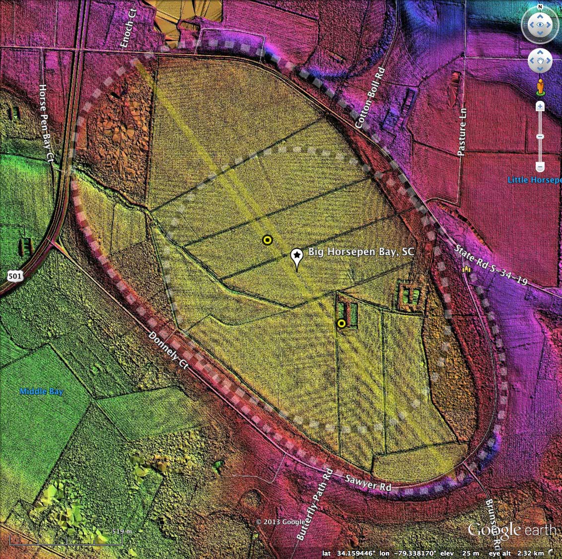
The shape of Big Horsepen Bay is interpreted by me as being the mash-up of two overlapping bayCarolina archetype shapes. The two shapes have an identical orientation, and are offset along the major axis by ~650 meters. The bay shape can also be fairly well represented by a single overlay, but does not track the rim as well as two.
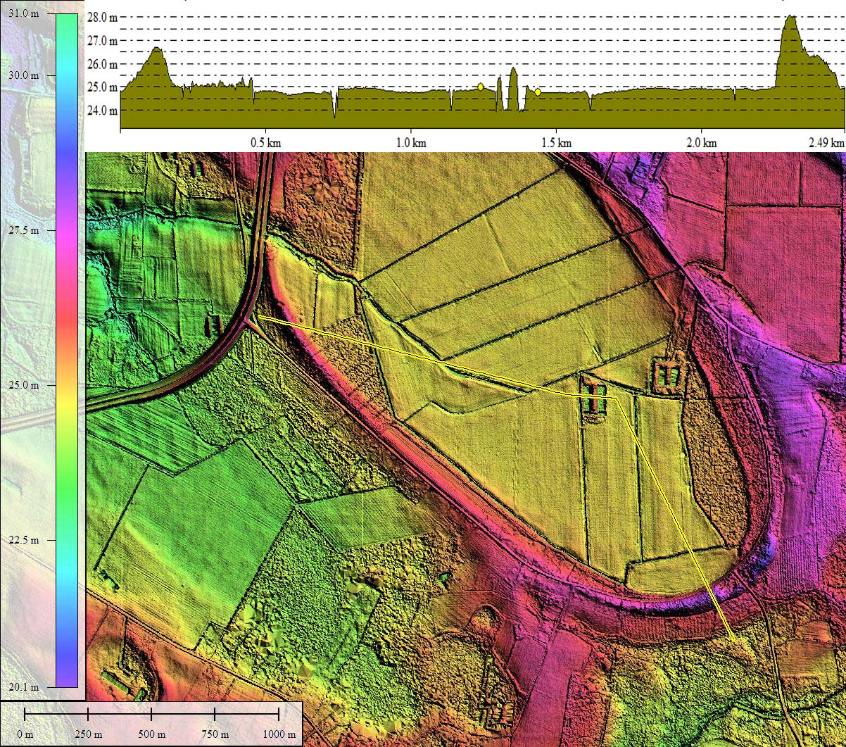
I used 25 cm gridded LiDAR data to produce the imagery here. The LiDAR overlay tiles for use in Google Earth were generated on a 1-meter grid to reduce their size. The resolution assists in the visualization of the finely-crafted rim seen around the bay. Most of the raised rim is in the southern and western sweep of the bay rim, while the north and eastern segments are set into the surrounding pediment. This juxtaposition of bay rim styles is seen quite often in the LiDAR survey, and is in direct conflict with the common Carolina Bay attribution of "raised rims seen on the southeastern side".
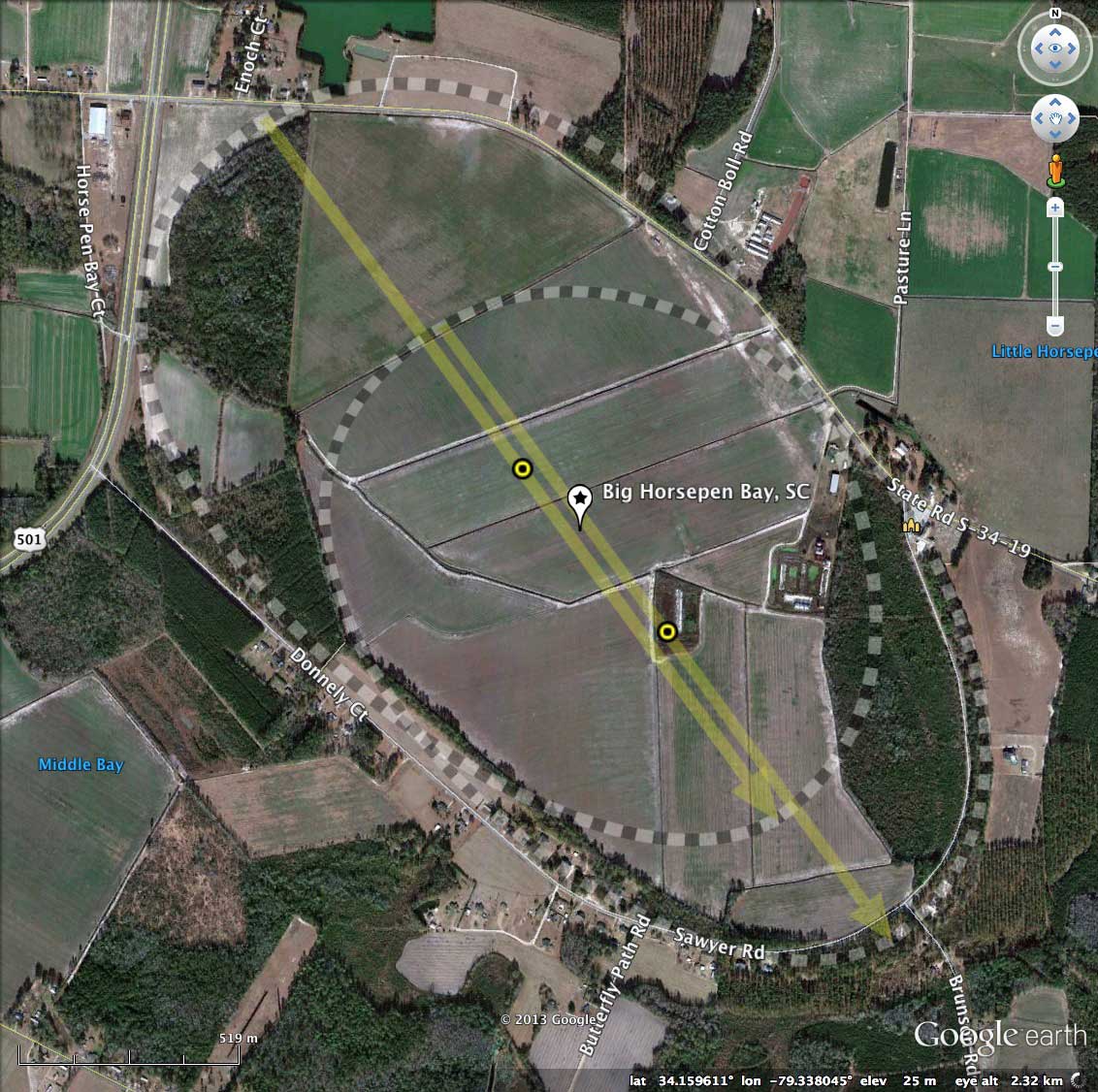
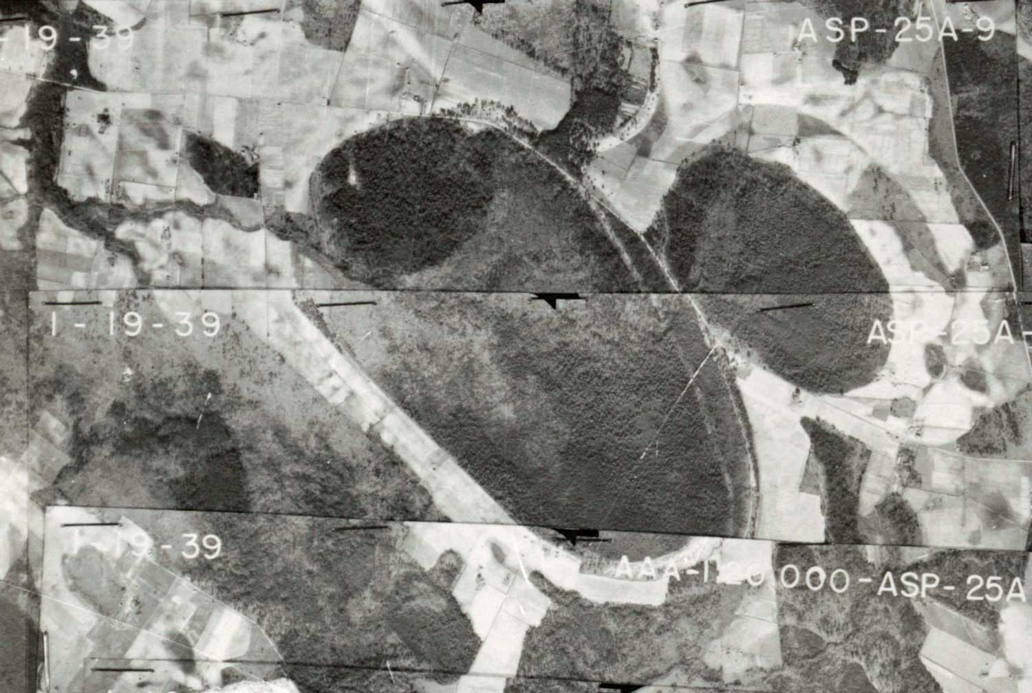
Also in the album here is an historical aerial photo from the South Carolina survey of 1938/39, sourced from the SC University Libraries Digital Collection. Both historical photos support a finding that the bay has had a natural drainage channel out the north west rim for some time. It has been enhanced by an extensive man-made drainage network inside the bay, extending eastward into, and draining, Little Horsepen Bay. In addition, several deep collection ponds are present on the bay floor.
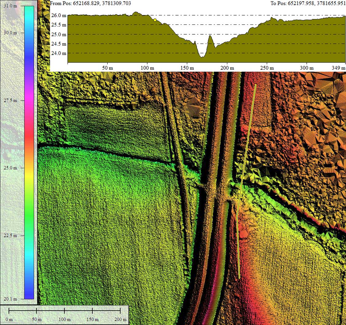
An elevation profile map of the natural drainage channel exiting through the rim is included in the attached album, and suggest the outlet is 150 meters wide and over 2 meters deep at the rim. Douglas Johnson, in his 1942 book on Carolina Bays, noted that occasionally bays possessed what seemed to be pre-existing drainage networks broaching the bay rims, and felt their existence falsified a direct impact cratering mechanism, as any such preexisting stream bed would have been destroyed in the process. He had not considered the bays old enough to be compromised by headward stream erosion since their creation. Streetview imagery from just outside the bay along the bay's drainage outlet shows the natural character of the channel, suggesting it is a pre-existing outlet rather than a man-made one. Explore interactively HERE.
The bay is also mentioned in the Eyton & Parkhurst 1975 paper on bay morphology [LINK], one of the last papers presenting a case for a catastrophic mechanism to make it past the peer review process.
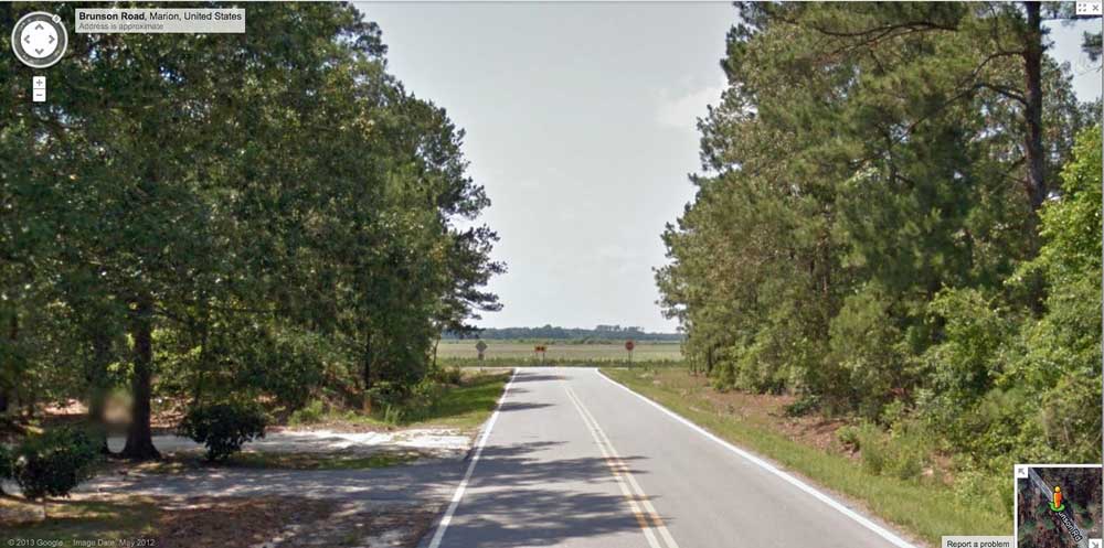
Google Streetview imagery is available almost continuously around the bay, and the open nature of the bay floor allows easy viewing. The album has an image showing Brunson Road as it passes through the rim and terminates at Sawyer Road, which tracks the bay's perimeter. Explore interactively with this LINK.
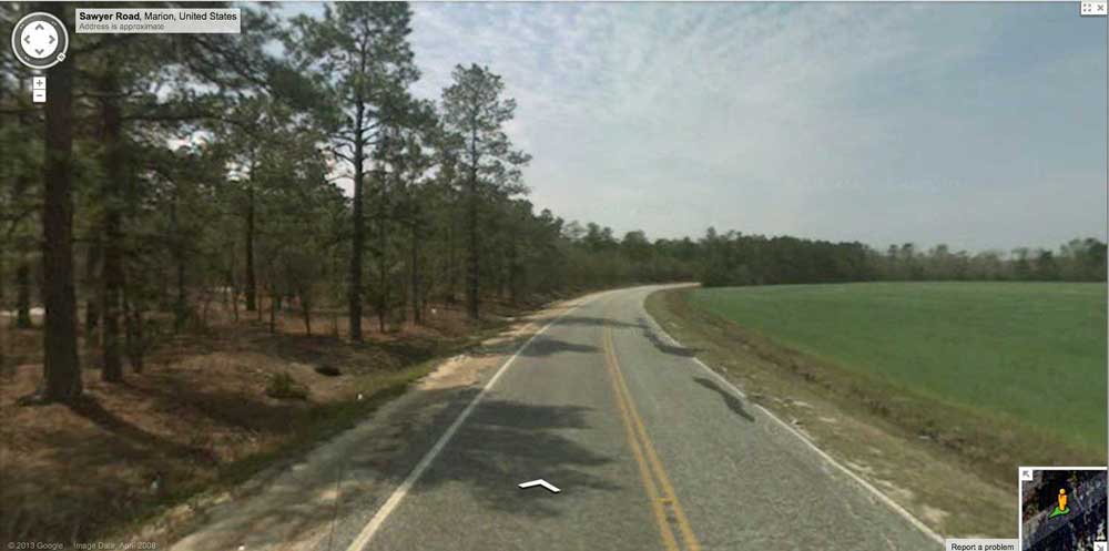
A second Google Streetview image is looking along Sawyer Road as it passes clockwise around the bay just inside the rim. The rim relief is evident on the left, and the bay floor sets lower on the right. The view corresponds location where the transect line crosses the western rim in the elevation map of the southern rim area. Explore interactively with: http://goo.gl/maps/ee8qS
The streetview locations are identified by placemarks in the referenced KMZ file for viewing in Google Earth.
The Carolina Bay Survey has identified and measured ~280 bays in Octant 136317. Their location and metrics can be referenced through a Fusion Table spatial visualization.
Big Horsepen Bay Composite Measurements
Big Horsepen Bay overlay A
Big Horsepen Bay overlay B
I used 25 cm gridded LiDAR data to produce the imagery here. The LiDAR overlay tiles for use in Google Earth were generated on a 1-meter grid to reduce their size. The resolution assists in the visualization of the finely-crafted rim seen around the bay. Most of the raised rim is in the southern and western sweep of the bay rim, while the north and eastern segments are set into the surrounding pediment. This juxtaposition of bay rim styles is seen quite often in the LiDAR survey, and is in direct conflict with the common Carolina Bay attribution of "raised rims seen on the southeastern side".
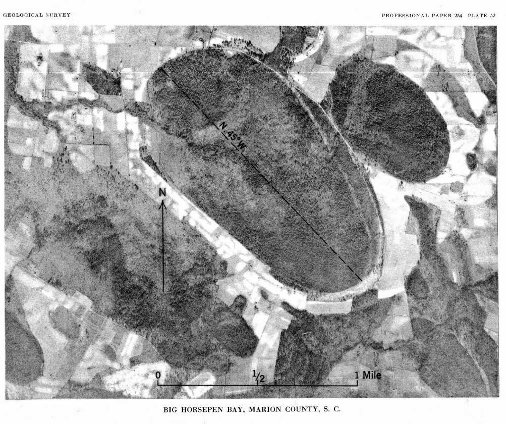
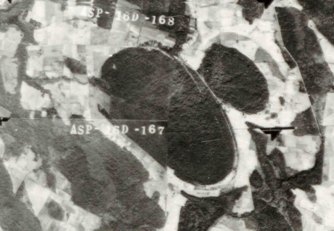
Also in the album here is an historical aerial photo from the South Carolina survey of 1938/39, sourced from the SC University Libraries Digital Collection. Both historical photos support a finding that the bay has had a natural drainage channel out the north west rim for some time. It has been enhanced by an extensive man-made drainage network inside the bay, extending eastward into, and draining, Little Horsepen Bay. In addition, several deep collection ponds are present on the bay floor.
An elevation profile map of the natural drainage channel exiting through the rim is included in the attached album, and suggest the outlet is 150 meters wide and over 2 meters deep at the rim. Douglas Johnson, in his 1942 book on Carolina Bays, noted that occasionally bays possessed what seemed to be pre-existing drainage networks broaching the bay rims, and felt their existence falsified a direct impact cratering mechanism, as any such preexisting stream bed would have been destroyed in the process. He had not considered the bays old enough to be compromised by headward stream erosion since their creation. Streetview imagery from just outside the bay along the bay's drainage outlet shows the natural character of the channel, suggesting it is a pre-existing outlet rather than a man-made one. Explore interactively HERE.
The bay is also mentioned in the Eyton & Parkhurst 1975 paper on bay morphology [LINK], one of the last papers presenting a case for a catastrophic mechanism to make it past the peer review process.
Google Streetview imagery is available almost continuously around the bay, and the open nature of the bay floor allows easy viewing. The album has an image showing Brunson Road as it passes through the rim and terminates at Sawyer Road, which tracks the bay's perimeter. Explore interactively with this LINK.
A second Google Streetview image is looking along Sawyer Road as it passes clockwise around the bay just inside the rim. The rim relief is evident on the left, and the bay floor sets lower on the right. The view corresponds location where the transect line crosses the western rim in the elevation map of the southern rim area. Explore interactively with: http://goo.gl/maps/ee8qS
The streetview locations are identified by placemarks in the referenced KMZ file for viewing in Google Earth.
The Carolina Bay Survey has identified and measured ~280 bays in Octant 136317. Their location and metrics can be referenced through a Fusion Table spatial visualization.
Big Horsepen Bay Composite Measurements
- Index #: 136317_6335
- Location: 34.15893187834899,-79.33797180671246
- Major: 2.47 km . . . Minor: 1.42 km
- Eccentricity: 0.819
- Area: 276.65 hectares
- Bearing: 143.83º
- Elevation: 24.76 m
- Archetype: bay
- Effective Diameter: 1,876.808 m
Big Horsepen Bay overlay A
- Index #: 136317_6435
- Location: 34.16027019833006,-79.33941023341995
- Major: 2.08 km . . . Minor: 1.38 km
- Eccentricity: 0.747
- Area: 226.17 hectares
- Bearing: 143.83º
- Elevation: 24.75 m
- Archetype: bay
- Effective Diameter: 1,696.962 m
Big Horsepen Bay overlay B
- Index #: 136317_6234
- Location: 34.15680618518339,-79.33568886039875
- Major: 1.82 km . . . Minor: 1.27 km
- Eccentricity: 0.713
- Area: 183.1 hectares
- Bearing: 143.83º
- Elevation: 23.93 m
- Archetype: bay
- Effective Diameter: 1,526.858 m
Copyright 2018 by Michael Davias