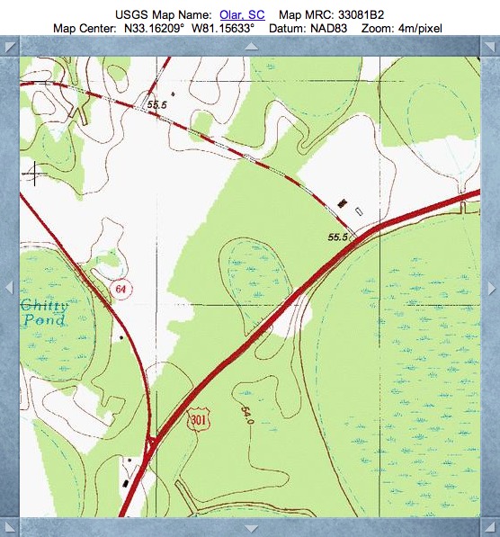
Chapel Bay, SC
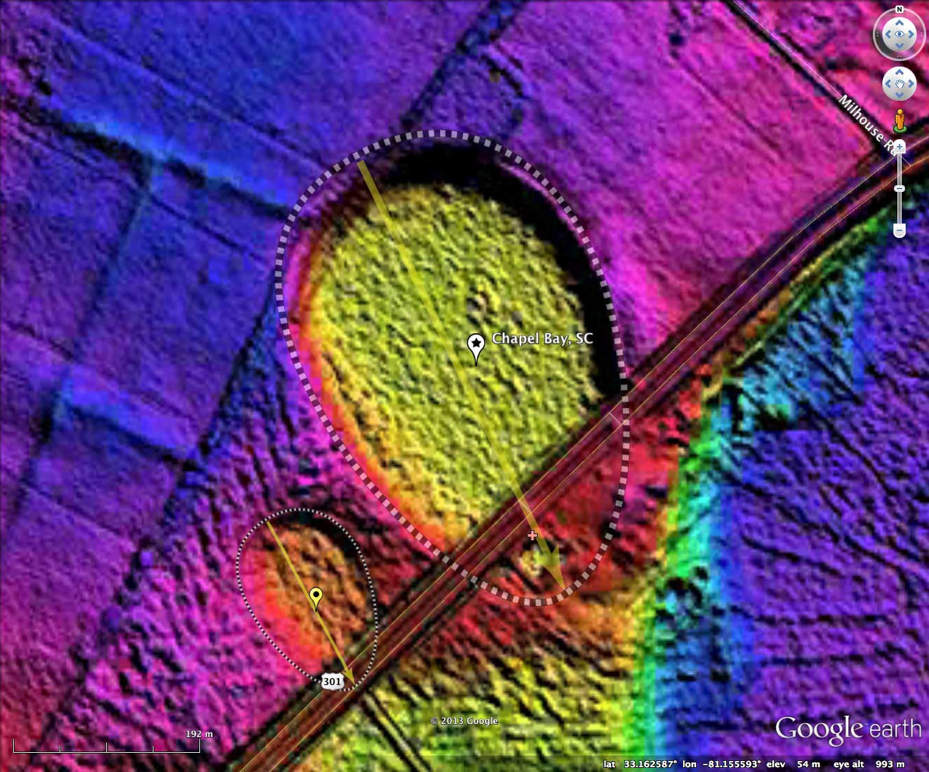
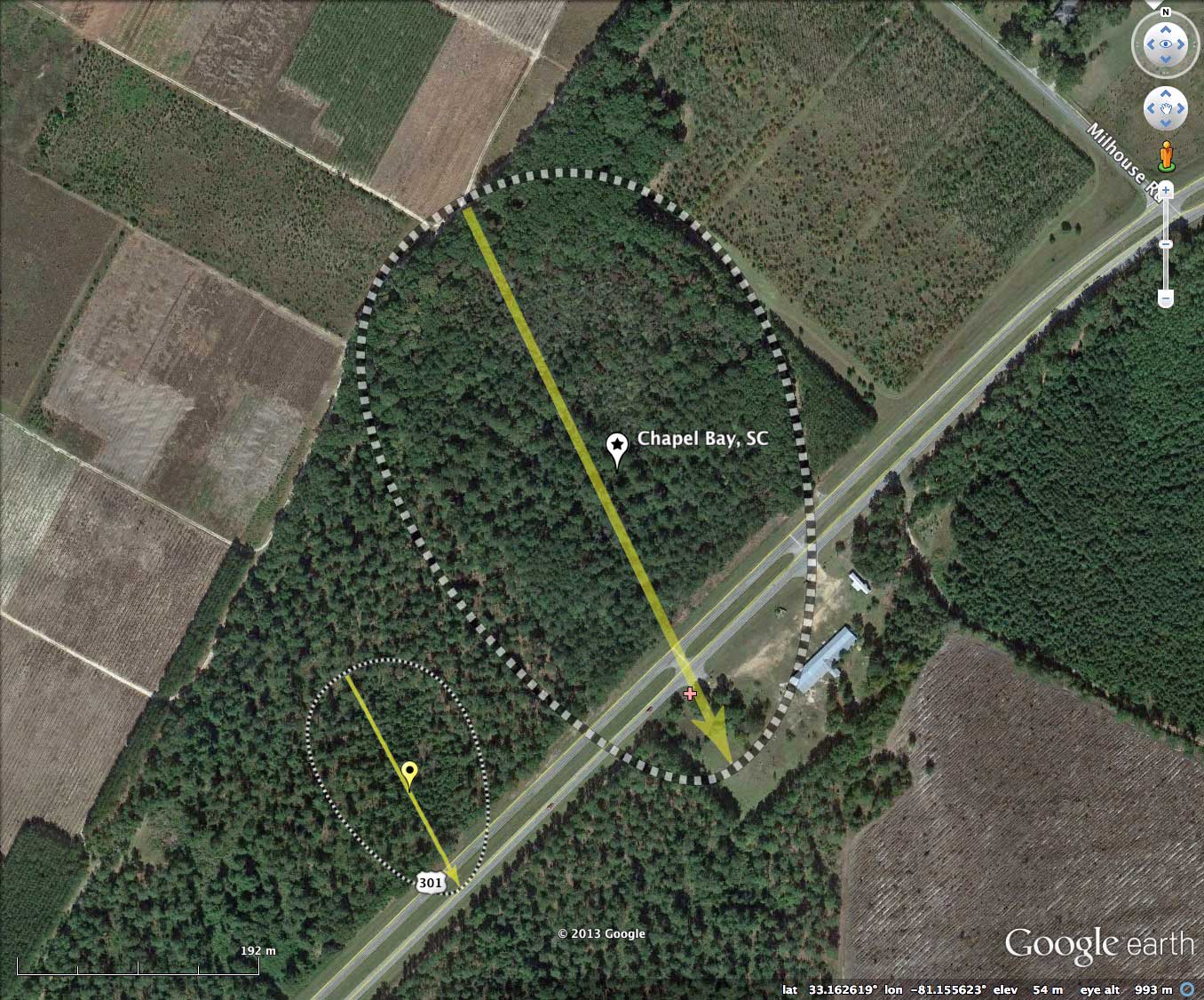
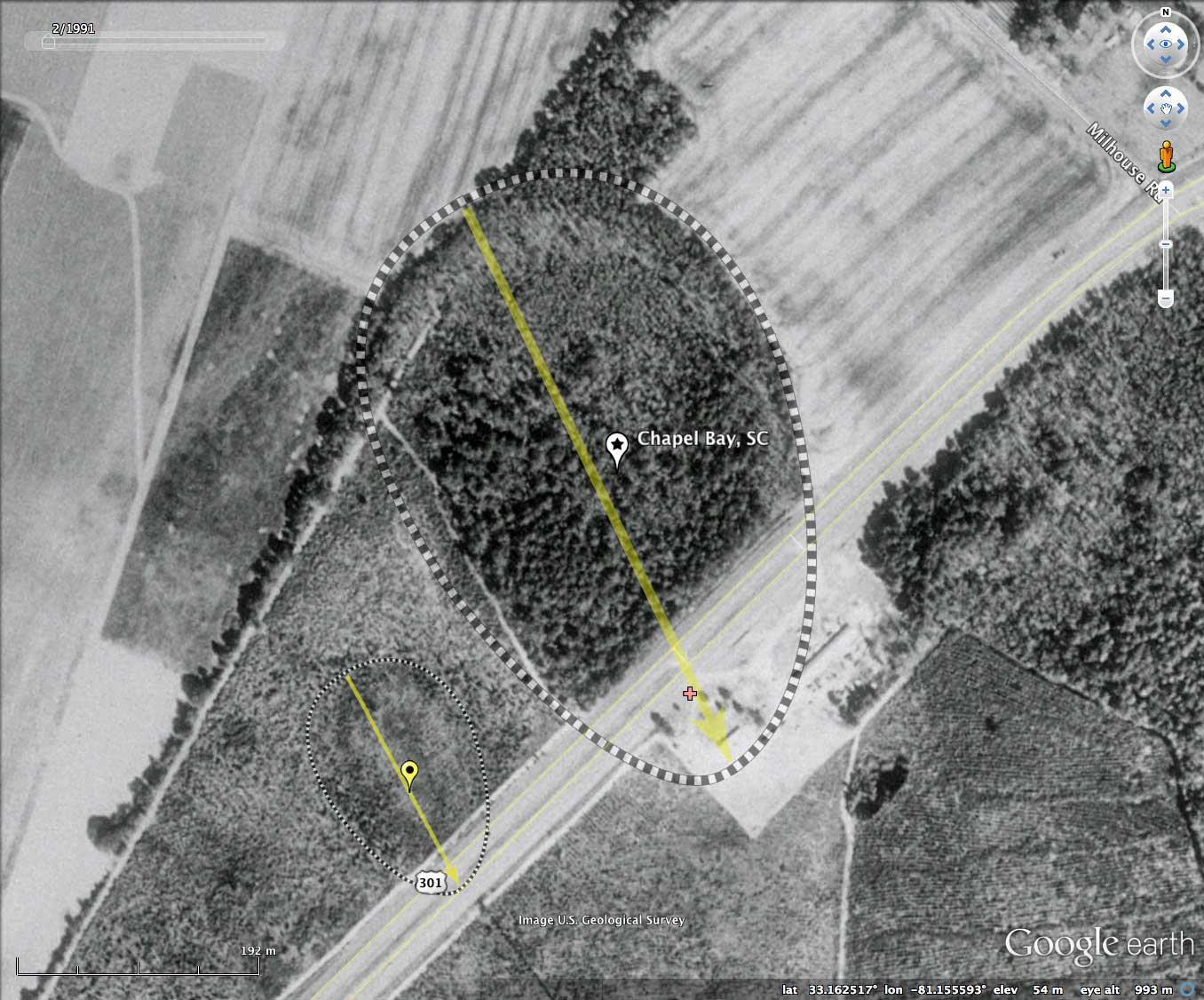
Chapel Bay is located between Cathedral Bay (Chitty Pond) and the very large Alligator Bay, 3 kilometers southeast of Olar in Bamberg County, SC. Four lanes of US Highway 301 traverse the southern end of the bay. Other than that insult, the northern 80% of the bay looks to be in a natural state.
The bay's name is not in the USGS geonames database, but I though it would be nice if the Cathedral had a chapel. There is even an Apse, seen as a even smaller bay between them. My index naming convention, based on a grid, gives both these the same number, so I have linked them together. Both bays, along with Cathedral and Alligator, are good fits to the baySouth archetype shape, and have similar orientations.
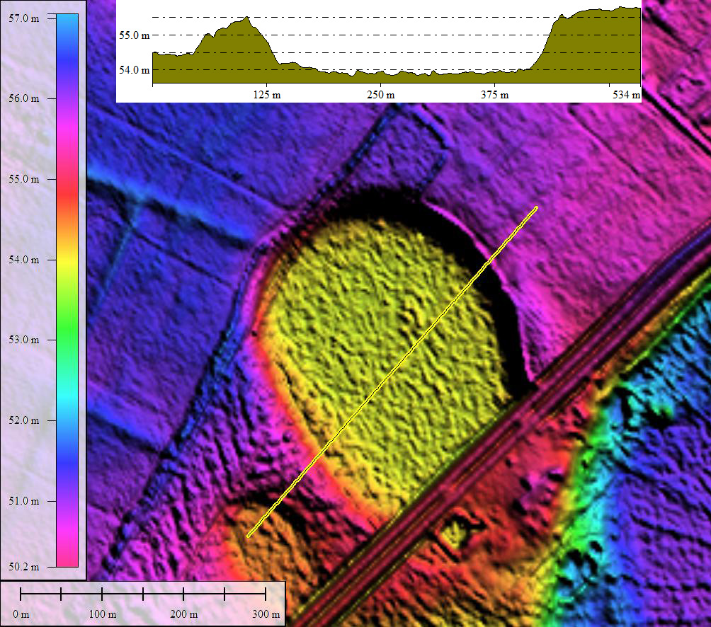
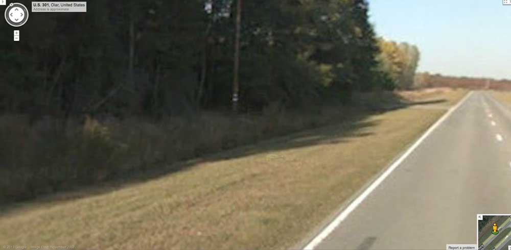
Google's Streetview imagery is available along the US 301, which has been constructed as a raised roadbed across the bay floor. A image in the attached album displays an informative view of the bay's subtle relief as seen from within the bay. In the immediate foreground, the road apron can be seen dipping down to the bay floor, which is forested. In the distance, at the short paved side-road, the roadway rim passes through the bay rim. Beyond that US 301's roadbed is seen as setting into the surrounding landscape, vs standing above it. the view location is shown as placemark in the KMZ file referenced above. You can also visit Streetview directly with this LINK.
The Carolina Bay Survey has identified and measured over 1,000 bays in _Octant 132324_, which puts the octant in the company of only a few with such a large concentration of bays. Their location and metrics can be referenced through a Fusion Table spatial visualization.
Let me make an observation here about the Google Fusion Tables map visualization facility. It will only present a maximum of 500 placemarks in a user's map, but as the viewer zooms into the map, it will be refreshed with more detail. This is an improvement over a full KML file, where Google Earth would attempt to load all the placemarks at once, and might overloaded the computer.
The bay's name is not in the USGS geonames database, but I though it would be nice if the Cathedral had a chapel. There is even an Apse, seen as a even smaller bay between them. My index naming convention, based on a grid, gives both these the same number, so I have linked them together. Both bays, along with Cathedral and Alligator, are good fits to the baySouth archetype shape, and have similar orientations.
Google's Streetview imagery is available along the US 301, which has been constructed as a raised roadbed across the bay floor. A image in the attached album displays an informative view of the bay's subtle relief as seen from within the bay. In the immediate foreground, the road apron can be seen dipping down to the bay floor, which is forested. In the distance, at the short paved side-road, the roadway rim passes through the bay rim. Beyond that US 301's roadbed is seen as setting into the surrounding landscape, vs standing above it. the view location is shown as placemark in the KMZ file referenced above. You can also visit Streetview directly with this LINK.
The Carolina Bay Survey has identified and measured over 1,000 bays in _Octant 132324_, which puts the octant in the company of only a few with such a large concentration of bays. Their location and metrics can be referenced through a Fusion Table spatial visualization.
Let me make an observation here about the Google Fusion Tables map visualization facility. It will only present a maximum of 500 placemarks in a user's map, but as the viewer zooms into the map, it will be refreshed with more detail. This is an improvement over a full KML file, where Google Earth would attempt to load all the placemarks at once, and might overloaded the computer.
- Index #: 132324_6462
- Location: 33.16239884328442,-81.15565385995859
- Major: 0.5 km . . . Minor: 0.32 km
- Eccentricity: 0.76
- Area: 13.05 hectares
- Bearing: 154.45º
- Elevation: 53.83 m
- Archetype: bay_south_prototype
- Effective Diameter: 407.624 m
- Index #: 132324_6462
- Location: 33.16023233743032,-81.15742740028135
- Major: 0.19 km . . . Minor: 0.12 km
- Eccentricity: 0.756
- Area: 2.0 hectares
- Bearing: 151.97º
- Elevation: 54.45 m
- Archetype: baySouth
- Effective Diameter: 159.577 m
Copyright 2018 by Michael Davias