Stink Pond Bay, GA
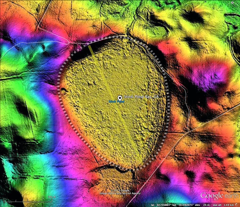
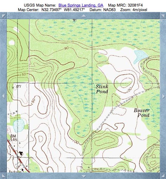
Today's Carolina Bay of the Day is located in east-central Screven County, Georgia, 14 kilometers east of Sylvania. "Stink Pond" does not have the "Bay" term in its USGS geoname, but it most certainly qualifies as one in every measure.
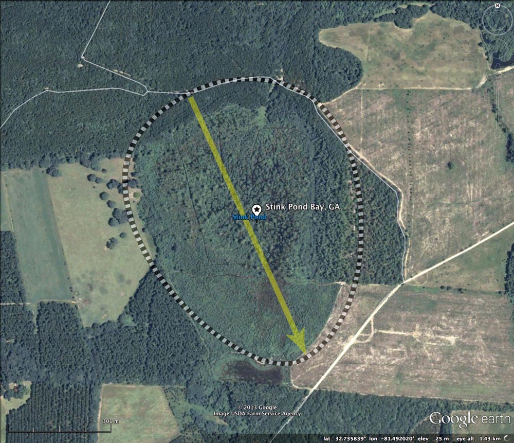
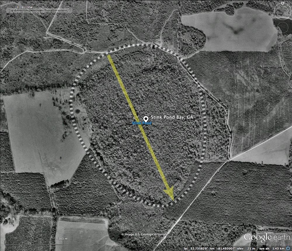
Stink Pond Bay has what appears to be an artificial drainage channel cut across the rim on the northern end of the bay. The 1999 Google historical satellite imagery shows the bay to be fully forested, but by 2005 the entire floor of the bay, with the exception of the most central area, and been clear-cut. As of the latest imagery (2010), the bay's tree population is returning.
Over the past three days, I have featured two neighboring bays, Noonan Pond and Beaver Pond. All three present the same orientation, and are almost identical in size. Any hypothesis as to the nature of the process which formed these baySouth landforms needs to explain the robust "cookie cutter" precision shown in the LiDAR.
The Carolina Bay Survey has identified and measured ~125 bays in Octant 130325.
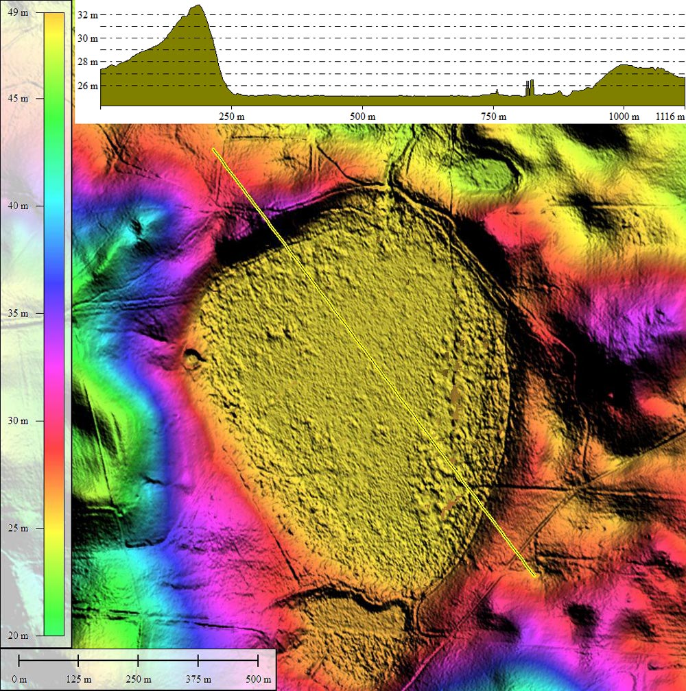
- Index #: 130325_9496
- Location: 32.73549416694172,-81.49206077721145
- Major: 0.88 km . . . Minor: 0.7 km
- Eccentricity: 0.603
- Area: 48.65 hectares
- Bearing: 155.85º
- Elevation: 25.12 m
- Archetype: baySouth
- Effective Diameter: 787.038 m
Copyright 2018 by Michael Davias